A lifetime of places worth exploring

THE AMERICANA ATLAS

Discover top-rated hiking trails, national and state parks, hidden gems, and outdoor adventures across America.

Explore by destination

Open a state, then select a park, region, or city to see its trails, activities, and links. Hawaii is organized by island with simple activity lists.

▸ Open a state, then a destination. Island activities and trails appear as bullet lists without extra tabs; city details can expand further.

Search results

Alabama
Bankhead National Forest / Sipsey Wilderness

Alabama’s largest wilderness area, defined by deeply carved sandstone canyons, waterfalls, caves, and the wild Sipsey River.

Hiking & Backpacking

Sougahoagdee Falls Trail: 3.4 Miles ★
Big Tree Loop: 8 Miles ★
Sipsey Wilderness Loop Trail: 19 Miles ★
Thompson Creek Trail and Sipsey River Trail: 20 Miles ★
Borden Creek Hiking Trail: 5.1 Miles ★
Thompson Creek Trail 206 to Needles Eye: 5.9 Miles ★
Sipsey Big Tree: 8.5 Miles ★
Northeast Sipsey Loop: 9.3 Miles ★
Wilderness Backpacking / Waterfalls / Canyon Hiking
River Crossings / Remote Terrain / Navigation Skills

Waterfalls & Natural Features

Kinlock Falls: 0.2 Miles ★

Visitor Planning & Safety

Wilderness Maps & Access Information
Birmingham ★

Alabama’s Magic City brings together landmark civil rights history, iron and-steel heritage, grand historic theaters, baseball traditions, Southern food, and forested urban escapes.

Civil Rights District

Birmingham Civil Rights Institute ★
16th Street Baptist Church ★
Kelly Ingram Park ★
Civil Rights Memorials / Birmingham Campaign History
Guided Civil Rights History Tour ★

Historic Landmarks & Theaters

Sloss Furnaces National Historic Landmark ★
Historic Ironworks / Industrial Heritage Tours
Vulcan Park & Museum ★
Cast-Iron Landmark / Observation Tower / City Views
Alabama Theatre ★
1927 Movie Palace / Mighty Wurlitzer Organ / Classic Films &
Concerts
Lyric Theatre ★
Restored Historic Theater / Live Performances

Museums & Local Culture

Barber Vintage Motorsports Museum ★
Motorcycle & Motorsports Collections
Birmingham Museum of Art ★
Art Collections / Rotating Exhibitions
McWane Science Center ★
Interactive Science Exhibits / IMAX
Irondale Café - Original Whistle Stop Café Inspiration ★
Fried Green Tomatoes / Southern Meat-and-Three / Railroad Heritage
Nearby Irondale / Inspired the Setting of Fannie Flagg’s Fried Green
Tomatoes
Pepper Place Saturday Market ★
Local Growers / Artisan Foods / Seasonal Market

Parks & Urban Space

Birmingham Botanical Gardens ★
Gardens / Seasonal Blooms
Railroad Park & Rotary Trail ★
Downtown Green Space / City Skyline / Public Art Walking Corridor
Ruffner Mountain Nature Preserve ★
Forest Hiking / Historic Quarry Landscapes / Mountain Views
Red Mountain Park ★
Wooded Hiking / Former Mining Landscape
Buck’s Pocket State Park ★

A rugged mountain preserve featuring steep ridges, forested ravines, and panoramic views across a dramatic Appalachian valley.

Hiking & Backpacking

Point Rock Trail to Jim Lynn Overlook: 2.3 Miles ★
High Bluff Trail: 1 Mile ★
Mountain Hiking & Scenic Overlooks
Park Hiking Trail, Maps & Visitor Planning
Cahaba River / Cahaba River National Wildlife Refuge ★

One of the most biologically diverse rivers in North America, famous for its rare Cahaba lilies and rich river habitat.

Paddling, Rafting & Water Adventures

Canoeing / Wildlife & Lily Photography
Guided Cahaba Lily Canoe Trips
Membership Required For Coalition Trips

Wildlife & Fishing

Cahaba Lily Viewing ★
Seasonal Bloom / May-June

Visitor Planning & Safety

Refuge Trails & Access Information
Cathedral Caverns State Park ★

A spectacular limestone cave with an enormous entrance, towering stalagmites, underground formations, and dramatic chambers.

Hiking & Backpacking

Cathedral Caverns Gray Trail: 1.9 Miles

Climbing, Caving & Mountain Adventures

Cathedral Caverns Yellow and Green Trails: 2.6 Miles
Guided Cathedral Caverns Cave Tour ★
Geological Formations / Underground Exploration
Cheaha State Park / Talladega National Forest ★

Alabama’s highest mountain landscape, with rocky ridges, forested summits, panoramic overlooks, and rugged sections of the Pinhoti Trail.

Hiking & Backpacking

Hernandez Peak and McDill Point via Pinhoti Trail: 4.8 Miles ★
Cave Creek Trail from Cheaha Trailhead: 6.9 Miles ★
Pulpit Rock Trail: 0.6 Miles ★
(Doug Ghee) Bald Rock Boardwalk: 0.6 Miles ★
Park Hiking Trails

Waterfalls & Natural Features

Cheaha Falls: 2.1 Miles ★

Other Highlights & Activities

Wilderness Areas & Access Information
Chewacla State Park

A wooded state park near Auburn featuring rocky creek beds, small waterfalls, forested trails, and a lake.

Hiking & Backpacking

Chewacla State Park Trail: 2.2 Miles ★
Falls View Trail: 0.5 Miles ★
Forest Hiking / Waterfalls / Mountain Biking

Visitor Planning & Safety

Park Trails & Recreation
Clanton / Peach Park ★

A classic Alabama road-trip stop celebrating Chilton County’s peach growing heritage, with seasonal fruit, Southern treats, and distinctive roadside landmarks.

History, Culture & Attractions

Other Highlights & Activities

Peach Park ★
Peach Ice Cream & Cobbler
Seasonal Fruit Market
Big Peach Water Tower ★
DeSoto State Park ★

A scenic mountain park filled with waterfalls, sandstone cliffs, wooded ravines, and rushing streams near Lookout Mountain.

Hiking & Backpacking

DeSoto Scout Trail - Full Route: 16 Miles ★
Long-Distance Hiking / Multiple Access Points
Laurel Falls and Lost Falls Trails Loop: 2.4 Miles ★
Azalea Cascade Trail: 0.5 Miles
Waterfall Hiking & Backcountry Exploration

Waterfalls & Natural Features

Desoto Falls Bottom and Bluff Overlook: 2 Miles ★
Park Trails & Waterfalls
Dismals Canyon ★

An atmospheric sandstone canyon with waterfalls, moss-covered rock walls, caves, and bioluminescent glowworms visible during guided nighttime tours.

Hiking & Backpacking

Dismals Canyon Hiking Trail: 1.5 Miles ★

Waterfalls & Natural Features

Sandstone Canyon / Waterfalls / Forest Photography

Other Highlights & Activities

Guided Dismalite Night Tour ★
Seasonal Tours / Reservation Recommended
Canyon Admission & Access Information
Gulf State Park / Bon Secour National Wildlife Refuge

Alabama’s Gulf Coast wilderness, with white-sand beaches, coastal dunes, maritime forests, lagoons, and bird-rich wetlands.

Hiking & Backpacking

Pine Beach Trail: 3.4 Miles ★
Hugh S. Branyon Backcountry Trail: 15 Miles ★
Jeff Friend Trail: 0.78 Miles ★

Wildlife & Fishing

Coastal Hiking / Birdwatching / Beach Exploration
Cycling & Wildlife Photography

Visitor Planning & Safety

Park Trails & Recreation
Refuge Trails & Access Information
Little River Canyon National Preserve ★

One of Alabama’s most dramatic natural landscapes, with a deep sandstone canyon, waterfalls, rocky river pools, and scenic overlooks.

Hiking & Backpacking

Little Falls Trail: 0.75 Miles ★
Beaver Pond Trail: 1.5 Miles ★
Canyon Mouth Trail: 1.4 Miles ★
Eberhart Trail: 0.8 Miles ★
Steep Canyon Descent
YCC Loop Trail: 3.75 Miles ★
Canyon Hiking Trails & Access Information

Waterfalls & Natural Features

Grace’s High Falls Overlook ★

Climbing, Caving & Mountain Adventures

Guided Canyon Traverses & Technical Climbing
Guided Wild Cave Exploration
Fort Payne / Northeast Alabama Area
Sims Cave Extreme Wild Caving ★
Wild Caving / Underground Climbing

Other Highlights & Activities

Little River Canyon: 1.4 Miles ★
Little River Canyon Rim Parkway ★
Scenic Drive / Canyon Overlooks
Manitou Cave of Alabama ★

An extraordinary cave near Fort Payne preserves Cherokee syllabary inscriptions, striking limestone formations, and centuries of cultural history.

Climbing, Caving & Mountain Adventures

Manitou Cave Cherokee Heritage & Guided Cave Tour ★
Cherokee Cultural History / Cave Geology / Historic Inscriptions
Tours Temporarily Suspended - Check Before Planning a Visit
Cave History & Preservation
Monte Sano State Park ★

A forested mountain park overlooking Huntsville, with rocky trails, wooded ravines, spring wildflowers, and sweeping views across northern Alabama.

Hiking & Backpacking

Sinks, Stone Cuts, and North Plateau Loop: 2.4 Miles ★
Mountain Mist Loop: 6.4 Miles ★
Arrowhead Trail: 6 Miles ★
Goat Trail: 2.5 Miles ★
Fire Tower Trail: 1.6 Miles
Mountain Hiking & Stone Formations

Visitor Planning & Safety

Park Trails & Recreation
Moss Rock Preserve ★

A distinctive nature preserve near Birmingham featuring giant boulders, sandstone outcrops, small waterfalls, and wooded creek valleys.

Hiking & Backpacking

Moss Rock Preserve Trail: 3.3 Miles ★

Waterfalls & Natural Features

Boulder Scrambling / Waterfalls / Rock Formations

Other Highlights & Activities

Preserve Trails & Access
Natural Bridge of Alabama ★

A massive natural sandstone arch tucked into a forested landscape, offering one of Alabama’s most unusual geological formations.

Hiking & Backpacking

Natural Bridge Nature Trail: 0.5 Miles ★

Waterfalls & Natural Features

Natural Bridge & Park Details

Other Highlights & Activities

Natural Arch / Geological Formations / Forest Exploration
Noccalula Falls Park ★

A striking waterfall plunging into a rocky gorge, surrounded by wooded trails, historic features, and scenic viewpoints.

Hiking & Backpacking

Noccalula Falls and Historic Gorge via Black Creek Trail: 2.9 Miles ★
Black Creek Trail to Noccalula Falls: 3.6 Miles ★
Waterfall Views / Gorge Hiking / Historic Park

Waterfalls & Natural Features

Noccalula Falls Overlook

Other Highlights & Activities

Park Admission & Access Information
Oak Mountain State Park

Alabama’s largest state park, with forested ridges, rocky summits, lakes, waterfalls, and an extensive trail network.

Hiking & Backpacking

Kings Chair Loop: 4.3 Miles ★
Peavine Falls Short Loop: 1.2 Miles ★
Double Oak Mountain Loop: 7.1 Miles ★
Park Hiking Trails

Waterfalls & Natural Features

Summit Views / Waterfalls / Mountain Biking / Lake Activities

Other Highlights & Activities

Kings Chair Overlook via Red Road: 3.3 Miles ★
Pinhoti Trail - Alabama ★

A long-distance mountain trail through Alabama’s forested ridges and backcountry, with opportunities for extended backpacking and shorter section hikes.

Hiking & Backpacking

Pinhoti Trail - Alabama: 171 Miles ★
Long-Distance Hiking & Backpacking

Waterfalls & Natural Features

Mountain Ridges / Forests / Scenic Overlooks
Russell Cave National Monument

An important archaeological site preserving evidence of thousands of years of human habitation beneath a massive limestone rock shelter.

Hiking & Backpacking

Russell Cave Nature Trail: 1.2 Miles ★
Russell Cave Shelter Access Trail: 0.2 Miles

History, Culture & Attractions

Archaeology / Indigenous History / Natural History
Cave Interior Closed

Other Highlights & Activities

Hours, Admission & Visit Planning
Sauta Cave National Wildlife Refuge ★

A protected cave near Scottsboro that shelters large colonies of bats, offering a remarkable seasonal wildlife spectacle at dusk.

Climbing, Caving & Mountain Adventures

Sauta Cave Bat Emergence Viewing ★
Summer Wildlife Viewing / Dusk Photography
Cave Interior Closed / Bat Protection

Other Highlights & Activities

Bat Viewing & Visitor Guidelines
Stephens Gap Callahan Cave Preserve ★

A spectacular vertical cave entrance with a dramatic shaft of sunlight illuminating the cavern below.

Hiking & Backpacking

Stephens Gap Cave Trail: 1.4 Miles ★
Permit Required

Climbing, Caving & Mountain Adventures

Technical Caving / Cave Photography / Vertical Rappelling
Separate Hiking & Cave Access / Technical Skills
Cave Access & Permit Requirements
U.S. Space & Rocket Center - Huntsville ★

A major space-history destination and the official visitor center for NASA’s Marshall Space Flight Center, with rockets, spacecraft, and exhibits celebrating human space exploration.

History, Culture & Attractions

Space Exploration History
Museum Admission & Exhibits

Other Highlights & Activities

Rocket & Spaceflight Exhibits ★
Space Camp Programs ★
Separate Registration Required
Space Camp Visitor FAQs
Walls of Jericho ★

A remote limestone gorge on the Alabama-Tennessee border, with dramatic cliffs, waterfalls, creek crossings, and rugged backcountry.

Hiking & Backpacking

Backcountry Hiking / Waterfalls / Limestone Gorge
Steep Elevation Changes / Creek Crossings

Visitor Planning & Safety

Trail Access & Access

Other Highlights & Activities

Walls of Jericho (AL Trailhead): 6.6 Miles ★
Alaska
Arctic National Wildlife Refuge ★

One of America’s wildest landscapes, spanning Arctic tundra, the Brooks Range, braided rivers, and the coastal plain where caribou migrate.

Hiking & Backpacking

Brooks Range Backpacking Expeditions ★

Wildlife & Fishing

Arctic Wilderness Backpacking & Wildlife Viewing ★
Caribou & Arctic Wildlife Photography

Visitor Planning & Safety

Refuge Access & Wilderness Planning Information
Chugach National Forest ★

A vast wilderness of rugged peaks, alpine lakes, glaciers, and remote mountain trails just beyond Anchorage, with some of Southcentral Alaska’s best multi-day hiking.

Hiking & Backpacking

Crow Pass Trail: 22-28 Miles ★
Resurrection Pass Trail: 38-39 Miles ★
Lost Lake Trail: 7.5 Miles ★
Portage Pass Trail: 4.5 Miles ★
Russian Lakes Trail: 21 Miles ★
Byron Glacier Trail: 1.4 Miles
Devil’s Pass Trail: 10 Miles
Trail of Blue Ice: 5 Miles

Guided Tours & Outdoor Experiences

Spencer Glacier Viewing & Guided Excursions ★
Helicopter Glacier Dog Sledding ★
Seasonal Glacier Camp / Weather-Dependent Flights

Other Highlights & Activities

Forest Recreation & Trip Planning
Chugach State Park ★

A dramatic mountain playground of steep ridgelines, glacial valleys, and panoramic views over Anchorage and Turnagain Arm.

Hiking & Backpacking

Flattop Mountain Trail: 3 Miles ★
South Fork Valley Trail to Eagle & Symphony Lakes: 12 Miles ★
Bird Ridge Trail: 3 Miles ★
McHugh Peak Trail: 5 Miles ★
Middle Fork Trail: 13 Miles ★
O’Malley Peak Trail: 5-7.5 Miles ★
Turnagain Arm Trail: 9.4 Miles ★
Twin Peaks Trail: 5 Miles ★
Wolverine Peak Trail: 10.4 Miles ★
Pepper Peak via Twin Peaks Trail: 8.5 Miles ★
Eklutna Lakeside Trail: 25 Miles ★
Thunderbird Falls Trail: 2 Miles
Mount Baldy Loop: 2.9 Miles
Guided Mountain Hiking & Backpacking

Other Highlights & Activities

Park Trails & Visit Planning
Denali National Park & Preserve ★

Alaska’s iconic wilderness of immense mountains, tundra, and wildlife, dominated by Denali, the highest peak in North America.

Hiking & Backpacking

Triple Lakes Trail: 9.1 Miles ★
Mount Healy Overlook Trail: 4.9 Miles ★
Savage Alpine Trail: 4.2 Miles ★
Horseshoe Lake Trail: 2.1 Miles
Mountain Vista Trail: 1.5 Miles
Oxbow Loop: 1.8 Miles
Rock Creek Trail: 2.4 Miles
Savage River Loop: 2 Miles
Taiga Loop: 1.5 Miles
Thorofare Ridge Trail: 2.4 Miles
Park Road Access / Current Conditions

Paddling, Rafting & Water Adventures

Nenana River Whitewater Rafting ★

Wildlife & Fishing

Denali Park Road Wildlife & Scenic Bus Excursion ★
Narrated Wildlife & Scenic Tours

Visitor Planning & Safety

Park Access & Trip Planning

Other Highlights & Activities

Gates of the Arctic National Park & Preserve ★

One of the most remote wilderness areas in the United States, with immense Arctic valleys, rugged peaks, and almost no developed trails or roads.

Hiking & Backpacking

Arrigetch Peaks Backpacking / Technical Alpine Climbing ★

Paddling, Rafting & Water Adventures

Noatak River Guided Packrafting ★
Brooks Range / Multi-Day Wilderness

Visitor Planning & Safety

Wilderness Access & Expedition Planning

Other Highlights & Activities

Flightseeing From Fairbanks ★
Glacier Bay National Park & Preserve ★

A spectacular coastal wilderness of tidewater glaciers, towering mountains, rainforest, and protected fjords best explored by boat, kayak, or foot.

Hiking & Backpacking

Bartlett Lake Trail: 8.5 Miles ★
Bartlett River Trail: 4.5 Miles ★
Forest & Point Gustavus Loop: 1.1 Miles
Red Glacier Trail: 1.4 Miles
Remote Access / Route Planning
Tlingit Trail: 1.1 Miles
Point Gustavus via Beach Trail: 12.5 Miles
Coastal Route / Tide Planning

Paddling, Rafting & Water Adventures

Wildlife & Fishing

Glacier & Wildlife Boat Excursions ★

Other Highlights & Activities

Point Gustavus & Towers Trails: 6 Miles
The Nose & Alsek River Area: 3.7 Miles
Remote River Expedition Access
Walker Glacier & Alsek River Area: 4 Miles
Remote River Expedition Access
Camping & Backcountry Trip Planning
Hatcher Pass & Talkeetna Mountains ★

A rugged alpine region of wildflower-filled tundra, turquoise lakes, abandoned mining history, and sweeping views of the Talkeetna Mountains.

Hiking & Backpacking

Reed Lakes Trail: 8.6 Miles ★
April Bowl Trail: 2.2 Miles ★
Gold Mint Trail: 16 Miles ★
Gold Cord Lake Trail: 1.5 Miles
Hatch Peak & Backcountry Hiking ★
Guided Alpine Hiking & Backcountry Exploration

Visitor Planning & Safety

Park Trails & Recreation

Other Highlights & Activities

Summit Lake Recreation Area
Icy Strait Point / Hoonah ★

A Tlingit-owned coastal destination pairs rainforest scenery with a dramatic mountainside zipline descent.

Other Highlights & Activities

Icy Strait Point ZipRider ★
Rainforest Descent / Cruise Shore Excursion
Cruise Guests: Reserve Through Cruise Line
Katmai National Park & Preserve ★
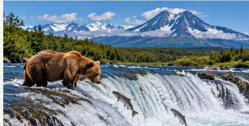
Approved artistic panoramic illustration of Katmai National Park, not a documentary photograph
Katmai National Park · Approved artistic panorama

A remote wilderness famous for brown bears gathering to feed on salmon, volcanic landscapes, and the immense Valley of Ten Thousand Smokes.

Hiking & Backpacking

Brooks River, Riffles Platform & Brooks Falls Trail: 2.9 Miles ★
Dumpling Mountain Trail: 8.9 Miles ★

Waterfalls & Natural Features

Windy Creek Overlook & Ukase Falls: 4.2 Miles

Wildlife & Fishing

Bear Viewing at Brooks Falls ★
Hallo Bay Bear Viewing ★
Seasonal Bear Viewing & Photography
Bear Viewing, Camping & Visit Planning

Other Highlights & Activities

Fat Bear Week ★
Valley of Ten Thousand Smokes Scenic Excursion ★
Kenai Fjords National Park ★
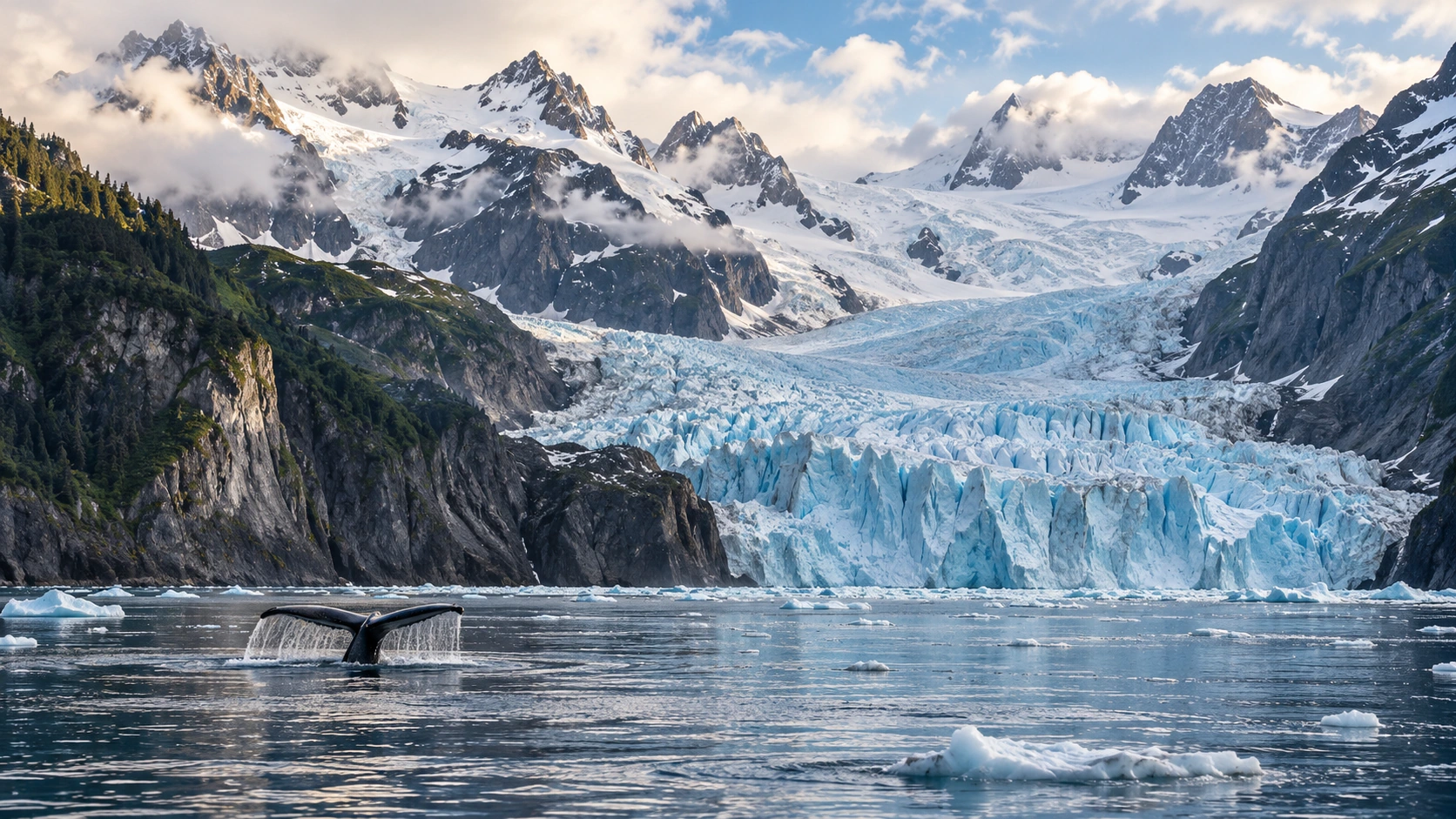
Approved artistic panoramic illustration of Kenai Fjords National Park, not a documentary photograph
Kenai Fjords National Park · Approved artistic panorama

A breathtaking meeting of ice, mountains, rainforest, and ocean, with tidewater glaciers, rugged coastal scenery, and wildlife-rich waters.

Hiking & Backpacking

Harding Icefield Trail: 8.6 Miles ★
Exit Glacier View & Overlook Loop: 2.2 Miles ★
Glacier View Loop: 1.2 Miles
Pedersen Lagoon Ridge Trail: 2.4 Miles
Remote Lodge Access
Hiking Trails & Safety Guidelines

Paddling, Rafting & Water Adventures

Kenai Fjords Glacier & Wildlife Cruises ★

Other Highlights & Activities

Rainforest Nature Walk: 1.1 Miles
Kobuk Valley National Park ★
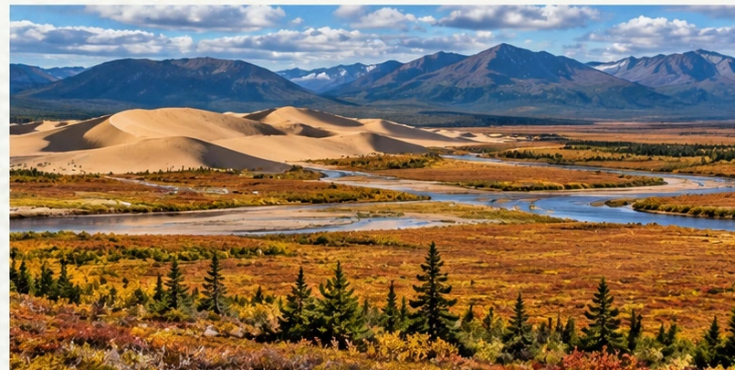
Approved artistic panoramic illustration of Kobuk Valley National Park, not a documentary photograph
Kobuk Valley National Park · Approved artistic panorama

A vast and rarely visited Arctic wilderness known for enormous sand dunes, migrating caribou, and remote river valleys.

Waterfalls & Natural Features

Great Kobuk Sand Dunes & Little Kobuk Sand Dunes ★

Wildlife & Fishing

Caribou Migration Viewing

Visitor Planning & Safety

Wilderness Access & Trip Planning

Other Highlights & Activities

Flightseeing from Kotzebue ★
Kobuk River & Remote Arctic Backcountry Expeditions
Exact River Section & Park Itinerary To Confirm
Lake Clark National Park & Preserve ★

An extraordinary wilderness of turquoise lakes, volcanoes, rugged mountains, and bear-rich coastlines, reached primarily by small plane or boat.

Hiking & Backpacking

Kontrashibuna Lake via Tanalian Falls Trail: 6.5 Miles ★
Tanalian Mountain Trail: 8.6 Miles ★
Tanalian Falls Trail: 4 Miles ★
Portage Creek Trail: 6.5 Miles
Beaver Pond Loop: 3.5 Miles
Remote Guided Wilderness & Backpacking Expeditions

Wildlife & Fishing

Chinitna Bay Bear Viewing ★
Crescent Lake Bear Viewing ★
Bear Viewing & Wilderness Access Information

Other Highlights & Activities

Turquoise Lake & Lake Clark Scenic Wilderness ★
Lake Clark Flightseeing from Anchorage, Kenai, or Homer
Matanuska Glacier & Glenn Highway ★

A dramatic glacier and mountain corridor with ice adventures, river rafting, and panoramic roadside scenery.

Hiking & Backpacking

Lion’s Head Trail: 2.1 Miles ★

Paddling, Rafting & Water Adventures

Climbing, Caving & Mountain Adventures

Matanuska Glacier Guided Ice Hikes & Ice Climbing ★
Guide Reservation / Glacier Access

Cycling & Scenic Routes

Glenn Highway Scenic Drive ★
Misty Fjords National Monument ★

A spectacular landscape of steep granite walls, waterfalls, rainforest, and deep fjords in Southeast Alaska, best experienced from the air or water.

Paddling, Rafting & Water Adventures

Guided Sea Kayaking ★
Remote Fjords / Guided Coastal Paddling

Wildlife & Fishing

Fjord & Wildlife Exploration

Guided Tours & Outdoor Experiences

Misty Fjords Floatplane & Seaplane Excursion ★

Other Highlights & Activities

Remote Coastal Wilderness Adventures
Rudyerd Bay & New Eddystone Rock ★
Forest Recreation & Trip Planning
Tongass National Forest ★

The largest national forest in the United States, filled with temperate rainforest, coastal mountains, waterfalls, and island-studded waterways.

Hiking & Backpacking

Mount Verstovia Trail: 4.6 Miles ★
Deer Mountain Trail: 5.2 Miles ★
Harbor Mountain Trail: 5.8 Miles ★
Indian River Trail: 9 Miles ★
Laughton Glacier Trail: 4.4 Miles ★
Mount Roberts Trail: 4.5 Miles ★
Nugget Falls Trail: 2 Miles ★
Perseverance Trail: 4.5 Miles ★
West Glacier Trail: 6.3 Miles ★
Carlanna Lake Trail: 5.4 Miles
Eye of the Needle Trail: 4.6 Miles
Herring Cove Trail: 3.6 Miles
Teetering Rock Trail: 1.8 Miles
West Glacier Spur Trail: 6.1 Miles
Perseverance Lake Trail: 5.1 Miles
Gavan Hill Trail: 12.1 Miles

Paddling, Rafting & Water Adventures

Guided Coastal Kayaking & Wildlife Excursions ★
Fords Terror Wilderness Sea Kayaking ★
Remote Fjord Kayaking / Multi-Day Expedition

Other Highlights & Activities

Guided Mendenhall Glacier Trekking ★
Helicopter Access & Guided Ice Exploration
Forest Recreation & Trip Planning
Valdez & Prince William Sound ★

A dramatic coastal region of glaciers, waterfalls, towering mountains, and sheltered waterways, with excellent opportunities for kayaking and glacier exploration.

Hiking & Backpacking

Solomon Gulch Viewpoint & John Hunter Memorial Trail: 3.8 Miles

Waterfalls & Natural Features

Bridal Veil Falls
Keystone Canyon Waterfalls ★

Paddling, Rafting & Water Adventures

Sea Kayaking & Coastal Wildlife Viewing ★
Icebergs / Fjord Scenery / Marine Wildlife
Guided Lowe River Whitewater Rafting ★
Keystone Canyon / Waterfall Views / Class II-III Rapids

Other Highlights & Activities

Worthington Glacier ★
Valdez Glacier & Glacier Lake ★
Columbia Glacier Boat Excursion ★
Glacier Views & Marine Wildlife
Regional Activities & Trip Planning
Wood-Tikchik State Park ★

Remote southwestern Alaska wilderness of interconnected glacial lakes, wild rivers, rugged mountains, and multi-day backcountry journeys.

Hiking & Backpacking

Wood River Lakes Water Trail: 85+ Miles ★
Multi-Day Lake & River Paddling / Wilderness Camping / Floatplane
Access

Paddling, Rafting & Water Adventures

Tikchik River Float Trip: 42 - 60 Miles ★
Remote River Expedition / Permit Required

Other Highlights & Activities

Wilderness Expedition & Backcountry Access ★
Fly-In Paddling / Primitive Camping / Wildlife Viewing
Wrangell-St. Elias National Park & Preserve ★

The largest national park in the United States, with enormous glaciers, towering volcanic peaks, historic mining settlements, and some of Alaska’s most ambitious wilderness adventures.

Hiking & Backpacking

Root Glacier Trail: 5.7 Miles ★
Bonanza Mine Trail: 8.4 Miles ★
Skookum Volcano Trail: 4.2 Miles ★
Caribou Creek Trail: 7.1 Miles
Jumbo Mine Trail: 5 Miles
West Kennicott Glacier Trail: 2.1 Miles
Rambler Mine Trail: 1.7 Miles
Guided Glacier Hiking / Ice Climbing / Alpine Expeditions ★

Paddling, Rafting & Water Adventures

Nizina River Guided Packrafting ★
Glacial Packrafting / Whitewater

Climbing, Caving & Mountain Adventures

Mount Blackburn Technical Climbing Expedition ★

History, Culture & Attractions

McCarthy & Kennicott Historic District ★

Visitor Planning & Safety

Park Access & Backcountry Planning

Other Highlights & Activities

Kennicott Glacier Exploration ★
Mount Wrangell Summit Expedition ★
Mount Wrangell Objective & Guide Availability To Confirm
Alaska Multi-Day Guided Adventures ★

Multi-day journeys through Alaska’s mountains, glaciers, fjords, and remote wilderness combine hiking, glacier exploration, kayaking, wildlife encounters, and expedition travel.

Hiking & Backpacking

G Adventures - Hike Alaska: Valdez & Wrangell-St. Elias: 7 Days ★
Anchorage / Valdez / Worthington Glacier / Valdez Glacier Lake
McCarthy / Bonanza Mine / Glennallen
Glacier Viewing / Alpine Hiking / Historic Mining Sites
Intrepid Travel - Hiking the Great Land of Alaska: 8 Days ★
Anchorage / Denali / Seward / Harding Icefield / Homer / Kachemak
Bay
Mountain Hiking / Coastal Exploration / Sea Kayaking

Paddling, Rafting & Water Adventures

Intrepid Travel - Alaska Hike, Bike & Kayak: 7 Days ★
Anchorage / Matanuska Glacier / Denali / Seward / Resurrection Bay
Hiking / Cycling / Glacier Exploration / Sea Kayaking

Other Highlights & Activities

Alaska Alpine Adventures - Guided Backcountry Trekking & Custom
Wilderness Trips ★
Remote Mountain Hiking / Backpacking / Custom Expeditions
EF Go Ahead Tours - Alaska Northern Lights: Anchorage to Fairbanks: 8
Days
Anchorage / Musk Ox Farm / Talkeetna / Denali / Fairbanks / Reindeer
Ranch
Northern Lights / Wildlife Encounters / Interior Alaska
Intrepid Travel - Best of Alaska: 10 Days ★
Anchorage / Denali / Talkeetna / Seward / Kenai Fjords / Homer
Wildlife Viewing / Glacier Cruises / Coastal Sightseeing
Much Better Adventures - The Ultimate Adventure in Alaska: 10 Days
Anchorage / Denali / Valdez / Prince William Sound / Wrangell-St. Elias
Hiking / Glacier Exploration / Canoeing / Sea Kayaking / Wildlife
Viewing
NOLS - Wilderness Leadership & Expedition Skills
Outdoor Leadership / Backcountry Travel / Expedition Training
Alaska Cruises ★

Scenic voyages explore Alaska’s fjords, glaciers, coastal mountains, and wildlife-rich waterways, with choices ranging from large-ship cruises to active small-ship expeditions. Seattle departures offer a convenient coastal circuit; Vancouver-Whittier sailings pair naturally with interior Alaska travel.

Paddling, Rafting & Water Adventures

Lindblad - Alaska Expedition Cruises ★
Naturalist-Led Excursions / Remote Fjords / Glacier Viewing /
Kayaking
UnCruise - Alaska Small-Ship Adventures ★
Guided Kayaking / Skiff Excursions / Coastal Hiking
Glaciers & Wildlife Encounters

Other Highlights & Activities

Holland America - Alaska Inside Passage: 7 Days ★
Southeast Alaska Waterways / Historic Ports / Shore Excursions
Glacier Viewing & Wildlife
Holland America - Glacier Discovery: 7 Days ★
Vancouver to Whittier
Glacier Scenery / Interior Alaska Extensions
Glacier Bay Visits - Sailing Dependent
Norwegian Bliss - Alaska From Seattle: 7 Days ★
Seattle Departure & Return
Juneau / Ketchikan / Victoria / Sitka Or Skagway - Sailing Dependent
Panoramic Observation Lounge / Inside Passage Scenery
Norwegian Jade - Vancouver to Whittier: 7 Days ★
Vancouver / Ketchikan / Juneau / Skagway / Whittier - Sailing
Dependent
Glacier Scenery / Interior Alaska Extensions / Alaska Railroad
Connections
American Samoa
Fagatele Bay National Marine Sanctuary ★

A protected volcanic bay known for vibrant coral reefs, tropical marine life, and rugged coastal scenery.

Other Highlights & Activities

National Park of American Samoa ★
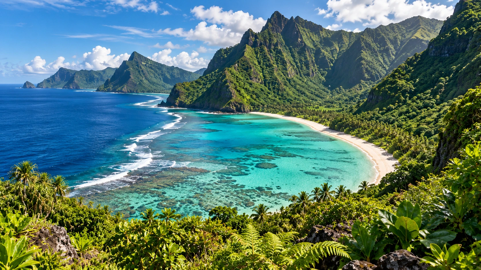
Approved artistic panoramic illustration of National Park of American Samoa, not a documentary photograph
National Park of American Samoa · Approved artistic panorama

A unique tropical national park spanning Tutuila, Taū, and Ofu, with rainforest hikes, volcanic ridges, secluded beaches, and spectacular ocean views.

Hiking & Backpacking

Fatifati Auala Trail: 2.8 Miles to Fagaloa Viewpoint; 5.8 Miles to Mount
‘Alava ★
Mount ‘Alava Adventure Trail: 5.6 Miles ★
Mount ‘Alava Trail: 7 Miles ★
Pola Island Trail: 0.1 Miles ★
Tuafanua Trail: 2.2 Miles ★
Upper Sauma Ridge Trail: 3.2 Miles ★
Blunts Point Trail: 0.6 Miles ★
Lower Sauma Ridge Trail: 0.4 Miles ★
World War II Heritage Trail: 1.7 Miles ★

Visitor Planning & Safety

Ofu & Olosega Islands ★

Remote tropical islands with white-sand beaches, brilliant turquoise water, coral reefs, and extraordinary isolation.

Waterfalls & Natural Features

Ofu Beach ★

Paddling, Rafting & Water Adventures

Ofu Coral Reef Snorkeling ★

Other Highlights & Activities

Island Transportation & Access ★
Taʻū Island ★

A remote volcanic island of rugged rainforest, traditional villages, dramatic coastal scenery, and the territory’s highest mountain.

Hiking & Backpacking

Siʻu Point Trail: 5.7 Miles ★

History, Culture & Attractions

Saua Cultural Site ★

Other Highlights & Activities

Remote Mount Lata Summit Exploration ★
Territory High Point / Remote Summit Access
Remote Rainforest & Coastal Exploration ★
Tutuila Island Coastal Adventures ★

Explore rugged volcanic coastlines, secluded bays, green ridgelines, and dramatic viewpoints around American Samoa’s main island.

Hiking & Backpacking

Leʻala Shoreline Trail: 3.2 Miles ★
Oge Beach Trail: 2.7 Miles ★

Waterfalls & Natural Features

Alega Beach & Tisa’s Barefoot Bar ★

Paddling, Rafting & Water Adventures

Pago Pago Scuba Diving, Snorkeling, and Fishing ★

Other Highlights & Activities

Island Activities & Trip Planning
Arizona
Aravaipa Canyon Wilderness

A remote desert canyon with towering cliffs, a flowing creek, lush riparian vegetation, and dozens of stream crossings through a remarkably wild landscape.

Hiking & Backpacking

Multi-Day Canyon Backpacking ★
Permit Required
Flash Flooding Risk

Visitor Planning & Safety

Wilderness Access & Permit Requirements

Other Highlights & Activities

Aravaipa Canyon East-to-West: 12.25 Miles ★
Arizona Trail - Arizona ★

An 800-mile cross-state journey from the Mexican border to Utah, linking Sonoran Desert, sky-island mountains, ponderosa forests, the Grand Canyon, and the Vermilion Cliffs.

Hiking & Backpacking

Arizona National Scenic Trail: 800 Miles ★
Passage Hiking & Multi-Day Backpacking ★
Trail Passages, Water Sources & Conditions

Other Highlights & Activities

Grand Canyon Crossing ★
Baboquivari Peak Wilderness

A dramatic sacred peak rising above the Sonoran Desert, famous for technical rock climbing and challenging summit routes.

Climbing, Caving & Mountain Adventures

Baboquivari Peak Technical Summit Climb ★
Guided Rock Climbing & Technical Summit Attempts ★
Baboquivari Trip Availability To Confirm / Technical Climbing
Experience Recommended
Tribal Land Access, Permissions & Current Conditions To Confirm

Visitor Planning & Safety

Wilderness Access & Route Planning
Canyon de Chelly National Monument ★

A spectacular canyon of towering sandstone walls, ancient cliff dwellings, and deep Navajo cultural history, including the iconic Spider Rock.

Hiking & Backpacking

White House Trail: 2.5 Miles ★
Navajo-Guided Canyon Hiking & Cultural Tours ★

Guided Tours & Outdoor Experiences

Canyon de Chelly Guided Horseback Riding ★

Other Highlights & Activities

North Rim Overlooks ★
South Rim Drive & Spider Rock Overlook ★
Guided Canyon Tours & Access
Chiricahua National Monument

A surreal landscape of towering rhyolite pinnacles, balanced rocks, narrow passages, and forested mountain trails.

Hiking & Backpacking

Heart of Rocks Loop: 7.4 Miles ★
The Big Loop: 9.5 Miles ★
Chiricahua Natural Bridge Trail: 4.7 Miles ★
Echo Canyon Loop: 3.3 Miles ★
Inspiration Point Trail: 5.4 Miles ★
Sugarloaf Mountain Trail: 1.8 Miles ★
Massai Point Overlook Trail: 0.5 Miles
Rhyolite Canyon Trail: 5.1 Miles

Waterfalls & Natural Features

Bonita Canyon Scenic Drive

Other Highlights & Activities

Park Trails & Visit Planning
Coconino National Forest

A vast landscape of red-rock formations, ponderosa pine forests, volcanic terrain, alpine summits, and dramatic Mogollon Rim scenery.

Hiking & Backpacking

Humphreys Peak Trail: 10.7 Miles ★
Arizona’s Highest Point: 12,633 Feet
West Clear Creek Wilderness Backpacking ★

Waterfalls & Natural Features

Mogollon Rim Scenic Overlooks ★

Climbing, Caving & Mountain Adventures

Lava River Cave: 0.8 Miles ★

Visitor Planning & Safety

Forest Trails & Recreation
Glen Canyon National Recreation Area / Navajo Nation ★

A spectacular region of sandstone canyons, blue-water reservoirs, sculpted rock formations, and unforgettable Colorado River scenery.

Paddling, Rafting & Water Adventures

Cycling & Scenic Routes

Hole-in-the-Rock Road Scenic Drive ★
Road Conditions / Vehicle Requirements

History, Culture & Attractions

Cathedral in the Desert
Water-Level Dependent / Boat Or Kayak Access

Other Highlights & Activities

Horseshoe Bend Overlook: 1.5 Miles ★
Lake Powell Boat Trips ★
Reflection Canyon
Remote Access & Strenuous Desert Hike
Lower Antelope Canyon ★
Upper Antelope Canyon ★
Grand Canyon National Park ★
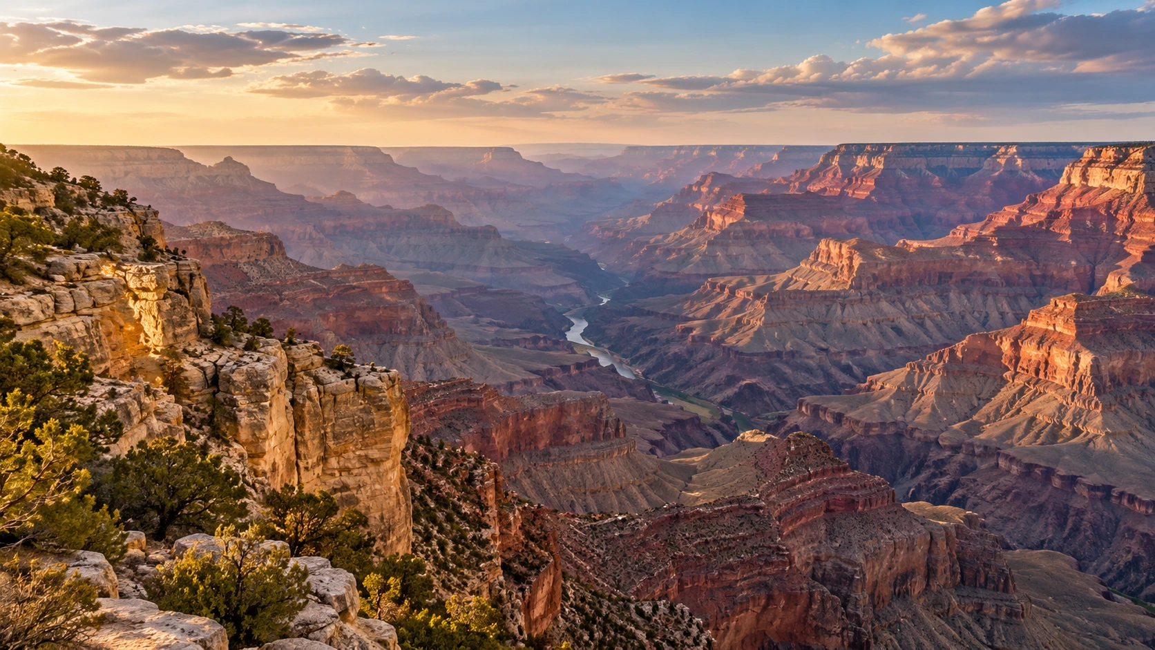
Approved artistic panoramic illustration of Grand Canyon National Park, not a documentary photograph
Grand Canyon National Park · Approved artistic panorama

One of the world’s most extraordinary landscapes: an immense, layered canyon carved by the Colorado River, with unforgettable rim views, challenging descents, and world-class backpacking.

Hiking & Backpacking

Bright Angel Trail: 15.8 Miles ★
Cape Final Trail: 4.2 Miles ★
Grandview Trail to Horseshoe Mesa: 6.4 Miles ★
Hermit Trail to Santa Maria Spring: 5 Miles ★
North Kaibab Trail to Roaring Springs: 9.4 Miles ★
Rim-to-Rim Hike: 23-24 Miles ★
Current Closures / Water Availability / Trail Conditions
South Kaibab Trail: 7 Miles ★
South Kaibab, Tonto & Bright Angel Loop: 17 Miles ★
South Kaibab, Phantom Ranch, and Bright Angel Trail: 16.6 Miles ★
Canyon Crossing / Water & Heat Planning
3-Mile Resthouse via Bright Angel Trail: 6.1 Miles ★
Rim Trail: 13 Miles ★
Shoshone Point Trail: 2.1 Miles ★
Widforss Trail: 9.3 Miles ★
Cape Royal Trail: 0.8 Miles
Overnight Grand Canyon Backpacking ★
Backcountry Permit Required

Waterfalls & Natural Features

Grand Canyon Scenic Flights ★
Scenic Flights & Helicopter Excursions

Paddling, Rafting & Water Adventures

Cycling & Scenic Routes

Grand Canyon Railway Journey ★
Historic Train / South Rim Access

Other Highlights & Activities

Phantom Ranch ★
Historic Lodging Deep in the Canyon
Overnight Reservations / Current Operations
Park Trails, Conditions & Safety
Grand Canyon-Parashant National Monument

An exceptionally remote landscape of desert mountains, volcanic formations, deep canyons, and some of the region’s darkest night skies.

Waterfalls & Natural Features

Whitmore Canyon Overlook ★

Other Highlights & Activities

Mount Logan Wilderness Exploration ★
Remote Backcountry Camping & Stargazing
High-Clearance / 4WD Access
Backcountry Access & Trip Planning
Havasupai Indian Reservation ★

A remarkable oasis of turquoise waterfalls, travertine pools, and red-rock canyon walls within the homeland of the Havasupai people.

Hiking & Backpacking

Havasu Canyon Backpacking: 24 Miles ★
Overnight Reservation Required
No Day Hiking

Waterfalls & Natural Features

Beaver Falls ★
Havasu Falls ★
Mooney Falls ★

Other Highlights & Activities

Tribal Access & Trip Planning
Hoover Dam / Lake Mead National Recreation Area ★

A dramatic meeting of desert mountains, deep blue water, the Colorado River, and one of America’s most famous engineering landmarks.

Hiking & Backpacking

Arizona Hot Spring Trail: 5.8 Miles ★
Goldstrike Canyon Trail: 6 Miles ★
Black Canyon Water Trail: 30 Miles ★
Full Paddling Route / Hoover Dam Launch Permit Required

Paddling, Rafting & Water Adventures

Guided Black Canyon Kayaking ★

Other Highlights & Activities

Hoover Dam ★
Hoover Dam & Colorado River Overlooks ★
Dam Tours & Visitor Access
Park Trails, Water Recreation & Access Information
Kofa National Wildlife Refuge

A vast, rugged Sonoran Desert refuge of isolated mountain ranges, desert palms, wildlife, and striking desert solitude.

Hiking & Backpacking

Palm Canyon Trail: 0.9 Miles ★

Wildlife & Fishing

Desert Wildlife Viewing & Remote Camping
High-Clearance Road Access

History, Culture & Attractions

Castle Dome Mountains Backcountry Exploration ★

Other Highlights & Activities

Kofa Queen Canyon Backcountry Exploration ★
Refuge Recreation & Access Information
Marble Canyon / Vermilion Cliffs National Monument ★

A surreal desert wilderness of swirling sandstone, narrow slot canyons, colorful rock formations, and some of Arizona’s most coveted hiking permits.

Hiking & Backpacking

Paria Canyon Backpacking: 38 Miles ★
The Maze Trail: 1.3 Miles
Sun Valley Mine Trail: 2.3 Miles

Climbing, Caving & Mountain Adventures

Guided Technical Canyoneering & Desert Adventures

History, Culture & Attractions

Monument Access, Permits & Trip Planning

Other Highlights & Activities

Coyote Buttes South from Cottonwood Teepees Trailhead: 3.9 Miles ★
Monument Valley / Navajo National Monument ★

Iconic sandstone buttes, desert panoramas, and ancestral cliff dwellings within the Navajo Nation.

Hiking & Backpacking

Wildcat Trail: 4 Miles ★
Sandal Trail to Betatakin Overlook: 1 Mile ★

Cycling & Scenic Routes

Monument Valley Scenic Drive ★

History, Culture & Attractions

Navajo-Guided Cultural & Backcountry Tours ★
Monument Trails & Access
Mount Lemmon / Santa Catalina Mountains ★

A striking transition from saguaro desert to pine forest, with high summits, cool mountain trails, granite climbing, and sweeping views over Tucson.

Hiking & Backpacking

Finger Rock Trail: 4.5 Miles ★
Seven Falls via Bear Canyon Trail: 8 Miles ★
Wilderness of Rocks Trail: 8.6 Miles ★
Mount Lemmon Lookout Trail: 0.7 Miles ★
Mount Lemmon Meadow Trail: 2 Miles ★
Seven Cataracts Trail: 2.5 Miles ★

Waterfalls & Natural Features

Mount Lemmon Summit Road & Scenic Overlooks ★

Climbing, Caving & Mountain Adventures

Visitor Planning & Safety

Forest Trails & Recreation
Organ Pipe Cactus National Monument

An extraordinary Sonoran Desert landscape filled with organ pipe and saguaro cacti, rugged volcanic mountains, and colorful desert sunsets.

Hiking & Backpacking

Estes Canyon - Bull Pasture Loop: 3.6 Miles ★
Senita Basin / Milton Mine Loop: 8.6 Miles ★
Alamo Canyon Trail: 1.8 Miles ★
Bull Pasture Trail: 4.6 Miles ★
Victoria Mine Trail: 4.4 Miles
Arch Canyon Trail: 2.9 Miles

Cycling & Scenic Routes

Park Trails & Scenic Drives

Other Highlights & Activities

Ajo Mountain Drive ★
Patagonia Lake State Park / Sonoita Creek State Natural Area

A scenic southern Arizona escape with a peaceful lake, rolling grasslands, riparian habitat, and exceptional birdwatching.

Hiking & Backpacking

Cat Cave Trail: 5.2 Miles ★
Coal Mine Spring Trail: 13 Miles ★
Patagonia-Sonoita Creek Preserve Hiking: 2-3 Miles ★
Sonoita Creek State Natural Area Overlook Trail: 1.5 Miles ★
Sonoita Creek Trail: 3 Miles ★
Blackhawk Trail: 2.8 Miles
Patagonia Lake Shoreline Trail: 0.7 Miles

Wildlife & Fishing

Birdwatching & Wildlife Photography ★

Other Highlights & Activities

Petrified Forest National Park ★
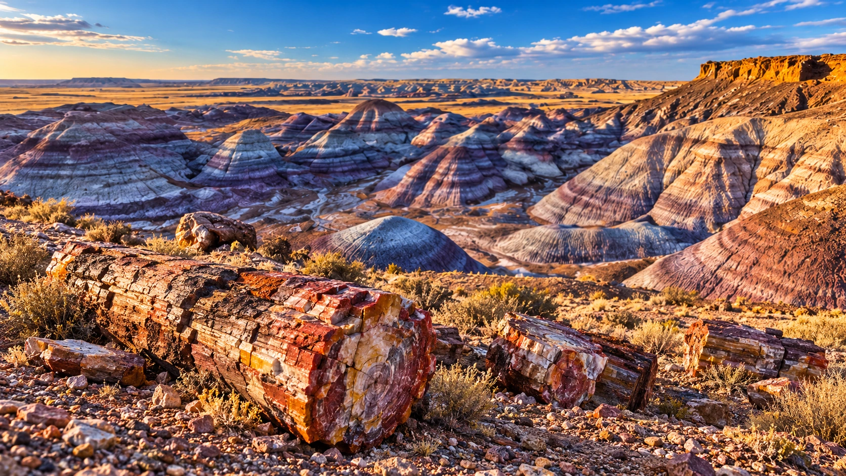
Approved artistic panoramic illustration of Petrified Forest National Park, not a documentary photograph
Petrified Forest National Park · Approved artistic panorama

A colorful badlands landscape of fossilized trees, painted desert hills, ancient petroglyphs, and remarkable geological formations.

Hiking & Backpacking

Blue Mesa Trail: 1 Mile ★
Crystal Forest Trail: 0.8 Miles ★
Agate House Trail: 2 Miles ★
Giant Logs Trail: 0.5 Miles ★
Long Logs Trail: 1.6 Miles ★
Onyx Bridge Trail: 4 Miles ★
Painted Desert Rim Trail: 1.2 Miles ★
Puerco Pueblo Trail: 0.3 Miles ★
Long Logs and Agate House Loop: 2.6 Miles ★
Historic Blue Forest Trail: 2.4 Miles

Cycling & Scenic Routes

Petrified Forest Scenic Drive

Other Highlights & Activities

Park Trails & Visit Planning
Phoenix Mountain Preserves ★

Hiking & Backpacking

Camelback Mountain via Echo Canyon Trail: 2.4 Miles ★
Piestewa Peak Summit Trail #300: 2 Miles ★

Other Highlights & Activities

Desert summits above Phoenix offer steep rocky trails and expansive
Sonoran Desert views.
Summit Trails & Access Information
Picacho Peak State Park ★

An iconic desert peak rising dramatically above the surrounding landscape, with steep trails, exposed scrambling, and sweeping summit views.

Hiking & Backpacking

Hunter Trail: 4 Miles ★
Sunset Vista Trail: 5.5 Miles ★

Visitor Planning & Safety

Park Trails & Access Information

Other Highlights & Activities

Picacho Peak Summit ★
Steep Terrain / Exposed Cable Sections
Roden Crater ★

James Turrell’s monumental land-art project transforms an extinct volcanic crater into an exploration of light, sky, and perception.

Other Highlights & Activities

Light & Sky Art Installation ★
Restricted Access / Visitor Availability
Project & Access Information
Saguaro National Park ★

A classic Sonoran Desert landscape filled with towering saguaro cacti, rugged mountain ridges, desert washes, and glowing sunsets.

Hiking & Backpacking

Tanque Verde Ridge Trail to The Dome: 5.4 Miles ★
Wasson Peak via Kings Canyon Trail: 7.8 Miles ★
Bridal Wreath Falls Trail: 4.7 Miles ★
Douglas Spring / Bridal Wreath / Three Tank / Garwood Loop: 7.3 Miles ★
Gould Mine Trail: 2.5 Miles ★
Hope Camp & Ridgewood Trail: 2 Miles ★
Hugh Norris Trail: 4.9 Miles ★
Loma Verde / Squeeze Pen Loop: 3.7 Miles ★
Mica View & Cactus Forest Loop: 2 Miles ★
Signal Hill Petroglyphs Trail: 0.3 Miles ★
Valley View Overlook Trail: 0.8 Miles ★
Mica View, Cholla, and Cactus Forest Loop: 3.9 Miles ★
Sendero Esperanza Trail: 5.4 Miles
Cactus Forest Loop Drive ★

Other Highlights & Activities

Garwood Dam & Wildhorse Tank: 6.4 Miles ★
Park Trails & Visit Planning
Santa Rita Mountains / Mount Wrightson ★

A prominent southern Arizona mountain range rising above oak woodland, pine forest, and desert foothills, with a challenging summit hike and expansive views.

Hiking & Backpacking

Mount Wrightson via Old Baldy Trail: 10.8 Miles ★
Summit Elevation: 9,456 Feet
Mount Wrightson via Super Trail: 13.1 Miles ★

Visitor Planning & Safety

Wilderness Trails & Access
Sedona / Red Rock-Secret Mountain Wilderness ★

A world-famous red-rock landscape of sandstone spires, natural arches, hidden caves, sacred-feeling canyons, and dramatic desert sunsets.

Hiking & Backpacking

Bear Mountain Trail: 4.6 Miles ★
Cathedral Rock Trail: 1.1 Miles ★
Devil’s Bridge Trail via Mescal Trailhead: 3.9 Miles ★
West Fork Oak Creek Trail: 6.5 Miles ★
Airport Loop Trail: 3.3 Miles ★
Bell Rock Trail: 0.8 Miles ★
Birthing Cave Trail: 1.9 Miles ★
Boynton Canyon Trail: 6.6 Miles ★
Broken Arrow Trail: 2.9 Miles ★
Fay Canyon Arch Trail: 1.5 Miles ★
Seven Sacred Pools & Soldier Pass Cave Trail: 2.9 Miles ★
Seven Sacred Pools via Soldier Pass to Brins Mesa Loop: 5.7 Miles ★
Soldier Pass Trail: 4.8 Miles ★

Climbing, Caving & Mountain Adventures

Cycling & Scenic Routes

Oak Creek Scenic Drive
Schnebly Hill Road Scenic Drive ★

Visitor Planning & Safety

Wilderness Trails & Access

Other Highlights & Activities

Red Rock Crossing / Crescent Moon ★
Sunrise Hot-Air Balloon Flight ★
Red-Rock Scenery / Weather-Dependent Departure
Sunset Crater Volcano / Wupatki National Monuments ★

A striking combination of black lava fields, volcanic cinder cones, painted desert landscapes, and ancient Puebloan villages connected by a scenic drive north of Flagstaff.

Hiking & Backpacking

Lava Flow Trail: 1 Mile ★
Wupatki Pueblo Trail: 1 Mile ★
Citadel Pueblo Trail: 0.2 Miles ★
Lenox Crater Trail: 1.6 Miles ★
Wukoki Pueblo Trail: 0.2 Miles ★

Cycling & Scenic Routes

Sunset Crater Volcano Scenic Drive ★

History, Culture & Attractions

Other Highlights & Activities

Lomaki & Box Canyon Pueblos: 0.5 Miles ★
Wupatki Pueblo & Ancient Settlement Exploration ★
Volcano Trails & Trip Planning
Superstition Wilderness ★

A rugged maze of jagged volcanic peaks, steep desert canyons, hidden caves, and legendary Lost Dutchman country.

Hiking & Backpacking

Flatiron via Siphon Draw Trail: 6 Miles ★
Exposed Scrambling / Experience Required
Peralta Trail to Fremont Saddle: 5.8 Miles ★
Hieroglyphic Trail: 2.9 Miles ★
Wave Cave Trail: 3 Miles ★

Climbing, Caving & Mountain Adventures

Guided Technical Climbing & Scrambling

Other Highlights & Activities

Weaver’s Needle Backcountry Route ★
Tonto National Forest / Four Peaks Wilderness

A diverse desert-and-mountain landscape of rugged peaks, deep river canyons, natural bridges, and seasonal waterfalls.

Hiking & Backpacking

Apache Trail Scenic Drive

Waterfalls & Natural Features

Tonto Natural Bridge ★
Pine Creek, Gowan & Waterfall Trails

Paddling, Rafting & Water Adventures

Salt River Whitewater Rafting ★
Seasonal Whitewater / Class III-IV Rapids

Climbing, Caving & Mountain Adventures

Guided Rock Climbing & Outdoor Adventures

Visitor Planning & Safety

Forest Trails & Recreation

Other Highlights & Activities

Fossil Creek ★
Four Peaks Summit & Backcountry Exploration ★
Salt River Canyon ★
Tucson Mountains ★

A rugged desert range west of Tucson, with towering saguaros, volcanic hills, scenic overlooks, and classic Sonoran Desert hiking.

Hiking & Backpacking

Tumamoc Hill Trail: 3 Miles ★
Tucson Mountain Park Hiking & Scenic Overlooks ★

Visitor Planning & Safety

Park Trails & Access Information

Other Highlights & Activities

Gates Pass Sunset Views ★
Walnut Canyon National Monument ★

A dramatic limestone canyon east of Flagstaff, where ancient cliff dwellings cling to steep canyon walls amid juniper forests and rugged high-desert scenery.

Hiking & Backpacking

Island Trail: 1 Mile ★
Canyon Stairways / Ancient Cliff Dwellings
Steep Stairways / Current Access
Rim Trail: 0.7 Miles ★
Rimside Walk / Canyon Overlooks

History, Culture & Attractions

Ancient Puebloan Cliff Dwellings & Cultural History ★

Other Highlights & Activities

Park Trails, Cliff Dwellings & Visitor Planning
Arizona Multi-Day Guided Adventures ★

Small-group journeys through Arizona and the surrounding Southwest combine canyon hiking, red-rock landscapes, and cultural experiences.

Hiking & Backpacking

Intrepid Travel - Hiking in Sedona and the Grand Canyon: 4 Days ★
Sedona / Grand Canyon National Park
Guided Hiking / Inn-Based Accommodation
Operated By Wildland Trekking

Other Highlights & Activities

G Adventures - Best of Utah & Arizona National Parks: 7 Days ★
Zion / Bryce Canyon / Horseshoe Bend / Monument Valley / Grand
Canyon / Route 66
Hiking / Navajo-Guided Jeep Tour / Canyon Scenery
Arkansas
Buffalo National River

One of America’s first national rivers, flowing through towering limestone bluffs, waterfalls, forested wilderness, and scenic Ozark valleys.

Hiking & Backpacking

Big Bluff / Goat Trail: 6 Miles ★
Lost Valley Trail: 2.3 Miles ★
Buffalo River Trail: 36-39 Miles ★
Guided Buffalo River Hiking & Backpacking ★

Waterfalls & Natural Features

Hemmed-in Hollow Falls: 5.7 Miles ★

Paddling, Rafting & Water Adventures

Other Highlights & Activities

River Trails & Access
Cossatot River State Park-Natural Area ★

A rugged river canyon in the Ouachita Mountains, known for rocky cascades, forested trails, and some of Arkansas’s most challenging whitewater.

Hiking & Backpacking

Cossatot River Corridor Trail: 12.5 Miles ★
Harris Creek Trail: 3.5 Miles ★
Brushy Creek Nature Trail: 0.75 Miles
Waterleaf Interpretive Trail: 0.5 Miles

Paddling, Rafting & Water Adventures

Cossatot Falls & Class IV-V Whitewater ★
River Trails, Whitewater & Access Information
Crater of Diamonds State Park ★

An eroded volcanic crater offers a hands-on diamond search where visitors may keep the gems they find.

Other Highlights & Activities

Diamond Searching ★
Admission Required / Tool Rentals Available
Finds Not Guaranteed
Hot Springs National Park
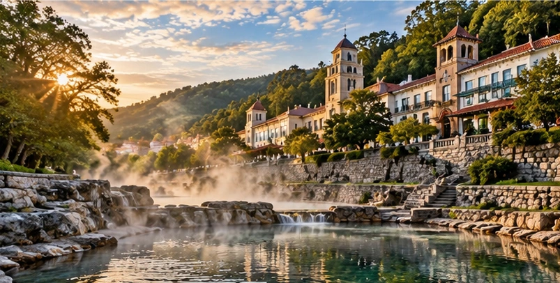
Approved artistic panoramic illustration of Hot Springs National Park, not a documentary photograph
Hot Springs National Park · Approved artistic panorama

A historic mountain landscape centered around naturally heated springs, forested ridges, scenic overlooks, and the elegant bathhouses of Hot Springs.

Hiking & Backpacking

Goat Rock Trail: 1.1 Miles ★
Hot Springs Mountain Trail: 1.7 Miles ★
Sunset Trail: 10 Miles ★
West Mountain Trail Loop: 2-3 Miles ★
Hot Springs Mountain Trail Loop to Gulpha Gorge and Goat Rock: 3.1
Miles ★
Oertel Trail: 0.5 Miles
Peak Trail to Hot Springs Mountain Tower: 0.6 Miles
Honeysuckle Trail and Peak Trail Loop: 1.3 Miles

Waterfalls & Natural Features

Hot Springs Mountain Tower ★

Other Highlights & Activities

Grand Promenade: 0.5 Miles
Bathhouse Row ★
Park Trails & Visit Planning
Mount Magazine State Park ★

Arkansas’s highest mountain, with dramatic bluff-top overlooks, forested ridges, diverse wildlife, and opportunities for climbing and hang gliding.

Hiking & Backpacking

Signal Hill Trail: 1.4 Miles ★
Arkansas’s Highest Point: 2,753 Feet
North Rim Trail: 2.7 Miles ★
Mossback Ridge Trail: 1.3 Miles

Waterfalls & Natural Features

Mount Magazine Scenic Overlooks ★

Climbing, Caving & Mountain Adventures

Rock Climbing & Technical Outdoor Adventures ★

Visitor Planning & Safety

Park Trails & Recreation
Ouachita National Forest ★

A rugged mountain landscape of forested ridges, clear rivers, waterfalls, and remote wilderness stretching across the Ouachita Mountains.

Hiking & Backpacking

Eagle Rock Loop: 26.8 Miles ★
Ouachita National Recreation Trail: 223 Miles ★

Waterfalls & Natural Features

Little Missouri Falls ★

Climbing, Caving & Mountain Adventures

Visitor Planning & Safety

Forest Trails & Recreation

Other Highlights & Activities

Caney Creek Wilderness ★
Forked Mountain ★
Ozark-St. Francis National Forests ★

A spectacular Ozark landscape of forested mountains, limestone bluffs, waterfalls, caves, and clear mountain streams, containing some of the most scenic hiking in the South.

Hiking & Backpacking

Glory Hole Waterfall Trail: 1.9 Miles ★
Kings Bluff & Pedestal Rocks Loop: 4 Miles ★
Ozark Highlands Trail: 165 Miles ★
White Rock Rim Trail: 2.1 Miles ★
Alum Cove Natural Bridge Trail: 1.2 Miles ★
Moonshiners Cave Trail: 0.8 Miles
Devils Canyon Scenic Area Trail and Bushwhack: 3.2 Miles
Unmarked Sections / Navigation
Ozark Highlands Trail: Indian Creek to Lick Branch: 9.6 Miles

Waterfalls & Natural Features

Richland Falls: 4.5-6 Miles ★
Twin Falls / Twin Falls of Richland Creek: 4.7-6.6 Miles ★

Climbing, Caving & Mountain Adventures

Ozark Mountain Rock Climbing & Outdoor Adventures ★

Visitor Planning & Safety

Forest Trails & Recreation

Other Highlights & Activities

Whitaker Point / Hawksbill Crag: 2.9 Miles ★
Richland Creek Wilderness ★
Petit Jean State Park ★

A classic Arkansas mountain landscape of forested canyons, towering bluffs, caves, natural bridges, and waterfalls, centered around historic Petit Jean Mountain.

Hiking & Backpacking

Cedar Falls Trail: 2 Miles ★
Seven Hollows Trail: 4.5 Miles ★
Bear Cave Trail: 0.25 Miles
Cedar Creek Trail: 1.2 Miles

Waterfalls & Natural Features

Cedar Creek Canyon & Cedar Falls Overlook ★

Climbing, Caving & Mountain Adventures

Rock House Cave ★
Guided Via Ferrata / Rock Climbing / Rappelling / Bouldering ★

Visitor Planning & Safety

Park Trails & Recreation
Pinnacle Mountain State Park ★

A distinctive rocky summit rising above the Arkansas River Valley, with panoramic views, exposed scrambling, and forested trails close to Little Rock.

Hiking & Backpacking

West Summit Trail: 1.5 Miles ★
Base Trail: 3.5 Miles ★
East Summit Trail: 1.5 Miles ★
Kingfisher Trail: 1.5 Miles

Visitor Planning & Safety

Park Trails & Recreation
California
Angeles National Forest / Bridge to Nowhere ★

A rugged river canyon leads to a historic bridge surrounded by mountain wilderness and used for guided bungee-jumping adventures.

Hiking & Backpacking

Bridge to Nowhere via East Fork Trail: 10 Miles ★
River Crossings / Full-Day Hiking Approach

Visitor Planning & Safety

Forest Access & Current Conditions

Other Highlights & Activities

Bridge to Nowhere Bungee Jumping ★
Jumpers & Spectators: Advance Registration Required
Hiking Approach / Parking Pass Requirements
Anza-Borrego Desert State Park

California’s great desert wilderness, where eroded badlands, slot canyons, palm oases, dry washes, and rugged mountains create an unexpectedly varied landscape.

Hiking & Backpacking

The Slot Trail: 2.2 Miles ★
Borrego Palm Canyon Trail: 2.8 Miles ★
Wind Caves Trail: 2 Miles
Guided Desert Hiking & Naturalist Tours ★
Guided Desert Hiking & Off-Road Adventures ★

Waterfalls & Natural Features

Hellhole Canyon to Maidenhair Falls: 5 Miles ★

Visitor Planning & Safety

Park Trails & Recreation

Other Highlights & Activities

Arroyo Tapiado Mud Caves
Borrego Badlands Overlook
Borrego Mountain Summit
Coyote Canyon
Desert Wildflower Season ★
Fonts Point Overlook ★
Galleta Meadows Sculptures
Berryessa Snow Mountain National Monument

A rugged Northern California landscape of volcanic peaks, oak woodlands, wildflower meadows, serpentine ridges, and remote wilderness.

Hiking & Backpacking

Berryessa Peak Trail: 14.5 Miles ★
Redbud Trail Loop: 3 Miles ★
Zim Zim Falls Trail: 7.1 Miles ★
Fiske Peak via Blue Ridge Trail: 7.5 Miles
Judge Davis Trail: 10.5 Miles
Valley Vista Trail: 4.8 Miles
Cache Creek Wilderness Hiking

History, Culture & Attractions

Monument Recreation & Access Information

Other Highlights & Activities

Knoxville Recreation Area
Snow Mountain Summit Routes
Walker Ridge Wildflower Viewing
Big Basin Redwoods State Park ★

California’s oldest state park, with ancient coast redwoods, fern-lined canyons, waterfalls, and forested trails in the Santa Cruz Mountains.

Hiking & Backpacking

Dool-Middle Ridge-Meteor Trail Loop: 5.5 Miles ★
Mount McAbee Overlook Trail: 5.7 Miles ★
Ocean View Summit Trail: 4.2 Miles ★
Redwood Loop Trail: 0.6 Miles ★
Sequoia-Skyline to the Sea Trail Loop via Sempervirens Falls: 4.3 Miles
Gazos Creek / Sandy Point / Johansen / Middle Ridge Fire Road Loop: 12
Miles
Shared Fire Roads / Hiking / Cycling / Horseback Riding
Big Sur / Los Padres National Forest ★

A spectacular meeting of mountains and Pacific coastline, with redwood filled canyons, waterfalls, chaparral-covered ridges, and some of California’s most dramatic coastal scenery.

Hiking & Backpacking

Boronda Trail: 10 Miles ★
Cone Peak Trail: 4.5 Miles ★
Ewoldsen Trail: 5.3 Miles ★
Manzana-Sisquoc Loop: 42.4 Miles ★
Sykes Hot Springs via Pine Ridge Trail: 19.7 Miles ★
Garrapata Creek and Soberanes Canyon Loop: 2.8 Miles ★
Partington Cove Trail: 1.5 Miles ★
Pfeiffer Falls and Valley View Trail: 1.5 Miles ★
Soberanes Point and Whale Peak Loop: 1.6 Miles ★
Vicente Flat Trail: 10.5 Miles ★
Andrew Molera Beach Trail: 2 Miles
Limekiln Falls Trail: 0.5 Miles
McWay Falls Overlook Trail: 0.6 Miles

Waterfalls & Natural Features

Santa Paula Canyon to First Falls: 7.2 Miles ★
Salmon Creek Falls: 0.3 Miles
Pacific Valley and Sand Dollar Beach

Visitor Planning & Safety

Forest Trails & Recreation

Other Highlights & Activities

Big Sur River Gorge: 1 Mile
Castle Rock State Park

A rugged Santa Cruz Mountains park known for sandstone formations, forested ridgelines, rock climbing, and views across the redwood covered hills.

Hiking & Backpacking

Castle Rock, Saratoga Gap and Ridge Trail Loop: 10.7 Miles ★
Saratoga Gap and Ridge Trail Loop: 5.6 Miles ★
Castle Rock Falls Trail: 1.3 Miles ★
Castle Rock Nature Trail: 1.6 Miles ★
Castle Rock, Goat Rock and Indian Rock Loop: 6.6 Miles ★
Goat Rock Overlook and High Point via Ridge Trail: 2.8 Miles ★

Climbing, Caving & Mountain Adventures

Rock Climbing & Bouldering ★

Visitor Planning & Safety

Park Trails & Recreation
Channel Islands National Park ★
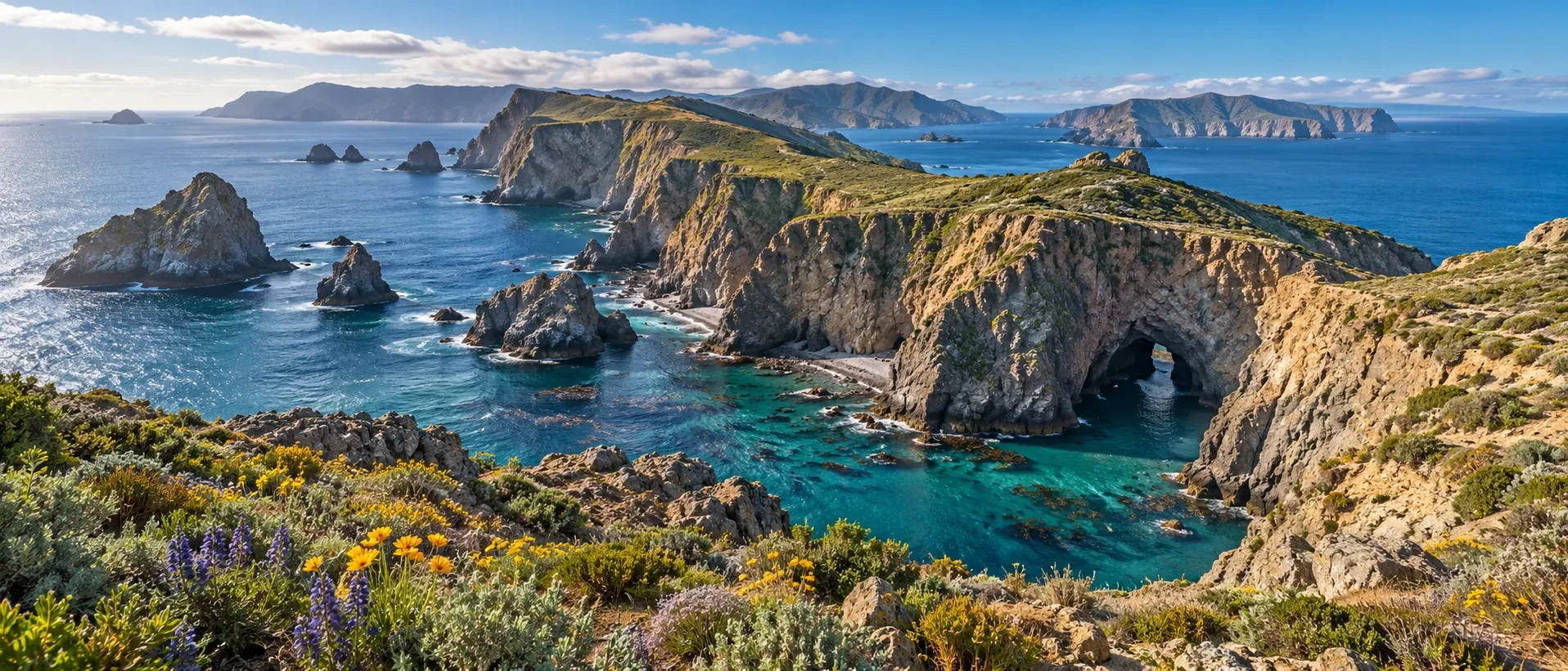
Approved artistic panorama illustrating Channel Islands National Park; not a documentary photograph
Channel Islands National Park · Approved artistic panorama

Five remote Pacific islands with dramatic sea cliffs, secluded beaches, wildlife, island scrub, and coastal hiking that feels worlds away from mainland California.

Anacapa Island

Inspiration Point via East Anacapa Island Trail: 1.5 Miles ★
Anacapa Island Lighthouse and Inspiration Point: 2 Miles ★

San Miguel Island

Restricted Island Access / Ranger-Guided Hikes
Point Bennett Hike: 12 Miles ★
Cuyler Harbor Beach Walk: 1 Mile ★
Nidever Canyon Route: 4 Miles

Santa Barbara Island

Arch Point Hike: 1 Mile ★
Sea Lion Rookery Overlook Hike: 2 Miles ★
Signal Peak Hike: 2.5 Miles ★
Webster Point Hike: 3 Miles ★
Elephant Seal Cove Overlook Hike: 2.5 Miles ★

Santa Cruz Island

Smugglers Road, Scorpion Canyon, and Potato Harbor: 7.8 Miles ★
Cavern Point Loop: 2 Miles ★
Potato Harbor Overlook Hike: 5 Miles ★
Scorpion Canyon Loop: 4.5 Miles ★
Smuggler’s Cove Hike: 7.5 Miles ★
Montañon Ridge Loop: 10 Miles ★

Santa Rosa Island

Cherry Canyon Loop: 3.5 Miles ★
Torrey Pines Loop: 7.5 Miles ★
Carrington Point: 8 Miles ★
Black Mountain: 10 Miles ★
Lobo Canyon: 9.6 Miles ★

Paddling, Rafting & Water Adventures

Island Kayaking & Sea Caves ★
Island Transportation & Guided Sea Cave Kayaking ★
Guided Sea Cave Kayaking ★

Visitor Planning & Safety

Park Access & Visit Planning
Chuckwalla National Monument ★

A remote Colorado Desert landscape of colorful canyons, rugged mountains, palm oases, and extensive off-road routes.

Hiking & Backpacking

Painted Canyon and Ladder Canyon Trail: 4.5 Miles ★
Chuckwalla Trail Loop: 2.1 Miles

Waterfalls & Natural Features

Corn Springs Oasis
Corn Springs Road OHV Route

History, Culture & Attractions

Monument Recreation & Access Information

Other Highlights & Activities

Desert Mountain Scrambles
Mecca Hills Wilderness
Pinto Basin Desert Exploration
Red Cloud Canyon OHV Route
Death Valley National Park ★
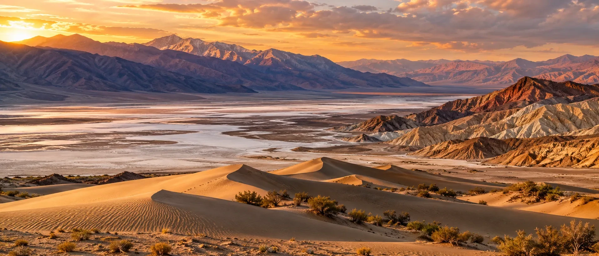
Approved artistic panorama illustrating Death Valley National Park; not a documentary photograph
Death Valley National Park · Approved artistic panorama

The largest national park in the contiguous United States, encompassing salt flats, immense sand dunes, colorful badlands, volcanic craters, rugged mountain ranges, and some of the lowest and hottest landscapes in North America.

Hiking & Backpacking

Darwin Falls Trail: 2 Miles ★
Golden Canyon and Gower Gulch Loop: 6.4 Miles ★
Telescope Peak Trail: 12.2 Miles ★
Mosaic Canyon Trail: 3.5 Miles ★
Natural Bridge Canyon Trail: 1.4 Miles ★
Wildrose Peak Trail: 7.8 Miles ★
The Grandstand via Racetrack Trail: 1.8 Miles ★
Remote Road Access / Sailing Stones
Ubehebe Crater Loop: 1.5 Miles
Artist’s Drive Scenic Loop

Waterfalls & Natural Features

Mesquite Flat Sand Dunes: 2 Miles ★
Badwater Basin Salt Flats: 1 Mile
Eureka Dunes
Titus Canyon Scenic Drive

History, Culture & Attractions

Golden Canyon to Red Cathedral: 3 Miles ★

Visitor Planning & Safety

Park Access & Visit Planning

Other Highlights & Activities

Corkscrew Peak Route: 7.1 Miles ★
Desolation Canyon: 3.6 Miles ★
Sidewinder Canyon: 4 Miles ★
Artists Palette: 0.3 Miles
Charcoal Kilns
Dante’s View
Panamint Valley Overlooks
Twenty Mule Team Canyon
Zabriskie Point
Eastern Sierra / Mount Whitney ★

A dramatic stretch of the Sierra Nevada’s eastern flank, with towering granite peaks, high alpine lakes, rugged desert valleys, and the highest summit in the contiguous United States.

Hiking & Backpacking

Mount Whitney Trail: 21.2 Miles ★
California’s Highest Point: 14,505 Feet
Highest Summit In The Contiguous United States
Permit Required
Lone Pine Lake via Mount Whitney Trail: 6 Miles ★
Mobius Arch Loop Trail: 0.6 Miles ★
Mount Muir via Mount Whitney Trail: 18.3 Miles

Climbing, Caving & Mountain Adventures

Other Highlights & Activities

Alabama Hills Scenic Area
Ancient Bristlecone Pine Forest
Inyo National Forest ★
White Mountain Peak
Trails, Wilderness Access & Recreation
Giant Sequoia National Monument ★

A vast Sierra Nevada landscape protecting some of the world’s largest trees amid high-elevation forests, granite formations, mountain streams, and wilderness.

Hiking & Backpacking

Trail of 100 Giants: 1.3 Miles ★
Freeman Creek Trail: 4 Miles ★
Needles Lookout Trail: 5.5 Miles ★
Trail of the Forgotten: 1.5 Miles

Visitor Planning & Safety

Forest Trails & Recreation

Other Highlights & Activities

Belknap Grove
Converse Basin Grove
Dome Rock Overlook
Long Meadow Grove
The Needles Scenic Area
Henry Cowell Redwoods State Park ★

An accessible redwood forest near Santa Cruz with towering old-growth trees, shaded trails, and peaceful creekside woodland.

Hiking & Backpacking

Redwood Grove Loop Trail: 0.8 Miles ★
Pipeline Road and Rincon Fire Road Loop: 4 Miles

Visitor Planning & Safety

Park Trails & Recreation

Other Highlights & Activities

Garden of Eden: 1 Mile
John Muir Wilderness ★

The heart of the High Sierra, where granite giants, crystalline alpine lakes, deep glacial valleys, and high passes form some of America’s greatest wilderness trekking.

Hiking & Backpacking

Big Pine Lakes Trail: 14.7 Miles ★
Bishop Pass Trail: 11.1 Miles ★
John Muir Trail: 211 Miles ★
Duck Pass Trail: 10.5 Miles ★
First, Second and Third Lakes via Big Pine Creek North Fork Trail: 11.1
Miles ★
Kearsarge Pass Trail to Kearsarge Lakes: 12.4 Miles ★
Mono Pass Trail: 7.5 Miles ★
Parker Lake Trail: 4.2 Miles ★
Piute Pass Trail: 9 Miles ★
Treasure Lakes Trail: 5.5 Miles ★
Seventh Lake and Sixth Lake via North Fork Big Pine Creek Trail: 15.1
Miles ★
Mount Gould Trail: 10.5 Miles
Cottonwood Lake #1 Trail: 10.1 Miles
Mount Langley via Cottonwood Lakes and New Army Pass Trail: 22.4
Miles
Alpine Backpacking & High Sierra Passes
Evolution Basin Backpacking

Visitor Planning & Safety

Forest Trails & Recreation

Other Highlights & Activities

Little Lakes Valley to Gem Lakes: 7.2 Miles ★
Duck Lake
Dusy Basin
Garnet Lake
Humphreys Basin
Lake Ediza
Sabrina Basin
Thousand Island Lake
Joshua Tree National Park ★
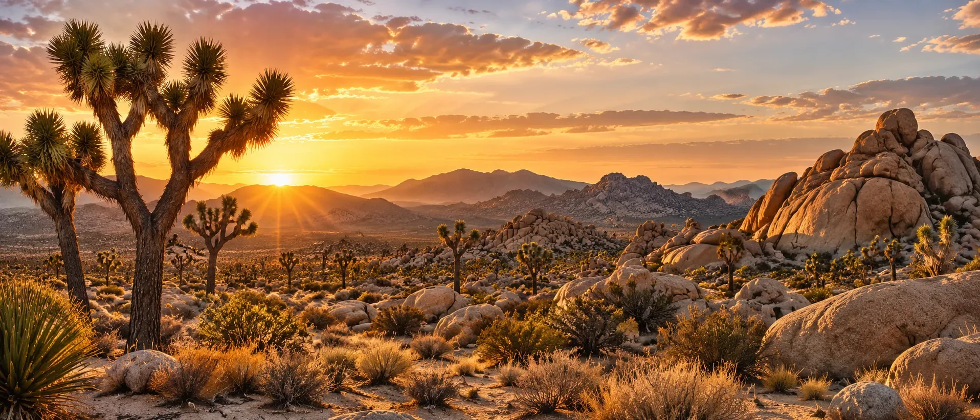
Approved artistic panorama illustrating Joshua Tree National Park; not a documentary photograph
Joshua Tree National Park · Approved artistic panorama

An otherworldly desert where twisted Joshua trees rise among enormous granite formations, cactus gardens, rugged mountains, abandoned mines, and extraordinarily dark skies.

Hiking & Backpacking

Boy Scout Trail to Willow Hole: 17.9 Miles ★
Fortynine Palms Oasis Trail: 3.2 Miles ★
Barker Dam Nature Trail: 1.1 Miles ★
Eureka Peak via Black Rock Canyon Loop: 9.8 Miles ★
Heart Rock and Arch Rock via Arch Rock Trail: 1.75 Miles ★
Hidden Valley Nature Trail: 1 Mile ★
Lost Horse Mine Loop: 6.5 Miles ★
Mastodon Peak Loop: 2.4 Miles ★
Panorama Loop and Warren Peak: 8 Miles ★
Ryan Mountain Trail: 2.8 Miles ★
Skull Rock Loop: 1.7 Miles ★
Split Rock Loop: 2.5 Miles ★
Boy Scout Trail to Willow Hole Trail: 6.8 Miles ★
Cholla Cactus Garden Nature Trail: 0.2 Miles
Lost Palms Oasis Trail: 7.4 Miles
Wall Street Mill Trail: 2 Miles
Hall of Horrors Loop: 0.6 Miles

Climbing, Caving & Mountain Adventures

Visitor Planning & Safety

Park Access & Visit Planning

Other Highlights & Activities

Keys View: 0.1 Miles
Stargazing
King Range Wilderness / Lost Coast ★

California’s most remote coastline, where the forested King Range plunges toward a wild Pacific shore with almost no roads or development between the mountains and ocean.

Hiking & Backpacking

Lost Coast Trail: Mattole to Black Sands Beach: 25.3 Miles ★
Overnight Backpacking Permit Required
King Peak Trail: 4.8 Miles ★
Mount Chemise Vista Point via Lost Coast Trail: 5 Miles
Horse Mountain Creek Trail: 13 Miles
Remote Coastal Backpacking

Waterfalls & Natural Features

Black Sands Beach

History, Culture & Attractions

Punta Gorda Lighthouse

Other Highlights & Activities

Chemise Peak and Nick’s Camp: 5.7 Miles
Cooskie Creek Route: 22.8 Miles
Overnight Wilderness Permits
Coastal Wilderness Access & Trip Planning
Lassen Volcanic National Park ★
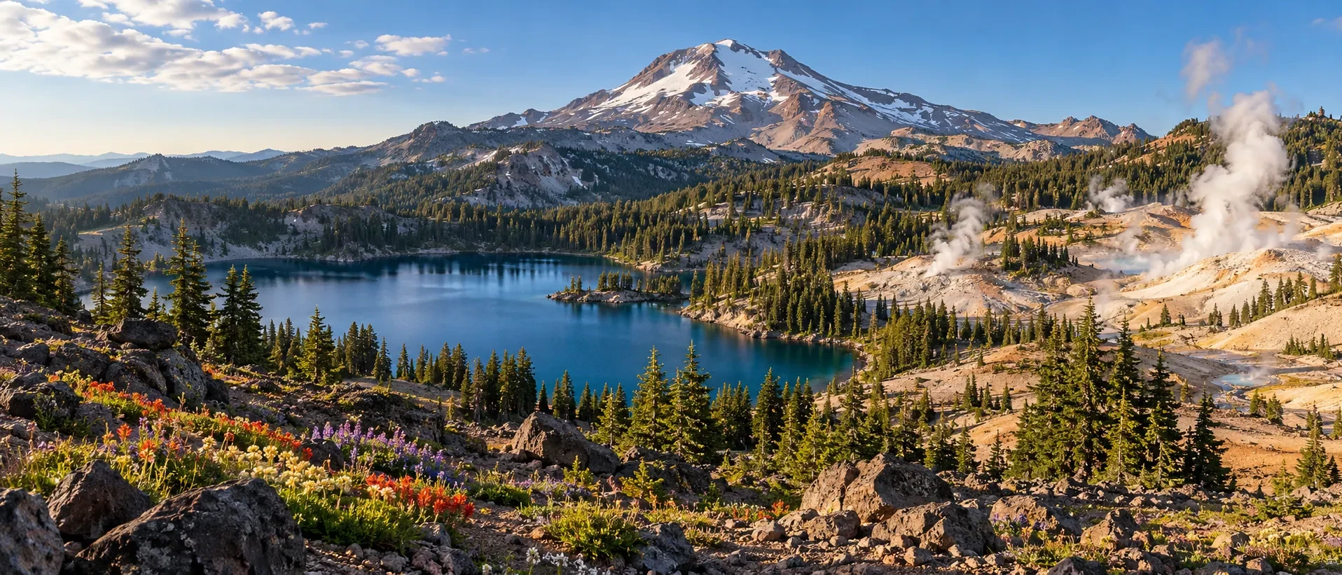
Approved artistic panorama illustrating Lassen Volcanic National Park; not a documentary photograph
Lassen Volcanic National Park · Approved artistic panorama

A volcanic wonderland of lava domes, steaming fumaroles, boiling hydrothermal basins, alpine lakes, lava formations, cinder cones and volcanic summits.

Hiking & Backpacking

Brokeoff Mountain Trail: 7.1 Miles ★
Bumpass Hell Trail: 3 Miles ★
Cinder Cone Trail: 4.7 Miles ★
Lassen Peak Trail: 4.9 Miles ★
Boiling Springs Lake Trail: 3 Miles ★
Kings Creek Falls Trail: 2.8 Miles ★
Manzanita Lake Loop: 1.9 Miles ★
Crags Lake Trail: 4 Miles
Devastated Area Interpretive Trail: 0.5 Miles
Devil’s Kitchen & Boiling Springs Lake Loop: 6.7 Miles ★
Lassen Volcanic Hydrothermal Hiking

Visitor Planning & Safety

Park Access & Visit Planning

Other Highlights & Activities

Chaos Crags and Chaos Jumbles: 4 Miles ★
Sulphur Works: 0.3 Miles
Terrace, Shadow and Cliff Lakes
Los Angeles ★

Film history, major art collections, distinctive neighborhoods, coastal landmarks, and hillside views create a varied city experience across Los Angeles and its nearby communities.

Landmarks & Neighborhoods

Griffith Observatory & Griffith Park ★
Planetarium / Hillside Hiking / Hollywood Sign Views
Observatory Admission Free / Planetarium Tickets Separate
Hollywood Walk of Fame & TCL Chinese Theatre
Film Landmarks / Celebrity Handprints
Santa Monica Pier & Beach ★
Historic Pier / Pacific Coast
Venice Beach & Venice Canals ★
Oceanfront Boardwalk / Canal Walks / Public Art
Grand Central Market & Historic Downtown ★
Food Stalls / Historic Architecture
Arts District & Little Tokyo ★
Murals / Galleries / Japanese-American Culture

Museums & Film Culture

Getty Center ★
Art Collections / Gardens / City Views
Free Admission / Timed Reservation Required / Parking Extra
The Broad ★
Contemporary Art / Infinity Mirror Room Options
General Admission Free / Advance Tickets Recommended
Academy Museum of Motion Pictures ★
Cinema History / Film Exhibitions
Getty Villa ★
Ancient Art / Villa Gardens
Timed Reservation Required / Check Access

Tours & Entertainment

Film & Studio Experiences ★
Warner Bros. Studio Tour Hollywood ★
Burbank / Working Studio / Film & TV
Universal Studios Hollywood ★
Studio Tour / Theme Park Rides
Hollywood Bowl & Walt Disney Concert Hall ★
Live Music / Landmark Architecture
Walt Disney Concert Hall Holiday Concerts ★
Seasonal Programs / Festive Music
Food & Neighborhood Dining ★
Koreatown / Korean Dining / Street Food
Downtown Los Angeles Food Tour
Local Tastings / Guided Historic Walk
City Attractions & Events
Mammoth Lakes / Devils Postpile National Monument ★

A high-altitude playground of basalt columns, alpine lakes, waterfalls, and dramatic views of the Ritter Range and Minarets.

Hiking & Backpacking

Devils Postpile Loop: 1.2 Miles ★
Duck Pass and Pika Lake Trail: 10.5 Miles ★
Rainbow Falls via Devils Postpile Trail: 4.9 Miles ★
Convict Lake Loop: 2.5 Miles ★
Crystal Lake Trail: 3.2 Miles ★
Heart Lake Trail: 2 Miles ★
Mammoth Crest Trail: 7.5 Miles ★
Sherwin Lakes Trail: 4.5 Miles ★
Horseshoe Lake Loop: 1.5 Miles
McLeod Lake Trail: 2 Miles
Skelton Lake Loop: 3.5 Miles

Visitor Planning & Safety

Other Highlights & Activities

Ediza Lake
Hot Creek Geological Site
Mammoth Lakes Basin
Minaret Vista Overlook
Reds Meadow Valley
Shadow Lake
Mission Peak Regional Preserve ★

Open grasslands and exposed ridges lead to a panoramic summit above the eastern San Francisco Bay.

Hiking & Backpacking

Mission Peak Loop from Stanford Avenue Staging Area: 6 Miles ★

Other Highlights & Activities

Preserve Trails & Access Information
Moaning Caverns ★

Deep beneath California's Gold Country, enormous limestone chambers and narrow passages offer adventurous underground exploration.

Climbing, Caving & Mountain Adventures

Moaning Caverns Adventure Caving ★
Spiral Staircase Cave Tour / Guided Expedition Caving / Crawling &
Climbing
Cave Tours & Adventure Planning
Mojave National Preserve ★

A vast, sparsely developed desert wilderness of towering sand dunes, ancient Joshua tree forests, volcanic mountains, lava tubes, abandoned mining landscapes, and exceptionally dark skies.

Hiking & Backpacking

Kelso Dunes Trail: 3 Miles ★
Lava Tube Trail: 0.5 Miles ★
Rings Loop Trail: 1.5 Miles ★
Teutonia Peak Trail: 3.5 Miles ★

Climbing, Caving & Mountain Adventures

History, Culture & Attractions

Kelso Depot Historic Site

Visitor Planning & Safety

Park Access & Visit Planning

Other Highlights & Activities

Cima Dome and Joshua Tree Forest
Mojave Road Overland Route
Providence Mountains
Zzyzx and Soda Dry Lake
Mount Diablo State Park ★

An isolated peak rising above the Bay Area, with sweeping views, oak woodlands, rugged canyons, and trails across open grasslands.

Hiking & Backpacking

Mary Bowerman Trail: 0.7 Miles ★
Mount Diablo Summit Trail: 7.8 Miles ★
Donner Creek Loop: 5.2 Miles
Rock City Trail: 1 Mile

Food, Lodging & Local Experiences

Mitchell Canyon to Juniper Campground: 6 Miles ★

Visitor Planning & Safety

Park Trails & Recreation

Other Highlights & Activities

Eagle Peak via Mitchell Canyon: 7 Miles ★
Summit Visitor Center and Panoramic Overlooks
Mount San Jacinto State Park ★

A dramatic leap from desert to alpine country, rising above Palm Springs into cool pine forests, granite peaks, subalpine meadows, and high elevation wilderness.

Hiking & Backpacking

San Jacinto Peak via Marion Mountain Trail: 11.4 Miles ★
Suicide Rock via Deer Springs Trail: 7.1 Miles ★
Tahquitz Peak via South Ridge Trail: 6.5 Miles ★
Desert View Trail: 1.5 Miles ★
Round Valley Trail to Wellman Divide: 7 Miles ★
San Jacinto Peak via Deer Springs Trail: 18 Miles ★

Waterfalls & Natural Features

Palm Springs Aerial Tramway

Visitor Planning & Safety

Park Trails & Recreation
Mount Tamalpais State Park ★

A forested coastal mountain landscape above San Francisco where redwood ravines, grassy ridges, waterfalls, and Pacific overlooks come together on classic Northern California trails.

Hiking & Backpacking

Cataract Falls Trail: 7.7 Miles ★
Steep Ravine, Dipsea and Matt Davis Loop: 7.1 Miles ★
Mount Tamalpais Summit via Verna Dunshee Trail: 0.7 Miles

Waterfalls & Natural Features

Muir Beach Overlook

Food, Lodging & Local Experiences

West Point Inn

Visitor Planning & Safety

Park Trails & Recreation

Other Highlights & Activities

Tennessee Valley to Tennessee Cove: 3.5 Miles ★
Bolinas Ridge
Mount Woodson / Lake Poway ★

Visitor Planning & Safety

Park Trails & Access Information

Other Highlights & Activities

Granite boulders and exposed chaparral slopes frame a popular summit
hike near San Diego.
Potato Chip Rock and Mt. Woodson Summit: 7.3 Miles ★
Muir Woods National Monument ★

A living cathedral of towering coast redwoods, with fern-lined ravines and peaceful forest trails tucked into the mountains north of San Francisco.

Hiking & Backpacking

Fern Creek, Lost and Canopy Trail Loop: 3 Miles ★
Ben Johnson Trail and Muir Woods Loop: 6 Miles ★
Bootjack Loop: 6.5 Miles ★
Main Redwood Creek Trail: 2 Miles ★

History, Culture & Attractions

Cathedral Grove

Visitor Planning & Safety

Park Access & Visit Planning

Other Highlights & Activities

Redwood Creek Watershed
Parking & Shuttle Reservations
Pacific Crest Trail - California ★

A long-distance mountain route connecting varied wilderness landscapes, with day hikes, section hikes, and extended backpacking options.

Hiking & Backpacking

Pacific Crest Trail - California: 1,691.7 Miles ★
Published PCTA State Mileage / 2019 Alignment

Other Highlights & Activities

Pinnacles National Park ★
Approved artistic panorama illustrating Pinnacles National Park; not a documentary photograph
Pinnacles National Park · Approved artistic panorama

A dramatic maze of volcanic spires, talus caves, narrow canyons, and massive rock formations left behind by an ancient volcanic landscape.

Hiking & Backpacking

Condor Gulch Trail to High Peaks Loop: 5.5 Miles ★
High Peaks Trail: 6.8 Miles ★
North Chalone Peak Trail: 9 Miles ★
Pinnacles Greatest Hits Loop: 12.8 Miles ★
Balconies Cave Trail: 2.6 Miles ★
Bear Gulch Cave Loop: 1.5 Miles ★
Condor Gulch Trail to Overlook: 2 Miles ★
Juniper Canyon Loop: 4.3 Miles ★
Moses Spring Trail to Bear Gulch Reservoir: 1.2 Miles ★

Climbing, Caving & Mountain Adventures

Rock Climbing
Talus Cave Exploration
Cave Access & Conditions

Visitor Planning & Safety

Park Access & Visit Planning

Other Highlights & Activities

California Condor Viewing
Point Lobos State Natural Reserve ★

A compact stretch of Monterey coastline where twisted cypress, rocky headlands, turquoise coves, tide pools, and abundant marine life meet.

Hiking & Backpacking

Cypress Grove Trail: 0.8 Miles ★
Point Lobos Loop: 6.7 Miles ★
Bird Island Trail: 0.8 Miles ★
Sea Lion Point Trail: 0.6 Miles ★
South Shore Trail: 2.4 Miles ★
Granite Point Trail: 1.3 Miles

Wildlife & Fishing

Coastal Wildlife Viewing

Food, Lodging & Local Experiences

Whalers Cove and Whalers Cabin

Visitor Planning & Safety

Park Trails & Recreation

Other Highlights & Activities

China Cove
Point Mugu State Park ★

A striking coastal wilderness in the Santa Monica Mountains, with sea cliffs, sandy coves, rolling chaparral hills, and dramatic ocean views.

Hiking & Backpacking

Mugu Peak Trail: 2.7 Miles ★
Chumash Trail: 2.5 Miles ★
La Jolla Canyon Trail: 3.6 Miles ★
Sycamore Canyon Trail: 6 Miles ★
Overlook Trail: 1.5 Miles

Waterfalls & Natural Features

Coastal Beaches and Tide Pools

Visitor Planning & Safety

Park Trails & Recreation

Other Highlights & Activities

Point Mugu Overlook
Point Reyes National Seashore ★

A windswept Pacific peninsula of dramatic cliffs, isolated beaches, coastal forests, tule elk habitat, and enormous ocean horizons.

Hiking & Backpacking

Coast Trail to Alamere Falls: 13.8 Miles ★
Tomales Point Trail: 9.4 Miles ★
Abbotts Lagoon Trail: 3.2 Miles ★
Bear Valley Trail: 8 Miles ★
Chimney Rock Trail: 1.8 Miles ★
Coast Trail to Kelham Beach: 6.5 Miles ★
Mount Wittenberg Trail: 5.5 Miles ★
Palomarin Trail to Bass Lake: 6.8 Miles ★
Sky Trail and Woodward Valley Loop: 7 Miles ★
Laguna Trail and Coast Trail Loop: 5.7 Miles

Waterfalls & Natural Features

Drakes Beach

Wildlife & Fishing

Whale Watching

History, Culture & Attractions

Point Reyes Lighthouse

Visitor Planning & Safety

Park Access & Visit Planning
Redwood National and State Parks ★
Approved artistic panorama illustrating Redwood National Park; not a documentary photograph
Redwood National Park · Approved artistic panorama

A magnificent coastal ecosystem where towering redwoods stand beside fern-filled canyons, wild rivers, open prairies, and remote Pacific beaches.

Hiking & Backpacking

Boy Scout Tree Trail: 5.5 Miles ★
Damnation Creek Trail: 4.4 Miles ★
James Irvine Trail to Fern Canyon: 12 Miles ★
Miners Ridge and James Irvine Loop: 11.6 Miles ★
Tall Trees Grove Loop: 3.6 Miles ★
Permit Required
Mill Creek Trail: 9.3 Miles ★
Coastal Trail and Yurok Loop: 2.3 Miles ★
Lady Bird Johnson Grove Trail: 1.5 Miles ★
Prairie Creek and Foothill Trail Loop: 2.4 Miles ★
Redwood Creek Trail: 8 Miles ★
Stout Memorial Grove Trail: 0.5 Miles ★
Trillium Falls Trail: 2.6 Miles ★
Enderts Beach Trail: 1.3 Miles
Fern Canyon Loop: 1.1 Miles
Seasonal Access Reservations

Waterfalls & Natural Features

Hidden Beach and False Klamath Rock: 7.6 Miles

Wildlife & Fishing

Roosevelt Elk Viewing

Visitor Planning & Safety

Park Access & Visit Planning

Other Highlights & Activities

Grove of Titans
Klamath River Overlook
Tall Trees & Fern Canyon Access Requirements
San Bernardino National Forest ★

Southern California’s high country, climbing from desert foothills into pine forests, alpine lakes, desert overlooks, granite peaks, and the summit of Southern California’s highest mountain.

Hiking & Backpacking

San Gorgonio via Vivian Creek Trail: 18.2 Miles ★
Bonita Falls Trail: 1.8 Miles ★
Cougar Crest Trail: 5 Miles ★
Ernie Maxwell Scenic Trail: 5 Miles ★
Etiwanda Falls Trail: 3.2 Miles ★
San Bernardino Peak Trail: 16.5 Miles ★
South Fork Trail to Dry Lake: 11.3 Miles ★
Castle Rock Trail: 2.9 Miles
Heart Bar Peak Trail: 7.2 Miles
Big Bear Lake Hiking

Waterfalls & Natural Features

Deep Creek Hot Springs

Visitor Planning & Safety

Forest Trails & Recreation

Other Highlights & Activities

Cucamonga Peak via Icehouse Canyon: 11.7 Miles ★
San Diego ★

Pacific beaches, celebrated museums, maritime history, and coastal adventures bring together San Diego’s city and seaside experiences.

Landmarks, Parks & Neighborhoods

Balboa Park ★
Gardens / Spanish Colonial Architecture / Cultural District
La Jolla Cove & Shores ★
Coastal Scenery / Beaches / Marine Wildlife
Coronado Beach & Waterfront ★
Sandy Beaches / Bay Views / Historic Hotel Exterior
Old Town San Diego ★
Historic Buildings / Mexican Heritage / Local Dining
Little Italy & Gaslamp Quarter ★
Neighborhood Restaurants / Markets / Nightlife
Embarcadero & Seaport Village ★
Harborfront Walking / Maritime Landmarks

Museums & Cultural Institutions

USS Midway Museum ★
Aircraft Carrier / Flight Deck / Naval History
San Diego Zoo ★
Wildlife Habitats / Conservation / Balboa Park
Balboa Park Museum Collections ★
Art / Natural History / Science / Photography
Museum Admission By Selected Institution
Balboa Park December Nights ★
Annual Holiday Lights / Performances / Food

Tours & Entertainment

La Jolla Sea Cave Kayaking ★
Guided Ocean Paddling / Marine Wildlife
Sea Conditions / Cave Entry Not Guaranteed
San Diego Harbor & Whale-Watching Cruises ★
Bay Sightseeing / Seasonal Whale Watching / Separate Sailing
Options
Neighborhood Food & Coastal Dining ★
Fish Tacos / Mexican Food / Waterfront Restaurants
City Attractions & Events
San Francisco ★

A city of steep hills, historic neighborhoods, celebrated museums, bay scenery, and coastal landmarks, with distinctive adventures on cable cars, ferries, and the waterfront.

Historic Landmarks & Neighborhoods

Golden Gate Bridge & Presidio ★
Bridge Views / Historic Landscapes / Waterfront Parks
Lands End ★
Lands End Trail: 3.4 Miles ★
Coastal Walking / Golden Gate Views
Golden Gate Park Gardens ★
Japanese Tea Garden / Botanical Garden / Conservatory Of Flowers
Ferry Building & Embarcadero ★
Waterfront Markets / Local Food / Bay Views
Chinatown & North Beach ★
Cultural Heritage / Local Food / Historic Streets
Mission District Murals & Food ★
Public Art / Latino Heritage / Neighborhood Dining
Haight-Ashbury & Painted Ladies ★
Neighborhood History / Victorian Architecture
Coit Tower & Telegraph Hill ★
Skyline Views / Historic Murals
Fisherman’s Wharf & Pier 39
Working Waterfront / Sea-Lion Viewing / Visitor Attractions

Museums & Cultural Institutions

San Francisco Museum of Modern Art ★
Modern & Contemporary Art
California Academy of Sciences ★
Aquarium / Rainforest / Planetarium
Exploratorium ★
Interactive Science / Waterfront Exhibits

Tours & Entertainment

Alcatraz Island Tour ★
Ferry & Cellhouse Audio Tour / Advance Booking Recommended
Cable Car Ride ★
Historic Transit / Hilltop Views
San Francisco Bay Cruise ★
Golden Gate Views / Waterfront Scenery
Bay Cruise Does Not Include Alcatraz Landing
Golden Gate Bridge Guided Bike Tour ★
Waterfront Cycling / Bridge Crossing / Sausalito
Standard & Electric Bike Options / Selected Route & Return
Arrangements
City Attractions, Neighborhoods & Activities

San Francisco Fleet Week

Waterfront Air Shows / Parade Of Ships / Maritime Events
Annual Schedule / Weather & Program Availability
Santa Monica Mountains National Recreation Area ★

A coastal mountain landscape winding through oak canyons and chaparral ridges above the Pacific, combining Southern California wilderness with sweeping ocean scenery.

Hiking & Backpacking

Backbone Trail: 67 Miles ★
Los Liones Trail to Parker Mesa Overlook: 7.1 Miles ★
Sandstone Peak via Mishe Mokwa Trail: 6.2 Miles ★
Escondido Falls Trail: 3.8 Miles ★
Solstice Canyon Loop: 3.2 Miles ★
Temescal Canyon Trail: 2.6 Miles ★
Zuma Canyon Trail: 3.5 Miles ★

Waterfalls & Natural Features

Point Dume State Beach

Visitor Planning & Safety

Other Highlights & Activities

Coastal Overlooks and Wildflower Walks
Paramount Ranch
Sequoia and Kings Canyon National Parks ★
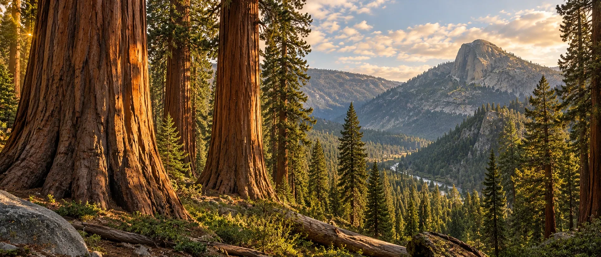
Approved artistic panorama illustrating Sequoia National Park; not a documentary photograph
Sequoia National Park · Approved artistic panorama
Approved artistic panorama illustrating Kings Canyon National Park; not a documentary photograph
Kings Canyon National Park · Approved artistic panorama

A vast Sierra Nevada landscape of immense giant sequoias, deep granite canyons, alpine lakes, and high Sierra wilderness, combining some of the world’s largest trees with dramatic mountain scenery.

Hiking & Backpacking

Alta Peak Trail: 13.5 Miles ★
General Sherman Tree and Congress Trail Loop: 2.7 Miles ★
High Sierra Trail: 70.5 Miles ★
Lakes Trail to Pear Lake: 11.2 Miles ★
Paradise Valley Trail: 8.2 Miles ★
Rae Lakes Loop: 41.4 Miles ★
Multi-Day Backpacking Route
Wilderness Permit Required
Sherman Tree, Congress, Trail of the Sequoias, and Tharp’s Log Loop: 7
Miles ★
Big Baldy Ridge Trail: 4.6 Miles ★
Big Trees Trail: 1.5 Miles ★
Buena Vista Peak Trail: 2 Miles ★
Crescent Meadow Loop: 1.3 Miles ★
General Grant Tree Trail: 0.7 Miles ★
Little Baldy Trail: 3.3 Miles ★
Mist Falls Trail: 7.8 Miles ★
Moro Rock Trail: 0.5 Miles ★
Tokopah Falls Trail: 4 Miles ★
Zumwalt Meadow Loop: 1.5 Miles ★
Moro Rock via Alta, Soldiers Hill, and Bear Hill Loop: 4.8 Miles ★
Roaring River Falls Trail: 0.3 Miles
Marble Falls Trail: 6.3 Miles

Waterfalls & Natural Features

Zumwalt Meadow and Roaring River Falls: 4.2 Miles
Cedar Grove and Kings Canyon Scenic Byway

Visitor Planning & Safety

Park Access & Visit Planning

Other Highlights & Activities

Mineral King Valley
Wilderness Permit Requirements
Shasta-Trinity National Forest ★

A vast Northern California mountain realm centered on Mount Shasta, with volcanic peaks, alpine lakes, waterfalls, wild rivers, old-growth forests, and the remote Trinity Alps.

Hiking & Backpacking

Burney Falls Loop: 1.2 Miles ★
Canyon Creek Lakes Trail: 16 Miles ★
Castle Crags Trail: 5.5 Miles ★
Four Lakes Basin Trail: 8.2 Miles ★
McCloud River Waterfalls Trail: 3.9 Miles ★
Stuart Fork Trail: 15 Miles ★
Boulder Lake Trail: 5.2 Miles ★
Grizzly Lake Trail: 11 Miles ★
Heart Lake Trail: 3 Miles ★
Tangle Blue Lake Trail: 8 Miles ★
Hedge Creek Falls Trail: 0.6 Miles
Trinity Alps Wilderness Backpacking

Climbing, Caving & Mountain Adventures

Climbing Permits & Mountain Conditions
Lake Shasta Caverns Boat & Cave Tour ★
Boat Transfer / Guided Cavern Tour

Visitor Planning & Safety

Forest Trails & Recreation

Other Highlights & Activities

Mount Shasta Summit via Avalanche Gulch: 11 Miles ★
Seven Lakes Basin
Sierra High Route ★

A demanding high-country route links granite basins, alpine lakes, and remote passes across the Sierra Nevada.

Other Highlights & Activities

Sierra High Route: 195 Miles ★
Off-Trail Navigation / Alpine Scrambling
Wilderness Permits / Route Planning
Route Planning & Wilderness Access Information
Tahoe / Desolation Wilderness ★

A spectacular alpine region of granite peaks, clear blue lakes, pine forests, and rugged wilderness surrounding Lake Tahoe.

Hiking & Backpacking

Aloha Lake via Glen Alpine Trail: 12 Miles ★
Mount Rose Summit Trail: 10.6 Miles ★
Mount Tallac Trail: 10 Miles ★
Pyramid Peak via Rocky Canyon Trail: 8 Miles ★
Rubicon Trail: 16 Miles ★
Bayview Trail to Granite Lake: 2.5 Miles ★
Cascade Falls Trail: 1.4 Miles ★
Eagle Lake Trail: 2 Miles ★
Five Lakes Trail: 5 Miles ★
Eagle Rock Trail: 0.7 Miles
Desolation Wilderness Backpacking

Paddling, Rafting & Water Adventures

Visitor Planning & Safety

Forest Trails & Recreation

Other Highlights & Activities

Emerald Bay State Park
Torrey Pines State Natural Reserve ★

A dramatic coastal reserve near San Diego, with sandstone cliffs, rare Torrey pines, ocean bluffs, and beautiful Pacific beaches.

Hiking & Backpacking

Torrey Pines Beach Trail Loop: 2.3 Miles ★
Broken Hill Trail: 2.5 Miles ★
Guy Fleming Trail: 0.7 Miles ★
Razor Point Trail: 1.4 Miles ★

Waterfalls & Natural Features

Beach and Coastal Bluff Walks

Visitor Planning & Safety

Park Trails & Recreation

Other Highlights & Activities

High Point Overlook: 0.1 Miles
Yosemite National Park ★
Approved artistic panorama illustrating Yosemite National Park; not a documentary photograph
Yosemite National Park · Approved artistic panorama

One of America’s most iconic mountain landscapes, where immense granite walls, waterfalls, giant sequoias, alpine meadows, and high country lakes surround the legendary Yosemite Valley.

Hiking & Backpacking

Clouds Rest Trail: 12.4 Miles ★
Eagle Peak via Yosemite Falls Trail: 12.6 Miles ★
Four Mile Trail: 9.6 Miles ★
Half Dome via the John Muir Trail (JMT): 16.5 Miles ★
Mariposa Grove of Giant Sequoias Trail: 6.6 Miles ★
Mist Trail to Vernal and Nevada Falls: 6.4 Miles ★
Panorama Trail: 9.1 Miles ★
Glacier Point Route / Return To Glacier Point
Pohono Trail: 17 Miles ★
Upper Yosemite Falls Trail: 7.6 Miles ★
Vernal Falls, Half Dome, Clouds Rest, Tenaya, and Mirror Lake Loop: 31.1
Miles ★
Wilderness Permit / Half Dome Cable Permit
Half Dome via the Mist Trail: 14.2 Miles ★
Cable Permit Required
Bridalveil Fall Trail: 0.7 Miles ★
Cathedral Lakes Trail: 5.8 Miles ★
Chilnualna Falls Trail: 8.2 Miles ★
Elizabeth Lake Trail: 4.8 Miles ★
Lower Yosemite Falls Trail: 1.2 Miles ★
May Lake Trail: 2.4 Miles ★
Mirror Lake Loop: 5 Miles ★
Sentinel Dome and Taft Point Loop: 5.1 Miles ★
Vernal Falls and Clark Point via Mist and John Muir Loop: 4.5 Miles ★
Yosemite Valley Loop Trail: 20.3 Miles ★
Glacier Point Trail: 0.5 Miles ★
Lembert Dome Loop: 3.8 Miles
Columbia Rock Trail: 2.2 Miles
Guided Yosemite Hiking & Backpacking ★

Paddling, Rafting & Water Adventures

Merced / Tuolumne River Whitewater Rafting

Climbing, Caving & Mountain Adventures

Visitor Planning & Safety

Park Access & Visit Planning

Other Highlights & Activities

Grand Canyon of the Tuolumne: 33 Miles ★
North Dome: 9.2 Miles ★
Mount Dana: 5.8 Miles ★
Tuolumne Meadows to Glen Aulin: 11.4 Miles ★
Pothole Dome: 1 Mile
Glacier Point Overlook
Yosemite High Sierra Camps Circuit: 56 Miles ★
California Multi-Day Adventures

Guided multi-day trips combining California’s national parks, mountain wilderness, coastline, and wine country, with transportation, accommodations, and activities organized for you.

Hiking & Backpacking

57hours - Yosemite National Park Camping & Hiking Tour: 5 Days ★
Yosemite National Park
Guided Hiking / Camping / Granite Cliffs / Waterfalls
Intrepid Travel - Hiking in Yosemite National Park: 6 Days ★
San Francisco / Yosemite Valley / Tuolumne Grove / Sentinel Dome /
Glacier Point
Vernal Fall / Nevada Fall / Taft Point / Guided Hiking
Hotel & Lodge Accommodation / Operated By Wildland Trekking
Much Better Adventures - Hike and E-Bike in Yosemite and California’s
Wine Country: 6 Days ★
San Francisco / Sonoma County / Yosemite / Glen Aulin / Sentinel
Dome / Tuolumne Grove
High-Country Hiking / Waterfalls / Coastal Walking / E-Biking / Wine
Country

Other Highlights & Activities

G Adventures - California National Park Discovery: 7 Days ★
Las Vegas / Death Valley / Kings Canyon / Sequoia / Yosemite / San
Francisco
National Park Hiking / Scenic Drives / Giant Sequoias
Colorado
Arapaho & Roosevelt National Forests ★

Alpine valleys, glacier-carved basins, and mountain ridges offer scenic hikes along Colorado’s Front Range.

Hiking & Backpacking

Herman Gulch Trail: 6.5 Miles ★
Silver Dollar Lake and Murray Lake Trail: 4.2 Miles ★
Lost Lake via Hessie Trail: 4.1 Miles ★
Maxwell Falls Trail: 3.9 Miles

Visitor Planning & Safety

Forest Trails & Recreation

Other Highlights & Activities

Saint Mary’s Glacier: 1.7 Miles ★
Black Canyon of the Gunnison National Park ★
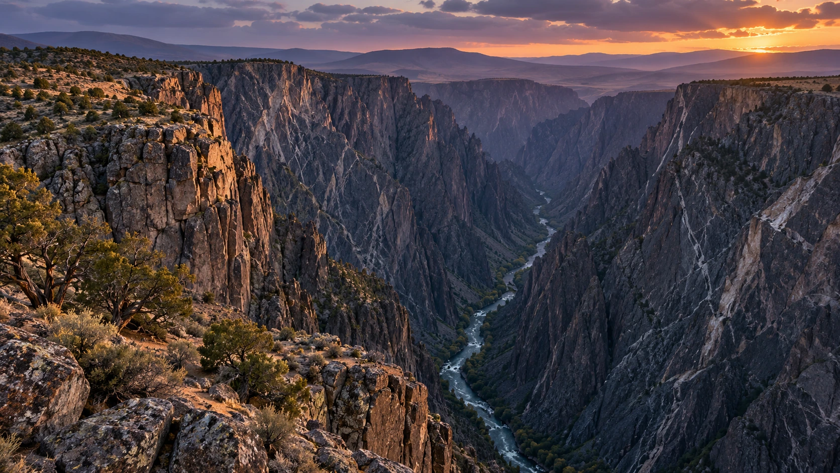
Approved artistic panorama illustrating Black Canyon of the Gunnison National Park; not a documentary photograph
Black Canyon of the Gunnison National Park · Approved artistic panorama

One of America’s most dramatic canyon landscapes, where the Gunnison River has carved an extraordinarily narrow gorge through nearly vertical black walls.

Hiking & Backpacking

North Vista Trail to Exclamation Point: 3.2 Miles ★
North Vista Trail to Green Mountain: 7.2 Miles ★
Oak Flat Loop Trail: 2 Miles ★
Warner Point Nature Trail: 1.6 Miles ★
Chasm View Nature Trail: 0.5 Miles
Rim Rock Nature Trail: 1 Mile

Cycling & Scenic Routes

North Rim Scenic Drive
South Rim Scenic Drive ★

Visitor Planning & Safety

Park Access & Visit Planning

Other Highlights & Activities

Gunnison Route: 1.5 Miles
Warner Route: 2.75 Miles
Boulder Open Space & Mountain Parks ★

Sandstone Flatirons, forested foothills, and rocky summits rise above Boulder’s extensive trail network.

Hiking & Backpacking

Royal Arch Trail: 3.3 Miles ★
First and Second Flatirons Loop: 2.7 Miles
Mount Sanitas, East Ridge, and Sanitas Valley Loop: 3.2 Miles
Chautauqua and Bluebell Trail Loop: 1.5 Miles
Green Mountain West Ridge Trail: 3.8 Miles

History, Culture & Attractions

Green Mountain via Chautauqua, Amphitheater, and Gregory Canyon
Loop: 6.1 Miles

Visitor Planning & Safety

Trails & Access Information
Breckenridge Winter Adventures ★

Guided Tours & Outdoor Experiences

Guided Husky Dog Sledding ★

Other Highlights & Activities

Snow-covered Rocky Mountain forests provide an interactive setting for
guided husky sledding.
Browns Canyon National Monument ★

A rugged Arkansas River canyon surrounded by granite cliffs, alpine mountains, forests, and one of Colorado’s premier whitewater corridors.

Hiking & Backpacking

Browns Canyon National Recreation Trail: 5 Miles ★
Ruby Mountain Trail: 2.5 Miles ★

Paddling, Rafting & Water Adventures

History, Culture & Attractions

River Recreation & Monument Access
Colorado National Monument / Black Ridge Canyons Wilderness

A dramatic red-rock landscape of towering sandstone monoliths, deep sandstone canyons, natural arches, and high desert plateaus overlooking the Colorado River and Grand Valley.

Hiking & Backpacking

Monument Canyon Trail: 12 Miles ★
Rattlesnake Arches Trail: 5.2 Miles ★
Devils Canyon Loop Trail: 6.8 Miles ★
Black Ridge Trail: 14 Miles ★
Coke Ovens Trail: 1 Mile ★
Liberty Cap Trail: 14 Miles ★
Otto’s Trail: 1 Mile ★
Serpents Trail: 3.8 Miles ★
Ute Canyon Trail: 14 Miles ★
Flume Canyon Trail: 5.1 Miles ★
Canyon Rim Trail: 1 Mile
Pollock Trail: 6.5 Miles
Knowles Canyon Trail: 6.5 Miles
Mee Canyon Trail: 5.2 Miles
Jones Canyon Trail: 6.8 Miles
Guided Hiking & Backcountry Exploration

Visitor Planning & Safety

Other Highlights & Activities

Rim Rock Drive ★
Colorado Trail ★

One of America’s great long-distance mountain trails, crossing Colorado’s high country from Denver to Durango through forests, alpine basins, wildflower meadows, and spectacular Continental Divide terrain.

Hiking & Backpacking

Colorado Trail: 486 Miles ★
Section Hiking / Alternate Alignments

Other Highlights & Activities

Segments 22-28: San Juan Mountains to Durango: 128 Miles ★
Segments CW01-CW05: Collegiate West Route: 84.8 Miles ★
Segments 1-11: Denver to the Collegiate Peaks: 177 Miles ★
Segments 12-15: Collegiate East Route: 78.3 Miles ★
Segments 16-21: Marshall Pass through the San Luis Valley: 90 Miles ★
Continental Divide Trail - Colorado ★

The Continental Divide Trail crosses high country, remote backcountry, and mountain passes in Colorado.

Hiking & Backpacking

East Shore Trail: 3 Miles
East Shore Trailhead To Shadow Mountain Dam Cutoff / Point-To-
Point Segment

Visitor Planning & Safety

Wilderness Maps & Access Information
Dinosaur National Monument

A remote meeting point of Colorado’s canyon country and the Green and Yampa Rivers, with immense sandstone walls, archaeological sites, desert wilderness, and spectacular overlooks.

Hiking & Backpacking

Ruple Point Trail: 9.2 Miles ★
Fossil Discovery Trail: 2.4 Miles ★
Harpers Corner Trail: 2 Miles ★
Sound of Silence Trail: 3.2 Miles ★

Paddling, Rafting & Water Adventures

Yampa River Whitewater Rafting ★

Cycling & Scenic Routes

Harpers Corner Scenic Drive ★

Visitor Planning & Safety

Park Access & Visit Planning

Other Highlights & Activities

Dinosaur Quarry Exhibit Hall ★
Echo Park ★
Echo Park Road
Confluence Trail: 1.25 Miles ★
Gates of Lodore Trail: 1 Mile ★
Steamboat Rock and Green-Yampa River Confluence
Petroglyphs and Historic Chew Ranch
Flat Tops Wilderness ★

A vast high-country wilderness of broad alpine plateaus, volcanic cliffs, wildflower meadows, remote lakes, and rugged backcountry far from Colorado’s busiest trails.

Hiking & Backpacking

Devil’s Causeway Trail: 6.5 Miles ★
Chinese Wall Trail: 10 Miles ★
Lost Lakes Trail: 8 Miles ★
Trappers Lake Loop: 5.5 Miles ★

Visitor Planning & Safety

Garden of the Gods ★

A spectacular collection of towering red sandstone formations, balanced rocks, and dramatic views of Pikes Peak, with trails winding through the rock towers.

Hiking & Backpacking

Palmer, Buckskin-Charley, Niobrara and Bretag Loop: 4 Miles ★
Perkins Central Garden Trail: 1.5 Miles ★
Ridge Trail: 0.5 Miles ★
Siamese Twins Trail: 1 Mile ★
Balanced Rock Trail: 1.2 Miles

Climbing, Caving & Mountain Adventures

Other Highlights & Activities

Glenwood Springs & Canyon ★

A spectacular stretch of the Colorado River corridor, with towering red rock canyon walls, waterfalls, turquoise lakes, hot springs, and scenic routes through the Rocky Mountains.

Hiking & Backpacking

Hanging Lake Trail: 2.8 Miles ★
Grizzly Creek Trail: 7 Miles ★

Waterfalls & Natural Features

Glenwood Hot Springs ★

Paddling, Rafting & Water Adventures

Whitewater Rafting on the Colorado River ★

History, Culture & Attractions

Local Attractions & Activities

Other Highlights & Activities

Glenwood Canyon Recreation Path: 16.5 Miles ★
Spouting Rock from Hanging Lake: 0.2 Miles ★
Giant Canyon Swing ★
Great Sand Dunes National Park ★
Approved artistic panorama illustrating Great Sand Dunes National Park; not a documentary photograph
Great Sand Dunes National Park · Approved artistic panorama

North America’s tallest sand dunes rise abruptly from the San Luis Valley against the Sangre de Cristo Mountains, creating an extraordinary landscape of shifting sand, alpine peaks, and exceptionally dark skies.

Hiking & Backpacking

High and Star Dune Loop: 8 Miles ★
Medano Lake Trail: 7.4 Miles ★
Mosca Pass Trail: 6.2 Miles ★
Dunes Overlook Trail: 2.7 Miles
Montville Nature Trail: 0.5 Miles

Waterfalls & Natural Features

Hidden Dune: 7 Miles ★
Star Dune: 6 Miles ★
High Dune on First Ridge: 2.5 Miles ★

Visitor Planning & Safety

Park Access & Visit Planning

Other Highlights & Activities

Night Sky and Milky Way Viewing ★
Sandboarding & Sand Sledding ★
Indian Peaks Wilderness

A high alpine stretch of wilderness of the Front Range where the Continental Divide forms a wall of jagged peaks above glacier-carved valleys, alpine lakes, and wildflower-filled meadows.

Hiking & Backpacking

Lake Isabelle via Pawnee Pass Trail: 8 Miles ★
Lone Eagle Peak and Mirror Lake via Crater Lake Trail: 14 Miles ★
Mount Audubon Trail: 8.5 Miles ★
Arapaho Pass Trail: 8.5 Miles ★
Pawnee Pass Trail: 9.2 Miles ★

Visitor Planning & Safety

Forest Trails & Recreation

Other Highlights & Activities

Crater Lake via Monarch Lake: 13.4 Miles ★
Manitou Springs / Pikes Peak ★

Waterfalls & Natural Features

Steep foothill ascents and mountain scenery surround Manitou Springs
below Pikes Peak.

Other Highlights & Activities

The Manitou Incline: 4 Miles ★
Published Incline & Descent Route
Maroon Bells-Snowmass Wilderness

Colorado’s quintessential high-country wilderness, where the Maroon Bells rise above glacial valleys, turquoise lakes, golden aspen groves, and some of the state’s finest backpacking terrain.

Hiking & Backpacking

Conundrum Hot Springs Trail: 17 Miles ★
Four Pass Loop: 26.4 Miles ★
West Maroon Pass Trail: 12 Miles ★
Capitol Lake Trail: 12 Miles ★
Crater Lake Trail: 3.6 Miles ★
East Maroon Creek Trail: 11 Miles ★
Maroon Lake Scenic Trail: 1.3 Miles ★

Visitor Planning & Safety

Forest Trails & Recreation

Other Highlights & Activities

Maroon Bells Scenic Area ★
Mesa Verde National Park ★
Approved artistic panorama illustrating Mesa Verde National Park; not a documentary photograph
Mesa Verde National Park · Approved artistic panorama

A remarkable archaeological landscape where Ancestral Pueblo communities built sophisticated cliff dwellings and mesa-top settlements amid the high desert of southwestern Colorado.

Hiking & Backpacking

Far View Sites Loop: 0.8 Miles ★
Petroglyph Point Trail: 2.4 Miles ★
Point Lookout Trail: 1.2 Miles ★
Soda Canyon Overlook Trail: 1.3 Miles ★
Spruce Canyon Trail: 2.4 Miles ★
Cliff Palace Loop: 0.4 Miles
Knife Edge Trail: 2 Miles
Prater Ridge Trail: 5.5 Miles

Guided Tours & Outdoor Experiences

Cliff Palace Guided Tour ★
Cliff Dwelling Guided Tours & Reservations

Visitor Planning & Safety

Park Access & Visit Planning

Other Highlights & Activities

Balcony House ★
Mount Blue Sky Wilderness / Front Range Fourteeners ★

A classic Colorado alpine region of high mountain passes, tundra, rugged ridgelines, and accessible but demanding fourteen-thousand-foot summits.

Hiking & Backpacking

Grays Peak Trail: 8 Miles ★
Mount Bierstadt Trail: 7 Miles ★
Mount Blue Sky Summit Trail: 5 Miles ★
Torreys Peak Trail: 8 Miles ★
Democrat-Cameron-Lincoln Loop: 7.25 Miles ★

Climbing, Caving & Mountain Adventures

Visitor Planning & Safety

Forest Trails & Recreation

Other Highlights & Activities

Grays and Torreys Peaks: 8.1 Miles ★
Mount Elbert / Sawatch Range ★

Colorado’s highest peak rises above a vast range of fourteeners, high alpine lakes, and enormous mountain panoramas. This is a top region for challenging summit hikes and multi-day alpine objectives.

Hiking & Backpacking

Mount of the Holy Cross via Half Moon Trail: 12 Miles ★
Browns Creek Falls via Wagon Loop and Browns Creek Trail: 5.7 Miles
Guided Mount Elbert Summit Hikes

Visitor Planning & Safety

Forest Trails & Recreation

Other Highlights & Activities

Huron Peak via Fourmile Creek: 6.5 Miles ★
Mount Elbert via Northeast Ridge: 9.5 Miles ★
Mount Massive via East Slopes: 14.5 Miles ★
La Plata Peak via Northwest Ridge: 9.5 Miles ★
Mount Yale via Denny Creek: 9.5 Miles ★
Mount Falcon Park ★

Forested foothills, historic ruins, and open ridges offer accessible mountain hiking west of Denver.

Hiking & Backpacking

Mount Falcon Castle Trail Loop: 7.4 Miles ★

Visitor Planning & Safety

Park Trails & Access Information
Rawah Wilderness ★

Remote northern Colorado valleys, alpine lakes, and flower-filled meadows offer a quieter mountain wilderness.

Hiking & Backpacking

West Branch Trail: 14 Miles ★

Visitor Planning & Safety

Wilderness Trails & Access Information
Rocky Mountain National Park ★
Approved artistic panorama illustrating Rocky Mountain National Park; not a documentary photograph
Rocky Mountain National Park · Approved artistic panorama

Colorado’s iconic alpine national park, rising from forested valleys through glacier-carved emerald lakes and waterfalls to enormous peaks, tundra, and the Continental Divide.

Hiking & Backpacking

Chasm Lake Trail: 8.4 Miles ★
Emerald Lake via Bear Lake Trailhead: 3.6 Miles ★
Sky Pond via Glacier Gorge Trail: 9.8 Miles ★
Four Lake Loop Trail: 7.2 Miles ★
Nymph, Dream, Emerald, and Haiyaha Lakes via Nymph Lake Trail: 5
Miles ★
Adams Falls Trail: 0.8 Miles ★
Alberta Falls Trail: 1.6 Miles ★
Cub Lake Loop: 6 Miles ★
Fern Lake Trail: 7.6 Miles ★
Flattop Mountain Trail: 8.8 Miles ★
Gem Lake Trail: 3.4 Miles ★
Lake Haiyaha Trail: 4.4 Miles ★
Lake Helene Trail: 5.8 Miles ★
Mills Lake Trail: 5.6 Miles ★
Lone Pine Lake via East Inlet Trail: 10.3 Miles ★
Sprague Lake Loop: 0.8 Miles
Sprague Lake via Glacier Creek and Sprague Lake Trail: 4.5 Miles
Bear Lake Loop: 0.7 Miles
The Pool via Fern Lake Trail: 3.3 Miles
Gem Lake Trail and Lumpy Ridge Loop: 3.8 Miles
Deer Mountain Trail: 6 Miles
Mills Lake and The Loch via Glacier Gorge Trail: 6.6 Miles
Ouzel Falls via Wild Basin Trail: 5.4 Miles
Twin Sisters Peak Trail: 7.4 Miles
Continental Divide & Trail Ridge Road ★

Visitor Planning & Safety

Park Access & Visit Planning

Other Highlights & Activities

Longs Peak via Keyhole Route: 16 Miles ★
Timed Entry & Bear Lake Corridor Reservations
Royal Gorge / Cañon City ★

A deep Arkansas River canyon combines a dramatic suspension bridge with high-above-the-river rides and guided cliff climbing.

Climbing, Caving & Mountain Adventures

Guided Royal Gorge Via Ferrata ★
Harnessed Cliff Climbing / Separate Reservation

Guided Tours & Outdoor Experiences

Cloudscraper Zipline ★
Gorge Crossing / Ride Requirements

Other Highlights & Activities

Royal Rush Skycoaster ★
Harnessed Freefall & Swing / Separate Ride Ticket
Bridge Admission & Adventure Tickets
San Juan National Forest ★

A vast mountain landscape of jagged fourteeners, old mining towns, alpine basins, waterfalls, and wildflower meadows, with spectacular scenery around Ouray, Silverton, and Telluride.

Hiking & Backpacking

Blue Lakes Trail: 8.7 Miles ★
Bridal Veil Falls Trail: 2.1 Miles ★
Ice Lakes Basin Trail: 8.4 Miles ★
Sneffels Highline Trail: 14 Miles ★
Island Lake via Ice Lakes Trail: 8 Miles ★
Alpine Lake / Seasonal Snow
American Basin Trail: 4 Miles ★
Bear Creek Trail to Bear Creek Falls: 8 Miles ★
Colorado - Telluride-to-Ouray Hut Trek: 34 Miles ★
Sneffels Traverse / Self-Guided Hut-to-Hut Hiking
5 Days / 4 Nights / Four Backcountry Huts
Last Dollar Pass Near Telluride → Sneffels Range → Ouray
Trailhead Shuttle Included / Optional Food Drops

Climbing, Caving & Mountain Adventures

Guided Mountain Climbs & Alpine Adventures
Guided Ice Climbing & Backcountry Skiing

Visitor Planning & Safety

Forest Trails & Recreation

Other Highlights & Activities

Handies Peak via American Basin: 5.5 Miles ★
Mount Sneffels: 7.2 Miles ★
Redcloud Peak & Sunshine Peak: 11.4 Miles ★
Million Dollar Highway ★
Ouray, Silverton and Telluride ★
Weminuche Wilderness

Colorado’s largest wilderness, stretching across the heart of the San Juan Mountains with the remote fourteeners, granite peaks alpine basins, deep river valleys, and some of the state’s most rugged backcountry.

Hiking & Backpacking

Chicago Basin Trail: 16 Miles ★
Mount Eolus
North Eolus
Sunlight Peak
Windom Peak
Pine River Trail to Weminuche Pass: 28.1 Miles ★
Fourmile Falls Trail: 6.2 Miles ★
Highland Mary Lakes Trail: 5.2 Miles ★
Johnson Creek Trail: 12 Miles ★
Vallecito Creek Trail: 11.6 Miles ★

Visitor Planning & Safety

Forest Trails & Recreation
Guided Colorado Mountain Adventures & Expedition Courses

Guided climbs and wilderness courses offer mountain skills, technical instruction, and longer expeditions, with destinations determined by the selected program.

Climbing, Caving & Mountain Adventures

American Alpine Institute - Colorado Climbing & Mountaineering
Technical Climbing / Mountain Skills / Private Programs
Colorado Mountain School - Guided Mountaineering & Summit Climbs
Private Guiding / Mountaineering Instruction

Other Highlights & Activities

NOLS - Wilderness Leadership & Expedition Courses
Backpacking / Outdoor Leadership / Expedition Skills
Courses Across Multiple Regions / Location Selection Required
Connecticut
Appalachian Trail - Connecticut ★

The Appalachian Trail traverses Connecticut’s rugged northwest corner, following forested ridges, rocky summits, waterfalls, and the Housatonic River through scenic New England countryside.

Hiking & Backpacking

Appalachian Trail - Connecticut: 52.2 Miles ★
Bear Mountain Trail: 6 Miles ★

Visitor Planning & Safety

Trail Access & Closures

Other Highlights & Activities

Lion’s Head: 5.6 Miles ★
St. John’s Ledges and Caleb’s Peak: 2.4 Miles
Bluff Point State Park & Coastal Reserve

A rare stretch of undeveloped Connecticut coastline where wooded trails emerge onto beaches, salt marshes, rocky bluffs, and sweeping views across Long Island Sound.

Hiking & Backpacking

Bluff Point State Park and Coastal Reserve Loop: 3.6 Miles ★

Visitor Planning & Safety

Other Highlights & Activities

Coastal Exploration
Bushy Point Beach
Kayaking / Paddleboarding / Mountain Biking / Fishing
Devil’s Den Preserve ★

A vast protected woodland with quiet ponds, rocky outcrops, and winding forest trails, offering some of southwestern Connecticut’s best long hikes.

Hiking & Backpacking

Blue Blazes to the Ledge to Pillars Trail: 4.9 Miles ★
Devil’s Den Preserve Trail: 7.9 Miles ★
Godfrey Pond Loop: 1.2 Miles

Other Highlights & Activities

Preserve Trails & Access Information
Devil’s Hopyard State Park ★

A scenic river gorge known for Chapman Falls, unusual pothole formations, and wooded trails alongside the Eightmile River.

Hiking & Backpacking

Devils Hopyard Blue and Yellow Loop: 3.6 Miles ★
Devil’s Hopyard White and Orange Blaze Loop: 2.6 Miles

Waterfalls & Natural Features

Chapman Falls

Visitor Planning & Safety

Park Trails & Recreation
Giuffrida Park

A dramatic landscape centered around Crescent Lake, with basalt ridges, exposed cliffs, rocky summits, forests, and some of the state’s best mountain views.

Hiking & Backpacking

Chauncey Peak Trail: 2.4 Miles ★

Other Highlights & Activities

Lamentation Mountain: 4.5 Miles ★
Rock Scrambling & Ridge Hiking
Kent Falls State Park ★

A striking cascade of waterfalls tumbling down a wooded hillside, with viewing points climbing alongside the falls.

Hiking & Backpacking

Kent Falls Red and Yellow Loop Trail: 0.8 Miles ★

Visitor Planning & Safety

Park Trails & Recreation
Ragged Mountain Memorial Preserve ★

A rugged traprock preserve with steep cliffs, exposed ridges, and forested trails, famous for traditional rock climbing and scrambling.

Hiking & Backpacking

Ragged Mountain Loop: 5.5 Miles ★
Rock Scrambling & Climbing

Climbing, Caving & Mountain Adventures

Sleeping Giant State Park

An iconic traprock ridge resembling a sleeping giant, with rocky summits, wooded trails, and panoramic views from its historic stone tower.

Hiking & Backpacking

Sleeping Giant Head Blue and Violet Loop: 7.3 Miles ★
Mount Carmel
Sleeping Giant Tower Trail: 3.1 Miles ★

Climbing, Caving & Mountain Adventures

Regional Guided Rock Climbing

Visitor Planning & Safety

Park Trails & Recreation

Other Highlights & Activities

Stony Creek & Thimble Islands ★

Branford’s waterfront village and offshore islands offer coastal paddling and scenic exploration along Long Island Sound.

Paddling, Rafting & Water Adventures

Thimble Islands Sea Kayaking ★
Self-Guided Coastal Paddling / Island Scenery
Stony Creek, Branford / Kayak, Canoe & Paddleboard Rentals
Equipment Delivery & Pickup At Stony Creek Boat Launch
Talcott Mountain State Park ★

A popular traprock summit with sweeping views across the Farmington River Valley and the historic Heublein Tower overlooking the countryside.

Hiking & Backpacking

Heublein Tower via Yellow Trail: 2.5 Miles ★

Visitor Planning & Safety

Park Trails & Recreation
Delaware
Bombay Hook & Delaware Bayshore ★

Tidal marshes, quiet bay beaches, and protected wildlife habitat offer nature walks, scenic drives, birdwatching, and seasonal horseshoe crab spawning along Delaware Bay.

Hiking & Backpacking

Forest Discovery Trail: 2.7 Miles ★
Parsons Point Trail: 1 Mile ★
Bear Swamp Trail: 0.25 Miles
Boardwalk Trail: 0.25 Miles
Raymond Tower Trail: 0.25 Miles
Shearness Tower Trail: 0.25 Miles

Wildlife & Fishing

Wildlife Drive ★
Bombay Hook National Wildlife Refuge
Wildlife Photography / Migratory Birds / Observation Towers
Refuge Trails & Wildlife Access

Other Highlights & Activities

Delaware Bay Horseshoe Crab Spawning & Shorebird Viewing ★
Slaughter Beach / DuPont Nature Center At Mispillion Harbor
Additional Viewing Locations: Pickering Beach / Kitts Hummock
Seasonal Wildlife Observation / Migratory Shorebirds
May - June / High Tides / Peak Activity Around New & Full Moons
Brandywine Creek State Park

Rolling Piedmont countryside of meadows, forests, rocky creek valleys, and historic stone walls, offering some of Delaware’s best traditional hiking.

Hiking & Backpacking

Brandywine Creek River Loop: 4.6 Miles ★
Brandywine Creek Long Loop: 11.7 Miles ★
Rocky Run Trail: 1.8 Miles ★
Tulip and Hidden Pond Trail: 2.1 Miles ★
Wildlife & Wildflowers
Creekside Trail: 2.6 Miles

Visitor Planning & Safety

Park Trails & Recreation
Cape Henlopen State Park & Delaware Beaches

Atlantic beaches, shifting dunes, maritime forests, and coastal towns combine scenic hiking and cycling with historic landmarks, paddling, and parasailing over Rehoboth Bay.

Hiking & Backpacking

Gordon’s Pond Trail: 6.4 Miles ★
Junction and Breakwater Trail: 6.2 Miles ★
Walking Dunes Trail: 2.7 Miles ★
Seaside Nature Trail: 1.8 Miles

Paddling, Rafting & Water Adventures
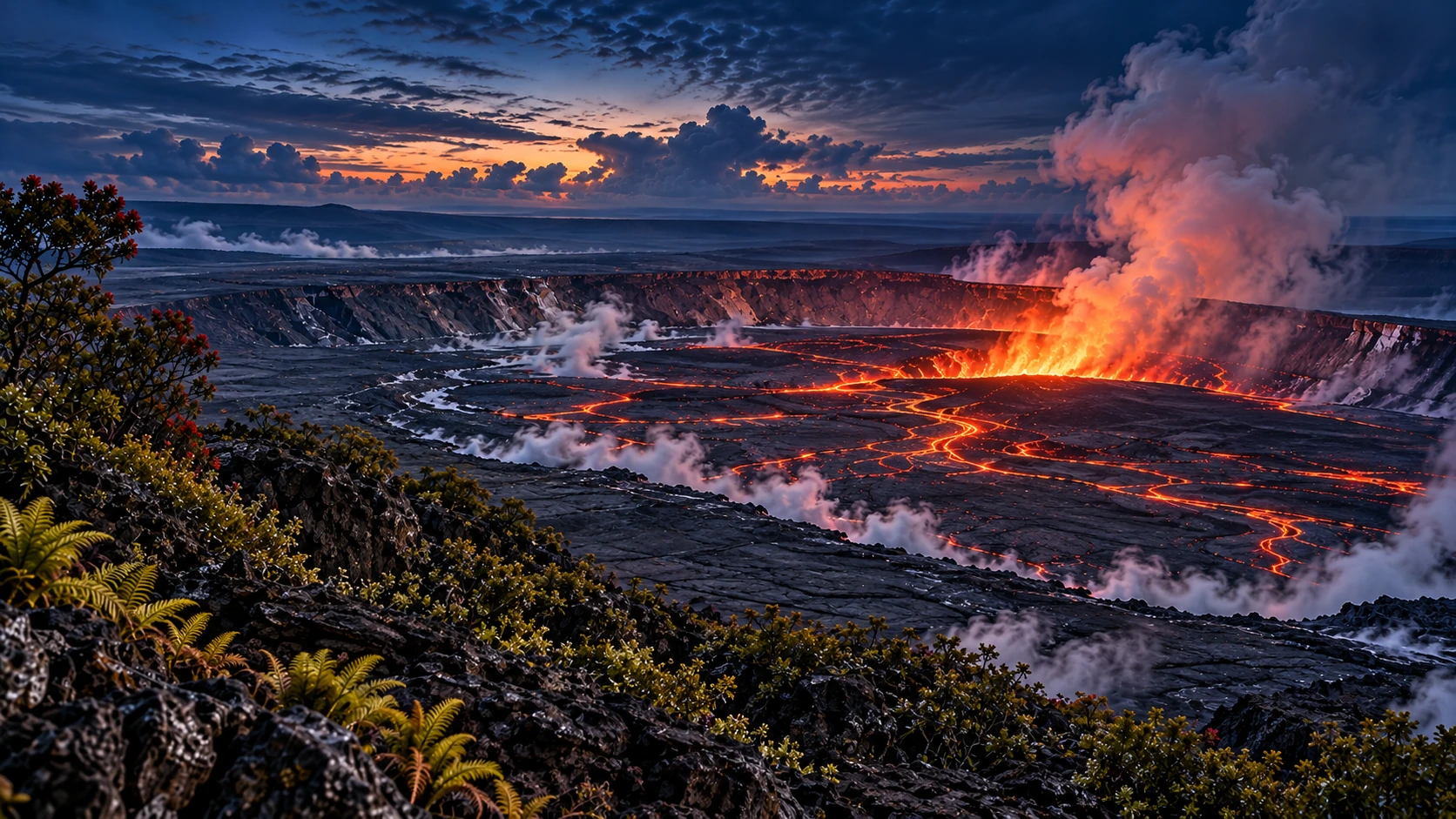
Dewey Beach Parasailing ★
Dewey Beach / Rehoboth Bay / Coastal Aerial Views
Departure: Rusty Rudder Waterfront - 113 Dickinson Avenue
Seasonal Excursions / Advance Reservations Recommended

Visitor Planning & Safety

Park Trails & Recreation

Other Highlights & Activities

Coastal Exploration
Beach Walks & Birdwatching
Cycling & Fishing
Fort Miles & World War II History
Trap Pond State Park ★

A distinctive wetland landscape centered around a large pond and one of the northernmost naturally occurring bald-cypress forests in the United States.

Hiking & Backpacking

Bob Trail: 4.5 Miles ★
Loblolly Trail: 5 Miles ★

Paddling, Rafting & Water Adventures

Visitor Planning & Safety

Park Trails & Recreation

Other Highlights & Activities

Bald Cypress Swamp Exploration
Kayaking & Canoeing
Wildlife & Birdwatching
Florida
Big Cypress National Preserve

An enormous subtropical wilderness of cypress swamps, sawgrass prairies, pinelands, and hardwood hammocks offering one of Florida’s most immersive wilderness adventures. National Geographic specifically highlights Big Cypress for its wet hikes, wildlife, stargazing, and swamp experiences.

Hiking & Backpacking

Florida National Scenic Trail - Big Cypress Section: 36 Miles ★
Gator Hook Trail: 5 Miles ★
Deep Lake Trail: 1.5 Miles ★
Swamp Hiking ★
Wildlife Viewing / Birdwatching
Stargazing
Wet-Hike Preparation Required

Visitor Planning & Safety

Park Access & Visit Planning

Other Highlights & Activities

Airboat / Swamp Buggy Excursions
Biscayne National Park ★
Approved artistic panorama illustrating Biscayne National Park; not a documentary photograph
Biscayne National Park · Approved artistic panorama

A spectacular underwater and island wilderness just south of Miami, where turquoise waters surround mangrove islands, coral reefs, seagrass beds, and historic shipwrecks.

Paddling, Rafting & Water Adventures

Guided Snorkeling, Paddling & Island Excursions ★

Visitor Planning & Safety

Park Access & Visit Planning

Other Highlights & Activities

Boca Chita Key ★
Historic Lighthouse / Island Exploration
Elliott Key
Kayaking / Paddleboarding / Camping
Corkscrew Swamp Sanctuary

An extraordinary old-growth cypress wilderness where an elevated boardwalk passes through ancient bald-cypress forest, marsh, and wet prairie.

Hiking & Backpacking

Corkscrew Swamp Sanctuary Boardwalk: 2.25 Miles ★
Wildlife Viewing / Birdwatching
Ancient Cypress Forest

Other Highlights & Activities

Admission & Guided Programs
Guided Naturalist Walks
Seasonal Wildlife & Birding Programs
Sanctuary Trails & Admission
Crystal River / Three Sisters Springs ★

Waterfalls & Natural Features

Clear freshwater springs and warm-water refuges provide remarkable
seasonal manatee encounters.
Spring Viewing & Refuge Access Information

Paddling, Rafting & Water Adventures

Guided Manatee Snorkeling ★
Dry Tortugas National Park ★
Approved artistic panorama illustrating Dry Tortugas National Park; not a documentary photograph
Dry Tortugas National Park · Approved artistic panorama

A remote chain of tropical islands nearly 70 Miles west of Key West, surrounded by brilliant blue water and coral reefs and dominated by the enormous brick fortress of Fort Jefferson.

Paddling, Rafting & Water Adventures

Snorkeling / Scuba Diving ★

Guided Tours & Outdoor Experiences

History, Culture & Attractions

Garden Key & Fort Jefferson ★
Historic Fortress / Snorkeling / Beach Exploration

Visitor Planning & Safety

Park Access & Visit Planning

Other Highlights & Activities

Bush Key
Seasonal Birdwatching / Wildlife Viewing
Camping ★
Advance Reservations Required
Loggerhead Key
Remote Island / Lighthouse / Reef Exploration
Everglades National Park ★
Approved artistic panorama illustrating Everglades National Park; not a documentary photograph
Everglades National Park · Approved artistic panorama

The largest subtropical wilderness in North America, where the legendary River of Grass flows through sawgrass marshes, mangrove forests, cypress hammocks, pine rocklands, and Florida Bay.

Hiking & Backpacking

Anhinga Trail: 0.8 Miles ★
Mahogany Hammock Trail: 0.5 Miles ★
Shark Valley Tram Trail: 14.9 Miles ★
Gumbo Limbo Trail: 0.4 Miles
Pa-Hay-Okee Overlook Trail: 0.2 Miles
Pinelands Trail: 0.4 Miles

Paddling, Rafting & Water Adventures

Hell’s Bay Canoe Trail to Hells Bay Chickee: 5.5 Miles
Point-To-Point Paddling Distance
Lard Can / Pearl Bay / Hell’s Bay Campsites
Nine Mile Pond Canoe Trail: 5.2 Miles ★
Kayaking / Canoeing / Cycling
Paddling Routes & Backcountry Planning

Wildlife & Fishing

Wildlife Viewing / Birdwatching ★

Visitor Planning & Safety

Park Access & Visit Planning

Other Highlights & Activities

Wilderness Waterway
Multi-Day Paddling / Backcountry Camping
Wilderness Permits Required For Overnight Trips
Guided Airboat Excursions ★
Fakahatchee Strand Preserve State Park ★

A vast subtropical strand swamp known for rare orchids, old-growth cypress, wildlife, and secluded wetlands often called the “Amazon of North America.”.

Hiking & Backpacking

Big Cypress Bend Boardwalk: 0.5 Miles ★
Old-Growth Cypress / Wildlife Viewing

Visitor Planning & Safety

Other Highlights & Activities

John Pennekamp Coral Reef State Park ★

The first undersea park in the United States, protecting spectacular coral reefs, tropical marine life, mangrove islands, and some of the Florida Keys’ most famous underwater scenery.

Paddling, Rafting & Water Adventures

Snorkeling / Scuba Diving
Glass-Bottom Boat / Kayaking
Reef & Snorkeling Excursions

Visitor Planning & Safety

Park Trails & Recreation

Other Highlights & Activities

Christ of the Abyss ★
Iconic Underwater Statue / Reef Diving
Kennedy Space Center / Space Coast ★

America’s spaceflight coast pairs spacecraft exhibits with hands-on astronaut-training simulations.

Other Highlights & Activities

Astronaut Training Experience ★
Mission Simulations / Separate Reservation
Age, Mobility & Simulator Requirements
Miami & Miami Beach ★

Art Deco streets, Cuban heritage, tropical gardens, contemporary art, and Biscayne Bay adventures bring together Miami’s coastal culture and city life.

Beaches, Landmarks, & Neighborhoods

South Beach & Art Deco District ★
Ocean Drive / Historic Architecture / Atlantic Beaches
Little Havana & Calle Ocho ★
Cuban Heritage / Cafés / Domino Park / Live Music
Wynwood & Design District ★
Street Art / Galleries / Design / Local Dining
Coconut Grove & Coral Gables ★
Waterfront Neighborhoods / Historic Architecture / Local Shops
Little Haiti ★
Haitian Heritage / Art / Food & Music
Fairchild Tropical Botanic Garden ★
Coral Gables / Tropical Plants / Gardens

Museums & Local Cultural

Vizcaya Museum & Gardens ★
Historic Waterfront Estate / Decorative Arts / Formal Gardens
Pérez Art Museum Miami ★
Modern & Contemporary Art / Waterfront Architecture
Phillip and Patricia Frost Museum of Science ★
Aquarium / Planetarium / Interactive Science
The Bass ★
Miami Beach / Contemporary Art / Changing Exhibitions
Wynwood Walls ★
Outdoor Street-Art Museum / Large-Scale Murals

Tours & Entertainment

Art Deco Architecture Walking Tour ★
South Beach / Historic Buildings / Guided Neighborhood Walk
Little Havana Food & Culture Tour ★
Cuban Tastings / Neighborhood History / Local Traditions
Biscayne Bay Sightseeing Cruises ★
Skyline Views / Waterfront Landmarks / Island Scenery
Oleta River Kayaking & Paddleboarding ★
North Miami Beach / Mangroves / Coastal Paddling
Guided Tours & Rentals / Park Admission Separate
Miami Food & Live Music ★
Cuban Cuisine / Caribbean Food / Latin Music
Venue Age Requirements / Performance Calendars
City Attractions & Events

Art Basel Miami Beach & Miami Art Week

Contemporary Art / Galleries / Citywide Exhibitions
Separate Fairs & Event Tickets / Annual Schedule
Myakka River State Park ★

A vast subtropical landscape of wetlands, open prairie, palm and oak hammocks, and wildlife-rich lakes, with a canopy walkway and excellent opportunities to see alligators and wading birds.

Hiking & Backpacking

William S. Boylston Nature Trail and Canopy Walkway: 0.9 Miles ★
Deep Hole Trail: 4.4 Miles ★
Wilderness Preserve Permit Required / Issued At The Ranger Station
Upper Myakka Lake Loop via Ranch House Road: 10.3 Miles ★
Mossy Hammock and Bee Island Loop: 4.2 Miles

Paddling, Rafting & Water Adventures

Wildlife & Fishing

Wildlife Viewing / Birdwatching

Visitor Planning & Safety

Park Trails & Recreation
Ocala National Forest ★

A vast inland wilderness of crystal-clear springs, pine forests, sand scrub, lakes, and spring-fed rivers that showcases a surprisingly wild side of central Florida.

Hiking & Backpacking

Juniper Springs to Hidden Pond via Florida Trail: 10.8 Miles ★
The Yearling Trail: 3.9 Miles ★
Clearwater Lake to Alexander Springs via Florida Trail: 10.7 Miles
Florida Trail: Alexander Springs to Juniper Springs: 16.9 Miles
Official Forest Recreation & Trail Information

Paddling, Rafting & Water Adventures

Juniper Springs Run Kayak: 6.9 Miles ★
Kayaking / Canoeing ★
Swimming / Snorkeling
Camping
Space Coast / Indian River Lagoon ★

Mangrove-lined lagoons host nocturnal paddling trips through water that can sparkle with natural bioluminescence.

Paddling, Rafting & Water Adventures

Guided Bioluminescent Kayaking ★
Night Paddling / Seasonal Glow / Natural Conditions Vary
Florida Multi-Day Sailing & Water Adventures ★

Liveaboard sailing, island-hopping voyages, reef diving, and kayak camping explore the Florida Keys, Dry Tortugas, and Everglades over several days.

Paddling, Rafting & Water Adventures

Dry Tortugas & Lower Keys Overnight Sailing ★
Key West / Remote Islands / Reef Snorkeling / Nights Aboard
Private Charters / Weather-Dependent Routes / Confirm Park Access
Dry Tortugas Voyage: 3 Days / 2 Nights
Marquesas / Boca Grande Key / Dry Tortugas
Everglades Kayak Camping Expeditions ★
Mangrove Waterways / Remote Beaches / Wildlife / Backcountry
Camping
Guided Trips: 3 - 8 Days / Route & Experience Level Vary
Overnight Wilderness Permits Required / Confirm Guide
Arrangements
Florida Keys Kayak Camping Expeditions ★
Lower Keys / Turquoise Flats / Mangroves / Island Camping
Lower Keys Camping: 3 - 5 Days
Key Largo To Key West Expedition: 10 Days
Seasonal Departures / Small Groups / Confirm Camping Itinerary
Florida Keys Sailing Voyages ★
Private Sailing / Reef Snorkeling / Island Anchorages / Nights Aboard
Biscayne Bay & Key Largo: 2 - 4 Days
Miami To Key West Voyages: 5 - 9 Days
Route & Return Arrangements By Selected Itinerary
Liveaboard Sailing Courses ★
Marathon / Hands-On Sailing / Navigation / Certification Options
Private Courses: 5 Days / 4 Nights Or 7 Days / 6 Nights
Dockside Overnight Accommodation / Daily Sailing Instruction
Course Prerequisites & Provisioning By Selected Program
Reef & Wreck Diving Packages ★
Islamorada / Guided Reef & Wreck Dives / Multiple Boat Trips
Packages: 3 - 5 Trips / Schedule Across Multiple Days
Land-Based Stay / Lodging Booked Separately
Open Water Certification For Reefs / Advanced Open Water For
Wrecks
Georgia
Amicalola Falls State Park ★

Home to Georgia’s tallest waterfall, where cascading water plunges 729 feet through the southern Appalachians and an approach trail leads toward the Appalachian Trail’s southern terminus.

Hiking & Backpacking

Amicalola Falls via East Ridge Loop Trail: 2.2 Miles ★
Appalachian Approach Trail to Springer Mountain: 8.5 Miles ★
Appalachian Trail Access / Mountain Hiking
Len Foote and Appalachian Approach Loop: 9.9 Miles

Food, Lodging & Local Experiences

Park Activities, Lodging & Trip Planning
Appalachian Trail - Georgia ★

The southern gateway to the Appalachian Trail, traversing rugged Blue Ridge ridges, dense forests, mountain summits, and panoramic overlooks across North Georgia.

Hiking & Backpacking

Appalachian Trail - Georgia: 78.3 Miles ★
Blood Mountain via Byron Reece Trail: 4 Miles ★
Springer Mountain Trail: 2 Miles ★
Long-Distance Backpacking / Mountain Camping

Visitor Planning & Safety

Trail Access & Closures

Other Highlights & Activities

Preachers Rock from Woody Gap: 2 Miles ★
Atlanta ★

A city shaped by civil rights history, music, art, and neighborhood creativity, with major museums, urban greenways, lively markets, and distinctive cultural experiences.

Historic Landmarks & Urban Spaces

Martin Luther King, Jr. National Historical Park ★
Ebenezer Baptist Church / King Center Area / Civil Rights History
Historic Sweet Auburn ★
Black History / Historic Streets / Community Heritage
Atlanta Botanical Garden ★
Canopy Walk / Plant Collections / Seasonal Light Displays
Piedmont Park ★
Skyline Views / Urban Green Space / Seasonal Festivals
Centennial Olympic Park ★
Olympic History / Downtown Green Space
Atlanta Beltline Eastside Trail: 2.4 Miles ★
Full Point-To-Point Segment / Public Art / Walking & Cycling

Museums & Civil Rights Heritage

National Center for Civil and Human Rights ★
Civil Rights Movement / Global Human Rights
High Museum of Art ★
Art Collections / Architecture / Special Exhibitions
Georgia Aquarium ★
Ocean Exhibits / Aquatic Wildlife
World of Coca-Cola
Brand History / Interactive Exhibits

Tours & Entertainment

Fox Theatre Show & Historic Tour ★
Neighborhood Food & Music ★
Southern Food / Hip-Hop Heritage / Live Performances
Little Five Points / East Atlanta Village
Porsche Driving Experience ★
Driver Development Tracks / Performance Driving / Coach-Led
Experience
Advance Booking / Driver Eligibility Requirements
Panola Mountain Guided Tree Climbing ★
Rope-Assisted Canopy Climbing
Ponce City Market & Krog Street Market ★
Food Halls / Neighborhood Dining / Beltline Connections
City Attractions, Neighborhoods & Events
Garden Lights, Holiday Nights ★
Atlanta Botanical Garden / Illuminated Gardens / Evening Displays
Seasonal Timed Tickets
Chattahoochee River National Recreation Area

A surprisingly wild stretch of river and forest near Atlanta, with rocky bluffs, riverside trails, and scenic woodland escapes.

Hiking & Backpacking

East Palisades Trail and Bamboo Forest: 4.2 Miles ★
River Bluffs / Bamboo Forest / Scenic Overlooks
Vickery Creek Trail: 3.5 Miles ★
Waterfalls / Historic Mill Ruins

Visitor Planning & Safety

Chattahoochee-Oconee National Forest ★

A vast North Georgia landscape of forested ridges, mountain peaks, waterfalls, and rushing rivers.

Hiking & Backpacking

Mount Yonah Trail: 4.3 Miles ★
Rock Climbing / Technical Routes
Panther Creek Falls Trail: 7.1 Miles ★
DeSoto Falls Trail: 2 Miles ★
Dukes Creek Falls Trail: 2.3 Miles ★
Long Creek Falls via Appalachian Trail: 1.9 Miles ★
Minnehaha Falls Trail: 0.4 Miles ★
Raven Cliff Falls Trail: 4.9 Miles ★

Paddling, Rafting & Water Adventures

Visitor Planning & Safety

Forest Trails & Recreation
Cloudland Canyon State Park ★

One of Georgia’s most spectacular landscapes, where massive sandstone cliffs plunge into a deep canyon filled with forests, waterfalls, and rugged trails.

Hiking & Backpacking

Cloudland Canyon West Rim Loop: 4.7 Miles ★
Cherokee Falls and Hemlock Falls Trail: 1.2 Miles ★
Sitton’s Gulch Trail: 4.9 Miles ★
Canyon Hiking / Waterfalls
Bear Creek Backcountry Trail: 7.4 Miles

Visitor Planning & Safety

Park Trails & Recreation
Cumberland Island National Seashore ★

A wild barrier island of enormous live oaks, maritime forest, salt marshes, pristine beaches, historic ruins, and free-roaming horses, accessible only by boat.

Hiking & Backpacking

Parallel Trail to Little Greyfield Road: 4.4 Miles ★
Nightingale Trail: 1.5 Miles ★
River Trail: 0.8 Miles
Backpacking / Beach Camping
Ferry Reservations / Camping Reservations Required

History, Culture & Attractions

Dungeness Historic District
Historic Ruins / Wild Horses / Beach Hiking

Visitor Planning & Safety

Park Access & Visit Planning

Other Highlights & Activities

Island Ferry Reservations
Lookout Mountain / Rising Fawn ★

The ridges above Rising Fawn provide a scenic launch region for introductory tandem flight experiences.

Other Highlights & Activities

Tandem Hang Gliding ★
Instructor Flight / Weather & Participant Requirements
Okefenokee National Wildlife Refuge ★

One of North America’s great wetland wildernesses, where blackwater channels wind through cypress forests, peat islands, open prairies, and vast expanses of wild swamp.

Hiking & Backpacking

Chesser Island Boardwalk: 0.75 Miles ★

Paddling, Rafting & Water Adventures

Multi-Day Wilderness Paddling ★
Backcountry Camping / Advance Planning Required

Other Highlights & Activities

Kingfisher Landing
Canoeing / Kayaking / Wilderness Paddling
Stephen C. Foster State Park ★
Guided Swamp Boat Tours / Night Sky Viewing
Swamp Island Drive ★
Refuge Recreation & Access Information
Providence Canyon State Park ★

Georgia’s colorful “Little Grand Canyon,” where dramatic pink, orange, red, and purple canyon walls have been carved into the landscape.

Hiking & Backpacking

Canyon Loop Trail: 2.5 Miles ★
Backcountry Trail: 7 Miles ★
Rugged Backcountry Hiking / Primitive Camping

Visitor Planning & Safety

Park Trails & Recreation
Savannah ★

Live-oak squares, historic homes, Black heritage, riverfront scenery, and distinctive art and storytelling experiences make Savannah a richly layered coastal city.

Historic District, Telfair & Urban Spaces

Historic District Squares ★
Chippewa Square / Monterey Square / Historic Streets
Forsyth Park ★
Landmark Fountain / Live Oaks / Urban Green Space
Cathedral Basilica of St. John the Baptist ★
Historic Architecture / Religious Art
Gregorian Chant / Sacred Choral Music
First African Baptist Church & Black Heritage ★
Historic Congregation / African American History
River Street & Savannah Waterfront ★
Historic Warehouses / River Views / Local Shops
Jones Street & Historic Homes ★
Architecture / Neighborhood Walking
Starland District ★
Local Art / Creative Shops / Neighborhood Dining
Wormsloe State Historic Site ★
Nearby Isle Of Hope / Live-Oak Avenue / Colonial History
Telfair Museums ★
Jepson Center / Telfair Academy / Owens-Thomas House & Slave
Quarters
Art / Architecture / History Of Enslavement

Tours & Entertainment

Guided History & Storytelling Tours ★
Bonaventure Cemetery Guided Tour ★
Cemetery Art / Local History / Live-Oak Landscapes
Historic Savannah Walking Tour ★
Guided City History / Advance Reservation
Savannah Ghost & Dark-History Tour ★
Guided Storytelling / Evening Departures
Savannah Riverboat Cruise ★
Riverfront Scenery / Sightseeing & Dining Options
City Market & Local Food ★
Galleries / Southern Dining / Neighborhood Culture
Savannah Food Tasting Tour ★
Southern Food / Historic Squares / Guided Tastings
City Attractions, Neighborhoods & Activities
Lucas Theatre for the Arts ★
Historic Theatre / Film Screenings / Live Performances
Restored Wurlitzer Organ / Selected Programs
Leopold’s Ice Cream ★
Historic Ice Cream Parlor / Handmade Ice Cream / Broughton Street

St. Patrick’s Day in Savannah

Historic District Parade / Irish Heritage / City Celebrations
Annual Route, Schedule & Event Requirements
Tallulah Gorge State Park ★

A spectacular two-Mile canyon where sheer walls plunge nearly 1,000 feet around the Tallulah River and six waterfalls.

Hiking & Backpacking

Gorge Floor Trail: 2.5 Miles ★
Free Daily Permit Required / Limited Availability
Tallulah Gorge and North and South Rim Loop Trail: 1.8 Miles ★
Stoneplace Trail: 9 Miles ★
Backcountry Hiking / Tugaloo Lake Access
Tallulah Gorge Overlooks Trail: 2.6 Miles ★
High Bluff Trail: 5.1 Miles

Paddling, Rafting & Water Adventures

Whitewater Kayaking
Expert-Level Whitewater / Scheduled Dam Releases

Visitor Planning & Safety

Park Trails & Recreation
Paddle Georgia: Multi-Day Georgia River Adventures

Organized paddling journeys explore Georgia’s rivers, combining canoeing, kayaking, camping, and river conservation.

Paddling, Rafting & Water Adventures

Georgia Rivers - Paddle Georgia ★
Annual Multi-Day Canoe & Kayak Journey / River Route Changes By
Year
Organized Group Event / Not A Commercially Guided Tour
Guam
Guam Adventures

A tropical Pacific island of jungle waterfalls, limestone caves, turquoise reefs, dramatic coastal cliffs, and ancient CHamoru heritage.

Hiking & Backpacking

Sella Bay Trail: 1.9 Miles ★

Waterfalls & Natural Features

Tarzan Falls: 1.6 Miles ★
Ritidian Point & Beach ★

Paddling, Rafting & Water Adventures

Climbing, Caving & Mountain Adventures

Pagat Cave & Point: 1.7 Miles ★

History, Culture & Attractions

War in the Pacific National Historical Park ★
Local Attractions & Activities

Other Highlights & Activities

Mount Lamlam: 2.7 Miles ★
Climb Guam’s Highest Peak
Cetti Bay Overlook & Inalåhan Natural Pools ★
Valley of the Latte ★
CHamoru Heritage / Latte Sites / River Valley
Hawaii
Hawaiʻi Island / Big Island

Hawaii’s largest island, with active volcanoes, immense lava fields, black and green sand beaches, lush valleys, high-altitude summits, and extraordinary marine wildlife.

Hiking & Backpacking

Ala Kahakai National Historic Trail ★
A historic coastal trail linking ancient Hawaiian pathways, lava
shorelines, beaches, and cultural sites across the island.
Ala Kahakai National Historic Trail: 175 Miles ★
Historic Trail Routes & Access

Waterfalls & Natural Features

Papakōlea Green Sand Beach ★
A remote beach set inside a volcanic cinder cone, famous for its
unusual green olivine sand and rugged coastal scenery.
Papakōlea Green Sand Beach Hike: 5.6 Miles
Remote Access / Exposed Terrain / Limited Shade

Paddling, Rafting & Water Adventures

Hawaiʻi Volcanoes National Park ★
Approved artistic panorama illustrating Hawaiʻi Volcanoes National Park; not a documentary photograph
Hawaiʻi Volcanoes National Park · Approved artistic panorama
Volcanic craters, lava landscapes, and rainforest reveal the forces
that continue to shape Hawaii Island.
Kīlauea Iki Trail: 3.3 Miles ★
Nāhuku (Thurston Lava Tube) Trail: 1.5 Miles ★
Route From Kīlauea Iki Overlook
Devastation Trail: 1 Mile
Chain of Craters Road Scenic Drive ★
Guided Volcano Hike / Geology Tour ★
Eruption Updates & Closures
Park Trails, Conditions & Access Information

History, Culture & Attractions

Puʻuhonua o Hōnaunau National Historical Park ★
A sacred place of refuge preserving traditional Hawaiian temples,
carved wooden images, royal grounds, and a dramatic lava-rock
coastline.
1871 Trail: 2 Miles ★
Cultural Sites, Trails & Park Access

Other Highlights & Activities

Hāmākua Coast ★
A lush, waterfall-filled coastline of tropical rainforest, dramatic sea
cliffs, and deep green valleys.
ʻAkaka Falls Loop Trail: 0.4 Miles ★
Hāmākua Coast Scenic Drive
Waterfall Trail & Park Access
Kealakekua Bay ★
A protected marine sanctuary with clear water, colorful coral, tropical
fish, and the historic Captain Cook Monument.
Captain Cook Monument
Kealakekua Bay Kayaking & Snorkeling ★
Kayaking Rules & Access Information
Mauna Kea ★
A towering dormant volcano rising above the clouds, known for
extraordinary high-altitude scenery, sunset views, and some of the
world’s clearest night skies.
Summit Sunset & Stargazing ★
High Summit Views Above the Clouds ★
Summit Access & Stargazing Guidelines
Pololū Valley ★
A dramatic northern valley with towering green cliffs, a black-sand
beach, and sweeping views of the rugged Kohala coastline.
Pololū Valley Lookout Trail: 0.9 Miles ★
Punaluʻu Black Sand Beach ★
A striking black-sand beach lined with coconut palms, often visited by
Hawaiian green sea turtles resting along the shore.
Black-Sand Beach & Sea Turtle Viewing ★
Waipiʻo Valley Lookout ★
A spectacular overlook above a deep, green valley framed by
towering cliffs, waterfalls, taro fields, and a black-sand beach.
Waipiʻo Valley Views ★
Valley Road Access Restrictions
Valley Road Access Updates
Big Island Adventures & Excursions
Guided island experiences combine ocean adventures, scenic flights,
cultural visits, and outdoor activities.
Volcano Helicopter Flight ★
Volcano Biking
Manta Ray Night Snorkeling ★
Kona Coast Snorkeling & Sailing ★
Umauma Falls Ziplining & ATV Adventures ★
Waterfall Zipline / Guided ATV Tours
Horseback Riding & Paniolo Ranch
Spearfishing ★
Deep-Sea Fishing ★
Kona Coffee Farm ★
Akaka Falls Zipline ★
Waikoloa Sunset Cruise
Kona Coffee Living History Farm
Guided Volcano & Circle-Island Tours ★
Guided Lava Tube Exploration ★
Native-Bird & Forest Excursions ★
Forest Route Subject To Access Conditions
Kauaʻi

Emerald cliffs, deep volcanic canyons, rainforest, waterfalls, and rugged Pacific coastline define the Garden Island.

A lush landscape of tropical river valleys, cascading waterfalls, and winding waterways, with scenic hikes and classic river adventures.

Hiking & Backpacking

Kuilau Ridge Trail: 3.6 Miles ★
Sleeping Giant (Nounou Mountain) East Trail: 3.4 Miles ★
Sleeping Giant (Nounou Mountain) West Trail: 1.7 Miles ★
Wailua Falls Viewpoint ★
Uluwehi Falls / Secret Falls ★
Wailua River Kayaking ★
Fern Grotto
River Recreation & Access Updates

Other Highlights & Activities

East Coast ★
Hāʻena & Hanalei ★
Kauai’s breathtaking North Coast, where lush emerald mountains
meet turquoise waters, golden beaches, and charming surf towns.
Hanalei Bay & Pier ★
Hāʻena State Park & Keʻe Beach ★
Park Entry & Parking Reservations
Kīlauea & Princeville ★
A scenic North Shore area of dramatic ocean bluffs, wildlife-rich
coastlines, lush gardens, and beautiful views over the Pacific.
Kīlauea Point Lighthouse & Wildlife Viewing ★
Princeville Botanical Gardens & Chocolate Tasting
Queen’s Bath Coastal Walk
Seasonal Closures / Dangerous Surf / Respect Closed Gates
Kōkeʻe Highlands & Polihale ★
A rugged western landscape of high-elevation forests, mist-covered
ridges, remote wilderness, and sweeping views above the Nā Pali
Coast and Waimea Canyon.
Alakaʻi Swamp Trail: 7 Miles ★
Awaʻawapuhi Trail: 5.8 Miles ★
Nuʻalolo Trail: 7.6 Miles ★
Pihea Trail: 3.8 Miles ★
Kalalau Lookout ★
Puʻu o Kila Lookout ★
Kōkeʻe Natural History Museum
Polihale Beach, Coastal Exploration & Sunset Photography ★
Pāʻulaʻula State Historic Site (Russian Fort Elizabeth)
Park Trails & Recreation
Beach Access & Camping
Nā Pali Coast State Wilderness Park ★
Kauai’s legendary northwest coastline, known for towering emerald
cliffs, fluted mountain ridges, hidden beaches, sea caves, and remote
valleys.
Kalalau Trail to Hanakāpīʻai Beach: 4 Miles ★
Kalalau Trail to Hanakāpīʻai Falls: 8 Miles ★
Full Kalalau Trail: 22 Miles ★
Camping & Backpacking
Permit Required
Kayaking & Sea Cave Expeditions ★
Sailboat, Catamaran, & Zodiac Tours ★
Sunset Dinner Cruise ★
Coastal Wilderness Access & Camping
Poʻipū & Māhāʻulepū Coast ★
Sunny South Shore beaches, rugged coastal cliffs, tide pools, and
scenic walking trails along Kauai’s southern coastline.
Māhāʻulepū Heritage Trail: 3.8 Miles ★
Makawehi Lithified Cliffs ★
Poʻipū Beach & Marine Wildlife ★
Shipwreck Beach & Coastal Cliffs
Spouting Horn ★
South Shore Zodiac Snorkeling ★
Guided Horseback Riding ★
Allerton Garden ★
Guided Snorkeling & Scuba Diving ★
Waimea Canyon ★
The spectacular “Grand Canyon of the Pacific,” where enormous red,
orange, and green cliffs descend into a deeply eroded volcanic
canyon surrounded by waterfalls and lush mountains.
Canyon Trail to Waipoʻo Falls: 3 Miles ★
Kukui Trail: 5 Miles ★
Iliau Nature Loop: 0.3 Miles
Waimea Canyon Lookouts ★
Private Canyon & Island Tours
Park Trails & Recreation
Kauaʻi Adventures & Excursions
Guided island experiences combine ocean adventures, scenic flights,
cultural visits, and outdoor activities.
Helicopter Flight over Manawaiopuna Falls / Jurassic Falls ★
Deep-Sea Sportfishing ★
Guided Surfing Lessons
Kauaʻi Mountain Tubing ★
Kīpū Ranch ATV Adventure ★
Kōloa Zipline ★
Seasonal Whale-Watching Cruises ★
Guided Waterfall Rappelling ★
Maui

Volcanic summits, lush rainforests, waterfalls, black-sand beaches, and Pacific wildlife combine with rich Hawaiian culture.

Hiking & Backpacking

Kapalua Coastal Trail ★
A beautiful coastal walk linking golden beaches, lava-rock shorelines,
rugged headlands, and turquoise coves along West Maui.
Kapalua Coastal Trail: 2.5 Miles ★
Tide Pools & Coastal Scenery
La Perouse Bay & Hoapili Trail ★
A rugged volcanic coastline of black lava fields, turquoise coves, and
remnants of an ancient Hawaiian coastal route.
Hoapili Trail / King’s Highway: 5.5 Miles
Historic Lava Fields & Coastal Hiking
Snorkeling in Suitable Ocean Conditions
Coastal Trail Access

Waterfalls & Natural Features

Makena State Park / Big Beach ★
A spectacular stretch of golden sand backed by volcanic slopes, with
expansive ocean views and a rugged atmosphere beyond the resort
beaches.
Big Beach & Coastal Walks
Little Beach Viewpoint
Swimming & Surf Conditions - Use Caution
Beach Access & Ocean Conditions
Polipoli Spring State Recreation Area
A cool, high-elevation forest on Haleakalā’s slopes, with redwoods,
eucalyptus, pine trees, and quiet trails overlooking the island.
Polipoli / Redwood / Plum Trail Loop: 3.5 Miles
Forest Hiking & Cool-Climate Scenery
Forest Trails, Camping & Access

History, Culture & Attractions

ʻĪao Valley State Monument ★
A lush, steep-sided valley in the West Maui Mountains, famous for its
emerald peaks, misty rainforest, and towering Īao Needle.
ʻĪao Needle Lookout Trail and Ethnobotanical Loop: 0.6 Miles ★
Tropical Valley / Hawaiian Cultural History
Entry & Parking Reservations

Other Highlights & Activities

Haleakalā National Park ★
Approved artistic panorama illustrating Haleakalā National Park; not a documentary photograph
Haleakalā National Park · Approved artistic panorama
A vast volcanic wilderness rising above the clouds, where enormous
cinder cones, colorful volcanic deserts, alpine shrublands, and deep
valleys create a landscape that feels almost extraterrestrial.
Keoneheʻeheʻe (Sliding Sands) Trail: 11 Miles ★
Halemauʻu Trail: 7.4 Miles ★
Pā Kaʻoao Trail: 0.4 Miles
Hosmer Grove Loop Trail: 0.5 Miles
Panoramic Summit Views Above the Clouds ★
Stargazing / Night-Sky Photography ★
Volcanic Crater Hiking & High-Altitude Scenery ★
Summit Sunrise & Sunset ★
Guided Summit Sunrise Excursions ★
Park Trails & Recreation
Kīpahulu / East Maui ★
A lush rainforest landscape on the eastern slopes of Haleakalā, where
bamboo forests, waterfalls, tropical valleys, and rugged coastal
scenery create some of Maui’s best hiking.
Pīpīwai Trail: 4 Miles ★
Bamboo Forest ★
Waimoku Falls ★
ʻOheʻo Gulch
Rainforest Trails & District Access
Nakalele Blowhole ★
A rugged northern coastline of sculpted lava rock, crashing surf, and
a natural blowhole that can shoot seawater high into the air.
Nakalele Blowhole Coastal Hike: 1.2 Miles
Lava Formations & Blowhole Viewing
Exposed Rocky Terrain / Dangerous Surf Conditions
Road to Hāna ★
A legendary coastal drive through tropical rainforest, sea cliffs,
waterfalls, bamboo groves, and remote Hawaiian villages along Maui’s
lush northeastern coast.
Twin Falls & Waterfall Swimming
Keʻanae Peninsula & Coastal Lava Shoreline
Waiʻānapanapa Black-Sand Beach ★
Wailua Falls
Rainforest Hiking & Bamboo Groves ★
Coastal Lookouts & Scenic Stops
Road to Hāna Scenic Drive ★
Waiʻānapanapa State Park ★
A dramatic volcanic coastline with a famous black-sand beach, sea
arches, lava formations, blowholes, and ancient coastal pathways.
Ke Ala Loa O Maui / Pīʻilani Trail: 3 Miles
Black-Sand Beach & Coastal Lava Formations ★
Sea Caves / Natural Arches / Blowholes
Advance Entry & Parking Reservations Required
Entry & Parking Reservations
West Maui Mountains ★
An ancient volcanic massif of jagged ridges, deep green valleys, lush
forests, and sweeping Pacific views.
Waiheʻe Ridge Trail: 5 Miles ★
Panoramic Mountain & Ocean Views
Horseback Riding ★
O’ahu

Honolulu and Waikīkī meet dramatic volcanic mountains, lush valleys, famous beaches, marine adventures, and important cultural and historic sites.

Hiking & Backpacking

Lanikai Pillbox Trail (Kaiwa Ridge) ★
A short ridge hike above turquoise water and the Mokulua Islands,
especially beautiful at sunrise.
Lanikai Pillbox Trail: 0.9 Miles ★

Guided Tours & Outdoor Experiences

Guided Adventures & Excursions
Guided island experiences combine ocean adventures, scenic flights,
cultural visits, and outdoor activities.
Hanauma Bay Snorkeling ★
North Shore Tandem Skydiving ★
Ocean & Mountain Views / Participant Requirements
North Shore Shark Cage Diving ★
Waikīkī Turtle Snorkeling ★
Catamaran Snorkeling & Sailing
Seasonal Whale-Watching Cruises ★
Oʻahu Parasailing & Ocean Watersports
Oʻahu Helicopter Flight ★
North Shore Surfing Lesson ★
Circle-Island Tour With Waimea Waterfall & Lunch ★
Polynesian Cultural Center & Lūʻau ★
ʻIolani Palace History Tour
Dole Plantation
Plantation Gardens / Visitor Attractions
Waikīkī Beach ★
Beach Exploration / Surfing
Mokulua Islands Guided Kayaking ★
Ocean Paddling / Guided Island Exploration

History, Culture & Attractions

Diamond Head State Monument ★
An iconic volcanic crater overlooking Honolulu, with a steep historic
trail climbing through tunnels and military fortifications to panoramic
views of Waikīkī and the Pacific.
Diamond Head Summit Trail: 1.6 Miles ★
Entry & Parking Reservations

Other Highlights & Activities

Ahupuaʻa ʻO Kahana State Park
A lush windward valley of rainforest, streams, rugged mountain
slopes, and traditional Hawaiian cultural landscapes.
Nakoa Trail From Orientation Center: 5 Miles
Kapaʻeleʻele Koʻa and Keaniani Lookout Trail: 1 Mile
Park Hiking Trails & Access
Kaʻena Point State Park ★
Oahu’s rugged western tip, where volcanic coastline, tide pools,
seabird colonies, and occasional Hawaiian monk seals create a wild
coastal landscape.
Kaʻena Point Trail - North Shore Access: 5 Miles
Kaʻena Point Trail - West Side Access: 6.1 Miles
Coastal Trails & Access Updates
Koʻolau Mountains ★
A dramatic volcanic mountain range of razor-edged ridges, lush
valleys, waterfalls, and steep trails overlooking the windward coast
and Honolulu.
Koko Crater Railway Trail: 1.4 Miles ★
Kuliʻouʻou Ridge Trail: 4.7 Miles ★
Wiliwilinui Ridge Trail: 4.5 Miles ★
Mānoa Falls Trail: 1.8 Miles ★
ʻAiea Loop Trail: 4.8 Miles
Likeke Falls Trail: 1 Mile
Kualoa Ranch Jurassic Valley Adventures ★
A spectacular valley of towering green cliffs, tropical forests, ancient
fishponds, and famous movie locations beneath the Koolau
Mountains.
Movie Sites Tours (Jurassic Park) ★
UTV / Raptor Tours ★
Horseback Riding
Jungle Expedition
Secret Island Kayaking / Paddleboarding
Ziplining / E-Bike Tours
Ranch Activities & Reservations
Makapuʻu Point ★
A dramatic southeastern coastline of black volcanic cliffs, crashing
surf, offshore islets, and a historic lighthouse.
Makapuʻu Point Lighthouse Trail: 2.5 Miles ★
Mount Kaʻala ★
Oahu’s highest summit, reached through a demanding climb into
cloud forest and a rare montane bog ecosystem.
Mount Kaʻala Trail: 6.8 Miles ★
Challenging Terrain / Muddy Sections / Rope-Assisted Sections
Trail Access & Conditions
Pearl Harbor National Memorial ★
One of America’s most significant historic sites, commemorating the
December 7, 1941 attack and the people who lost their lives.
USS Arizona Memorial ★
Battleship Missouri Memorial
Pearl Harbor Aviation Museum
Memorial Access & Reservations
Waimea Valley
A lush botanical and cultural valley on the North Shore, with tropical
plants, archaeological sites, and a waterfall at the end of a paved
path.
Waimea Valley Trail: 1.9 Miles ★
Garden Admission & Access
Hawaii Multi-Day Island-Hopping Adventures ★

Guided multi-island journeys combine flights, accommodations, cultural experiences, and natural highlights. Independent trips allow longer stays for hiking, snorkeling, and local adventures.

Other Highlights & Activities
Independent Hawaiʻi Island-Hopping ★
Flexible Island Stays / Separate Accommodations / Inter-Island Flights
Hiking / Snorkeling / Waterfalls / National Parks / Local Adventures
Trafalgar - Best of Hawaiʻi: 10 Days ★
Oʻahu / Hawaiʻi Island / Maui
Pearl Harbor / North Shore / Hawaiʻi Volcanoes / Kona / Maui Coast
Trafalgar - Hawaiian Discovery: 11 Days ★
Oʻahu / Hawaiʻi Island / Maui / Kauaʻi
Cultural Experiences / Volcanoes / Coffee Regions / Waterfalls /
Waimea Canyon
Trafalgar - Hawaiʻi Four Island Adventure: 13 Days ★
Oʻahu / Hawaiʻi Island / Maui / Kauaʻi
Pearl Harbor / Volcanoes / Botanical Gardens / Local Food / Optional
Ocean Excursions
Hawaii Cruises ★

Scenic voyages connect volcanic coastlines, mountains, beaches, sea cliffs, and waterfalls. Honolulu departures suit a week of island visits; mainland departures include longer Pacific crossings.

Paddling, Rafting & Water Adventures
Holland America Line - Hawaiian Islands Cruises ★
San Diego Or Vancouver Departures / Itinerary Dependent
Island Excursions / Volcanic Scenery / Waterfalls / Days At Sea
Norwegian Pride of America - Inter-Island Cruise: 7 Days ★
Honolulu Departure & Return / Oʻahu / Maui / Hawaiʻi Island / Kauaʻi
Maui & Kauaʻi Overnight Calls / Beaches / Volcanoes / Island
Excursions
Princess Cruises - Hawaiian Islands Voyages ★
U.S. Mainland Departures / Pacific Crossing / Hawaiian Island Calls
Beaches / Volcanic Landscapes / Cultural Excursions
UnCruise Adventures - Hawaiian Seascapes: 7 Nights ★
Hawaiʻi Island / Maui / Lānaʻi / Molokaʻi
Manta Ray Snorkeling / Sea Turtles / Hiking / Kayaking / Cultural
Encounters
Activities Subject To Sailing & Ocean Conditions
Idaho
Borah Peak & Lost River Range ★

Idaho’s highest mountain, rising to 12,662 feet in the spectacular Lost River Range, with a demanding ascent involving steep alpine terrain and the exposed Chicken-Out Ridge.

Hiking & Backpacking

Borah Peak Trail: 7 Miles ★
Chicken-Out Ridge Scramble ★
Idaho State High Point ★
Alpine Scrambling / High-Elevation Hiking

Climbing, Caving & Mountain Adventures

Guided Borah Peak Summit Climbs ★

Other Highlights & Activities

Forest Trails & Summit Access Information
City of Rocks National Reserve ★

A surreal high-desert landscape of enormous granite monoliths, spires, arches, windows, and weathered formations that creates one of Idaho’s most distinctive hiking and climbing destinations.

Hiking & Backpacking

Flaming Rock Loop: 0.8 Miles ★
Boxtop Loop: 3 Miles ★
Creekside Towers Trail: 1.4 Miles ★
Window Arch Trail: 0.1 Miles

Climbing, Caving & Mountain Adventures

Rock Climbing / Bouldering

Visitor Planning & Safety

Park Access & Visit Planning

Other Highlights & Activities

Dark-Sky Stargazing ★
Continental Divide Trail - Idaho ★

The Continental Divide Trail crosses high country, remote backcountry, and mountain passes in Idaho.

Visitor Planning & Safety

Wilderness Maps & Access Information

Other Highlights & Activities

Lemhi Pass Towards Goldstone Pass: 2-8 Miles ★
Shared Idaho / Montana Border Route / Turnaround Options
Craters of the Moon National Monument & Preserve ★

An otherworldly volcanic wilderness of black lava flows, cinder cones, volcanic craters, lava tubes, and fissures that looks more like another planet than Idaho.

Hiking & Backpacking

Caves Trail: 1.2 Miles ★
Lava Tube Caving ★
Indian Tunnel ★
North Crater Trail: 3.7 Miles ★
Broken Top Loop: 1.8 Miles ★
Tree Molds Trail: 2.1 Miles
Ancient Lava-Cast Trees
Scenic Loop Drive ★

Visitor Planning & Safety

Other Highlights & Activities

Inferno Cone: 0.4 Miles ★
Dark-Sky Stargazing ★
Frank Church-River of No Return Wilderness ★

One of the largest contiguous wilderness areas in the Lower 48, covering roughly 2.3-2.4 million acres of rugged mountains, deep river canyons, alpine lakes, forests, and extraordinarily remote backcountry.

Hiking & Backpacking

Marsh Creek Trail: 8 Miles ★

Paddling, Rafting & Water Adventures

Middle Fork Salmon River Whitewater Rafting ★
Multi-Day Wilderness Rafting / Riverside Hot Springs
Guided Salmon River Rafting ★

History, Culture & Attractions

Cathedral Lake via Bighorn Crags: 8.8 Miles ★

Visitor Planning & Safety

Other Highlights & Activities

Harbor Lake & Wilson Lake: 13.5 Miles ★
Ship Island Lake: 23 Miles ★
Middle Fork Salmon River ★
Multi-Day Rafting / Floating ★
Whitewater
Riverside Hot Springs
Hells Canyon National Recreation Area & Wilderness ★

North America’s deepest river canyon, where the Snake River cuts through an enormous wilderness of sheer canyon walls, rugged mountains, alpine lakes, and remote backcountry.

Hiking & Backpacking

Seven Devils Loop: 29.6 Miles ★
Multi-Day Alpine Backpacking / Seven Devils Mountains
He Devil Peak Trail: 6.9 Miles ★
Sheep Lake Trail: 17.4 Miles ★
Snake River Trail: 29 Miles ★

Paddling, Rafting & Water Adventures

Guided Snake River Whitewater Rafting ★

Guided Tours & Outdoor Experiences

Backcountry Horseback Riding

Visitor Planning & Safety

Other Highlights & Activities

Sheep Lake Shortcut: 4.3 Miles ★
Hells Canyon Jet Boat Expedition ★
Idaho Hot Springs ★

Idaho’s remote mountain valleys are famous for natural hot springs, many tucked beside rivers and deep within forests-making a hike followed by a wilderness soak one of the state’s most distinctive adventures.

Waterfalls & Natural Features

Goldbug Hot Springs: 3.6 Miles ★
Jerry Johnson Hot Springs: 2.6 Miles ★
Kirkham Hot Springs ★
Burgdorf Hot Springs Wilderness Cabin Stay ★

Other Highlights & Activities

Backcountry Soaking
Idaho Panhandle National Forests ★

A dramatically different side of Idaho, where dense evergreen forests, glacial lakes, rugged mountains, and enormous northern wilderness create some of the state’s best scenery outside the central mountains.

Hiking & Backpacking

Mineral Point Trail: 3.9 Miles ★
Lake Pend Oreille
Scotchman Peak Trail: 8.3 Miles ★
Pulaski Tunnel Trail: 4 Miles ★
Upper Priest Lake Trail: 20 Miles ★
Upper Priest River Trail: 16.2 Miles ★
Pacific Northwest National Scenic Trail: 1,200 Miles
Full Montana / Idaho / Washington Route
Stevens Lakes Trail: 5.4 Miles

Paddling, Rafting & Water Adventures

Kayaking / Canoeing

Visitor Planning & Safety

Forest Trails & Recreation

Other Highlights & Activities

Salmo-Priest Wilderness ★
Island Park & Henry’s Fork ★

Celebrated trout waters and scenic river landscapes offer guided fishing and float trips through eastern Idaho.

Wildlife & Fishing

Henry’s Fork Guided Fly Fishing ★
Trout Fly Fishing / Guided Angling
Sawtooth National Recreation Area & Sawtooth Wilderness ★

Idaho’s signature mountain landscape, where jagged granite peaks rise above hundreds of alpine lakes, flower-filled meadows, forests, and clear mountain streams. National Geographic specifically highlights the Sawtooths as one of Idaho’s premier wilderness destinations, with hiking, climbing, paddling, wildlife, and dramatic mountain scenery.

Hiking & Backpacking

Alice-Toxaway Loop: 18.8 Miles ★
Goat Lake and Goat Falls via Iron Creek Trail, Alpine Way Trail: 8.3 Miles
Sawtooth Lake via Iron Creek Trail: 9.8 Miles ★
Alpine Lake via Iron Creek Trailhead: 7.7 Miles ★
Pettit Lake to Twin Lakes via Trail 095: 13.9 Miles ★

Climbing, Caving & Mountain Adventures

Guided Alpine Climbs & Summit Objectives ★

Cycling & Scenic Routes

Scenic Sawtooth Road Trip ★

Visitor Planning & Safety

Forest Trails & Recreation

Other Highlights & Activities

Thompson Peak: 13 Miles ★
Redfish Lake ★
Twin Falls / Perrine Bridge ★

The Snake River Canyon beneath Perrine Bridge provides an iconic setting for a guided tandem parachute jump from a fixed span.

Other Highlights & Activities

Perrine Bridge Tandem BASE Jump ★
Instructor-Led Parachute Jump / Eligibility & Conditions
White Clouds Wilderness ★

A spectacular, quieter counterpart to the Sawtooths, with enormous granite peaks, turquoise alpine lakes, high basins, and wildflower meadows.

Hiking & Backpacking

Big Boulder Lakes via Walker Lake Trail: 17 Miles ★
Fourth of July Creek to Born Lakes Trail: 8 Miles ★
White Cloud Peaks Loop Trail: 28 Miles ★

History, Culture & Attractions

Castle Peak: 12 Miles ★

Visitor Planning & Safety

Forest Trails & Recreation
Illinois
Cache River State Natural Area

One of Illinois’ most unusual landscapes, where ancient cypress swamps, wetlands, bayous, and towering bald-cypress trees create a distinctly Southern-looking wilderness in the heart of the Midwest.

Hiking & Backpacking

Cache River Wetlands Trail: 6 Miles ★
Heron Pond Trail: 1.5 Miles ★

Paddling, Rafting & Water Adventures

Canoeing / Kayaking

Wildlife & Fishing

Wildlife & Birdwatching

Other Highlights & Activities

Wetland Trails & Access
Chicago ★

A lakefront city of bold architecture, celebrated museums, lively neighborhoods, blues and jazz, historic baseball, and memorable experiences on the river and high above the skyline.

Landmarks, Architechture & Parks

Millennium Park & Grant Park ★
Cloud Gate / Crown Fountain / Buckingham Fountain
Public Art / Gardens / Seasonal Concerts
Willis Tower Skydeck & The Ledge ★
Glass-Balcony Experience / Skyline Views / Timed Admission
Lakefront Pedestrian Trail: 18.5 Miles ★
Full Point-To-Point Route / Lake Michigan / Skyline Views
Walking / Running / Beaches
John Hancock Center / 360 CHICAGO ★
Observation Deck / CloudBar
Lake Michigan & Skyline Views
TILT (Tilting Glass Platform)
Additional Ticket Required
Wrigley Field Game & Ballpark Tour ★
Historic Ballpark / Seasonal Tours
Navy Pier & Centennial Wheel ★
Lakefront Promenade / Skyline Views / Seasonal Fireworks
Garfield Park Conservatory ★
Glasshouse Gardens / Botanical Photography
Ticketed Entry / Advance Reservations Recommended
Lincoln Park & Lincoln Park Zoo ★
Magnificent Mile & Historic Architecture ★
Michigan Avenue / Historic Buildings / Shopping
Chinatown & Pilsen ★
The 606 / Bloomingdale Trail: 2.7 Miles ★
Full Point-To-Point Route / Elevated Neighborhood Greenway

Museums & Cultural Institutions

Art Institute of Chicago ★
Impressionist Paintings / Modern Art / Global Collections
Museum of Contemporary Art Chicago ★
Contemporary Art / Experimental Exhibitions / Performance & Design
Field Museum ★
Dinosaurs / Natural History / Cultural Collections
Griffin Museum of Science and Industry ★
U-505 Submarine / Coal Mine Tour / Interactive Science
Selected Tours & Experiences: Additional Tickets
Shedd Aquarium ★
Aquatic Wildlife / Marine & Freshwater Habitats / Conservation
Adler Planetarium ★
Space Exhibits / Sky Shows / Museum Campus Skyline Views
Chicago Architecture Center ★
City Models / Skyscraper Exhibits / Architectural History
Riverfront Location / Pair With Architecture River Cruise
Chicago Cultural Center ★
Tiffany Glass Dome / Art Exhibitions •

Tours & Entertainment

Chicago River Experiences ★
Chicago Architecture River Cruise ★
Chicago River Guided Kayaking ★
Chicago Riverwalk ★
Waterfront Walking / Public Art / Riverside Dining
The Second City Comedy Show ★
Sketch Comedy & Improvisation
Chicago Blues & Jazz ★
Buddy Guy’s Legends / Kingston Mines / Green Mill
Venue Age Requirements / Performance Schedules
Chicago Food & Neighborhood Dining ★
Deep-Dish Pizza / Chicago-Style Hot Dogs / Italian Beef
City Attractions, Events & Neighborhoods

St. Patrick’s Day in Chicago

St. Patrick’s Day in Chicago

Chicago River Dyeing
State Street To Columbus Drive
Downtown St. Patrick’s Day Parade
Columbus Drive / Bagpipes / Irish Dancing & Marching Bands
Green River Cruises
Seasonal Departures / Advance Reservations
Family-Friendly & Adults-Only Options / Check Selected Sailing
Irish Pubs & Live Music
Irish Food / Traditional Music / Venue Age Requirements
Illinois Beach State Park

Illinois’ rare stretch of undeveloped Lake Michigan shoreline, with shifting sand dunes, beaches, wetlands, prairie, and coastal forest.

Hiking & Backpacking

Dunes Trail: 3 Miles ★
Dead River Trail: 2 Miles
Swimming & Beach Hiking

Visitor Planning & Safety

Park Trails & Recreation
Matthiessen State Park ★

A quieter companion to Starved Rock, with spectacular moss-covered sandstone dells, waterfalls, cliffs, caves, and forested canyon trails.

Hiking & Backpacking

Dells Area Trail: 5 Miles ★
Upper & Lower Dells
Cascade Falls
Sandstone Canyons
Lake Falls Trail: 2 Miles ★
45-Foot Waterfall
Matthiessen State Park Loop Trail: 5 Miles ★
Waterfall Hiking

Climbing, Caving & Mountain Adventures

Rock Scrambling

Guided Tours & Outdoor Experiences

Horseback Riding

Visitor Planning & Safety

Park Trails & Recreation
Midewin National Tallgrass Prairie

The first national tallgrass prairie in the United States, preserving more than 20,000 acres of restored prairie, wetlands, and woodland on the former Joliet Arsenal.

Hiking & Backpacking

Iron Bridge Trail: 1.5 Miles ★
Prairie Creek Woods Trail: 1.6 Miles ★
Twin Oaks Trail: 6 Miles

Wildlife & Fishing

Bison Viewing ★

Guided Tours & Outdoor Experiences

Horseback Riding

Other Highlights & Activities

Prairie Wildflowers ★
Prairie Trails & Access
Shawnee National Forest ★

Illinois’ premier outdoor destination. Nearly 300,000 acres of sandstone bluffs, deep canyons, waterfalls, forests, wetlands, lakes, and unusual geological formations across Southern Illinois. National Geographic has highlighted Shawnee as a landscape worthy of consideration for national park status.

Hiking & Backpacking

Garden of the Gods Loop Trail: 5 Miles ★
Garden of the Gods Observation Trail: 0.25 Miles ★
Camel Rock ★
Table Rock
Devil’s Smokestack
Panoramic Shawnee Hills Views ★
Little Grand Canyon Trail: 3 Miles ★
River to River Trail: 157 Miles ★
Long-Distance Backpacking ★
Ferne Clyffe Big Rocky Hollow Trail: 1 Mile ★
50-Foot Waterfall ★
Giant City Nature Trail: 1 Mile ★
Pomona Natural Bridge Trail: 0.8 Miles ★
90-Foot Sandstone Natural Bridge ★
Rim Rock National Recreation Trail: 1 Mile ★

Paddling, Rafting & Water Adventures

Kayaking / Canoeing

Climbing, Caving & Mountain Adventures

Rock Climbing
Guided Rock Climbing & Instruction ★

Guided Tours & Outdoor Experiences

Horseback Riding

Visitor Planning & Safety

Forest Trails & Recreation

Other Highlights & Activities

Fall Foliage ★
Stargazing
Starved Rock State Park ★

Illinois’ most famous canyon landscape, where the Illinois River cuts through sandstone bluffs creating narrow canyons, waterfalls, caves, and dramatic overlooks.

Hiking & Backpacking

Canyon Loop Trail: 4.7 Miles ★
Multiple Canyons ★
Waterfalls ★
St. Louis Canyon Trail: 3 Miles ★
St. Louis Canyon ★
Waterfall
Starved Rock & Sandstone Point Overlook Trail: 4.3 Miles ★
Illinois River Views ★
Sandstone Bluffs
French Canyon Trail: 2.6 Miles ★
45 Foot Canyon Walls
Waterfall Hiking ★

Paddling, Rafting & Water Adventures

Kayaking / Canoeing

Climbing, Caving & Mountain Adventures

Winter Ice Climbing ★

Visitor Planning & Safety

Park Trails & Recreation

Other Highlights & Activities

Fall Foliage ★
LaSalle Canyon ★
Waterfall ★
Sandstone Canyon
Indiana
Clifty Falls State Park

Dramatic limestone gorges overlooking the Ohio River, with waterfalls, rugged ravines, forested hills, and some of southern Indiana’s best canyon hiking.

Hiking & Backpacking

Clifty Falls Loop Trail: 5 Miles ★
Clifty Falls Trail: 3.4 Miles ★
Clifty Creek Trail: 2.5 Miles

Waterfalls & Natural Features

Waterfalls / Ohio River Views

Visitor Planning & Safety

Park Trails & Recreation

Other Highlights & Activities

Fall Foliage
Hoosier National Forest ★

Indiana’s largest expanse of public forest, covering rugged hills, limestone caves, deep ravines, lakes, and the state’s most substantial backcountry wilderness.

Hiking & Backpacking

German Ridge Trail: 10.5 Miles ★
Hemlock Cliffs National Scenic Trail: 1.2 Miles ★
Sandstone Cliffs / Waterfalls / Caves & Ravines

Visitor Planning & Safety

Forest Trails & Recreation

Other Highlights & Activities

Charles C. Deam Wilderness
Grubb Ridge Trail: 7 Miles ★
Terrill Ridge Trail: 6 Miles
Indiana Dunes National Park / Indiana Dunes State Park ★
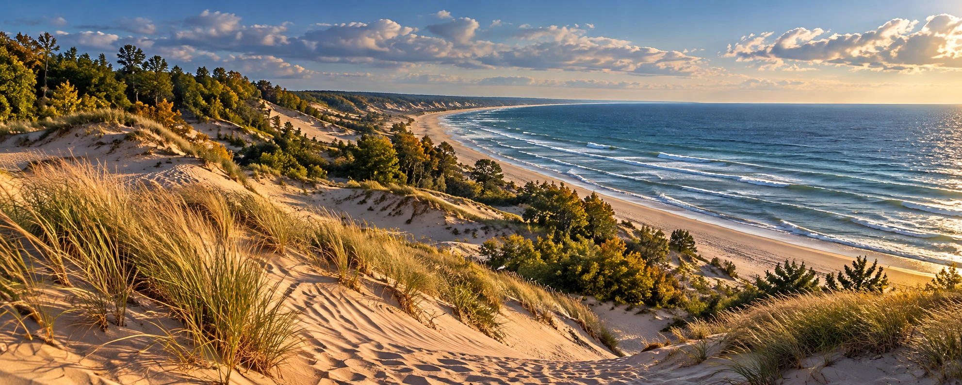
Approved artistic panorama illustrating Indiana Dunes National Park; not a documentary photograph
Indiana Dunes National Park · Approved artistic panorama

A remarkably diverse Lake Michigan landscape of enormous sand dunes, beaches, wetlands, black-oak savannas, prairie, forests, and coastal habitats.

Hiking & Backpacking

Cowles Bog Trail: 4.7 Miles ★
Dune Ridge Trail: 0.7 Miles ★
Paul H. Douglas Trail: 3.4 Miles ★
Tolleston Dunes Trail: 2.9 Miles ★
Glenwood Dunes Trail: 6.8 Miles
Mount Baldy Beach Trail: 0.75 Miles
Lake Michigan Beach Hiking & Swimming ★

Waterfalls & Natural Features

3 Dune Challenge: 1.5 Miles ★
Indiana Dunes State Park / Separate Admission

Visitor Planning & Safety

Park Access & Visit Planning

Other Highlights & Activities

State Park Trails & Admission
Knobstone Trail - Indiana ★

A demanding southern Indiana backpacking route follows wooded ridges and hollows through Clark and Jackson-Washington state forests.

Hiking & Backpacking

Knobstone Trail: 60 Miles ★
State-Forest Backpacking / Point-To-Point Route

Visitor Planning & Safety

Pokagon State Park ★

Glacial lakes, wooded hills, and scenic trails surround Lake James, with one of Indiana's most distinctive winter adventures.

Hiking & Backpacking

Hiking / Cross-Country Skiing / Lake James Recreation

Other Highlights & Activities

Pokagon State Park Toboggan Run ★
Refrigerated Toboggan Track / Seasonal Winter Recreation
Park Trails & Winter Activities
Shades State Park & Pine Hills Nature Preserve

A rugged sandstone wilderness along Sugar Creek, with deep ravines, cliffs, forested hollows, and some of Indiana’s most adventurous hiking.

Hiking & Backpacking

Pine Hills Nature Preserve Trail: 3 Miles ★
Shades State Park Trail #1: 3 Miles
Shades State Park Trail #4: 2 Miles
Shades State Park Trail #7: 0.7 Miles

Paddling, Rafting & Water Adventures

Sugar Creek Canoeing

Climbing, Caving & Mountain Adventures

Rock Scrambling

Visitor Planning & Safety

Park Trails & Recreation

Other Highlights & Activities

Sandstone Canyons
Six Ravine Challenge ★
Turkey Run State Park

Indiana’s most iconic hiking park, where Sugar Creek cuts through ancient sandstone to create narrow ravines, cliffs, ladders, caves, forests, and rugged canyon trails.

Hiking & Backpacking

Turkey Run 3, 10, 9 & 5 Trails Loop: 4.1 Miles ★
Trail 3: 1.7 Miles ★
Trail 9: 1 Mile ★
Trail 10: 1.4 Miles

Paddling, Rafting & Water Adventures

Sugar Creek Canoeing / Kayaking
Sugar Creek Canoe & Kayak Trips ★

Climbing, Caving & Mountain Adventures

Rock Scrambling

Visitor Planning & Safety

Park Trails & Recreation

Other Highlights & Activities

Fall Foliage ★
Iowa
Backbone State Park

Iowa’s first state park and one of its most rugged landscapes, built around a narrow limestone ridge known as the Devil’s Backbone, with cliffs, forested ravines, a lake, and excellent scrambling.

Hiking & Backpacking

Backbone Trail: 2 Miles
Richmond Springs Trail: 2 Miles

Climbing, Caving & Mountain Adventures

Rock Climbing & Rappelling

Wildlife & Fishing

Backbone Lake / Trout Fishing

Visitor Planning & Safety

Park Trails & Recreation
Effigy Mounds National Monument ★

A spectacular cultural and natural landscape above the Mississippi River, preserving more than 200 American Indian mounds-including bear and bird-shaped effigies-amid forested bluffs and sweeping river views.

Hiking & Backpacking

Marching Bear Group Trail: 4 Miles ★
Largest Effigy Mound Group
Hanging Rock Trail: 7 Miles ★
Mississippi River Valley Views
Effigy Mounds
Nezekaw Point Overlook Trail: 2 Miles ★
Fire Point Loop Trail: 2 Miles
Great Bear & Little Bear Mounds
Mississippi River Overlook
Twin Views Trail: 3 Miles

Visitor Planning & Safety

Park Access & Visit Planning

Other Highlights & Activities

Fall Foliage
Ranger-Guided Mound Tours
Ledges State Park

One of Iowa’s most dramatic small parks, where 100-foot sandstone and limestone cliffs form a narrow canyon above Pea’s Creek and the Des Moines River.

Hiking & Backpacking

Ledges State Park Trail System: 4.6 Miles ★
Crow’s Nest Trail: 1 Mile
Hog’s Back Trail: 0.5 Miles

Other Highlights & Activities

Canyon Drive ★
CCC Stone Bridge
Pea’s Creek Wading
Pedal Railbike Excursion
Loess Hills State Forest & Preparation Canyon

One of Iowa’s most geographically unusual landscapes: enormous wind blown loess ridges covered in prairie and oak woodland, creating steep, narrow ridgelines and surprisingly rugged hiking. The state forest contains more than 11,000 acres and over 60 Miles of trails.

Hiking & Backpacking

Brent’s Trail: 8 Miles ★
Hawk Ridge Trail Loop: 2.1 Miles ★
Hitchcock Nature Center: Dozer Cut, Bunker Hill & Badger Ridge Loop:
5.9 Miles ★
Preparation Canyon Trail System: 5 Miles ★
Overlook Trail: 3 Miles

Cycling & Scenic Routes

Loess Hills National Scenic Byway ★

Visitor Planning & Safety

Maquoketa Caves State Park ★

Iowa’s most unusual cave landscape, with a network of caves, limestone bluffs, natural bridges, balanced rocks, ladders, and forest trails.

Hiking & Backpacking

Maquoketa Caves Trail System: 6 Miles ★
15 Caves
Natural Bridge
Balanced Rock
Limestone Bluffs

Climbing, Caving & Mountain Adventures

Cave Exploration / Spelunking ★
Dancehall Cave ★
1,100-Foot Cave
Hernado’s Hideaway Cave
Wye Cave

Visitor Planning & Safety

Park Trails & Recreation
Pikes Peak State Park

One of Iowa’s premier Mississippi River overlooks, perched on a 500-foot bluff above the confluence of the Mississippi and Wisconsin Rivers, with dramatic valleys, waterfalls, and wooded ridges.

Hiking & Backpacking

Point Ann Trail: 4 Miles ★
Bridal Veil Falls Trail: 1 Mile
Bridal Veil Falls
Horn Hollow Loop Trail: 1.8 Miles

Visitor Planning & Safety

Park Trails & Recreation

Other Highlights & Activities

Fall Foliage
Great River Road
Mississippi & Wisconsin River Confluence
RAGBRAI - Cross-Iowa Cycling ★

An annual bicycle ride crosses Iowa through changing host towns, combining long days on rural roads with community celebrations and overnight stops.

Cycling & Scenic Routes

RAGBRAI - Cross-State Cycling: 7 Days ★
Annual Road-Cycling Event / Route, Mileage & Overnight Towns
Change Each Year
Kansas
Kanopolis State Park & Mushroom Rock

A surprisingly rugged corner of central Kansas where sandstone bluffs, narrow canyons, caves, prairie, and unusual Cretaceous rock formations create some of the state’s best hiking.

Hiking & Backpacking

Buffalo Tracks Nature Trail: 1 Mile
Rockin’ K Trail: 6 Miles
Canyon Hiking / Creek Crossings
Prairie Trail Scenic Byway

Waterfalls & Natural Features

Rock Formations & Park Access

Climbing, Caving & Mountain Adventures

Rock Scrambling

Visitor Planning & Safety

Park Trails & Recreation

Other Highlights & Activities

Horsethief Canyon Trails: 5.5 Miles ★
Trail Network / Trailheads A-D
Mushroom Rock Exploration ★
Konza Prairie ★

One of the finest places to experience the Flint Hills on foot, with rolling tallgrass prairie, limestone ledges, creek valleys, wildflowers, and huge views across the Kansas River Valley.

Hiking & Backpacking

Godwin Hill Loop: 6.2 Miles ★
Kings Creek Loop: 4.6 Miles ★
Nature Trail: 2.6 Miles ★

Wildlife & Fishing

Bison Viewing

Other Highlights & Activities

Nature Trails & Visitor Guidelines
Little Jerusalem Badlands State Park ★

Kansas’ most dramatic badlands landscape, where a Mile-long wall of 100-foot chalk cliffs and spires rises unexpectedly from the western prairie.

Hiking & Backpacking

Life on the Rocks Trail: 2.5 Miles ★
Niobrara Chalk Formations
Chalk Cliffs & Spires
Overlook Trail: 0.5 Miles
Guided Off-Trail Hikes ★
Park-Staff Guided Access / Scheduled Programs

Wildlife & Fishing

Bison & Great Plains Wildlife ★
Monument Rocks National Natural Landmark ★

An iconic western Kansas landscape of enormous chalk monoliths, pyramids, buttes, and arches rising from flat prairie.

Cycling & Scenic Routes

Western Vistas Scenic Byway

History, Culture & Attractions

Castle Rock Exploration
Chalk Cliffs & Badlands
Monument Rocks Exploration ★
Chalk Pyramids
Natural Arches
Cretaceous Fossils

Other Highlights & Activities

Sunset / Stargazing ★
Tallgrass Prairie National Preserve & Flint Hills ★

The quintessential Kansas landscape and one of the last great remnants of the tallgrass prairie that once covered much of central North America, with rolling hills, limestone outcrops, wildflowers, bison, and enormous open horizons.

Hiking & Backpacking

Scenic Overlook Trail: 6.5 Miles ★
West Branch & Palmer Creek Loop: 12 Miles ★
Remote Prairie Hiking ★
Palmer Creek
Southwind Nature Trail: 1.75 Miles

Wildlife & Fishing

Bison Viewing

Cycling & Scenic Routes

Flint Hills Scenic Byway

Visitor Planning & Safety

Other Highlights & Activities

Night-Sky Viewing
Kentucky
Big South Fork National River & Recreation Area ★

A huge Cumberland Plateau wilderness straddling Kentucky and Tennessee, with deep river gorges, sandstone cliffs, waterfalls, arches, and some of the region’s best long-distance hiking.

Hiking & Backpacking

Lick Creek Trail to Princess Falls: 2.5 Miles ★
Princess Falls
Twin Arches Loop Trail: 5 Miles ★
Angel Falls Overlook Trail: 4 Miles
Sheltowee Trace National Recreation Trail: 354 Miles
Long-Distance Backpacking ★
Full Kentucky / Tennessee Route / Published 2020 Alignment

Paddling, Rafting & Water Adventures

Whitewater Rafting / Kayaking ★

Climbing, Caving & Mountain Adventures

Rock Climbing

Visitor Planning & Safety

Bowling Green & NCM Motorsports Park ★

Bowling Green’s Corvette heritage extends onto the road course at NCM Motorsports Park, with driving experiences and instruction using performance cars.

Other Highlights & Activities

Corvette Performance Track Driving ★
Bowling Green / NCM Motorsports Park / Lead-Follow Laps & Driving
Experiences
Cumberland Falls State Resort Park ★

Home to one of the largest waterfalls in the eastern United States and the famous moonbow, a rare lunar rainbow that can appear on clear nights around the full moon.

Hiking & Backpacking

Cumberland Falls via Eagle Falls Trail: 1.8 Miles ★
Moonbow Trail: 13.2 Miles ★
Cumberland River Trail: 5 Miles

Waterfalls & Natural Features

Moonbow / Waterfall Viewing ★

Paddling, Rafting & Water Adventures

Guided Cumberland River Whitewater Rafting ★

Visitor Planning & Safety

Park Trails & Recreation
Cumberland Gap National Historical Park ★

A spectacular Appalachian gateway where Kentucky, Tennessee, and Virginia meet, combining forested mountains, dramatic overlooks, caves, and the historic route through the Cumberland Gap used by westward travelers.

Hiking & Backpacking

Sand Cave & White Rocks via Ewing Trail: 8.2 Miles ★
Pinnacle Overlook Trail: 0.2 Miles ★
Cumberland Gap Views ★
Skylight Cave Lewis Hollow Trail: 1.9 Miles ★
Tri-State Peak via Wilderness Road Trail: 2.2 Miles ★
Kentucky / Tennessee / Virginia

Climbing, Caving & Mountain Adventures

Gap Cave Tour ★
Underground Cave Exploration
Stairways / Guided Underground Exploration

History, Culture & Attractions

Historic Wilderness Road

Visitor Planning & Safety

Park Access & Visit Planning
Louisville Mega Cavern ★

Guided Tours & Outdoor Experiences

Guided Underground Ziplining ★
Subterranean Zipline Course / Participant Requirements

Other Highlights & Activities

A former limestone mine beneath Louisville offers a distinctive
underground zipline adventure.
Mammoth Cave National Park ★
Approved artistic panorama illustrating Mammoth Cave National Park; not a documentary photograph
Mammoth Cave National Park · Approved artistic panorama

A World Heritage Site protecting the world’s longest known cave system, with more than 365 Miles explored, while the surface contains forests, rivers, sinkholes, bluffs, and more than 85 Miles of hiking trails.

Hiking & Backpacking

Green River Bluffs Trail: 1.3 Miles ★
Mammoth Cave Creek / First Creek Trail: 12.8 Miles ★
Dixon Cave / Green River Bluffs / River Styx Loop: 1.7 Miles
Turnhole Bend Nature Trail: 0.6 Miles

Climbing, Caving & Mountain Adventures

Cave Tours & Spelunking ★
Grand Avenue Cave Tour ★
4 Miles underground
Underground Canyons & Passages
Guided Cave Tours & Reservations
Wild Cave Tour ★
Technical Cave Exploration

Visitor Planning & Safety

Park Access & Visit Planning
Red River Gorge Geological Area ★

Kentucky’s premier hiking and climbing destination, with an extraordinary concentration of sandstone arches, cliffs, natural bridges, waterfalls, forested gorges, and exposed ridgelines.

Hiking & Backpacking

Double Arch, Courthouse Rock & Auxier Ridge Loop: 6.1 Miles ★
Gray’s Arch Trail: 2.4 Miles ★
Gray’s Arch Long Loop: 4.8 Miles
Backpacking ★

Climbing, Caving & Mountain Adventures

Multi-Pitch Climbing ★
Rock Climbing ★
Guided Rock Climbing & Instruction ★

Other Highlights & Activities

Indian Staircase to Sheltowee Trace: 9.7 Miles ★
Cloudsplitter via Sheltowee Connector: 4 Miles ★
Louisiana
Atchafalaya Basin ★

Louisiana’s defining wilderness: the largest remaining forested wetland in the contiguous United States, a vast maze of cypress-tupelo swamps, bayous, lakes, and bottomland forest. This is much more of a water based adventure with swamp paddling than a traditional hiking destination.

Paddling, Rafting & Water Adventures

Atchafalaya Basin Paddling ★
Multiple Water Routes / Route-Specific Distance
Lake Fausse Pointe State Park Canoeing & Kayaking

Cycling & Scenic Routes

Atchafalaya Scenic Drives & Levee Roads

Other Highlights & Activities

Lake Martin
Guided Swamp Boat Excursions ★
Bogue Chitto State Park ★

A surprisingly rugged corner of Louisiana with hardwood forest, cypress tupelo swamp, streams, and the park’s unusual sandstone gorge and rock formations.

Hiking & Backpacking

Bogue Chitto State Park Hiking Trail: 7 Miles ★
Forest & Swamp
Sandstone Formations
Mountain Bike Trail Network: 14+ Miles
Multiple Routes / Network Mileage

Paddling, Rafting & Water Adventures

River Tubing, Canoe & Kayak Rentals ★

Climbing, Caving & Mountain Adventures

Fricke’s Cave ★
Sandstone Spires
Natural Rock Formations

Visitor Planning & Safety

Park Trails & Recreation

Other Highlights & Activities

Bogue Chitto River
Canoeing & Kayaking
River Tubing ★
Honey Island Swamp & Pearl River ★

Forested wetlands near Slidell shelter cypress-lined channels and abundant wildlife within the Pearl River swamp landscape.

Paddling, Rafting & Water Adventures

Honey Island Swamp - Guided Boat Tour ★
Slidell Area / Pearl River Swamp / Guided Wildlife & Natural-History
Excursion
Jean Lafitte National Historical Park & Preserve ★

A quintessential South Louisiana landscape of bayous, cypress swamp, bottomland forest, and marsh, with alligators and more than 200 bird species.

Hiking & Backpacking

Bayou Coquille Trail: 1 Mile ★
600-Year-Old Bald Cypress
Indigenous Shell Mound
Marsh Overlook Trail: 0.8 Miles ★
Palmetto Trail: 1.8 Miles
Boardwalk
Plantation Trail Loop A: 1.8 Miles
Wetland Trace Boardwalk: 1 Mile
Town Of Jean Lafitte / Offsite From Barataria Preserve

Paddling, Rafting & Water Adventures

Canoeing / Kayaking ★

Visitor Planning & Safety

Other Highlights & Activities

Kisatchie National Forest ★

Louisiana’s largest national forest and wildest inland landscape, where longleaf pine forests rise into rugged sandstone hills deep ravines and remote wilderness.

Hiking & Backpacking

Wild Azalea Trail: 31 Miles ★
Louisiana’s premier long-distance hiking trail
Backpacking
Longleaf Vista Interpretive Trail: 1.5 Miles ★
Turpentine Hill Trail: 1.5 Miles

Visitor Planning & Safety

Forest Trails & Recreation

Other Highlights & Activities

Kisatchie Hills Wilderness ★
Backbone Trail: 7 Miles ★
Caroline Dormon Trail: 10.5 Miles ★
New Orleans ★

Historic neighborhoods, traditional jazz, distinctive food, and riverfront culture combine with guided bayou paddling and Mississippi River cruises in and around New Orleans.

Landmarks, Parks & Cultural Attractions

French Quarter & Jackson Square ★
Historic Architecture / St. Louis Cathedral / Royal Street
Garden District & Magazine Street ★
Historic Homes / Neighborhood Shops / Architecture
St. Charles Avenue Streetcar ★
Historic Transit / Uptown Scenery
Tremé & Congo Square ★
Black Cultural Heritage / Music History
City Park & Sculpture Garden ★
National WWII Museum ★
World War II History / Immersive Exhibitions

Tours & Entertainment

Frenchmen Street & Live Music ★
Jazz Clubs / Local Performances / Venue Age Requirements
Preservation Hall Jazz Performance ★
Traditional New Orleans Jazz
Beignets & Creole / Cajun Food ★
Café Du Monde / Po’boys / Gumbo / Local Dining
Creole & Cajun Cooking Class ★
Hands-On Food Preparation / Local Culinary History
St. Louis Cemetery No. 1 Guided Tour ★
Historic Cemetery
Guided Access Required
Guided Swampmontana & Bayou Adventures ★
Small-Group Paddling / Wetland Ecology / Wildlife Viewing
Regional Excursion / Confirm Departure Location
Moonlight & Sunset Paddling ★
Seasonal Departures / Guided Swamp Paddling
New Orleans Riverboat Jazz Cruise ★
Live Jazz / Mississippi River / Optional Dining
Vessel Assigned By Selected Sailing
Mardi Gras Float Studio Tour ★
Working Float-Building Studio / Carnival Craftsmanship / Year-Round
Tours
Mardi Gras & Jazz Fest ★
Seasonal Celebrations / Parades / Music
Event Dates & Admission Vary
Event Dates & Admission VaryCity Attractions, Festivals & Neighborhoods
Tunica Hills Wildlife Management Area ★

One of Louisiana’s biggest surprises: rugged loess hills, steep ravines, bluffs, creeks, and seasonal waterfalls along the Mississippi River.

Hiking & Backpacking

Tunica Hills C Trail: 3.6 Miles ★
North Tract Trail: 5.7 Miles ★
Tunica Hills A Trail: 4.1 Miles ★
Tunica Hills B Trail: 3.3 Miles
South Tract Hiking

Waterfalls & Natural Features

Waterfalls

Wildlife & Fishing

Wildlife Viewing
Maine
100-Mile Wilderness ★

Moosehead Lake’s wooded shores and mountain cliffs meet the remote forests of the 100-Mile Wilderness, with waterfall hikes, wildlife canoe trips, and backcountry lodge stays.

Hiking & Backpacking

Gulf Hagas Rim & Tote Road Loop: 8 Miles ★
From Gulf Hagas Parking Area Via The AT / Unbridged Pleasant River
Ford
Access Fees & River Levels Affect The Approach
Mount Kineo Bridle Trail: 1.1 Miles ★
One-Way Trail Segment / Dock Approach & Return Mileage Additional
Mount Kineo Indian Trail: 0.9 Miles ★
One-Way Trail Segment / Steep Ledges / Dock Approach & Return
Mileage Additional

Paddling, Rafting & Water Adventures

Moosehead Region Guided Moose Watching By Canoe ★
Greenville & Shirley Mills Area / Registered Maine Guides / Wildlife
Sightings Vary

Wildlife & Fishing

Moosehead Lake - Guided Ice Fishing ★
Greenville Departure / Winter Lake Fishing / Heated Shelter & Guide-
Provided Equipment
Lake Selection Depends On Ice Conditions & Seasonal Access

Food, Lodging & Local Experiences

Maine - Wilderness Lodge Stays ★
Little Lyford / Gorman Chairback / Medawisla / Hiking, Paddling &
Seasonal Activities
Maine - Lodge-to-Lodge Skiing: 4 Days ★
Self-Guided Winter Route / Three Backcountry Lodges / Meals & Gear
Transfers
For Experienced Nordic Skiers / Reserve Lodging & Transportation
Acadia National Park ★
Artistic panoramic concept for Acadia National Park (not a documentary photograph)
Acadia National Park · Approved artistic panorama

A spectacular meeting of granite mountains and the Atlantic, where glacially carved peaks rise directly from a rugged coastline of rocky shores, islands, forests, and clear ponds.

Hiking & Backpacking

Precipice Trail: 0.9 Miles ★
Beehive Trail: 0.7 Miles ★
Cadillac South Ridge Trail: 3.9 Miles ★
Cadillac Summit Loop: 0.3 Miles
Sunrise ★
Great Head Trail: 1.5 Miles
Jordan Cliffs Trail: 1.4 Miles

Paddling, Rafting & Water Adventures

Mount Desert Island Guided Sea Kayaking ★
Southwest Harbor / Acadia’s Western Shore / Coastal Wildlife & Island
Scenery

Climbing, Caving & Mountain Adventures

Rock Climbing ★
Guided Coastal Rock Climbing ★
Sea-Cliff Climbing / Instruction / Routes Matched To Experience

Visitor Planning & Safety

Park Access & Visit Planning

Other Highlights & Activities

Ocean Path: 2.2 Miles ★
Jordan Pond Path: 3.2 Miles
Carriage Roads
Hiking & Cycling
Sunrise from Cadillac Mountain ★
Allagash Wilderness Waterway ★

A 92-Mile wilderness river corridor through the heart of northern Maine, linking lakes, ponds, rapids, forests, and remote campsites. The Allagash is less a hiking destination than a true backcountry expedition by canoe, and is one of America’s premier wilderness paddling trips.

Waterfalls & Natural Features

Allagash Falls

Paddling, Rafting & Water Adventures

Allagash Guided Canoe Expeditions: 5, 7 Or 9 Days ★
Remote Rivers & Lakes / Wilderness Camping / Registered Maine
Guides
Nine-Day Route: Custom Early-Summer Option / Water Levels
Determine Availability

Wildlife & Fishing

Fishing
Moose & Wildlife Viewing ★

Visitor Planning & Safety

Park Access & Visit Planning

Other Highlights & Activities

Telos Lake → Allagash Village: 98 Miles ★
Full-Length Wilderness Paddle
7-10 Days
Chase Rapids: 9 Miles
Whitewater Canoeing ★
Remote Wilderness Camping ★
Appalachian Trail - Maine ★

The northernmost and one of the wildest sections of the Appalachian Trail, crossing Maine’s rugged mountains, remote forests, rivers, bogs, and the Mahoosuc Range before reaching Katahdin.

Hiking & Backpacking

Appalachian Trail - Maine: 282.0 Miles ★

Visitor Planning & Safety

Trail Access & Closures

Other Highlights & Activities

100-Mile Wilderness ★
100 Miles remote wilderness section
Multi-Day Backpacking ★
Limited Resupply
Multiple River & Stream Crossings
White Cap Mountain ★
Chairback Mountain
Gulf Hagas “Grand Canyon of the East” ★
Moose & Wildlife Viewing ★
Bigelow Range ★
Mahoosuc Notch ★
Mahoosuc Range ★
Mount Katahdin ★
Northern Terminus ★
Baxter State Park, Katahdin & Penobscot River ★

Katahdin’s granite ridges and alpine basins anchor a wilderness region with remote lakes, backcountry camping, winter mountaineering, and Penobscot River rafting near Millinocket.

Hiking & Backpacking

Chimney Pond Trail: 3.3 Miles
One Way From Roaring Brook / 6.6 Miles Out And Back
Hamlin Ridge Trail: 1.5 Miles ★
One-Way Ridge Segment / Trailhead Approach & Descent Require
Additional Mileage
Mount Katahdin via Hunt Trail: 10.4 Miles ★
Baxter Peak / Maine’s Highest Summit ★
Katahdin Stream Falls / Hunt Spur Boulders / Alpine Tableland
Guided Katahdin Summer Hiking ★
Custom Guided Ascents / Full-Day Mountain Hiking / Route Selection
With Your Guide

Paddling, Rafting & Water Adventures

Penobscot River Guided Whitewater Rafting ★
Millinocket Region / Outside Baxter State Park / Upper & Lower River
Options

Wildlife & Fishing

Sandy Stream Pond & Moose Viewing ★
Katahdin Views & Wildlife Watching ★

Other Highlights & Activities

Knife Edge: 1.1 Miles ★
Ridge Segment Only / Exposed Scrambling / Longer Summit Route
Required
Backcountry Camping ★
Wassataquoik Lake
Remote Baxter State Park Backcountry
Maine - Katahdin Guided Winter Ascent: 2 Days ★
Winter Mountaineering / Overnight Camp / Snow Travel & Alpine Skills
Park Trails, Access Information & Camping & Reservations
Camden Hills, Penobscot Bay & Midcoast Maine ★

Wooded hills rise above working harbors and island-filled bays, with short summit hikes, overnight windjammer voyages, and sea-kayak camping along the Midcoast.

Hiking & Backpacking

Mount Battie Trail: 1 Mile ★
Round Trip / Camden Hills State Park / Steep Summit Approach

Paddling, Rafting & Water Adventures

Maine - Windjammer Overnight Sailing: 3 - 6 Nights ★
Camden Or Rockland Departure / Traditional Schooners / Coastal
Islands & Nights Aboard
Voyage Length & Itinerary Vary By Vessel
Maine - Muscongus Bay Guided Kayak Camping: 3 Days ★
Island Hopping / Coastal Wildlife / Maine Island Trail Campsites
Round Pond Or Friendship Departure / Route Depends On Conditions

Other Highlights & Activities

Park Trails & Coastal Access
Cutler Coast & Downeast Maine ★

Boreal forest, granite headlands, cobble beaches, and quiet harbors frame Maine’s eastern coast, with cliff-top hiking and seasonal seabird and whale excursions.

Hiking & Backpacking

Black Point Brook Loop: 5.4 Miles ★
Coastal Trail to Ocean Overlook: 2.8 Miles ★
Fairy Head Loop: 9.7 Miles ★
Rugged Coastal Hiking / Forest & Cliffside Sections
Inland Trail: 4.5 Miles

Wildlife & Fishing

Wildlife & Birdwatching
Eastport Whale Watching ★
Eastport Departure / Coastal Wildlife / Seasonal Ocean Trips

Other Highlights & Activities

Primitive Coastal Camping ★
Designated Cutler Coast Campsites Above The Cliffs
Machias Seal Island Puffin Excursion ★
Cutler Harbor Departure / Seasonal Seabird Watching / Island
Landings Depend On Conditions
Coastal Trails & Camping Access
Grafton Notch, Mahoosuc Range & Bethel ★

Steep passes, exposed summits, boulder fields, and remote campsites define the Mahoosuc high country, with winter adventures in the nearby Bethel area.

Hiking & Backpacking

Baldpate Mountain Trail: 7.6 Miles ★
Open Summit & Mountain Views
Eyebrow Loop Trail: 2.2 Miles ★
Ladders & Steel Rungs / Views Into Grafton Notch
Grafton Loop Trail: 38 Miles ★
Multi-Day Backpacking / Nine Scenic Peaks / Remote Mountain
Campsites
Old Speck Mountain Trail: 7.6 Miles ★
Round Trip / 4,170-Foot Summit / Observation Tower
Table Rock Loop Trail: 2.4 Miles ★
Boulder Scrambling / Cliffside Views

Visitor Planning & Safety

Other Highlights & Activities

Bethel Area Guided Dogsledding ★
Mason Township / Winter Forest Trails / Musher-Led Trips
Katahdin Woods and Waters National Monument ★

A vast North Woods landscape east of Katahdin, protecting wild rivers, boreal forests, waterfalls, mountains, and expansive views toward Katahdin.

Hiking & Backpacking

Barnard Mountain Trail: 4 Miles ★
Round Trip / Katahdin & Lake Views
Orin Falls Trail: 6 Miles ★
Round Trip / Forest Road Approach & Streamside Falls
Katahdin Loop Road ★

Paddling, Rafting & Water Adventures

Canoeing & Kayaking ★
River Routes / Access & Conditions Vary

Wildlife & Fishing

Moose & Wildlife Viewing ★

Visitor Planning & Safety

Other Highlights & Activities

East Branch Penobscot River
Grand Pitch ★
Katahdin Views ★
Seboeis River
Wassataquoik River ★
Backcountry Camping ★
Dark Skies & Stargazing ★
International Dark Sky Sanctuary / Self-Guided Night-Sky Viewing
Kennebec & Dead Rivers - The Forks ★

Forested river gorges and dam-released whitewater meet near The Forks, with guided rafting and a short waterfall hike to Moxie Falls.

Hiking & Backpacking

Moxie Falls Trail: 2 Miles ★
Round Trip / Forest Walk & Waterfall Views
Waterfall Trail & Access Information

Paddling, Rafting & Water Adventures

Kennebec River Guided Whitewater Rafting ★
The Forks Departure / Upper River Gorge / Seasonal Day Trips
Dead River Guided Whitewater Rafting ★
The Forks Area / Scheduled Water-Release Dates / Extended
Whitewater Run
Portland, Casco Bay & Southern Maine Coast ★

Waterfront paths, island forts, lighthouses, and working harbors make Portland a base for sea kayaking, coastal cycling, and longer journeys along the Maine coast.

Hiking & Backpacking

Eastern Promenade Trail: 1.9 Miles ★
Waterfront Trail / One-Way Trail Length / Walking & Cycling

Paddling, Rafting & Water Adventures

Fort Gorges Guided Sea Kayaking ★
Portland’s East End Beach / Casco Bay Paddle / Island Fort
Exploration

Cycling & Scenic Routes

Five Lighthouse Guided Bike Tour ★
Portland Area / Coastal Roads & Lighthouse Stops / Guided Day Trip
Maine - Coastal Maine & Acadia Guided Cycling: 6 Days ★
Portland Round Trip / Midcoast Harbors / Acadia National Park

Other Highlights & Activities

Waterfront Trails & Local Access
Rangeley Lakes & Western Maine Mountains ★

From the Rangeley area and Tumbledown Mountain to Bigelow and Carrabassett Valley, western Maine combines waterfalls, alpine ponds, high ridges, and backcountry hut stays.

Hiking & Backpacking

Angel Falls Trail: 1.4 Miles ★
Round Trip / Township D Near The Rangeley Lakes / Stream Crossings
Flagstaff Lake Hut via Maine Huts Trail & Shore Trail Loop: 4.4 Miles ★
Poplar Stream Waterfall Loop: 5.93 Miles ★
Stratton Brook Hut Loop via Oak Knoll & Newton’s Revenge: 7.3 Miles ★
Tumbledown Mountain Trail: 5.6 Miles ★
Alpine Pond / Rocky Summit Terrain

Other Highlights & Activities

Bigelow Preserve & Mountain Lakes ★
Alpine Hiking / Wilderness Backpacking / Appalachian Trail
Connections
Maine - Backcountry Hut Stays & Winter Hut Trips ★
Carrabassett Valley & Flagstaff Lake / Hiking, Nordic Skiing &
Snowshoeing
Self-Guided Trips / Open Huts, Meals & Gear Transfers Vary By
Season
Maine Multi-Day Guided Adventures ★

Guided journeys combine active exploration with overnight stays, from wilderness camps to inns or nights aboard; routes, inclusions, and departures vary by selected trip.

Paddling, Rafting & Water Adventures

Maine Windjammer Overnight Sailing ★
Traditional Schooners / Coastal Islands / Nights Aboard
Three - Six Night Options / Departure Port & Itinerary By Vessel

Wildlife & Fishing

Moosehead Lake - Guided Ice Fishing ★
Winter Lake Fishing / Guide & Ice Conditions Must Be Confirmed

Cycling & Scenic Routes

Coastal Maine & Acadia Guided Cycling ★
Coastal Roads / Harbor Villages / Multi-Day Guided Cycling
Maryland
Appalachian Trail - Maryland ★

Maryland’s 40.9-Mile stretch of the Appalachian Trail follows wooded ridges and rocky overlooks through South Mountain, connecting historic sites with some of the state’s best mountain scenery.

Hiking & Backpacking

Annapolis Rock via Appalachian Trail: 5 Miles ★
Appalachian Trail - Maryland: 40.9 Miles ★
Section Hiking / Backpacking ★
Weverton Cliffs via Appalachian Trail: 2 Miles ★
Potomac River Views
Harpers Ferry Views
Washington Monument via Appalachian Trail: 3 Miles

Visitor Planning & Safety

Trail Access & Closures

Other Highlights & Activities

Gathland State Park
Civil War History
Assateague Island National Seashore ★

A wild Atlantic barrier island of windswept dunes, broad beaches, salt marshes, and maritime forest, best known for its famous population of free-roaming wild horses.

Hiking & Backpacking

Beach Hiking: 37 Miles ★
Wild Horses ★
Dunes & Coastal Wilderness
Life of the Dunes Trail: 0.8 Miles ★
Life of the Forest Trail: 0.5 Miles
Life of the Marsh Trail: 0.5 Miles
Wild Horse Viewing

Waterfalls & Natural Features

Backcountry Beach Camping ★
Oceanside Wilderness Camping

Paddling, Rafting & Water Adventures

Surfing & Swimming
Sea Kayaking

Visitor Planning & Safety

Park Access & Visit Planning
Baltimore ★

A historic harbor city of maritime landmarks, distinctive art museums, Black and literary heritage, neighborhood markets, Chesapeake seafood, and memorable waterfront experiences.

Landmarks, Parks & Neighborhoods

Federal Hill & Inner Harbor ★
Harbor Views / Waterfront Walking
Fell’s Point ★
Historic Streets / Maritime Heritage / Waterfront Dining
Fort McHenry National Monument and Historic Shrine ★
War Of 1812 / National Anthem History
Mount Vernon & Washington Monument ★
Historic Architecture / Cultural District / Monument Tower Climb
Oriole Park at Camden Yards ★
Patterson Park ★
Historic Pagoda / Gardens / Urban Green Space
Edgar Allan Poe Heritage ★
Westminster Hall / Poe’s Gravesite / Literary History

Museums & Cultural Institutions

National Aquarium ★
Baltimore Museum of Art ★
Art Collections / Sculpture Gardens
The Walters Art Museum ★
Art Collections / Decorative Arts / Historic Architecture
American Visionary Art Museum ★
Self-Taught Art / Unusual Collections
National Museum of Railroad History & Innovation ★
Former B&O Railroad Museum / Historic Roundhouse / Train
Collections
Historic Ships In Baltimore ★
Ship Museums / Maritime History / Open Vessels Vary
Reginald F. Lewis Museum ★
Maryland African American History & Culture
Edgar Allan Poe House & Museum ★
Historic Home / Poe’s Baltimore Life / Literary Exhibits
Timed Reservations Required / Steep Stairs
Baltimore Symphony Orchestra ★
Orchestral Concerts / Live Music / Venue By Performance

Tours & Entertainment

Chesapeake Seafood & Lexington Market ★
Maryland Blue Crabs / Crab Cakes / Public Market
The Horse You Came In On Saloon ★
Fell’s Point / Historic Tavern / Live Music
Edgar Allan Poe’s “Last Drink” Legend
B&O American Brasserie ★
Former Railroad Headquarters / American Dining / Craft Cocktails
Pride of Baltimore II Sailing Experience ★
Historic Topsail Schooner / Maritime Heritage / Day Sails
Seasonal Schedule / Confirm Baltimore Departure
Lighted Boat Parade ★
Decorated Boats / Fell’s Point Waterfront / Holiday Tradition
Annual Schedule & Viewing Locations
City Attractions, Neighborhoods & Experiences
Blackwater National Wildlife Refuge ★

A vast tidal-marsh wilderness on Maryland’s Eastern Shore, centered around the Blackwater River and thousands of acres of marsh, forest, and open water; it is particularly important for bald eagles, waterfowl, and other migratory wildlife.

Hiking & Backpacking

Key Wallace Drive / Trail: 2.5 Miles ★
Marsh Edge Trail: 0.4 Miles
Blackwater River
Boardwalk
Tubman Road Trail: 1.5 Miles

Paddling, Rafting & Water Adventures

Paddling Trails ★
Blackwater River
Tidal Marsh Exploration
Guided Marsh Kayaking ★
Tidal Creeks / Marsh Wildlife / Guided Paddling

Wildlife & Fishing

Birdwatching ★
Bald Eagles / Osprey / Migratory Waterfowl
Wildlife Drive ★

Cycling & Scenic Routes

Maryland - Chesapeake Bay & Eastern Shore Guided Cycling ★
Regional Eastern Shore Cycling / Chesapeake Bay Communities
Coastal Communities / Quiet Roads / Multi-Day Cycling Holiday

Visitor Planning & Safety

Refuge Trails & Access Information
Calvert Cliffs State Park ★

Massive Miocene-era cliffs rising above Chesapeake Bay, exposing fossils from a prehistoric sea that covered southern Maryland millions of years ago. The beach is especially famous for shark teeth and other fossils.

Hiking & Backpacking

Red Trail to Beach: 3.7 Miles ★
Calvert Cliffs ★
Chesapeake Bay Beach
Fossil / Shark Teeth Hunting ★
Orange Trail: 2.4 Miles

Waterfalls & Natural Features

Chesapeake Bay Beach ★

Visitor Planning & Safety

Park Access & Visit Planning

Other Highlights & Activities

Fossil Hunting ★
Miocene Shark Teeth
Fossilized Mollusks
Oyster Shells
Catoctin Mountain Park ★

A rugged section of the Blue Ridge Mountains with forested ridges, waterfalls, rocky outcrops, and dramatic formations.

Hiking & Backpacking

Catoctin Mountain Loop: 8 Miles ★
Cunningham Falls
Chimney Rock
Wolf Rock ★
Thurmont Vista
Catoctin Trail: 26.6 Miles ★
Blue Ridge Mountain Hiking
Multi-Day Backpacking
Chimney Rock and Wolf Rock Loop: 3.9 Miles
Rocky Overlook
Blue Ridge Views

Waterfalls & Natural Features

Cunningham Falls
Maryland’s Highest Cascading Waterfall ★

Climbing, Caving & Mountain Adventures

Rock Climbing

Visitor Planning & Safety

Park Access & Visit Planning

Other Highlights & Activities

Wolf Rock
Massive Rhyolite Formations ★
Rock Scrambling
Chesapeake & Ohio Canal National Historical Park ★

A 184.5-Mile historic corridor following the Potomac River from Georgetown to Cumberland, combining forested river scenery with an extraordinary collection of locks, aqueducts, lockhouses, waterfalls, and historic engineering. The towpath is one of the best long-distance hiking and cycling routes in the East.

Hiking & Backpacking

Billy Goat Trail A: 1.7 Miles ★
Great Falls of the Potomac
Rock Scrambling
Paw Paw Tunnel & Tunnel Hill Trail: 3.5 Miles ★
3,118-Foot Paw Paw Tunnel ★
Historic Canal Engineering
Ferry Hill Trail: 1.6 Miles
Potomac River Views
Harpers Ferry Views
Historic Ferry Site

Waterfalls & Natural Features

Great Falls Overlooks ★
Great Falls of the Potomac
Great Falls Tavern
Historic Lock & Canal Structures
Canal Boat Rides

Paddling, Rafting & Water Adventures

Canoeing & Kayaking ★

Cycling & Scenic Routes

Chesapeake Bay & Eastern Shore Guided Cycling ★
Coastal Communities / Quiet Roads / Multi-Day Cycling Holiday

Visitor Planning & Safety

Other Highlights & Activities

C&O Canal Towpath: 184.5 Miles ★
Multi-Day Backpacking / Bikepacking ★
74 Historic Locks
11 Aqueducts
C&O Canal Aqueducts & Lockhouses
Historic Engineering
Canal History
Hiker-Biker Camping ★
31 Hiker-Biker Campsites
Massachusetts
Appalachian Trail - Massachusetts ★

Massachusetts’ 90-Mile section of the Appalachian Trail crosses the Berkshire Mountains from the Connecticut border to Vermont, passing through open ridges, forested mountains, ponds, waterfalls, and several of the state’s finest viewpoints. It also climbs Mount Greylock, Massachusetts’ highest summit.

Hiking & Backpacking

Appalachian Trail - Massachusetts: 90.2 Miles ★
Long-Distance Hiking / Backpacking ★
Tyringham Cobble Trail: 2 Miles ★
Pine Cobble Trail: 5 Miles
Race Brook Falls Trail: 3 Miles
Mount Greylock AT Inn-to-Inn Hiking: 23.4 Miles ★
Multi-Day Appalachian Trail Hiking / Inn Lodging Arranged Separately /

Visitor Planning & Safety

Boston ★

Historic neighborhoods, waterfront journeys, celebrated museums, distinctive food, and urban heritage trails make Boston a rewarding mix of culture and outdoor exploration.

Landmarks, Parks & Neighborhoods

Freedom Trail: 2.5 Miles ★
Full Historic Route / Revolutionary-Era Sites
Guided Tours Cover Selected Sites / Individual Admission Varies
Boston Common & Public Garden ★
Historic Green Space / Gardens / Seasonal Swan Boats
USS Constitution & Charlestown Navy Yard ★
Naval Heritage / Historic Waterfront
Black Heritage Trail: 1.6 Miles ★
Beacon Hill / Black History / Abolitionist Heritage
Fenway Park Game & Ballpark Tour ★
Faneuil Hall & Quincy Market ★
Historic Meeting Hall / Market Food / Street Performances
Back Bay & Beacon Hill ★
Historic Architecture / Acorn Street / Neighborhood Walking
Boston Harbor Waterfront ★
Harborwalk Areas / Seaport / Waterfront Dining
Island Ferries & Camping: See Boston Harbor Islands Section
Charles River Esplanade ★
Riverfront Walking / Cycling / Skyline Views
Boston Public Library ★
Historic Reading Rooms / Courtyard / Architecture
Harvard University & Harvard Square ★
Cambridge / Historic Campus / Student-Led Tours / Bookshops &
Cafés

Museums & Cultural Institutions

Museum of Fine Arts, Boston ★
Global Art Collections / Special Exhibitions
Isabella Stewart Gardner Museum ★
Art Collections / Courtyard / Historic Interiors
New England Aquarium & Whale Watching ★
Aquarium Exhibits / Separate Seasonal Whale-Watch Cruises
Wildlife Sightings & Sea Conditions Vary
Harvard Art Museums ★
Global Art Collections / Calderwood Courtyard / Free Admission
Harvard Museum of Natural History ★
Glass Flowers / Minerals / Wildlife Collections
Peabody Museum of Archaeology & Ethnology ★
Archaeology / Cultural Collections / Human History

Tours & Entertainment

North End Food & Neighborhood Culture ★
Italian Dining / Bakeries / Historic Streets
Cambridge & Harvard Square Day Trip ★
Across The Charles River / Campus History
Boston Duck Tour ★
Amphibious City Tour / Charles River Splashdown / Narrated History
Seasonal Departures / Advance Booking
Fourth of July in Boston ★
Boston Pops / Charles River Fireworks / Independence Day
Celebrations
Annual Schedule & Viewing Access
City Attractions, Trails & Cultural Experiences
Boston Harbor Islands National Recreation Area ★

A remarkable collection of 34 islands and peninsulas just offshore from Boston, combining rocky shorelines, beaches, forests, tide pools, historic forts, lighthouses, and secluded camping with sweeping views of the city.

Paddling, Rafting & Water Adventures

Sea Kayaking ★

Visitor Planning & Safety

Other Highlights & Activities

Spectacle Island: 5 Miles of trails ★
Georges Island
Fort Warren, Historic Civil War Fort
Island Camping ★
Island-Hopping by Ferry ★
Boston Harbor Exploration
Historic Lighthouses
Beaches & Tide Pools
Lovells Island
Secluded Beaches
Coastal Hiking
Camping
Peddocks Island
Coastal Hiking
Beaches & Woodlands
Camping ★
Thompson Island
Coastal Trails
Boston Skyline Views
Cape Cod National Seashore ★

Forty Miles of wild Atlantic beach, towering dunes, salt marshes, freshwater ponds, pine forests, and historic coastal landscapes stretching along Cape Cod’s outer edge.

Hiking & Backpacking

Great Island Trail: 3.9 - 8.8 Miles ★
Nauset Marsh Trail: 1.3 Miles ★
Province Lands Bike Trail: 5.45 Miles ★
Beech Forest Trail: 1 Mile
Fort Hill Trail: 1 Mile
Cape Cod National Seashore Beach Hiking ★

Waterfalls & Natural Features

Coast Guard Beach ★
Race Point Beach ★
Provincetown Dune Tours ★
Guided Vehicle Excursions / Dune Landscapes / Sunset Options

Paddling, Rafting & Water Adventures

Sea Kayaking ★

Wildlife & Fishing

Whale Watching
Provincetown Whale Watching ★
Offshore Wildlife Cruise / Seasonal Departures / Sightings Vary

Visitor Planning & Safety

Park Access & Visit Planning
Mount Greylock State Reservation ★

Massachusetts’ highest mountain at 3,491 feet, rising above the Berkshire landscape with expansive views that can stretch roughly 90 Miles on a clear day. Granite peaks, spruce-fir forests, rocky ridges, and the Appalachian Trail make Greylock the state’s premier mountain destination.

Hiking & Backpacking

Mount Greylock via Cheshire Harbor Trail: 6.6 Miles ★
Mount Greylock Summit ★
Veterans War Memorial Tower
Bascom Lodge
Bellows Pipe Trail: 2.6 Miles ★
Steep Mountain Ascent
Mount Greylock via Appalachian Trail: 13.6 Miles ★
Long Mountain Approach
Hopper Trail: 5.3 Miles

Food, Lodging & Local Experiences

Sperry Campground
Backcountry Camping ★

Visitor Planning & Safety

Park Access & Visit Planning

Other Highlights & Activities

Fall Foliage ★
Mount Washington State Forest & Bash Bish Falls ★

A rugged corner of the southern Berkshires where deep northern hardwood forests, rocky mountain ridges, gorges, and Massachusetts’ highest waterfall create an unexpectedly wild landscape.

Hiking & Backpacking

Bash Bish Falls Trail: 0.6 Miles ★
60-Foot Waterfall
South Taconic Trail: 12.4 Miles ★
Alander Mountain Trail: 6 Miles
2,250-Foot Summit
Panoramic Views ★
Race Brook Falls Trail: 3.9 Miles
Backcountry Hiking ★

Visitor Planning & Safety

Michigan
Isle Royale National Park ★
Artistic panoramic concept for Isle Royale National Park (not a documentary photograph)
Isle Royale National Park · Approved artistic panorama

A remote wilderness archipelago in Lake Superior, accessible only by boat or seaplane, where boreal forests, rocky shorelines, inland lakes, exposed ridges, and moose-and-wolf country create one of the most isolated hiking experiences in the eastern United States.

Hiking & Backpacking

Greenstone Ridge Trail: 41 Miles ★
Lake Superior Views ★
Multi-Day Backpacking ★
Minong Ridge Trail: 30 Miles ★
Isle Royale’s Most Rugged Long-Distance Trail
Remote Wilderness
Multi-Day Backpacking
Feldtmann Loop: 30 Miles ★
Stoll Trail: 4.2 Miles
Isle Royale Guided Hiking Adventures: 6 Days ★
Remote Island Hiking / Backpacking Or Lodge-Based Options
Ferry Logistics & Selected Itinerary Inclusions

Paddling, Rafting & Water Adventures

Kayaking & Canoeing ★

Wildlife & Fishing

Moose & Wildlife Viewing ★

History, Culture & Attractions

Rock Harbor Lighthouse

Visitor Planning & Safety

Park Access & Visit Planning

Other Highlights & Activities

Mount Ojibway & Daisy Farm: 7 Miles
Ojibway Fire Tower
Dark-Sky Stargazing ★
Wilderness Camping ★
Ferry Access Information & Reservations
Pictured Rocks National Lakeshore ★

A spectacular Lake Superior coastline of towering sandstone cliffs, sea caves, waterfalls, beaches, dunes, forests, and turquoise water stretching for more than 40 Miles along Michigan’s Upper Peninsula.

Hiking & Backpacking

Mosquito Falls and Chapel Falls via Chapel Loop: 10.5 Miles ★
Chapel Falls ★
Chapel Rock ★
Chapel Beach
Pictured Rocks Cliffs ★
Beaver Basin Wilderness Loop: 5.5 Miles ★
Chapel Beach Loop: 6.5 Miles ★
Miners Falls Trail: 1.2 Miles ★
Mosquito Beach Loop: 4.5 Miles ★
Mosquito Falls
North Country National Scenic Trail: 42 Miles ★
Lake Superior Clifftop Hiking
Long-Distance Backpacking
Sable Falls Trail: 0.4 Miles

Paddling, Rafting & Water Adventures

Sea Kayaking ★
Pictured Rocks Cliffs
Sea Caves
Rock Arches
Guided Sea Kayaking ★

Visitor Planning & Safety

Park Access & Visit Planning

Other Highlights & Activities

Backcountry Camping ★
Porcupine Mountains Wilderness State Park ★

Michigan’s largest wilderness landscape, where ancient northern hardwood forests rise into a 12-Mile-long escarpment above Lake Superior. Lake of the Clouds, dramatic ridges, waterfalls, old-growth forest, and more than 90 Miles of trails make the Porkies the state’s premier mainland wilderness. The park contains one of the largest

Hiking & Backpacking

Escarpment Trail: 4.3 Miles ★
Lake of the Clouds Views ★
Big Carp River Trail: 9.6 Miles ★
East River Trail: 1.2 Miles
Government Peak Trail: 16 Miles
West River Trail: 1.1 Miles
Backcountry Backpacking ★
Porcupine Mountains Intro To Backpacking: 5 Days ★
Old-Growth Forest / Lake Superior / Backpacking Skills

Waterfalls & Natural Features

Lake of the Clouds Scenic Overlook ★
Waterfalls ★

Visitor Planning & Safety

Park Access & Visit Planning

Other Highlights & Activities

relatively undisturbed northern hardwood forests west of the
Adirondacks.
Fall Foliage ★
Summit Peak
Scenic Lookout Tower ★
Port Austin & Turnip Rock ★

Lake Huron’s shoreline at the tip of Michigan’s Thumb features sculpted rock formations and coastal paddling routes reached from Port Austin.

Paddling, Rafting & Water Adventures

Turnip Rock Kayak Trail: 7 Miles ★
Round-Trip Paddling Route / Port Austin & Point Aux Barques / Lake
Huron
Self-Guided Kayak Rentals / Wind & Wave Conditions Affect Access /
Respect Private Shoreline
Sleeping Bear Dunes National Lakeshore ★

An extraordinary Lake Michigan landscape of massive sand dunes, towering bluffs, beaches, forests, glacial lakes, and offshore islands.

Hiking & Backpacking

Empire Bluff Trail: 1.5 Miles ★
400-Foot Bluff ★
Platte Plains Trail: 3.5-14.7 Miles ★
Pyramid Point Trail: 2.7 Miles ★
High Dunes
Sleeping Bear Point Trail: 2.8 Miles ★
Old Indian Trail: 2.5 Miles
Sleeping Bear Heritage Trail: 22 Miles
Lake Michigan Beach Hiking ★

Waterfalls & Natural Features

Dune Climb ★
Massive Sand Dunes

Paddling, Rafting & Water Adventures

Kayaking & Canoeing ★
Lake Michigan Paddleboarding & Kayak Rentals ★
Empire Area / Lakeshore Paddling / Conditions & Experience
Determine Route

Cycling & Scenic Routes

Pierce Stocking Scenic Drive

Visitor Planning & Safety

Park Access & Visit Planning

Other Highlights & Activities

Dark-Sky Stargazing ★
Tahquamenon Falls State Park ★

A huge wilderness park surrounding the Tahquamenon River and its two major waterfalls, with dense northern forest, wetlands, boardwalks, and the famous amber-colored Upper Falls.

Hiking & Backpacking

Tahquamenon Falls River Trail: 5 Miles ★
Upper Falls
Lower Falls
North Country Trail: 18 Miles through the park ★
Upper Falls Trail: 0.8 Miles ★
Upper Tahquamenon Falls
50-Foot Waterfall
Lower Falls Trail: 4 Miles
Five Cascading Falls
Tahquamenon River

Paddling, Rafting & Water Adventures

Canoeing & Kayaking ★

Visitor Planning & Safety

Park Access & Visit Planning

Other Highlights & Activities

Backcountry Camping
Fall Foliage ★
Michigan Multi-Day Guided Adventures ★

Guided journeys combine active exploration with overnight stays, from wilderness camps to inns or nights aboard; routes, inclusions, and departures vary by selected trip.

Hiking & Backpacking

Isle Royale Guided Hiking Adventures: 6 Days ★
Remote Island Hiking / Backpacking Or Lodge-Based Options
Ferry Logistics & Selected Itinerary Inclusions
Porcupine Mountains Intro To Backpacking: 5 Days ★
Old-Growth Forest / Lake Superior / Backpacking Skills
Minnesota
Boundary Waters Canoe Area Wilderness ★

One of America’s great wilderness canoe destinations, covering more than a million acres of interconnected lakes, rivers, islands, boreal forest, and remote campsites along the Canadian border.

Hiking & Backpacking

Border Route Trail: 65 Miles ★
Angleworm Trail: 12 Miles ★
Kekekabic Trail: 41 Miles ★
Pow Wow Trail: 30 Miles ★

Paddling, Rafting & Water Adventures

Canoe Tripping ★
Multi-Day Wilderness Expeditions
Portages Between Remote Lakes
Backcountry Camping
Boundary Waters Guided Canoe Expedition: 7 Days ★
Lake Travel / Portages / Remote Campsites / Small-Group Expedition
Canoe Outfitting & Wilderness Trip Planning ★

Wildlife & Fishing

Fishing & Wildlife Viewing
Boundary Waters - Dog-Sledding & Ice-Fishing Expedition ★
Winter Wilderness Travel / Dogsledding
Ice Fishing Only Where Included In Selected Trip

Other Highlights & Activities

Northern Lights ★
Wilderness Camping ★
Itasca State Park ★

Minnesota’s oldest state park and the source of the Mississippi River, where the enormous river begins as a small stream flowing through a pristine northwoods landscape of pine forests, lakes, wetlands, and glacial terrain.

Hiking & Backpacking

Mississippi Headwaters Trail: 3 Miles ★
Dr. Roberts Trail: 2 Miles
Ozawindib Trail: 2.5 Miles

Paddling, Rafting & Water Adventures

Canoeing & Kayaking ★

Wildlife & Fishing

Wildlife Viewing

Visitor Planning & Safety

Park Access & Visit Planning

Other Highlights & Activities

Aiton Heights Fire Tower ★
Panoramic Northwoods Views
Fall Foliage ★
Mississippi River Headwaters ★
Walk Across the Beginning of the Mississippi River
Wilderness Drive
Lake of the Woods ★

Northern Minnesota’s broad border lake supports winter fishing from heated houses, including overnight stays on the ice when conditions allow.

Wildlife & Fishing

Lake of the Woods - Overnight Ice Fishing ★
Baudette & South Shore / Heated Sleeper Fish Houses / Overnight
Stay On The Ice
Seasonal Placement & Access Depend On Ice Conditions
North Shore of Lake Superior ★

Minnesota’s most dramatic mainland landscape, where the Sawtooth Mountains rise directly above Lake Superior through boreal forest, rocky cliffs, waterfalls, inland lakes, and rugged shoreline.

Hiking & Backpacking

Bean and Bear Lakes Loop: 7 Miles ★
Superior Hiking Trail: 310 Miles ★
Multi-Day Backpacking ★
Eagle Mountain Trail: 7 Miles ★
Minnesota’s Highest Point
Hiking & Waterfalls ★

Waterfalls & Natural Features

Gooseberry Falls State Park
Fifth Falls Trail: 3 Miles ★
River View Trail: 2.5 Miles

Paddling, Rafting & Water Adventures

Sea Kayaking on Lake Superior ★

History, Culture & Attractions

Split Rock Lighthouse State Park
Day Hill Trail: 4 Miles ★
Split Rock Lighthouse

Visitor Planning & Safety

Other Highlights & Activities

Cascade River State Park
Lookout Mountain Trail: 3 Miles
Fall Foliage ★
Temperance River State Park
Hidden Falls Trail: 2 Miles
Tettegouche State Park
Shovel Point Trail: 2 Miles ★
High Falls Trail: 3 Miles ★
Lake Superior Cliffs
Palisade Valley
Superior National Forest & Gunflint Trail ★

The vast boreal wilderness surrounding the Boundary Waters, filled with thousands of lakes, rugged ridges, waterfalls, and dense northern forest.

Hiking & Backpacking

Caribou Rock Trail: 7 Miles ★
Caribou Lake
Magnetic Rock Trail: 3 Miles ★
Pincushion Mountain Trail: 10 Miles
Gunflint Trail Scenic Drive

Wildlife & Fishing

Wildlife Viewing

Guided Tours & Outdoor Experiences

Cross-Country Skiing & Snowshoeing ★

Visitor Planning & Safety

Forest Trails & Recreation

Other Highlights & Activities

Northern Lights ★
Voyageurs National Park ★
Approved artistic panorama illustrating Voyageurs National Park; not a documentary photograph
Voyageurs National Park · Approved artistic panorama

An enormous water-based wilderness of interconnected lakes, rocky islands, boreal forests, wetlands, and remote bays along Minnesota’s Canadian border. Voyageurs is best experienced from the water, where boats replace roads and campsites are scattered across the islands.

Hiking & Backpacking

Blind Ash Bay Trail: 2.5 Miles ★
Locator Lake Trail: 2.5 Miles ★
Beaver Pond Overlook Trail: 2 Miles
Oberholtzer Trail: 1.5 Miles

Paddling, Rafting & Water Adventures

Ranger-Led Boat Tours ★
Lake Scenery / Island History / Seasonal Routes
Voyageurs Guided Canoe Camping: 5 Days ★
Island Campsites / Lake Paddling / Wildlife / Family & Adult Options

Wildlife & Fishing

Wildlife Viewing ★
Moose
Black Bears
Loons
Bald Eagles

Visitor Planning & Safety

Park Access & Visit Planning

Other Highlights & Activities

Houseboat Camping ★
Multi-Day Water-Based Wilderness
Remote Lake Camping
Kabetogama Lake Overlooks ★
Northern Lights ★
Voyageurs Water Trails ★
Canoeing & Kayaking
Island Exploration
Remote Campsites
Minnesota Multi-Day Guided Adventures ★

Guided journeys combine active exploration with overnight stays, from wilderness camps to inns or nights aboard; routes, inclusions, and departures vary by selected trip.

Paddling, Rafting & Water Adventures

Boundary Waters Guided Canoe Expedition: 7 Days ★
Lake Travel / Portages / Remote Campsites / Small-Group Expedition
Voyageurs Guided Canoe Camping: 5 Days ★
Island Campsites / Lake Paddling / Wildlife / Family & Adult Options

Wildlife & Fishing

Lake of the Woods - Overnight Ice Fishing ★
Heated Sleeper Fish Houses / Frozen Lake / Seasonal Ice Safety
Mississippi
Clark Creek Natural Area ★

One of Mississippi’s best hidden hiking destinations, with more than 50 waterfalls cascading through steep wooded ravines, creek crossings, and rugged terrain.

Hiking & Backpacking

Primitive Trail: 2.6 Miles ★
50+ Waterfalls ★
Improved Trail: 1.75 Miles ★

Waterfalls & Natural Features

Waterfall Exploration ★
Cascades 30+ feet

Wildlife & Fishing

Wildlife Viewing

Visitor Planning & Safety

Park Access & Visit Planning
De Soto National Forest & Black Creek Wilderness

Mississippi’s best large-scale wilderness hiking, centered around Black Creek, the state’s only federally designated Wild and Scenic River. Longleaf pine forests, hardwoods, sandy riverbanks, streams, and remote backcountry make this the state’s premier backpacking landscape.

Hiking & Backpacking

Black Creek Trail: 40.8 Miles
Black Creek Wild & Scenic River
Backcountry Camping
Witch Dance Trail: 15 Miles
Tombigbee National Forest
Backpacking

Paddling, Rafting & Water Adventures

Canoeing & Kayaking ★
Black Creek Outfitted Canoe Camping: 2 - 3 Days ★
Self-Guided Paddling / Sandbar Camping / Rental Boats & Shuttles
Overnight & Three-Day Routes / Day Floats Also Available

Wildlife & Fishing

Wildlife Viewing

Visitor Planning & Safety

Forest Trails & Recreation
Gulf Islands National Seashore ★

Mississippi’s most unexpected coastal wilderness, where white-sand barrier islands, turquoise Gulf waters, maritime forests, dunes, marshes, and historic forts stretch offshore. The islands are best explored by boat, on foot, or as a primitive camping adventure.

Waterfalls & Natural Features

Beach Camping ★

Paddling, Rafting & Water Adventures

Snorkeling & Swimming ★
Sea Kayaking ★
Ship Island Ferry & Coastal Cruises ★
Gulfport Departure / Barrier-Island Beaches / Seasonal Service

Wildlife & Fishing

Birdwatching ★

Visitor Planning & Safety

Park Access & Visit Planning

Other Highlights & Activities

Cat Island
Davis Bayou Area
Nature’s Way Trail: 1.5 Miles ★
Davis Bayou Trail: 2.1 Miles ★
Horn Island ★
Wilderness Island Hiking
White-Sand Beaches
Island Hopping & Boat Trips ★
Petit Bois Island ★
Wilderness Beach Hiking
Dunes & Maritime Habitat
Ship Island ★
Fort Massachusetts
White-Sand Beach
Gulf Swimming & Snorkeling
Natchez Trace Parkway & National Scenic Trail ★

Mississippi’s defining historic landscape: a 444-Mile scenic corridor following the ancient Natchez Trace through forests, wetlands, overlooks, Native American sites, historic settlements, and sections of the original trail.

Hiking & Backpacking

Jeff Busby Little Mountain Trail: 1 Mile ★
Sunken Trace Trail: 0.1 Miles ★
Natchez Trace National Scenic Trail: 60+ Miles ★
Five Separate Hiking Sections
Historic Old Natchez Trace
Long-Distance Hiking ★

Waterfalls & Natural Features

Rocky Springs Section: 10 Miles ★
Owen Creek Waterfall

Visitor Planning & Safety

Other Highlights & Activities

Cypress Swamp Walk: 0.4 Miles ★
Boardwalk
Emerald Mound Walk: 0.08 Miles ★
Massive Indigenous Ceremonial Mound
Mississippi’s Largest Known Native American Mound
Natchez Trace Parkway: 444 Miles ★
Scenic Road Trip ★
Historic Sites
Waterfalls & Overlooks
Cycling ★
Potkopinu Section: 3 Miles ★
Yockanookany Section: 26 Miles ★
Blackland Prairie Section: 6 Miles
Chickasaw Village Area
Tishomingo State Park ★

Mississippi’s most unusual mountain landscape, tucked into the foothills of the Appalachians. Massive sandstone outcrops, rocky ridges, waterfalls, creeks, dense hardwood forest, and a historic swinging bridge make it feel remarkably different from the rest of the state.

Hiking & Backpacking

Outcroppings Trail: 3 Miles ★
Massive Sandstone Formations ★
Rocky Bluffs
Bear Creek Trail: 2.5 Miles ★
Chickasaw Trail: 2.5 Miles
Warrior Trail: 2 Miles

Waterfalls & Natural Features

Waterfalls ★

Paddling, Rafting & Water Adventures

Bear Creek Canoeing & Kayaking ★

Climbing, Caving & Mountain Adventures

Rock Climbing ★

Visitor Planning & Safety

Park Access & Visit Planning

Other Highlights & Activities

Swinging Bridge ★
Missouri
Bonne Terre Mine ★

A historic flooded lead mine beneath Bonne Terre is known for subterranean scuba exploration among rock pillars and mining remnants.

Paddling, Rafting & Water Adventures

Bonne Terre Mine - Scuba Diving ★
Underground Scuba Diving / Flooded Mine Chambers / Certified Diver
Experience
Seasonal or Operational Access May Vary
Elephant Rocks State Park ★

Ancient pink granite giants, some towering more than 20 feet high, form one of Missouri’s most bizarre and memorable natural playgrounds.

Hiking & Backpacking

Braille Trail: 1 Mile ★
Elephant Rocks
Giant Granite Boulders

Climbing, Caving & Mountain Adventures

Rock Scrambling & Exploration ★

History, Culture & Attractions

Historic Granite Quarry

Visitor Planning & Safety

Park Access & Visit Planning
Ha Ha Tonka State Park ★

One of Missouri’s most unusual landscapes, combining massive karst formations, sinkholes, caves, springs, and castle ruins above Lake of the Ozarks.

Hiking & Backpacking

Colosseum Trail: 0.6 Miles ★
60-Foot Natural Bridge
150-Foot Sinkhole
Spring Trail: 1.75 Miles ★
Ha Ha Tonka Spring
Castle Ruins
Turkey Pen Hollow Trail: 6.8 Miles ★
Sinkholes & Glades
Karst Landscape

Visitor Planning & Safety

Park Access & Visit Planning

Other Highlights & Activities

Caves & Sinkholes ★
Johnson’s Shut-Ins State Park & Taum Sauk Mountain ★

Missouri’s closest thing to a mountain adventure, with volcanic rock formations, natural swimming holes, waterfalls, and the state’s highest point.

Hiking & Backpacking

Shut-Ins Trail: 2.25 Miles ★
Black River Shut-Ins
Natural Chutes & Pools
Rock Scrambling
Taum Sauk Section, Ozark Trail: 35 Miles ★
Mina Sauk Falls Trail: 2.9 Miles ★
Missouri’s Highest Waterfall

Visitor Planning & Safety

Other Highlights & Activities

Natural Swimming Holes ★
Mark Twain National Forest - Bell Mountain Wilderness

Remote St. Francois Mountain wilderness with ancient volcanic ridges, granite glades, steep rocky outcrops, and expansive Ozark views.

Hiking & Backpacking

Bell Mountain Trail: 11.9 Miles ★
Wilderness Backpacking

Visitor Planning & Safety

Forest Trails & Recreation

Other Highlights & Activities

Remote Backcountry Camping
Ozark National Scenic Riverways ★

Crystal-clear spring-fed rivers cut through the Ozarks, creating caves, bluffs, waterfalls, forests, and some of the best paddling in the state.

Hiking & Backpacking

Alley Overlook Trail: 1.3 Miles ★
Alley Spring
Historic Alley Mill
Cave Spring Trail: 4.6 Miles ★
Cave Spring
Devil’s Well
Dolomite Bluffs
Jerk-Tail Loop: 5.2 Miles ★
Current River Bluffs
River Fords
Rocky Falls Trail: 0.4 Miles ★

Waterfalls & Natural Features

Round Spring Cave Tour ★

Paddling, Rafting & Water Adventures

Outfitted Canoe Camping: 2 - 5+ Days ★
Self-Guided Paddling / Rental Boats & Shuttles
Route Availability & Minimum Group Size Vary / Arrange Camping
Separately

Visitor Planning & Safety

Park Access & Visit Planning

Other Highlights & Activities

Backcountry Camping ★
Current River & Jacks Fork Floating ★
Pickle Springs Natural Area

An easily missed sandstone wonderland of arches, hoodoos, natural bridges, slot-like canyons, and balancing rocks.

Hiking & Backpacking

Double Arch Trail: 2 Miles ★

Waterfalls & Natural Features

Natural Bridges & Rock Formations

Climbing, Caving & Mountain Adventures

Rock Scrambling

Other Highlights & Activities

Natural Area Trails & Visitor Guidelines
St. Louis ★
Approved artistic panoramic illustration of Gateway Arch National Park, not a documentary photograph
Gateway Arch National Park · Approved artistic panorama

The Gateway Arch, riverfront history, major parks, inventive museums, and baseball traditions bring together St. Louis’s signature city experiences.

Landmarks, Parks & Neighborhoods

Gateway Arch National Park ★
Tram Ride To The Top / Mississippi River Views
Gateway Arch Grounds / Advance Tram Reservations Recommended
Old Courthouse ★
Dred & Harriet Scott History / Historic Architecture
Forest Park ★
Gardens / Lakes / Cultural Institutions
Missouri Botanical Garden ★
Plant Collections / Historic Gardens / Seasonal Displays
Soulard & The Delmar Loop ★
Historic Neighborhoods / Restaurants / Live Music
Busch Stadium Baseball ★
St. Louis Cardinals / Downtown Ballpark

Museums & Cultural Institutions

City Museum ★
Climbing Passages / Slides / Reimagined Industrial Spaces
Saint Louis Art Museum ★
Global Art Collections / Forest Park
Museum at the Gateway Arch ★
Westward Expansion / City History / Free Museum Admission
Saint Louis Zoo ★
Wildlife Habitats / Conservation / Forest Park

Tours & Entertainment

Mississippi Riverboat Excursions ★
Riverfront Sightseeing / Skyline Views / Selected Dinner Cruises
Live Blues & Neighborhood Dining ★
Local Music / Barbecue / Regional Food
City Attractions & Events
Montana
Absaroka-Beartooth Wilderness & Beartooth Mountains ★

One of America’s wildest alpine regions, with granite peaks, hundreds of alpine lakes, glaciers, high-elevation plateaus, and enormous mountain scenery.

Hiking & Backpacking

Glacier Lake Trail: 9.2 Miles ★
Pine Creek Lake Trail: 10 Miles ★
East Rosebud Trail: 16+ Miles ★

Paddling, Rafting & Water Adventures

Bighorn Canyon Guided Kayaking & Pontoon Rentals ★
Ranger-Guided Kayak Programs In Both Districts / Seasonal Dates
Self-Guided Pontoon Rentals At Ok-A-Beh Marina / Fort Smith,
Montana

Wildlife & Fishing

Bighorn River Guided Fly Fishing ★
Fort Smith, Montana / Guided Trout Fishing Below Yellowtail Dam
Madison River - Guided Drift-Boat Fly Fishing ★
Drift Boat / Trout / Seasonal River Conditions

Visitor Planning & Safety

Forest Trails & Recreation

Other Highlights & Activities

The Beaten Path: 26 Miles ★
Beartooth Highway ★
High-Elevation Mountain Passes
10,000+ Foot High Country
Beartooth Lake & Basin ★
Granite Peak ★
Montana’s Highest Point
Technical Mountaineering
Bighorn Canyon National Recreation Area ★

Huge limestone canyon country along the Montana-Wyoming border, with landscapes that feel completely different from Montana’s alpine west.

Hiking & Backpacking

State Line Trail: 1.5 Miles ★
Sykes Mountain Trail: 4.6 Miles ★
Barry’s Island Trail: 4 Miles
Mouth of the Canyon Trail: 1.8 Miles
Canyon Rim Hiking

Visitor Planning & Safety

Park Access & Visit Planning

Other Highlights & Activities

Bighorn Canyon ★
Wild Horses ★
Bitterroot Mountains & Selway-Bitterroot Wilderness ★

Hiking & Backpacking

Bear Creek Trail: 5.7 Miles ★
Blodgett Canyon Overlook Trail: 3 Miles ★
Blodgett Canyon Trail: 7+ Miles ★

Visitor Planning & Safety

Forest Trails & Recreation

Other Highlights & Activities

Massive granite peaks and remote valleys stretching along the Montana-
Idaho border.
Selway-Bitterroot Wilderness ★
Wilderness Backpacking
Alpine Lakes
Remote Mountain Valleys
Trapper Peak ★
Highest Peak in the Bitterroots
Alpine Scrambling
Bob Marshall Wilderness Complex ★

One of America’s greatest wilderness landscapes: enormous river valleys, limestone cliffs, remote alpine country, and hundreds of Miles of backcountry trails.

Hiking & Backpacking

Chinese Wall Trail: 53.8 Miles ★
Wilderness Backpacking ★
Montana - Bob Marshall Pack-Supported Hiking ★
Multi-Day Guided Hiking / Pack Stock Carry Camp Gear
Routes & Durations Vary

Guided Tours & Outdoor Experiences

Montana - Chinese Wall Horseback Pack Trip: 7 Days ★
Guided Riding / Moving Wilderness Camps
Half Moon Park & Chinese Wall Scenery

Visitor Planning & Safety

Forest Trails & Recreation

Other Highlights & Activities

Our Lake from South Fork Teton Trailhead: 6.6 Miles ★
Sun River West Fork: 19.9 Miles
Great Bear Wilderness ★
Scapegoat Wilderness ★
Bozeman, Bridger Range & Big Sky ★

Alpine ridges rise above Bozeman and Big Sky, with nearby Gallatin River adventures, rock climbing, and winter ice climbing in Hyalite Canyon.

Paddling, Rafting & Water Adventures

Gallatin River Guided Whitewater Rafting ★
Gallatin Canyon / Big Sky Area / Trip Difficulty Varies With Route &
Water Levels

Climbing, Caving & Mountain Adventures

Bozeman & Gallatin Canyon Guided Rock Climbing ★
Introductory Lessons / Custom Climbs / Multi-Pitch Options
Hyalite Canyon Guided Ice Climbing ★
Winter Frozen-Waterfall Climbing / Introductory & Advanced Options

Guided Tours & Outdoor Experiences

Big Sky Zipline Adventure ★
Gallatin Canyon / Guided Aerial Adventure / Seasonal Trips

Visitor Planning & Safety

Forest Trails & Recreation

Other Highlights & Activities

Sacajawea Peak: 5 Miles ★
Cabinet Mountains Wilderness ★

Rugged and surprisingly wild mountains in northwest Montana, with alpine lakes, waterfalls, dramatic peaks, and far fewer visitors than Glacier.

Hiking & Backpacking

Cedar Lakes Trail: 10.5 Miles ★
Leigh Lake Trail: 3.1 Miles ★
Lost Buck Pass Trail to Geiger Lakes: 6.1 Miles ★
Saint Paul Lake Trail: 7.8 Miles

Visitor Planning & Safety

Forest Trails & Recreation

Other Highlights & Activities

Granite Lake: 12.1 Miles ★
Cliff Lake and St. Paul Peak: 3.5 Miles
Continental Divide Trail - Montana ★

The Continental Divide Trail crosses high country, remote backcountry, and mountain passes in Montana.

Hiking & Backpacking

Continental Divide Trail - Horseback Pack Expedition: 7 Days ★
Scapegoat Wilderness / Montana CDT Sections
Guided Riding & Wilderness Camps

Visitor Planning & Safety

Wilderness Maps & Access Information

Other Highlights & Activities

Upper Seymour Lake on the CDT: 13.7 Miles ★
Flathead National Forest & Jewel Basin ★

Hundreds of alpine lakes tucked into the Swan Range, offering exceptional hiking and backpacking just east of Flathead Lake.

Hiking & Backpacking

Mount Aeneas Trail: 6.5 Miles ★
Devil’s Hump Trail: 4.5 Miles ★
Jewel Basin Hiking Area ★

Paddling, Rafting & Water Adventures

Wild Horse Island Kayaking & Hiking ★
Guided Flathead Lake Paddle / Self-Guided Island Walk / Wildlife
Viewing
Meet In Lakeside / Day Trip / Seasonal Departures

Visitor Planning & Safety

Forest Trails & Recreation

Other Highlights & Activities

Jewel Basin Alpine Lakes ★
Gates of the Mountains Wilderness & Missouri River ★

Towering limestone cliffs rise directly from the Missouri River through the spectacular canyon Lewis and Clark called the “Gates of the Mountains.”

Hiking & Backpacking

Wilderness Hiking

Paddling, Rafting & Water Adventures

Missouri River Paddling ★
Gates of the Mountains Boat Tour ★
Narrated Canyon Cruise / Departure North Of Helena
Seasonal Schedule

Visitor Planning & Safety

Forest Trails & Recreation

Other Highlights & Activities

Bear Trap Canyon
Gates of the Mountains Wilderness
Glacier National Park ★
Approved artistic panoramic illustration of Glacier National Park, not a documentary photograph
Glacier National Park · Approved artistic panorama

Hiking & Backpacking

Avalanche Lake Trail: 4.8 Miles ★
Cracker Lake Trail: 12.8 Miles ★
Dawson-Pitamakan Loop: 18.8 Miles ★
Continental Divide / Triple Divide Views
Florence Falls via Gunsight Pass and Florence Falls Trail: 9.3 Miles
Grinnell Glacier Trail: 10 Miles ★
Grinnell Lake / Grinnell Glacier / Upper Grinnell Lake
Highline Trail to Grinnell Glacier Overlook: 15.1 Miles ★
Garden Wall
Continental Divide
Haystack Pass
Grinnell Glacier Overlook ★
Granite Park Chalet ★
Swiftcurrent Lookout ★
Iceberg Lake Trail: 9.6 Miles ★
John’s Lake Loop: 2.1 Miles ★
Ptarmigan Tunnel Trail: 10.6 Miles ★
Quartz Lake Loop: 13 Miles ★
Siyeh Pass Loop: 8.7 Miles ★
Swiftcurrent Pass Trail: 13.6 Miles ★
Redrock Falls / Bullhead Lake
Trail of the Cedars: 0.7 Miles ★
Boardwalk & Paved Nature Trail / Avalanche Area
Triple Divide Pass Trail: 14.4 Miles ★
Glacier Guided Backpacking: 3 Or 6 Days ★
Alpine Meadows / Mountain Passes / Backcountry Campsites
Routes Depend On Permits, Snow & Group Ability
Glacier Hike & Raft Adventure: 5 Days ★
Backpacking / Flathead River Rafting
Backcountry & Riverside Camping

Waterfalls & Natural Features

St. Mary Falls & Virginia Falls: 4.8 Miles ★

Paddling, Rafting & Water Adventures

Glacier Lake Boat Tours & Paddling Rentals ★
Many Glacier / Two Medicine / Lake McDonald / St. Mary Boat Tours
Flathead River Guided Rafting & Scenic Floats ★
North & Middle Forks / Glacier’s Western Boundary / Whitewater &
Scenic Options

Cycling & Scenic Routes

Going-to-the-Sun Road Guided E-Biking ★
Seasonal Cycling / Routes Depend On Snow Clearance & Road Access

Guided Tours & Outdoor Experiences

Glacier Guided Horseback Riding ★
Apgar / Lake McDonald / Many Glacier / Seasonal Trail Rides

History, Culture & Attractions

Glacier & Blackfeet Cultural Tours ★
Blackfeet Guides / Park Landscapes & Tribal Perspectives / Scenic
Road Tour

Visitor Planning & Safety

Park Access & Visit Planning

Other Highlights & Activities

The Crown of the Continent: immense glacial valleys, jagged peaks,
turquoise lakes, alpine passes, waterfalls, and some of America’s greatest
mountain hiking.
Apgar Lookout: 7.2 Miles
Fish Lake: 5.7 Miles
Hidden Lake Overlook: 2.6 Miles ★
Round Trip From Logan Pass / Overlook Route
Mount Brown Lookout: 10.1 Miles
Rocky Point: 2 Miles
Sperry Chalet: 12.4 Miles ★
Going-to-the-Sun Road ★
Many Glacier ★
Two Medicine ★
Guided Glacier Day Hikes ★
Alpine Scenery / Naturalist Guides
Routes Matched To Season & Fitness
Kootenai National Forest ★

Wild northwest Montana country combining waterfalls, deep forests, giant cedars, alpine lakes, and rugged mountain valleys.

Hiking & Backpacking

Kootenai Falls & Swinging Bridge Trail: 1.6 Miles ★

Wildlife & Fishing

Kootenai River Guided Fly Fishing ★
Drift-Boat Fishing / Montana River Sections Below Libby Dam

Visitor Planning & Safety

Forest Trails & Recreation

Other Highlights & Activities

Ross Creek Cedars Scenic Area ★
Yaak Valley ★
Lewis & Clark Caverns State Park ★

One of the Northwest’s largest known limestone cave systems, filled with elaborate underground formations.

Hiking & Backpacking

Cave Trail: 2 Miles ★
Prospector Trail: 2.3 Miles
Tendoy Lake Trail: 6.7 Miles

Climbing, Caving & Mountain Adventures

Visitor Planning & Safety

Park Access & Visit Planning
Little Bighorn Battlefield National Monument ★

An important historic landscape preserving the site of the 1876 Battle of the Little Bighorn and the stories of the Northern Plains tribes and U.S. Army.

Hiking & Backpacking

Deep Ravine Trail: 1 Mile

History, Culture & Attractions

Battlefield Tour Road
Apsáalooke Guided Battlefield Tour ★
Native American Guides / Interpretive Bus Tour / Seasonal Service
Standard Tour Tickets Purchased In Person On The Day

Visitor Planning & Safety

Other Highlights & Activities

Custer National Cemetery
Native American Memorial ★
Madison River & Ennis ★

The Madison River winds through southwestern Montana’s open valley near Ennis before entering the wilderness whitewater of Bear Trap Canyon.

Paddling, Rafting & Water Adventures

Bear Trap Canyon Guided Rafting ★
Madison River / Wilderness Whitewater / Full-Day Adventure

Wildlife & Fishing

Madison River - Guided Drift-Boat Fly Fishing ★
Ennis & Madison Valley / Guided Trout Fishing / Drift-Boat Trips

Other Highlights & Activities

Bear Trap Canyon ★
Madison River / Wilderness Canyon Southwest Of Bozeman
Makoshika State Park ★

Montana’s largest state park and one of its most surreal landscapes: badlands, hoodoos, pinnacles, and dinosaur fossils.

Hiking & Backpacking

Bluebird Trail: 1.5 Miles ★
Caprock Trail: 2.5 Miles ★
Gunners Ridge Trail: 4.5 Miles ★

Visitor Planning & Safety

Park Access & Visit Planning

Other Highlights & Activities

Badlands & Hoodoos ★
Dinosaur Fossils ★
Makoshika Paleontology Programs & Guided Walks ★
Missoula, Rattlesnake Wilderness & Clark Fork River ★

Forested valleys and mountain lakes rise above Missoula, while the Clark Fork River offers scenic floats and whitewater through Alberton Gorge west of town.

Hiking & Backpacking

Rattlesnake Lake Trail: 8.5 Miles ★

Paddling, Rafting & Water Adventures

Alberton Gorge Guided Whitewater Rafting ★
Clark Fork River / Alberton Area West Of Missoula / Half-Day & Full-
Day Options
Alberton Gorge - Guided Riverboarding ★
Clark Fork River West Of Missoula / Guided Whitewater Swimming &
River Surfing

Visitor Planning & Safety

Forest Trails & Recreation

Other Highlights & Activities

Rattlesnake Corridor ★
Rattlesnake Wilderness
Backcountry Hiking / High Mountain Lakes
Pioneer Mountains & Crystal Park ★

Mountain lakes and forested high country surround the Pioneer Mountains, with hiking near Dillon and a designated quartz-collecting area at Crystal Park.

Hiking & Backpacking

Tendoy Lake Trail: 6.7 Miles
East Pioneer Mountains / Beaverhead-Deerlodge National Forest

Other Highlights & Activities

Crystal Park Rockhounding ★
Self-Guided Quartz Crystal Collecting / Designated Digging Area /
Seasonal Road Access
Official Forest Trails & Access Information
Seeley - Swan Valley ★

Forest lakes, wetlands, and waterfalls lie between the Swan and Mission mountains, with day hikes and quiet paddling near Seeley Lake.

Hiking & Backpacking

Morrell Falls National Recreation Trail: 5.5 Miles
Seeley Lake Area / Lolo National Forest

Paddling, Rafting & Water Adventures

Clearwater River Canoe Trail: 3.5 Miles ★
Self-Guided Paddling / One-Way Water Route Into Seeley Lake

Visitor Planning & Safety

Forest Trails & Recreation
Upper Missouri River Breaks National Monument ★

White sandstone cliffs, prairie badlands, and remote river camps define a multi-day paddling landscape downstream of Fort Benton.

Paddling, Rafting & Water Adventures

Upper Missouri Guided Canoe Camping: 3 - 7 Days ★
White Cliffs & Badlands Itineraries / River Camping / Guided Paddling
& Shore Excursions
Route & Duration Vary By Departure

Other Highlights & Activities

White Cliffs & Missouri Breaks River Scenery ★
Yellowstone National Park - (Montana Entrance / Northern Yellowstone) ★

Montana provides access to Yellowstone’s northern landscapes, where volcanic features, mountain valleys, wildlife, and the Lamar Valley create a completely different side of the park.

Hiking & Backpacking

Mount Washburn Trail: 6.2 Miles ★
Bunsen Peak Trail: 4.6 Miles ★
Lava Creek Trail: 8 Miles ★
Wraith Falls Trail: 1 Mile

Waterfalls & Natural Features

Mammoth Hot Springs ★

Paddling, Rafting & Water Adventures

Yellowstone River Guided Rafting From Gardiner ★
Montana River Trip Outside The National Park
Whitewater & Mountain Scenery

Wildlife & Fishing

Wildlife Viewing ★
Northern Yellowstone Guided Wildlife Watching ★
Northern Range & Lamar Valley, Wyoming
Summer & Winter Options
Naturalist Guides

Visitor Planning & Safety

Other Highlights & Activities

Boiling River ★
Lamar Valley ★
Montana Multi-Day Guided Adventures ★

Guided journeys combine active exploration with overnight stays, from wilderness camps to inns or nights aboard; routes, inclusions, and departures vary by selected trip.

Hiking & Backpacking

Glacier Guided Backpacking: 3 Or 6 Days ★
Alpine Meadows / Mountain Passes / Backcountry Campsites
Routes Depend On Permits, Snow & Group Ability
Glacier Hike & Raft Adventure: 5 Days ★
Backpacking / Flathead River Rafting / Backcountry & Riverside
Camping
Nebraska
Fort Robinson State Park & Pine Ridge ★

Dramatic Pine Ridge scenery with pine-covered buttes, canyons, sandstone formations, wildlife, and more than 60 Miles of hiking trails.

Hiking & Backpacking

Lover’s Leap & East Red Cloud Buttes Loop: 4.5 Miles ★
Lover’s Leap Butte via Wagon Wheel Trail: 2.9 Miles ★
SMiley Canyon & Johnson Trail Loop: 6.2 Miles

Wildlife & Fishing

Pine Ridge Scenic Drives & Wildlife ★

Guided Tours & Outdoor Experiences

Horseback Riding & Backcountry Adventures ★

Visitor Planning & Safety

Park Access & Visit Planning
Nebraska National Forest & Oglala National Grassland ★

An unexpected landscape of Nebraska’s western Sandhills, ponderosa pine forests, open grasslands, badlands, fossils, and remote hiking.

History, Culture & Attractions

Nebraska National Forest - Bessey Ranger District
Scott Lookout Trail: 3 Miles ★
Point-To-Point Route

Visitor Planning & Safety

Forest Trails & Recreation

Other Highlights & Activities

Hudson-Meng Education & Research Center ★
Oglala National Grassland
Toadstool Geological Park ★
Toadstool Geological Park Trail: 0.8 Miles ★
Toadstool, High Plains & Bison Loop: 5.2 Miles ★
Hoodoos & Badlands
Fossils & Ancient Trackways
Nebraska Sandhills ★

One of North America’s largest intact grass-stabilized dune ecosystems, covering an enormous stretch of rolling dunes, wetlands, lakes, ranchland, and open prairie.

Waterfalls & Natural Features

Dune & Prairie Exploration

Cycling & Scenic Routes

Sandhills Journey National Scenic Byway: 272 Miles ★

Other Highlights & Activities

Sandhill Crane Migration ★
Stargazing ★
Niobrara National Scenic River ★

One of Nebraska’s biggest surprises: a wild river cutting through 200-300-foot bluffs, wooded valleys, waterfalls, and Great Plains prairie.

Hiking & Backpacking

Fort Falls Trail: 1 Mile ★
Waterfall Hunting & River Valley Hiking ★

Waterfalls & Natural Features

Smith Falls ★
Nebraska’s Highest Waterfall

Paddling, Rafting & Water Adventures

Niobrara River Float ★
Canoeing / Kayaking / Tubing
Outfitted Niobrara Canoeing, Kayaking & Tubing ★
River Floats / Waterfall Stops / Local Outfitter & Shuttle Options

Wildlife & Fishing

Fort Niobrara National Wildlife Refuge ★

Visitor Planning & Safety

Park Access & Visit Planning
Scotts Bluff National Monument ★

An enormous sandstone bluff rising about 800 feet above the North Platte River and one of Nebraska’s most dramatic western landmarks.

Hiking & Backpacking

Saddle Rock Trail: 3.2 Miles ★
Scotts Bluff Summit
Foot Tunnel
North Platte Valley Views
North Overlook Trail: 0.6 Miles ★
Oregon Trail: 1 Mile ★
South Overlook Trail: 0.3 Miles

Visitor Planning & Safety

Park Access & Visit Planning

Other Highlights & Activities

Summit Road & Three Tunnels ★
Wildcat Hills State Recreation Area ★

Rugged pine-covered sandstone ridges rising above the North Platte Valley, providing some of the best short hiking and overlooks in the Nebraska Panhandle.

Visitor Planning & Safety

Park Access & Visit Planning

Other Highlights & Activities

North Platte Valley Views
Pine Forest & Sandstone Ridges
Nevada
Cathedral Gorge State Park ★

An extraordinary landscape of narrow clay slot canyons, cathedral-like spires, caves, and deeply eroded formations in eastern Nevada.

Hiking & Backpacking

Miller Point & Juniper Draw Loop: 2.7 Miles ★
Hawk’s Ridge Trail: 4.2 Miles ★
Cathedral Gorge Nature Loop: 0.6 Miles

History, Culture & Attractions

Slot Canyons & Cathedral Spires ★

Visitor Planning & Safety

Park Access & Visit Planning

Other Highlights & Activities

Moon Caves: 0.2 Miles ★
Miller Point Overlook ★
Ely & Nevada Northern Railway ★

Ely’s preserved railway combines historic locomotives, an active rail yard, and excursions through eastern Nevada’s mining landscape.

Cycling & Scenic Routes

Nevada Northern Railway - Historic Train Excursion ★
Ely / Historic Railroad / Scheduled Excursions
Extraterrestrial Highway ★

Nevada State Route 375 crosses remote desert country through Rachel, with unusual roadside stops, broad mountain views, and dark night skies.

Cycling & Scenic Routes

Extraterrestrial Highway - Scenic Road Trip ★
Nevada State Route 375 / Remote Desert / Fuel Planning
Great Basin National Park ★
Approved artistic panorama illustrating Great Basin National Park; not a documentary photograph
Great Basin National Park · Approved artistic panorama

One of Nevada’s most surprising landscapes: 13,000-foot mountains, ancient bristlecone pines, alpine lakes, Nevada’s only glacier, limestone caves, and exceptionally dark skies.

Hiking & Backpacking

Bristlecone Pine Glacier Trail: 3.7 Miles ★
Wheeler Peak Summit Trail: 8.5 Miles ★
Bristlecone & Alpine Lakes Loop: 6 Miles ★
Alpine Lakes Loop: 2.7 Miles
South Fork Baker Creek & Timber Creek Loop: 5.3 Miles

Climbing, Caving & Mountain Adventures

Upper Pictograph Cave

Cycling & Scenic Routes

Wheeler Peak Scenic Drive ★

Visitor Planning & Safety

Park Access & Visit Planning

Other Highlights & Activities

Lexington Arch: 5.6 Miles ★
Lehman Creek: 6.5 Miles
Magic Grove: 12.8 Miles
Mather Overlook: 4.5 Miles
Mountain View Nature: .4 Miles
Sky Island Forest: .3 Miles
Lehman Caves ★
Dark-Sky Stargazing ★
Great Basin Astronomy Festival (Late September) ★
Humboldt-Toiyabe National Forest ★

An enormous mountain landscape stretching across Nevada, from the glacial Ruby Mountains to the alpine wilderness above Lake Tahoe, with granite peaks, high lakes, waterfalls, meadows, and remote backcountry.

Hiking & Backpacking

Mount Rose Peak Trail: 10.7 Miles ★
Ruby Crest Trail: 36.6 Miles ★
Galena Falls Trail: 4.8 Miles ★
Island Lake Trail: 4.4 Miles ★
Lamoille Lake Trail: 4.4 Miles ★
Ruby Lakes Trail: 27.6 Miles ★
Tamarack Peak Trail: 3.3 Miles ★
Backcountry Backpacking ★

Visitor Planning & Safety

Forest Trails & Recreation

Other Highlights & Activities

Lamoille Canyon ★
Mount Rose Wilderness ★
Ruby Mountains Wilderness ★
Lake Mead National Recreation Area ★

An enormous Mojave Desert landscape where rugged canyons, mountains, blue reservoirs, and the Colorado River come together around Hoover Dam.

Hiking & Backpacking

Goldstrike Canyon Trail: 5.3 Miles ★
Historic Railroad Tunnel Trail: 7.5 Miles ★
Five Railroad Tunnels
Black Canyon Water Trail ★

Paddling, Rafting & Water Adventures

Black Canyon Guided Kayaking ★
Colorado River Below Hoover Dam / Emerald Cave Area / Guided
Paddling

Visitor Planning & Safety

Park Access & Visit Planning

Other Highlights & Activities

Desert Canyons & Bighorn Sheep
Hoover Dam ★
Lake Mead & Lake Mohave ★
Lake Tahoe ★

One of America’s great alpine lakes, with impossibly clear blue water, granite shorelines, mountain scenery, beaches, and outstanding hiking and paddling.

Hiking & Backpacking

Flume Trail: 13 Miles ★
Tahoe Rim Trail: 165 Miles ★

Waterfalls & Natural Features

Lake Tahoe Beaches & Granite Shoreline ★

Paddling, Rafting & Water Adventures

Kayaking & Paddleboarding ★

Climbing, Caving & Mountain Adventures

Cave Rock ★

Visitor Planning & Safety

Other Highlights & Activities

Sand Harbor State Park ★
Sand Harbor to Memorial Point Trail: 0.5 Miles
Tahoe East Shore Trail: 3 Miles ★
Swimming & Kayaking ★
Spooner Lake & Marlette Lake ★
Van Sickle Bi-State Park ★
Las Vegas ★

The Strip’s landmark resorts, downtown neon, major live shows, and unusual museums combine into a city built around spectacle and entertainment.

Landmarks, Parks & Neighborhoods

Las Vegas Strip ★
Resort Architecture / Nighttime Lights / Landmark Hotels
Bellagio Fountains & Conservatory ★
Fremont Street & Downtown ★
Neon / Live Music / Canopy Light Shows
High Roller Observation Wheel ★
Elevated City Views / Observation Cabins
Arts District ★
Galleries / Vintage Shops / Local Dining

Museums, Tours & Entertainment

The Neon Museum ★
Historic Signs / Las Vegas Design History
Selected Experience & Ticket Requirements
The Mob Museum ★
Organized Crime / Law Enforcement / Interactive Exhibits
Sphere ★
Immersive Films / Concert Residencies / Wraparound Screen
Broadway & Performing Arts At The Smith Center ★
Touring Broadway Musicals / Theatre / Live Music
AREA15 & Meow Wolf’s Omega Mart ★
Immersive Art / Interactive Installations / Hidden Rooms & Storytelling
Omega Mart & Other Attractions: Check Selected Ticket Inclusions
Cirque du Soleil & Live Shows ★
Acrobatics / Theatre / Major Productions
SlotZilla Zipline ★
Downtown Aerial Ride / Fremont Street
Height & Weight Requirements / Advance Tickets
Las Vegas Strip Helicopter Flight ★
Illuminated Resorts / Aerial City Views / Evening Flight Options
Las Vegas Dining & Nightlife ★
Restaurants / Live Entertainment / Venue Age Requirements
New Year’s Eve in Las Vegas ★
Fireworks / Major Shows / Annual Celebrations
Event Tickets & Access By Selected Venue
City Attractions & Events
Red Rock Canyon National Conservation Area ★

Huge red-and-cream sandstone cliffs, narrow canyons, desert peaks, and world-class climbing immediately outside Las Vegas.

Hiking & Backpacking

Turtlehead Peak Trail: 4.6 Miles ★
First Creek Canyon Trail to The Grotto: 3.5 Miles ★
Ice Box Canyon Trail: 2.1 Miles ★
Boulder Scrambling
Seasonal Waterfall
Keystone Thrust Trail: 2.2 Miles ★
Kraft Mountain Loop: 3.6 Miles ★
Lost Creek Trail: 1 Mile ★
Mount Wilson via First Creek Trail: 7.0 Miles ★
Pine Creek Canyon, Knoll, & Fire Ecology Loop: 2.8 Miles ★
White Rock Mountain Loop: 6.2 Miles ★
Grand Circle Loop Trail: 11.5 Miles
Wilson’s Pimple Loop: 4.7 Miles

Climbing, Caving & Mountain Adventures

Rock Climbing & Scrambling ★
Guided Rock Climbing ★

Cycling & Scenic Routes

Red Rock Scenic Drive ★
Scenic Drive Reservations & Visitor Planning

Other Highlights & Activities

Calico Hills to Calico Tanks: 5.9 Miles ★
Calico Tanks Trail: 2.4 Miles ★
First Creek Canyon to the Grotto: 3.5 Miles
Guardian Angel Pass: 3.3 Miles
Spring Mountains National Recreation Area ★

An alpine island rising dramatically above the Mojave, with pine and aspen forests, bristlecone pines, high peaks, and cooler mountain scenery above Las Vegas.

Hiking & Backpacking

Mount Charleston Peak via North Loop: 20.4 Miles ★
Fletcher Canyon Trail: 3.8 Miles ★
Griffith Peak Trail: 8.9 Miles ★
Mary Jane Falls Trail: 3.3 Miles ★

Wildlife & Fishing

Alpine Meadows & Wildlife ★

Visitor Planning & Safety

Forest Trails & Recreation

Other Highlights & Activities

Bristlecone Pine Forests ★
Mount Charleston Wilderness ★
Valley of Fire State Park ★

Nevada’s most spectacular concentration of fiery red sandstone, sculpted arches, narrow canyons, petrified dunes, and prehistoric rock art.

Hiking & Backpacking

Fire Wave, White Domes & Seven Wonders Loop: 3.1 Miles ★
Mouse’s Tank Trail: 0.8 Miles ★
Petroglyphs
Sandstone Canyon
Rainbow Vista Trail: 1 Mile ★
White Domes Trail: 1.1 Miles ★

Waterfalls & Natural Features

Petrified Sand Dunes ★

Visitor Planning & Safety

Park Access & Visit Planning

Other Highlights & Activities

Arch Rock
Atlatl Rock ★
Elephant Rock ★
New Hampshire
Appalachian Trail - New Hampshire ★

New Hampshire contains one of the A.T.’s most rugged and spectacular sections, including extensive above-treeline hiking through the White Mountains.

Hiking & Backpacking

Appalachian Trail - New Hampshire: 160.9 Miles ★
AT Section Hiking & Backpacking
White Mountains AT Hut-to-Hut Hiking ★
Appalachian Trail Segments / Hut Stays / Itinerary Mileage Varies

Visitor Planning & Safety

Other Highlights & Activities

White Mountains AT Section ★
Crawford Notch State Park ★

One of the most dramatic mountain valleys in New Hampshire, with enormous cliffs, waterfalls, alpine peaks, and some excellent shorter hikes.

Hiking & Backpacking

Mount Willard Trail: 3.2 Miles ★
Arethusa Falls Trail: 2.9 Miles ★
Mount Webster-Mount Jackson Loop: 6.5 Miles ★

Waterfalls & Natural Features

Ripley Falls ★

Cycling & Scenic Routes

Crawford Notch Scenic Drive ★

Visitor Planning & Safety

Park Access & Visit Planning
Dixville Notch & Northern New Hampshire ★

Remote northern mountain scenery with dramatic granite cliffs, narrow notches, waterfalls, and considerably less-developed surroundings than the central White Mountains.

Hiking & Backpacking

Table Rock Trail: 1.5 Miles ★
Northern Forest Hiking & Scenic Drives ★

Visitor Planning & Safety

Park Access & Visit Planning

Other Highlights & Activities

Dixville Notch State Park ★
Lake Gloriette ★
Franconia Notch State Park ★

One of New Hampshire’s signature mountain landscapes, combining dramatic granite peaks, waterfalls, alpine ridges, lakes, and spectacular views.

Hiking & Backpacking

Flume Gorge Trail: 2 Miles ★
Lonesome Lake Trail: 3.2 Miles ★
Artist’s Bluff Loop: 1.5 Miles ★
Basin-Cascades Trail: 2 Miles ★
Falling Waters Trail: 2.9 Miles ★
Hi-Cannon Trail: 4.9 Miles ★
Mount Pemigewasset Trail: 3.6 Miles ★

Paddling, Rafting & Water Adventures

Swimming, Kayaking & Paddleboarding ★

History, Culture & Attractions

Old Man of the Mountain Historic Site

Visitor Planning & Safety

Park Access & Visit Planning

Other Highlights & Activities

Franconia Notch Recreation Path: 8.7 Miles ★
Echo Lake ★
Lannon Mountain Aerial Tramway ★
Lake Winnipesaukee & Lakes Region ★

New Hampshire’s great lake country, combining mountain-ringed lakes with islands, forests, beaches, boating, and scenic mountain hikes.

Hiking & Backpacking

Mount Major Loop: 3.7 Miles ★
Mount Cardigan via West Ridge Trail: 3.1 Miles ★

Paddling, Rafting & Water Adventures

Kayaking & Paddling ★

Cycling & Scenic Routes

Lake Winnipesaukee Scenic Drives ★

Other Highlights & Activities

Lake & Mountain Views ★
Mount Monadnock & Monadnock State Park ★

One of New England’s most famous hiking mountains, rising dramatically above southern New Hampshire with extensive exposed granite and panoramic views.

Hiking & Backpacking

White Dot-White Cross Loop: 4.1 Miles ★
White Dot Trail: 3.8 Miles ★
Sunrise & Sunset Hiking ★

Visitor Planning & Safety

Park Access & Visit Planning

Other Highlights & Activities

Monadnock Summit ★
Presidential Traverse ★

One of New Hampshire’s defining alpine adventures, crossing the highest peaks of the Presidential Range with long stretches above treeline and dramatic mountain weather.

Hiking & Backpacking

Mount Washington via Tuckerman Ravine Trail: 8.4 Miles ★
Mizpah Cutoff Trail: 0.7 Miles ★

Cycling & Scenic Routes

Mount Washington Cog Railway ★
Mountain Railway / Summit Views / Seasonal Summit Access

Other Highlights & Activities

Crawford Path: 8.5 Miles ★
Presidential Traverse: 19 Miles ★
Mount Madison
Mount Adams
Mount Jefferson
Mount Washington ★
Mount Eisenhower
Mount Pierce
Mount Jackson
Above-Treeline Alpine Tundra ★
Alpine Gardens ★
Mount Washington Auto Road ★
Hut Reservations & Mountain Trip Planning
White Mountain National Forest ★

The heart of New Hampshire’s mountain wilderness, with rugged 4,000 foot peaks, alpine ridges, deep valleys, waterfalls, wilderness areas, and an enormous network of interconnected trails.

Hiking & Backpacking

Baldface Circle Trail: 10.1 Miles ★
Franconia Ridge Loop: 8.9 Miles ★
Named one of National Geographic’s Top 20 Dream Trails
Little Haystack Mountain
Mount Lincoln
Mount Lafayette ★
Alpine Ridge ★
360° White Mountain Views
Mount Carrigain via Signal Ridge Trail: 10 Miles ★
Mount Moosilauke via Gorge Brook Trail: 8 Miles ★
White Mountain Hut-to-Hut Hiking: 45.6 Miles ★
Appalachian Mountain Club (AMC) Hut-t-Hut
Self-Guided Mountain Travel
Route Length By Itinerary / Reserve Each Overnight Hut
Seasonal Meal Service / Alpine Weather & Mountain Experience
Backcountry Backpacking ★
Guided Mountain Hiking & Climbing ★

Waterfalls & Natural Features

Mount Chocorua via Champney Falls: 8.4 Miles ★

Visitor Planning & Safety

Forest Trails & Recreation

Other Highlights & Activities

Bond Traverse: 20 Miles ★
Great Gulf Wilderness ★
Pemigewasset Wilderness ★
Sandwich Range Wilderness ★
Guided Mount Washington Ascents ★
New Jersey
Appalachian Trail - New Jersey ★

New Jersey’s Appalachian Trail crosses the Kittatinny Ridge through a surprisingly rugged stretch of northwestern New Jersey, with open ridge walks, forests, lakes, and dramatic Delaware River views.

Hiking & Backpacking

Appalachian Trail - New Jersey: 72.4 Miles ★
New Jersey AT Section Hiking ★
Ridge Hiking & Fall Foliage ★

Visitor Planning & Safety

Trail Access & Closures

Other Highlights & Activities

Delaware River Crossing ★
Delaware Water Gap National Recreation Area ★

A spectacular mountain-and-river landscape where the Delaware River cuts through the Kittatinny Ridge, creating cliffs, waterfalls, forests, mountain summits, and some of New Jersey’s best hiking.

Hiking & Backpacking

Mount Tammany and Sunfish Pond Loop: 9.9 Miles ★
Mount Tammany ★
Sunfish Pond ★
Delaware Water Gap Views
Mount Tammany via Red Dot Trail: 2.4 Miles ★
Rocky Scrambling
Delaware River Views
Buttermilk Falls Trail: 1.4 Miles ★
Buttermilk Falls
Kittatinny Ridge
Coppermine Trail: 2 Miles ★
Copper Mines
Hemlock Ravine
Waterfall Hiking ★

Paddling, Rafting & Water Adventures

Delaware River Paddling ★

Visitor Planning & Safety

Other Highlights & Activities

Delaware Water Gap ★
High Point State Park & Kittatinny Mountains ★

New Jersey’s highest country, where the Kittatinny Mountains rise above the surrounding countryside with sweeping views across New Jersey, New York, and Pennsylvania.

Hiking & Backpacking

High Point Loop Trail: 10.8 Miles ★
Monument Trail: 3.5 Miles ★

History, Culture & Attractions

High Point Monument ★
Highest Point in New Jersey
Three-State Views

Visitor Planning & Safety

Park Access & Visit Planning

Other Highlights & Activities

Fall Foliage ★
Kittatinny Mountain Ridge ★
Lake Marcia ★
Palisades Interstate Park ★

Dramatic basalt cliffs rising above the Hudson River, with steep wooded ravines, waterfalls, giant boulders, rock scrambling, and extraordinary views remarkably close to New York City.

Hiking & Backpacking

Long Loop via Peanut Leap Cascade, Giant Stairs & Closter Dock: 8.8
Miles ★
Giant Stairs ★
Peanut Leap Cascade
Hudson River
Rock Scrambling
Long Path & Shore Loop: 5.7 Miles ★
Long Path & Shoreline Trail Loop: 4.6 Miles ★

Climbing, Caving & Mountain Adventures

Giant Stairs Rock Scrambling ★

Visitor Planning & Safety

Park Trails & Access Information

Other Highlights & Activities

Peanut Leap Cascade via Long Path: 2.9 Miles ★
Hudson River Views ★
Palisades Cliffs ★
Pine Barrens ★

An enormous, unexpectedly wild landscape of pitch-pine forests, cedar swamps, tea-colored rivers, sandy trails, historic ghost towns, and secluded backcountry in the heart of the New Jersey Pinelands.

Hiking & Backpacking

Batona Trail: 53 Miles ★
Wharton State Forest
Brendan T. Byrne State Forest
Bass River State Forest
Pine Barrens Backcountry
Batona Trail - Wharton State Forest: 28 Miles ★
Batsto Blue Trail: 1.8 Miles

Paddling, Rafting & Water Adventures

Pine Barrens River Paddling ★
Batsto River Canoeing & Kayaking ★
Pinelands Canoe & Kayak Outings ★
Cedar-Lined Waterways
Self-Guided Rentals & Selected Guided Outings
Mullica River Overnight Canoe & Kayak Trip: 2 Days ★
Wharton State Forest / Self-Guided Paddling / Outfitter Shuttle
Mullica River Wilderness Campsite Reservation Required Separately

Wildlife & Fishing

Pine Barrens Wildlife & Dark Skies ★

Visitor Planning & Safety

Other Highlights & Activities

Backcountry Camping ★
Batsto Village ★
Historic Iron Village / Batsto Mansion / Batsto River
Jersey Devil Folklore ★
Legendary Creature Of The Pine Barrens / Local Stories & Regional
History
Sandy Hook - Gateway National Recreation Area ★

A long barrier peninsula projecting into the Atlantic with broad beaches, dunes, maritime forest, historic military batteries, the Sandy Hook Lighthouse, and views toward New York City.

Waterfalls & Natural Features

Gunnison Beach ★
Maritime Forest & Dune Exploration ★
Sandy Hook Beaches ★

Paddling, Rafting & Water Adventures

Sea Kayaking ★

Wildlife & Fishing

Birdwatching & Migratory Wildlife ★

History, Culture & Attractions

Fort Hancock ★
Historic Coastal Defense Fort
Battery Gunnison
Nike Missile Site
Sandy Hook Lighthouse ★
Oldest operating lighthouse in the United States

Visitor Planning & Safety

Other Highlights & Activities

Sandy Hook Multi-Use Path: 7 Miles ★
Sandy Hook Lighthouse
Fort Hancock
Historic Military Batteries
Atlantic & New York Harbor Views
New York City Skyline Views ★
Sandy Hook Bay ★
Kayaking / Paddleboarding
Surf Fishing & Birdwatching ★
New Mexico
Albuquerque International Balloon Fiesta ★

One of the world’s most spectacular festivals, when hundreds of colorful hot-air balloons fill Albuquerque’s skies against the Sandia Mountains and high-desert landscape. Largest hot air balloon festival in the entire world.

Guided Tours & Outdoor Experiences

Hot-Air Balloon Ride ★
Sunrise Flight Over Albuquerque
Rio Grande & Mountain Views

Other Highlights & Activities

Balloon Glow ★
Hundreds of Balloons Illuminated After Dark
Evening Festival Atmosphere
Festival Grounds ★
Food & Local Vendors
Live Entertainment
Mass Balloon Launch ★
Hundreds of Hot-Air Balloons Taking Flight Together
Sandia Mountains Backdrop
Special-Shaped Balloons ★
Giant Character & Animal-Shaped Balloons
Festival Tickets & Event Planning
Bandelier National Monument ★

An extraordinary landscape of volcanic mesas and rugged canyons filled with ancient Pueblo dwellings, cliffside cavates, petroglyphs, and dramatic high-desert scenery.

Hiking & Backpacking

Alcove House Trail: 2.0 Miles ★
Four Ladders
Ancestral Pueblo Site
Pueblo Loop Trail: 1.4 Miles ★
Tyuonyi Pueblo
Long House
Cliff Dwellings
Falls Trail: 3.5 Miles ★
Frey Trail: 1.4 Miles ★
Frijoles Canyon Views

Visitor Planning & Safety

Park Access & Visit Planning

Other Highlights & Activities

Ancestral Pueblo Dwellings ★
Frijoles Canyon ★
Petroglyphs & Cavates ★
Bisti/De-Na-Zin Wilderness ★

One of New Mexico’s most surreal landscapes, with endless badlands, hoodoos, spires, arches, petrified wood, and bizarre rock formations spread across remote desert wilderness.

Hiking & Backpacking

Bisti Badlands Loop: 5.9 Miles ★
Hoodoo City
Alien Egg Hatchery
Manta Ray Wing
Bisti Arch

Visitor Planning & Safety

Wilderness Access & Route Planning

Other Highlights & Activities

De-Na-Zin Wilderness ★
Hoodoos & Badlands ★
Petrified Wood ★
Stargazing ★
Carlsbad Caverns National Park ★
Approved artistic panoramic illustration of Carlsbad Caverns National Park, not a documentary photograph
Carlsbad Caverns National Park · Approved artistic panorama

One of America’s greatest underground landscapes, where the Chihuahuan Desert descends into enormous limestone chambers filled with spectacular formations.

Hiking & Backpacking

Big Room Trail: 1.25 Miles ★
Giant Dome
Bottomless Pit
Hall of Giants
Natural Entrance Trail: 1.25 Miles ★
Underground Descent
Devil’s Den

Climbing, Caving & Mountain Adventures

Cavern Entry & Guided Tour Reservations
Spider Cave Tour ★

Visitor Planning & Safety

Park Access & Visit Planning

Other Highlights & Activities

Bat Flight Program ★
Natural Entrance & Big Room ★
Bat Flight Program - No Reservation Required
Bat Flight Seating - First-Come Access
Chihuahuan Desert ★
Hall of the White Giant Tour ★
King’s Palace Tour ★
Chaco Culture National Historical Park ★

An extraordinary archaeological landscape where massive ancestral Puebloan great houses, ceremonial structures, ancient roads, and astronomical alignments fill a remote high-desert canyon.

Hiking & Backpacking

Pueblo Alto & Jackson Staircase Loop: 4.7 Miles ★
Pueblo Alto Trail: 3.3 Miles ★
Pueblo Bonito & Chetro Ketl Loop: 5 Miles ★

Visitor Planning & Safety

Park Access & Visit Planning

Other Highlights & Activities

Ancient Roads & Petroglyphs ★
Casa Rinconada ★
Chacoan Great Houses ★
Chetro Ketl ★
Pueblo Bonito ★
Stargazing ★
Continental Divide Trail - New Mexico ★

The Continental Divide Trail crosses high country, remote backcountry, and mountain passes in New Mexico.

Visitor Planning & Safety

Wilderness Maps & Access Information

Other Highlights & Activities

Southern Terminus To Highway 9: 50 Miles
Remote Desert Section / Water Caching & Shuttle Planning
El Malpais National Monument ★

An enormous volcanic landscape of black lava flows, cinder cones, lava tubes, sandstone cliffs, and ancient trails A completely different side of New Mexico’s desert.

Hiking & Backpacking

El Calderon Trail: 5 Miles ★
Cinder Cone
Lava Tubes
Lava Fields
Lava Falls Trail: 1 Mile ★
Narrows Rim Trail: 8 Miles ★
Lava Fields
Sandstone Cliffs

Climbing, Caving & Mountain Adventures

Lava Tube Caving ★

Visitor Planning & Safety

Park Access & Visit Planning

Other Highlights & Activities

Cinder Cones & Lava Flows ★
La Ventana Arch ★
Night Skies ★
Sandstone Bluffs Overlook ★
Ghost Ranch / Kitchen Mesa ★

Hiking & Backpacking

Hiking Access & Trip Planning

History, Culture & Attractions

Colorful sandstone cliffs and high-desert mesas rise above the historic Ghost
Ranch landscape.

Other Highlights & Activities

Kitchen Mesa: 5 Miles ★
Gila Wilderness & Gila Cliff Dwellings ★

America’s first designated wilderness, combining remote mountain wilderness, river canyons, hot springs, pine forests, and ancient cliff dwellings.

Hiking & Backpacking

Middle Fork Trail: 6.1 Miles ★
Middle Fork Trail: 20+ Miles ★
Multi-Day Wilderness Backpacking
Wilderness Backpacking ★

Waterfalls & Natural Features

Gila Hot Springs ★
Light Feather Hot Springs ★

Visitor Planning & Safety

Park Access & Visit Planning

Other Highlights & Activities

Gila Cliff Dwellings ★
Kasha-Katuwe Tent Rocks National Monument ★

An otherworldly volcanic landscape of cone-shaped tent rocks, narrow canyons, and towering formations created by erosion.

Hiking & Backpacking

Slot Canyon Trail: 1.5 Miles ★
Narrow Canyon
Tent Rocks
Cave Loop Trail: 1.2 Miles ★

Other Highlights & Activities

Canyon Walls & Hoodoos
High-Desert Views ★
Tent Rocks ★
Entry Requirements & Access Information
Pecos Wilderness & Sangre de Cristo Mountains ★

New Mexico’s great alpine wilderness, with rugged 12,000-foot peaks, high meadows, alpine lakes, forests, and some of the state’s best mountain backpacking.

Hiking & Backpacking

East Fork Trail: 10.2 Miles ★
South Boundary Trail: 22 Miles ★
High-Mountain Backpacking ★

Visitor Planning & Safety

Forest Trails & Recreation

Other Highlights & Activities

Fall Aspens ★
Pecos Baldy Lake ★
Pecos River Headwaters ★
Pecos Wilderness ★
Truchas Peaks ★
Quemado & The Lightning Field ★

Walter De Maria’s remote land-art installation occupies a high-desert setting in western New Mexico, experienced through a reserved overnight stay.

Other Highlights & Activities

The Lightning Field - Overnight Art Experience ★
Western New Mexico / Overnight Cabin Stay / Land Art & Changing
Desert Light
Advance Reservations / Dia Transportation From Quemado / Seasonal
Visits
Rio Grande Gorge & Taos ★

One of New Mexico’s most dramatic landscapes, where the Rio Grande cuts a massive volcanic gorge through the high desert beneath the Sangre de Cristo Mountains.

Hiking & Backpacking

West Rim Trail: 6 Miles ★
Rio Grande Gorge Rim Trail: 4.5 Miles ★

Paddling, Rafting & Water Adventures

Rio Grande Whitewater Rafting ★
New Mexico - Rio Chama Guided Rafting: 3 Days / 2 Nights ★
Sandstone Canyons / Riverside Camping / Moderate Whitewater
Seasonal Dam Releases & Water Levels Determine Departures
Guided Rio Grande Rafting ★

Cycling & Scenic Routes

New Mexico - Santa Fe & Taos Guided Cycling ★
High-Desert Roads / Cultural Stops / Multi-Day Cycling

Other Highlights & Activities

Gorge Overlooks ★
Rio Grande Gorge Bridge ★
Taos Mountain Views ★
Taos Pueblo ★
Valles Caldera National Preserve ★

A vast volcanic caldera surrounded by the Jemez Mountains, with enormous grassy meadows, forests, streams, elk herds, and one of New Mexico’s most unusual high-country landscapes.

Hiking & Backpacking

Cerro Grande Trail: 5.1 Miles ★
Banco Bonito Trail: 4.5 Miles ★
Coyote Call Trail: 2.5 Miles ★

Wildlife & Fishing

Elk Viewing ★

Cycling & Scenic Routes

Mountain Biking & Cross-Country Skiing ★

Visitor Planning & Safety

Park Access & Visit Planning

Other Highlights & Activities

Jemez Mountains ★
Valle Grande ★
White Sands National Park ★
Approved artistic panoramic illustration of White Sands National Park, not a documentary photograph
White Sands National Park · Approved artistic panorama

One of America’s most surreal landscapes, where enormous white gypsum dunes create an almost endless sea of white in the Tularosa Basin. The park has five established hiking trails through the dunefield. Hike in the morning to avoid footprints.

Hiking & Backpacking

Alkali Flat Trail: 5 Miles ★
Dune Life Nature Trail: 1 Mile ★
Interdune Boardwalk: 0.5 Miles
Playa Trail: 0.5 Miles

Waterfalls & Natural Features

Sledding the Dunes ★
White Gypsum Dunes ★

Visitor Planning & Safety

Park Access & Visit Planning

Other Highlights & Activities

Full-Moon & Night-Sky Experiences ★
Sunset ★
New Mexico Multi-Day Guided Adventures ★

Guided journeys combine active exploration with overnight stays, from wilderness camps to inns or nights aboard; routes, inclusions, and departures vary by selected trip.

Paddling, Rafting & Water Adventures

Rio Chama Guided Rafting: 3 Days / 2 Nights ★
Sandstone Canyons / Riverside Camping / Moderate Whitewater
Seasonal Dam Releases & Water Levels Determine Departures

Cycling & Scenic Routes

Santa Fe & Taos Guided Cycling ★
High-Desert Roads / Cultural Stops / Multi-Day Cycling
New York
Adirondack Park ★

An enormous six-million-acre mountain wilderness covering roughly one fifth of New York, with rugged High Peaks, deep forests, thousands of lakes and ponds, remote wilderness, waterfalls, and some of the best backcountry hiking in the eastern United States.

Hiking & Backpacking

Gothics via Ore Bed Brook Trail: 12.3 Miles ★
Mount Marcy via Van Hoevenberg Trail: 14.8 Miles ★
Mount Marcy - 5,343 feet
Highest Point in New York ★
Mount Marcy, Mount Skylight & Gray Peak Loop: 17.3 Miles ★
Cascade Mountain Trail: 4.8 Miles ★
Giant Mountain via Roaring Brook Trail: 6.8 Miles ★
Backcountry Camping & Wilderness Backpacking ★
Guided Mountain Hiking & Climbing ★
Adirondack Rail Trail - Cycling: 34 Miles ★
Lake Placid → Saranac Lake → Tupper Lake / Multi-Use Rail Trail /
Point To Point
Adirondack Rail Trail - Cycling ★
Rail-Trail Cycling / Segment Openings & Conditions

Waterfalls & Natural Features

Indian Head & Rainbow Falls: 10.8 Miles ★
High Falls Gorge ★

Paddling, Rafting & Water Adventures

Paddling & Canoeing ★

Cycling & Scenic Routes

New York - Adirondacks Guided Cycling ★
Mountain Lakes / Forest Roads / Multi-Day Cycling Holiday

Other Highlights & Activities

Algonquin Peak via Avalanche Pass: 11.9 Miles ★
Mount Haystack via Shorey Shortcut: 17.3 Miles ★
Adirondack Great Range ★
Ausable Chasm ★
Avalanche Pass ★
High Peaks Wilderness ★
Guided Adirondack Hikes & Outdoor Skills ★
Mountain Hikes / Natural History / Seasonal Instruction
Appalachian Trail - New York ★

New York’s Appalachian Trail crosses the Hudson Highlands and rugged hills of the Lower Hudson Valley, providing a scenic long-distance hiking experience surprisingly close to New York City.

Hiking & Backpacking

Appalachian Trail - New York: 91.3 Miles ★
AT Shelters & Overnight Hiking ★
New York AT Section Hiking / Backpacking ★

Visitor Planning & Safety

Trail Access & Closures
Catskill Mountains & Catskill Park ★

New York’s eastern mountain wilderness combines forested peaks, dramatic escarpments, waterfalls, and historic hiking routes.

Visitor Planning & Safety

Forest Trails & Access Information
Finger Lakes & Waterfalls ★

New York’s spectacular lake country, where long, narrow glacial lakes are surrounded by steep gorges, waterfalls, forests, and vineyard-covered hills.

Hiking & Backpacking

Finger Lakes Trail: 560 Miles ★

Waterfalls & Natural Features

Buttermilk Falls State Park ★
Gorge & Rim Trails: 1.6 Miles ★
Buttermilk Falls
Taughannock Falls State Park ★
Gorge Trail: 1.9 Miles ★
Taughannock Falls
215 Foot Waterfall

Paddling, Rafting & Water Adventures

Kayaking & Paddling ★

Cycling & Scenic Routes

Finger Lakes Scenic Drives ★
Finger Lakes Guided Cycling ★
Lake Country / Vineyard Landscapes / Multi-Day Cycling Holiday

Visitor Planning & Safety

Other Highlights & Activities

Robert H. Treman State Park ★
Gorge Trail: 2.9 Miles ★
Lucifer Falls ★
Swimming Hole
Watkins Glen State Park ★
Gorge Trail: 1.5 Miles ★
19 Waterfalls
Stone Bridges & Staircases
Rainbow Falls ★
Fire Island National Seashore ★

A wild Atlantic barrier island of enormous beaches, shifting dunes, maritime forests, salt marshes, historic landmarks, and protected wilderness just off Long Island.

Hiking & Backpacking

Sunken Forest Trail: 1.5 Miles ★
Old Inlet Trail: 3 Miles ★

Waterfalls & Natural Features

Barrier-Island Beaches & Dunes ★
Lighthouse Beach ★
Otis Pike Fire Island High Dune Wilderness ★

Paddling, Rafting & Water Adventures

Kayaking & Paddling ★

History, Culture & Attractions

Fire Island Lighthouse ★

Visitor Planning & Safety

Park Access & Visit Planning

Other Highlights & Activities

Great South Bay ★
Watch Hill ★
Hudson Highlands & Breakneck Ridge ★

Dramatic mountains rise directly above the Hudson River in one of the Northeast’s most spectacular mountain landscapes, remarkably close to New York City.

Hiking & Backpacking

Breakneck Ridge Trail: 3.2 Miles ★
Anthony’s Nose Trail: 2.6 Miles ★
Breakneck Ridge & Bull Hill Loop: 4.5 Miles ★
Bull Hill via Washburn Trail: 5.4 Miles ★
Storm King Mountain Trail: 2.6 Miles ★

Paddling, Rafting & Water Adventures

Hudson River Paddling ★

Visitor Planning & Safety

Park Access & Visit Planning

Other Highlights & Activities

Hudson Highlands ★
Lake Placid ★

The iconic Adirondack mountain village and two-time Winter Olympic host, surrounded by lakes, mountains, Olympic venues, and some of New York’s best high-country scenery.

Hiking & Backpacking

Mount Jo Trail: 2.6 Miles ★

Paddling, Rafting & Water Adventures

Paddling & Canoeing ★

Cycling & Scenic Routes

Adirondack Scenic Drives ★

Other Highlights & Activities

Adirondack Loj & Heart Lake ★
Lake Placid ★
Mirror Lake ★
Olympic Center & Miracle on Ice ★
Olympic Ski Jump Complex ★
Whiteface Mountain ★
Olympic Venue Adventures ★
Bobsled Experience / Cliffside Coaster / Seasonal Activities &
Eligibility
Letchworth State Park ★

Known as the “Grand Canyon of the East,” where the Genesee River cuts through a spectacular gorge with towering cliffs, three major waterfalls, and more than 60 Miles of trails.

Hiking & Backpacking

Gorge Trail: 7 Miles ★
Upper Falls
Middle Falls ★
Lower Falls
Genesee River Gorge
Finger Lakes Trail - Letchworth Section: 21.5 Miles ★
Hemlock Trail: 2.5 Miles ★

Paddling, Rafting & Water Adventures

Whitewater Rafting & Kayaking ★

Visitor Planning & Safety

Park Access & Visit Planning

Other Highlights & Activities

Fall Foliage ★
Genesee River Gorge ★
Hot-Air Ballooning Over the Gorge ★
Long Island & The Hamptons ★

Long Island’s spectacular Atlantic coastline, combining beaches, dunes, maritime landscapes, coastal villages, wineries, and the upscale seaside communities of the Hamptons.

Waterfalls & Natural Features

Long Island Beaches ★

Paddling, Rafting & Water Adventures

Atlantic Ocean Kayaking & Paddleboarding ★

Cycling & Scenic Routes

Coastal Cycling ★

Visitor Planning & Safety

Other Highlights & Activities

Hither Hills State Park ★
Atlantic Beaches
Walking Dunes
Long Island Wine Country ★
North Fork Vineyards
Wine Tasting
Montauk Point State Park ★
Montauk Point Lighthouse ★
Montauk Point ★
Atlantic Ocean & Block Island Sound Views
Shadmoor State Park ★
Coastal Bluffs
Ocean Views
The Hamptons ★
Southampton
East Hampton
Sag Harbor
Coastal Villages & Beaches
New York City ★

Iconic architecture, extraordinary museums, historic neighborhoods, expansive parks, waterfront scenery, and seasonal celebrations make New York a city worth exploring across several visits.

Landmarks, Parks & Neighborhoods

Statue of Liberty & Ellis Island ★
Statue Of Liberty Crown / Ellis Island National Museum Of Immigration
New York Harbor Views / Ferry Ticket Required
Crown Access: Advance Reservation Required
Brooklyn Bridge ★
Historic Suspension Bridge / Pedestrian Crossing / East River Views
Empire State Building ★
Skyline Views / Observation Deck Admission
Rockefeller Center ★
Historic Architecture / Plaza / Skyline Experiences
One World Observatory ★
Skyline & Harbor Views / Timed Admission
Central Park ★
Bethesda Terrace / The Mall / The Ramble
Jacqueline Kennedy Onassis Reservoir
Times Square ★
Illuminated Billboards / Theatre District / Pedestrian Plazas
Grand Central Terminal ★
Beaux-Arts Architecture / Celestial Ceiling / Grand Concourse
New York Public Library ★
Stephen A. Schwarzman Building / Historic Reading Rooms / Marble
Lions
High Line ★
Elevated Railway Park / Gardens / Public Art
New York Harbor & Waterfront ★
Waterfront Promenades / Harbor Views / Ferry Rides
Greenwich Village & West Village ★
Historic Streets / Brownstones / Cafés & Live Music
Chinatown & Little Italy ★
Neighborhood Dining / Cultural Heritage / Local Shops
Prospect Park ★
Brooklyn Green Space / Long Meadow / Wooded Paths
New York Botanical Garden (Bronx) ★
Botanical Collections / Gardens / Plant Exhibitions

Museums & Cultural Institutions

The Metropolitan Museum of Art (The Met) ★
Ancient Egyptian Art / European Paintings / Global Collections
American Museum of Natural History ★
Dinosaur Fossils / Wildlife Dioramas / Earth & Space Exhibits
Museum of Modern Art (MoMA) ★
Modern & Contemporary Art / Painting / Film & Design
The 9/11 Memorial & Museum ★
September 11 Remembrance / Reflecting Pools / Historical Exhibits
Memorial & Museum / Museum Admission Separate
Solomon R. Guggenheim Museum ★
Modern Art / Frank Lloyd Wright Architecture / Spiral Rotunda
Whitney Museum of American Art ★
American Art / Contemporary Exhibitions / Outdoor Terraces
The Frick Collection ★
European Paintings / Sculpture & Decorative Arts / Historic Mansion
Timed Tickets Required Except For Members
Brooklyn Museum ★
Art Across Cultures / Ancient Egyptian Collections / American Art
Intrepid Museum ★
USS Intrepid / Space Shuttle Enterprise
Concorde / Submarine Growler
MoMA PS1 ★
Contemporary Art / Experimental Exhibitions / Former Schoolhouse

Tours & Entertainment

Broadway ★
Live Theatre / Musicals & Plays
New York Harbor Schooner Sail ★
Manhattan Skyline / Statue Of Liberty Views / Sailing Experience
Sightseeing Sail / No Island Landing / Seasonal Departures
NYC Doors-Off Helicopter Flight ★
Aerial Photography / Flight Restrictions & Weather
City Attractions, Neighborhoods & Seasonal Events

Holidays & Seasonal Experiences

Christmas in New York ★
Rockefeller Center Christmas Tree
Dyker Heights Christmas Lights / Fifth Avenue Decorations
Christmas Markets
Bryant Park Winter Village
Union Square Holiday Market
Columbus Circle Holiday Market
Grand Central Holiday Fair
Holiday Windows
Macy’s Herald Square / Bergdorf Goodman / Saks Fifth Avenue
Holiday Ice Skating
Rockefeller Center / Bryant Park / Central Park
Rolf’s German Restaurant
Elaborate Christmas Decorations / Lights & Ornaments
SantaCon NYC ★
Halloween at the Cathedral of St. John the Divine ★
Silent Film & Live Organ / Procession Of Ghouls & Goblins
Halloween Crypt Crawl
Cathedral Crypt / Hidden Chambers & Tombs / Halloween History
Annual Program Availability / Event Tickets
Macy’s Thanksgiving Day Parade ★
Giant Balloons / Floats / Marching Bands
Thanksgiving Morning In Manhattan
New Year’s Eve in Times Square ★
Times Square Ball Drop / Midnight Countdown
Niagara Falls ★

One of the world’s great natural wonders, where the enormous Niagara River plunges over three massive waterfalls along the U.S. - Canada border, creating a spectacular landscape of cliffs, mist, rainbows, and rushing water.

Hiking & Backpacking

Niagara Gorge Rim Trail: 6.2 Miles ★

Waterfalls & Natural Features

American Falls ★
Bridal Veil Falls ★
Fireworks Over the Falls ★
Horseshoe Falls ★
Largest of the Three Falls
Niagara Falls State Park ★
Prospect Point
Goat Island
Three Sisters Islands

Paddling, Rafting & Water Adventures

Maid Of The Mist Boat Tour ★
American-Side Departure / Close-Up Falls Views / Seasonal Operation

Climbing, Caving & Mountain Adventures

Cave of the Winds ★
Hurricane Deck
Up-Close Waterfall Experience

History, Culture & Attractions

Park Attractions & Activities

Other Highlights & Activities

Maid of the Mist ★
Boat Ride Directly Into the Falls
Horseshoe Falls & American Falls Views
Niagara Gorge ★
Niagara River ★
Scenic Cruises
Kayaking & Whitewater Adventures
Nighttime Illumination ★
Rainbow & Mist Views ★
Whirlpool State Park ★
North Carolina
Appalachian Trail - North Carolina ★

North Carolina’s Appalachian Trail crosses some of the most dramatic high country in the Southern Appalachians, including grassy balds, deep mountain valleys, and rugged ridgelines.

Hiking & Backpacking

Appalachian Trail - North Carolina: 96.5 Miles ★
Additional NC/TN Border Section: 217.8 Miles
A.T. Section Hiking & Backpacking ★
Grassy Balds & High-Elevation Hiking ★

Visitor Planning & Safety

Other Highlights & Activities

Max Patch ★
Nantahala River Gorge ★
Roan Highlands ★
Blue Ridge Parkway ★

One of America’s great scenic roads, following the crest of the Blue Ridge through long-range mountain vistas, waterfalls, forests, high-elevation balds, and some of North Carolina’s best hiking.

Hiking & Backpacking

Graveyard Fields Loop: 1.3 Miles ★
Upper & Lower Falls
Mount Mitchell Trail: 11.3 Miles ★
Mount Mitchell ★
Highest Point East of the Mississippi River
Rough Ridge Trail: 1.2 Miles ★
Craggy Pinnacle Trail: 1.4 Miles ★
Craggy Gardens ★
Devil’s Courthouse Trail: 0.8 Miles ★
Linville Falls Plunge Basin Trail: 1 Mile ★
Mount Pisgah Trail: 2.8 Miles ★

Cycling & Scenic Routes

Blue Ridge Parkway Scenic Drive ★
Trails, Scenic Drives & Access Information

Food, Lodging & Local Experiences

Linn Cove viaduct ★

Other Highlights & Activities

Fall Foliage ★
Grandfather Mountain ★
Grandfather Trail: 2.4 Miles ★
Profile Trail: 6.1 Miles ★
Mile-High Swinging Bridge ★
Linville Peak
Calloway Peak ★
DuPont State Recreational Forest ★

Spectacular mountain landscape of granite domes, waterfalls, lakes, forests, and broad scenic trails near Brevard.

Hiking & Backpacking

Three Waterfalls Loop: 6.2 Miles ★
High Falls ★
Triple Falls ★
Bridal Veil Falls ★
Big Rock Trail: 1.2 Miles ★
Cedar Rock Trail: 2.7 Miles ★
Waterfall Hiking ★

Cycling & Scenic Routes

Mountain Biking ★

Other Highlights & Activities

Lake Imaging ★
Lake Julia ★
Gorges State Park & Whitewater Falls ★

Rugged southwestern North Carolina landscape of deep river gorges, towering waterfalls, forested mountains, and remote backcountry.

Hiking & Backpacking

Backcountry Hiking & Camping ★

Waterfalls & Natural Features

Rainbow Falls ★
Turtleback Falls ★

Paddling, Rafting & Water Adventures

Whitewater Falls ★
Upper Whitewater Falls
Lower Whitewater Falls

Visitor Planning & Safety

Park Access & Visit Planning

Other Highlights & Activities

Gorges State Park ★
Horsepasture River ★
Linville Gorge Wilderness ★

One of the wildest landscapes in the Southern Appalachians, where the Linville River cuts through a deep gorge beneath rugged cliffs, exposed ridges, and remote wilderness.

Hiking & Backpacking

Linville Gorge Loop: 31.7 Miles ★
Multi-Day Wilderness Backpacking
Rock Scrambling
Table Rock Trail: 2.2 Miles ★
Hawksbill Mountain Trail: 1.9 Miles ★
Shortoff Mountain Trail: 4.6 Miles ★
Wilderness Backpacking & Rock Climbing ★

Waterfalls & Natural Features

Linville Falls ★

Visitor Planning & Safety

Forest Trails & Recreation

Other Highlights & Activities

Daffodil Flats: 5.6 Miles ★
Seasonal Daffodil Bloom / Steep Gorge Ascent
Spence Ridge ★
Outer Banks ★

North Carolina’s extraordinary chain of barrier islands, combining vast beaches and dunes, historic lighthouses, wild horses, maritime forests, remote wilderness, shipwreck history, and distinctive coastal communities.

Waterfalls & Natural Features

Beach Driving & Remote Beach Exploration ★
Currituck Beach Lighthouse ★
Historic Red-Brick Lighthouse
Corolla
Dune Hang Gliding ★
Jockey’s Ridge / Introductory Lessons / Weather-Dependent Flights

Cycling & Scenic Routes

Outer Banks Scenic Byway ★

History, Culture & Attractions

Bodie Island Lighthouse ★
Black-and-White Lighthouse
Lighthouse Climb ★
Oregon Inlet
Cape Hatteras Lighthouse ★
Black-and-White Spiral Lighthouse
Graveyard of the Atlantic
Lighthouse Grounds & Museum

Other Highlights & Activities

Buxton Woods Coastal Reserve ★
Cape Hatteras National Seashore ★
Beaches & Dunes
Maritime Forests
Sea Turtles
Beach Camping ★
Surfing & Windsurfing ★
Sea Kayaking ★
Cape Lookout National Seashore ★
Cape Lookout Lighthouse ★
Shackleford Banks ★
Wild Horses ★
Portsmouth Village ★
South Core Banks
Remote Beaches & Dunes
Graveyard of the Atlantic ★
Shipwreck History
Graveyard of the Atlantic Museum
Jockey’s Ridge State Park ★
Jockey’s Ridge
Tallest Active Sand Dune System on the East Coast
Sandboarding ★
Hang Gliding ★
Kitty Hawk / Wright Brothers National Memorial ★
1903 First Flight Site ★
First Flight Monument ★
First Flight Boulder
Wright Brothers’ Early Experiments
Ocracoke Island ★
Ocracoke Lighthouse ★
Oldest Operating Lighthouse in North Carolina
Ocracoke Village
Ocracoke Beaches
Blackbeard History
Wild Horses of Corolla ★
Coastal Recreation & Visitor Planning
Pisgah National Forest & Shining Rock Wilderness ★

Rugged mountain wilderness surrounding Brevard, with granite domes, high-elevation balds, waterfalls, dense forests, and some of the finest hiking in the Southern Appalachians.

Hiking & Backpacking

Art Loeb Trail: 31.1 Miles ★
Black Balsam Knob & Tennent Mountain Loop: 9.6 Miles ★
Looking Glass Rock Trail: 6.3 Miles ★
Shining Rock Wilderness Loop: 9.7 Miles ★
John Rock Trail: 5 Miles ★
Moore Cove Falls Trail: 1.2 Miles ★
Waterfall Hiking ★
Blue Ridge & Appalachian Guided Backpacking ★
Appalachian Trail / Pisgah / Smokies / Scheduled & Private Trips
Two - Seven Day Options / Actual Route & Length By Departure

Cycling & Scenic Routes

Mountain Biking & Backcountry Camping ★

Visitor Planning & Safety

Forest Trails & Recreation

Other Highlights & Activities

Sliding Rock ★
Uwharrie National Forest & Birkhead Mountains Wilderness ★

Ancient low mountains and rugged forested ridges in central North Carolina, offering a surprisingly wild landscape of granite outcrops, lakes, and backcountry trails.

Hiking & Backpacking

Dutchman’s Creek Trail: 10.4 Miles ★
Uwharrie National Recreation Trail: 20 Miles ★
Backcountry Hiking & Camping ★

Visitor Planning & Safety

Forest Trails & Recreation

Other Highlights & Activities

Badin Lake ★
Birkhead Mountains Wilderness ★
Morrow Mountain ★
North Dakota
Devils Lake ★

A broad northeastern North Dakota lake supports winter angling from mobile heated fishing shelters and guided outings across the ice.

Wildlife & Fishing

Devils Lake - SnoBear Ice Fishing ★
Guided Winter Fishing / Heated Tracked Fish House / Mobile Fishing
Locations
Fort Dilts State Historic Site ★

The remains of an 1864 emigrant wagon-train fortification where settlers spent sixteen days under siege during their journey west.

History, Culture & Attractions

“Fort” Dilts ★
Basically Gone
Fort Dilts Historical Marker

Visitor Planning & Safety

Park Access & Visit Planning

Other Highlights & Activities

1864 Wagon Train Siege
Maah Daah Hey Trail ★

One of America’s great long-distance adventures, crossing remote Badlands, grasslands, river valleys, and rugged buttes through western North Dakota.

Hiking & Backpacking

Maah Daah Hey Trail: 144 Miles ★
Multi-Day Backpacking ★
Mountain Biking ★
Horseback Riding
Backcountry Camping

Cycling & Scenic Routes

Guided Badlands Mountain Biking ★
Medora Area / Rental Bikes / Rides Matched To Skill Level
Maah Daah Hey Supported Mountain Biking: 5 Days ★
Badlands Singletrack / Camping / Guides & Gear Transport
Intermediate - Advanced Riding / Technical Sections & River Crossings

Visitor Planning & Safety

Trail Access & Camping

Other Highlights & Activities

Little Missouri Badlands ★
Little Missouri River
Remote Backcountry Exploration ★
Pembina Gorge State Park ★

North Dakota’s most unexpected landscape, with steep wooded cliffs, the Pembina River, prairie, wetlands, and one of the state’s largest remaining blocks of forest.

Waterfalls & Natural Features

Scenic Overlooks & Fall Colors ★

Wildlife & Fishing

Wildlife & Backcountry Exploration

Visitor Planning & Safety

Park Access & Visit Planning

Other Highlights & Activities

Pembina Gorge ★
Pembina River
Kayaking ★
Theodore Roosevelt National Park ★

North Dakota’s spectacular Badlands of colorful buttes, winding canyons, rolling prairie, the Little Missouri River, bison, wild horses, and enormous open skies.

Wildlife & Fishing

Badlands Wildlife Viewing ★
Bison & Wild Horses ★

Visitor Planning & Safety

Park Access & Visit Planning

Other Highlights & Activities

Elkhorn Ranch Unit ★
Theodore Roosevelt’s Historic Ranch
Remote Badlands
North Unit ★
Caprock Coulee Trail: 4.4 Miles ★
Oxbow Overlook ★
River Bend Overlook ★
South Unit ★
South Unit Scenic Loop: 36 Miles ★
Wind Canyon Trail: 0.4 Miles ★
Petrified Forest Loop: 10.3 Miles ★
Painted Canyon ★
Buck Hill ★
Boicourt Overlook ★
Northern Mariana Islands
Rota ★

Limestone landscapes, coral habitats, and ancient latte sites offer a quiet Pacific island experience.

Waterfalls & Natural Features

Teteto Beach & Coral Garden ★
Guided Reef Diving / Local Operator Planning

Climbing, Caving & Mountain Adventures

Tonga Cave ★

Other Highlights & Activities

Mount Sabana ★
As Nieves Latte Stone Quarry ★
Bird Sanctuary & Mochong Latte Village ★
Saipan ★

Hiking & Backpacking

Forbidden Island Trail: 1.2 Miles ★
Guided Trekking & Snorkeling

Paddling, Rafting & Water Adventures

Grotto Guided Snorkeling ★
Limestone Cavern / Ocean Entry / Swimming Ability & Sea Conditions

History, Culture & Attractions

Coastal trails, limestone caves, and historic sites surround a bright
turquoise lagoon.
Historic Sites & Tours

Other Highlights & Activities

Mount Tapochau: 8.3 Miles ★
The Grotto ★
Guided Hiking & Snorkeling Adventures
Bird Island Lookout ★
Banzai Cliff, Suicide Cliff & Last Command Post ★
American Memorial Park ★
Tinian ★

Historic airfields, ancient latte stones, beaches, and coastal formations reveal the island’s layered history.

Waterfalls & Natural Features

Taga Beach & Blowhole ★

Other Highlights & Activities

House of Taga ★
Atomic Bomb Pits & North Field ★
Private Historic Tour Options
Ohio
Cuyahoga Valley National Park ★
Approved artistic panoramic illustration of Cuyahoga Valley National Park, not a documentary photograph
Cuyahoga Valley National Park · Approved artistic panorama

Ohio’s most significant national park, preserving a surprisingly rugged landscape of wooded hills, sandstone cliffs, waterfalls, ravines, and the Cuyahoga River between Cleveland and Akron.

Hiking & Backpacking

Brandywine Gorge Loop: 1.4 Miles ★
60-Foot Waterfall
Ledges Trail: 1.8 Miles ★
Ledges Overlook ★
Massive Sandstone Cliffs
Buckeye Trail: 1,400+ Miles ★
Full Ohio Loop / Local Sections Available

Waterfalls & Natural Features

Blue Hen Falls ★

Paddling, Rafting & Water Adventures

Nearby Cuyahoga River Paddling ★
Cuyahoga Falls Area Outside The National Park / Rental Boats &
Shuttles

Cycling & Scenic Routes

Cuyahoga Valley Scenic Railroad ★

Visitor Planning & Safety

Park Access & Visit Planning
Hocking Hills State Park & Hocking Hills Region ★

Ohio’s most dramatic natural landscape, where towering sandstone cliffs, deep gorges, caves, waterfalls, and hemlock forests create an unexpectedly wild Appalachian-like landscape.

Hiking & Backpacking

Ash Cave Trail: 0.5 Miles ★
Conkle’s Hollow Rim Trail: 2.5 Miles ★
Old Man’s Cave Trail: 1.3 Miles ★
Cedar Falls Trail: 1.4 Miles ★
Rock House Trail: 0.8 Miles ★
Cantwell Cliffs Trail: 2 Miles
Hocking Hills Backpacking & Backcountry Hiking ★

Climbing, Caving & Mountain Adventures

Guided Rappelling & Rock Climbing ★
Hocking Region Cliffs / Waterfall-Rappel Options / Location By
Selected Tour

Visitor Planning & Safety

Park Access & Visit Planning
Lake Erie Islands ★

Ohio’s unexpected island escape, with limestone cliffs, glacial geology, caves, clear lake water, beaches, and small island communities scattered across western Lake Erie.

Paddling, Rafting & Water Adventures

Kayaking & Lake Erie Paddling ★

Climbing, Caving & Mountain Adventures

Crystal Cave ★

Visitor Planning & Safety

Park Access & Visit Planning

Other Highlights & Activities

Gibraltar Island ★
Kelleys Island ★
Glacial Grooves ★
Kelleys Island State Park
North Shore Cliffs
Scheele Preserve
South Bass Island ★
Put-in-Bay
Perry’s Victory & International Peace Memorial ★
South Bass Island State Park
Lake Erie Views
Oklahoma
Alabaster Caverns State Park ★

A rare gypsum cavern and rugged canyon landscape offer guided underground walks and seasonal wild caving in northwestern Oklahoma.

Hiking & Backpacking

Alabaster Cave Loop: 0.7 Miles ★
Guided Cavern Tour / Gypsum Formations / Reservations
Recommended

Climbing, Caving & Mountain Adventures

Wild Caving ★
Independent Caving / Own Equipment / Park Office Permit Required
May 1-September 30 / Seasonal Bat Protection Closures
Beavers Bend State Park & Broken Bow ★

Oklahoma’s great forest-and-lake escape, with dense pine forests, rugged hills, the Lower Mountain Fork River, and the enormous waters of Broken Bow Lake.

Hiking & Backpacking

David Boren Trail: 16 Miles ★
Primitive Backcountry Camping ★
Friends Trail Loop: 1.5 Miles ★
Lakeview Lodge Trail: 3.7 Miles ★
Cedar Bluff Nature Trail: 0.9 Miles ★
Skyline Trail: 5 Miles ★
Beaver Lodge Nature Trail: 3 Miles
Lookout Mountain Loop Trail: 2.3 Miles
Mountain Fork River Trail: 1 Miles
Skyline Trail: 8.6 Miles ★
Strenuous Forest Route / Steep Climbs / Creek Crossings

Paddling, Rafting & Water Adventures

Broken Bow Lake Paddling ★
Kayaking & Paddleboarding / Forested Shoreline
Lower Mountain Fork Kayaking ★
Self-Guided Rentals / Class II Rapids & Gentler Float Options

Wildlife & Fishing

Lower Mountain Fork Guided Fly Fishing
Half-Day & Full-Day Trips / Instruction / Oklahoma Fishing License

Visitor Planning & Safety

Park Access & Visit Planning
Black Mesa State Park & Nature Preserve ★

Oklahoma’s most western landscape, where high desert, shortgrass prairie, volcanic rock, and the dramatic Black Mesa plateau rise above the Panhandle.

Hiking & Backpacking

Black Mesa Summit Trail: 8.4 Miles ★
Highest Point in Oklahoma
4,973-Foot Summit

Visitor Planning & Safety

Park Access & Visit Planning

Other Highlights & Activities

Black Mesa ★
Cimarron River Valley
Dark Skies & Milky Way ★
Nature Preserve ★
Western Oklahoma High Desert
Chickasaw National Recreation Area ★

An oasis of springs, creeks, waterfalls, forest, and swimming holes in the Arbuckle Mountains, centered around the clear waters of Travertine Creek and Lake of the Arbuckles.

Hiking & Backpacking

Antelope Springs Trail: 1 Mile ★
Freshwater Springs / Travertine Nature Center Start
Bromide Hill Trail: 2.9 Miles ★
Buffalo Springs & Antelope Springs Trail: 3.1 Miles ★
Travertine Creek Trail via Pavillion Springs: 2.8 Miles ★
Little Niagara Falls ★

Waterfalls & Natural Features

Turner Falls Waterfall & Swimming ★
Nearby Davis / Separate Park Admission / Seasonal Swimming

Wildlife & Fishing

Bison Pasture Trail: 2.7 Miles ★

Visitor Planning & Safety

Park Access & Visit Planning

Other Highlights & Activities

Lake of the Arbuckles ★
Kayaking & Canoeing / Sheltered Coves
Little Niagara & Travertine Creek Swimming ★
Designated Areas / Water Conditions & Swimming Closures
Gloss Mountain State Park

One of Oklahoma’s strangest landscapes, where brilliant selenite-rich mesas rise abruptly from the surrounding prairie and appear to shimmer like glass in the sunlight.

Hiking & Backpacking

Cathedral Mountain Mesa Trail: 1.2 Miles ★

Waterfalls & Natural Features

Mesa Exploration & Rock Formations ★

Visitor Planning & Safety

Park Access & Visit Planning

Other Highlights & Activities

Prairie & Badlands Views ★
Illinois River & Tahlequah ★

A scenic Ozark river winds through the Cookson Hills near the quiet woodland and prairie trails of J.T. Nickel Family Nature & Wildlife Preserve.

Hiking & Backpacking

Pine Ridge Trail: 1.5 Miles ★
J.T. Nickel Preserve / Woodland & Wildflowers
Savanna Trail: 1.5 Miles
J.T. Nickel Preserve / Wildlife & Prairie Habitat
Wetland Trail: 0.5 Miles
J.T. Nickel Preserve / Short Wetland Walk

Paddling, Rafting & Water Adventures

Illinois River Rafting & Kayaking ★
Self-Guided Floats / Equipment Rentals & Shuttle Service

Other Highlights & Activities

Park Trails, Maps & Visit Planning
Daylight Access / No Dogs / Bathtub Rocks Closed
McGee Creek Natural Scenic Recreation Area ★

Quiet forests, rocky ridges, small canyons, and secluded lake coves make this southeastern Oklahoma area a rewarding hiking and backpacking escape.

Hiking & Backpacking

Little Bugaboo, South Rim, North Rim and Wildcat Loop: 9.5 Miles ★
Longer Forest Circuit / Navigation Skills
South Rim and Little Bugaboo Loop: 3.8 Miles
Shorter Loop Option
Primitive Backpacking & Lakeside Camping ★
Whiskey Flats & Box Spring / Free Trail Use Permit Required

Other Highlights & Activities

Rocky Point, Whisky Flats, Little Bugaboo: 4.8 Miles ★
Lakeshore & Forest Route
Official Wilderness Trails, Maps & Permit Information
Free Registration Permit / Natural Scenic Recreation Area Office
Natural Falls State Park ★

A waterfall drops into a sheltered Ozark ravine surrounded by mossy rock walls, wooded trails, and quiet camping areas.

Hiking & Backpacking

Dripping Springs Trail: 1.1 Miles ★
Waterfall Views / Stairs & Rocky Sections / No Swimming
Ghost Coon Trail: 1.4 Miles
Longer Loop / Shared Dripping Springs Section

Other Highlights & Activities

Fox Meadows Primitive Camping
Hike-In Access / Advance Park Manager Approval
Official Trails, Camping Permits & Access Information
Oklahoma City - RIVERSPORT Adventures ★

An urban outdoor-adventure center combines a purpose-built whitewater course, paddling, climbing, and aerial activities beside Oklahoma City’s Boathouse District.

Hiking & Backpacking

Sky Trail & River Zipline
Aerial Obstacles / Height & Weight Requirements

Paddling, Rafting & Water Adventures

Guided Whitewater Rafting ★
Class II-IV Course / Reserved Raft Times / Seasonal Operations
Whitewater Kayaking
Skills Approval / Day Passes / Instruction Options
Ouachita Mountains & Talimena National Scenic Byway ★

Forested ridges, mountain streams, and autumn color surround Oklahoma's section of the Ouachita National Forest, with demanding loops and overnight backpacking routes.

Hiking & Backpacking

Cedar Lake Trail: 2.8 Miles
Lakeshore Loop / Pine & Oak Forest
Horse Thief Spring and Ouachita Loop: 13.1 Miles ★
Cedar Lake Start / Winding Stair Mountain / Strenuous Climb
Old Military Road, Ouachita, and Boardstand Loop: 20.2 Miles ★
Backpacking Loop / Rocky Terrain / Seasonal Water Sources
Ouachita National Recreation Trail: Talimena to Big Cedar: 27.2 Miles ★
Oklahoma Segment / Point-To-Point / Shuttle & Water Planning

Cycling & Scenic Routes

Talimena Scenic Drive ★
Oklahoma Section / Forested Ridges / Fall Color

Other Highlights & Activities

Quartz Mountain State Park ★

Granite domes and steep climbing walls rise above Lake Altus-Lugert, offering compact summit hikes and guided climbing in southwestern Oklahoma.

Hiking & Backpacking

Baldy Point Summit Trail: 2.2 Miles ★
Steep Granite / Summit Views
New Horizon Trail: 0.5 Miles ★
Rocky Climb / Lake Views
Twin Peaks Trail: 0.9 Miles
Paved Route / Lake Altus-Lugert

Climbing, Caving & Mountain Adventures

Guided Granite Rock Climbing ★
Quartz Mountain / Climbing Instruction / Advance Arrangements

Other Highlights & Activities

Park Trails, Maps & Access Information
Red Rock Canyon Adventure Park ★

Sheltered red sandstone walls, canyon woods, and remnants of the historic California Road create a distinctive hiking and rappelling stop near Hinton.

Hiking & Backpacking

Red Rock Canyon Rim Trail: 3.8 Miles ★
Canyon Rim & Sandstone Views
Rough Horsetail Nature Trail: 0.6 Miles
Shaded Canyon Floor / Springs & Seasonal Waterfalls

Climbing, Caving & Mountain Adventures

Canyon Rappelling ★
Independent Activity / Prior Experience & Own Equipment / Park
Admission

Other Highlights & Activities

Trails, Maps & Access Information
Robbers Cave State Park ★

Sandstone bluffs, forested hills, and small lakes surround the park's rocky cave passage in the San Bois Mountains.

Hiking & Backpacking

Belle Starr Loop Trail: 1.7 Miles
Cattail Pond Loop: 4.5 Miles ★
Robber's Cave Trail: 0.4 Miles ★
Rock Steps & Scrambling / Cave Passage
Rough Canyon Trail: 2.9 Miles ★

Climbing, Caving & Mountain Adventures

Rock Climbing & Rappelling
Sandstone Cliffs / Own Equipment & Skills
Park Trails, Climbing, Access & Camping Information
Salt Plains National Wildlife Refuge ★

White salt flats, shallow wetlands, and seasonal bird migrations create one of Oklahoma's most unusual landscapes, with a designated area for digging selenite crystals.

Hiking & Backpacking

Eagle Roost Nature Trail: 1.25 Miles
Wetlands & Wildlife Viewing

Wildlife & Fishing

Wildlife Viewing & Bird Photography ★
Migratory Waterbirds / Salt Flats & Wetlands

Other Highlights & Activities

Selenite Crystal Digging ★
April 1-October 15 / Designated Dig Area / Free Access
Park Trails, Maps & Access Information
Tallgrass Prairie Preserve ★

Expansive native prairie near Pawhuska protects sweeping grasslands, wildflowers, and free-ranging bison at the Joseph H. Williams Tallgrass Prairie Preserve.

Hiking & Backpacking

Bottomland Trail: 0.5 Miles
Prairie Earth Trail: 2 Miles ★

Wildlife & Fishing

Bison Viewing & Prairie Scenic Drive ★
Wildlife Photography / Seasonal Herd Management

Other Highlights & Activities

Trails, Maps & Access Information
Daylight Access / No Dogs / No Camping
Turkey Mountain Urban Wilderness - Tulsa

Wooded ridges, rocky gullies, and an extensive trail network offer a convenient hiking and mountain biking escape above the Arkansas River.

Hiking & Backpacking

Tulsa Turkey Mountain Gully Loop: 5 Miles ★
Western Trails / Creek Gullies
Turkey Mountain Blue Trail: 1.5 Miles
Turkey Mountain via Yellow Loop: 3.7 Miles ★

Cycling & Scenic Routes

Mountain Biking
Shared Trails / Designated Bike Routes / Wet Weather Closures

Visitor Planning & Safety

Trail Maps & Current Conditions
Wichita Mountains Wildlife Refuge ★

Oklahoma’s most spectacular wilderness landscape, where ancient granite mountains rise from the prairie among enormous boulder fields, lakes, grasslands, and free-roaming bison, elk, longhorns, and prairie dogs.

Hiking & Backpacking

Charon's Garden Trail: 4.8 Miles ★
Boulder Fields / Scrambling & Route Finding
Elk Mountain Trail: 2.4 Miles ★
Granite Summit / Prairie Views
Kite Trail: 2.4 Miles ★
Narrows Trail to Overlook: 1 Mile
Post Oak Falls Trail: 1.4 Miles ★
Seasonal Waterfall

Climbing, Caving & Mountain Adventures

Guided Granite Rock Climbing ★
Full-Day Trips / Top-Rope Climbing / Instruction

Wildlife & Fishing

Longhorn Trail and Bison Loop: 6.3 Miles ★
Bison, Longhorns & Prairie Wildlife ★
Wildlife Viewing & Photography

Visitor Planning & Safety

Refuge Trails & Access Information

Other Highlights & Activities

Crab Eyes: 3.7 Miles ★
Rock Formation Approach / Technical Summit Climb Excluded
Wichita Mountains Forty-Foot Hole: 0.9 Miles ★
Rocky Canyon / Light Scrambling
Charon's Garden Backcountry Camping ★
Designated Camping Area / Overnight Permit Required
Mount Scott Summit Drive ★
Granite Panorama / Road Access Subject To Refuge Rules
Oregon
Bend, Deschutes River & Newberry National Volcanic Monument ★

Volcanic peaks, obsidian fields, forest waterfalls, and river canyons surround Bend, with hiking, cave exploration, and guided whitewater adventures.

Hiking & Backpacking

Big Obsidian Flow Trail: 0.7 Miles ★
Deschutes River South Canyon Trail: 3.1 Miles
Paulina Falls Trail: 0.5 Miles
Paulina Lakeshore Loop #3955: 7 Miles ★
Paulina Peak Trail: 6.3 Miles ★
Tumalo Creek Falls via North Fork Trail #24.2: 6.3 Miles ★
Tumalo Mountain Trail: 4.1 Miles ★

Paddling, Rafting & Water Adventures

Big Eddy Guided Whitewater Rafting ★
Deschutes River / Bend Departure / Seasonal Trips
Deschutes River Guided Rafting: 2-5 Days ★
Lower Deschutes / Riverside Camping / Canyon Scenery

Climbing, Caving & Mountain Adventures

Lava River Cave Exploration ★
Seasonal Access / Timed Parking Reservation

Other Highlights & Activities

Oregon Outback - Dark-Sky Stargazing ★
Remote High Desert / Dark-Sky Viewing / Weather
Official Forest Trails, Maps & Access Information
Central Cascades & McKenzie River ★

The Three Sisters and neighboring Cascade peaks rise above alpine lakes, wildflower meadows, lava fields, and the waterfall-lined McKenzie River.

Hiking & Backpacking

Clear Lake Trail: 4.9 Miles ★
Green Lakes Trail: 9.2 Miles ★
Koosah and Sahalie Falls Trail: 2.5 Miles ★
McKenzie River National Recreational Trail: 25.6 Miles ★
Point-To-Point / Shuttle Planning
Moraine Lake via South Sister Climber Trail: 5.8 Miles
No Name Lake and Bend Glacier via Broken Top Trail: 5.6 Miles ★
Rough Trailhead Road / High-Clearance Access
Obsidian Trail: 11 Miles ★
Proxy Falls Loop: 1.6 Miles ★
South Sister Trail: 12.4 Miles ★
Strenuous Summit Hike / Seasonal Snow
Tam McArthur Rim Trail: 5.4 Miles ★
Tamolitch Blue Pool via McKenzie River Trail: 4.1 Miles ★
Upper Chush Falls via Whychus Creek Falls Trail: 5.9 Miles ★

Climbing, Caving & Mountain Adventures

Guided Cascade Summit Climbs ★
Technical Rock Climbing / Roped Ascents / Route-Specific Skills

Other Highlights & Activities

Three Fingered Jack, Canyon Creek Meadows, and Wasco Lake: 7.6 Miles
Meadow & Lake Route / Summit Excluded
Wilderness Day Use & Overnight Permits
Seasonal Requirements / Selected Day Use Trailheads / Overnight
Wilderness Trips
Columbia River Gorge ★

One of the Pacific Northwest’s great landscapes, where enormous basalt cliffs, lush forests, wildflower-covered slopes, and an extraordinary concentration of waterfalls line the Columbia River.

Hiking & Backpacking

Latourell Falls Loop: 2.2 Miles ★
Multnomah Falls via Larch Mountain Trail: 2.4 Miles ★
Seasonal Timed-Use Reservation / I-84 Exit 31 Parking Access
Tunnel Falls via Eagle Creek Trail #440: 12.6 Miles ★
Exposed Cliffside Sections / Longer Eagle Creek Route
Wahclella Falls Trail: 1.9 Miles ★
Wahkeena and Multnomah Falls Loop: 5.2 Miles ★
Official Hiking Trails, Closures & Access Information

Waterfalls & Natural Features

Eagle Creek to Punchbowl Falls: 4 Miles ★

Other Highlights & Activities

Angel's Rest: 4.7 Miles ★
Crater Lake National Park ★
Approved artistic panoramic illustration of Crater Lake National Park, not a documentary photograph
Crater Lake National Park · Approved artistic panorama

The deepest lake in the United States, filling the collapsed caldera of Mount Mazama with extraordinarily blue water surrounded by sheer volcanic cliffs and snow-covered peaks.

Hiking & Backpacking

Annie Creek Canyon Trail: 2.2 Miles
Cleetwood Cove Trail: 2.2 Miles ★
Closed 2026-2028 / Trail Rehabilitation / No Lakeshore Access
Discovery Point Trail: 2.1 Miles ★
Garfield Peak Trail: 3.5 Miles ★
Godfrey Glen Trail: 1.1 Miles
Mount Scott Trail: 4.4 Miles ★
Plaikni Falls Trail: 2 Miles
Sun Notch Trail: 0.8 Miles ★
The Watchman Peak Trail: 1.7 Miles ★
Wizard Island Trail: 2.5 Miles ★
Official Hiking Trails, Closures & Park Information

Other Highlights & Activities

Rim Drive & Stargazing ★
Caldera Views / Seasonal Road Access / Night Photography
The Pinnacles
Volcanic Spires / Geology
Hells Canyon National Recreation Area ★

The Snake River cuts a vast canyon along the Oregon-Idaho border, with remote trails, dramatic rim views, and multi-day whitewater trips.

Hiking & Backpacking

Bench Trail via Hells Canyon Trail: 7.4 Miles ★
Imnaha River Trail: 11.9 Miles ★

Paddling, Rafting & Water Adventures

Hells Canyon Guided Rafting: 4-5 Days ★
Snake River / Oregon-Idaho Border / Riverside Camping & Side Hikes

Other Highlights & Activities

Hat Point & Canyon Rim Views ★
Remote Road Access / Seasonal Conditions
John Day Fossil Beds National Monument ★

An extraordinary high-desert landscape preserving colorful badlands, volcanic formations, ancient fossils, and some of the most unusual geology in Oregon.

Hiking & Backpacking

Blue Basin Overlook Trail: 3.25 Miles ★
Carroll Rim Trail: 1.6 Miles ★
Clarno Arch Trail: 0.25 Miles ★
Trail of Fossils: 0.25 Miles ★
Geologic Time Trail: 0.5 Miles
Island in Time Trail: 0.75 Miles
Leaf Hill Trail: 0.25 Miles
Painted Cove Trail: 0.25 Miles
Painted Hills Overlook Trail: 0.5 Miles
Red Scar Knoll Trail: 0.25 Miles

Visitor Planning & Safety

Park Access & Visit Planning

Other Highlights & Activities

Fossil Hunting & Geology ★
High Desert Landscapes ★
Painted Hills ★
Mount Hood & Mount Hood National Forest ★

Oregon’s iconic volcanic peak surrounded by alpine meadows, old growth forests, waterfalls, glacial lakes, and extensive mountain trails.

Hiking & Backpacking

McNeil Point Trail: 9.6 Miles ★
Mirror Lake Loop: 4.3 Miles ★
Pacific Crest Trail, Paradise Park 757, and Trail 778: 9.7 Miles ★
Ramona Falls Trail: 7.2 Miles ★
Seasonal River Crossing
Tamanawas Falls Trail: 3.4 Miles ★
Timberline Trail #600: 40.3 Miles ★
Multi-Day Backpacking / River Crossings / Wilderness Permit
Tom, Dick and Harry Mountain via Mirror Lake Trail #664: 8.2 Miles ★
Trillium Lake Loop: 1.9 Miles

Paddling, Rafting & Water Adventures

Guided Mount Hood Hiking & Rafting: 4 Days ★
Lodge Stays / Alpine Hiking / River Adventure

Climbing, Caving & Mountain Adventures

Guided Mount Hood Summit Climb: 2 Days ★
Mountaineering Instruction / Snow Skills / Guided Summit Attempt

Food, Lodging & Local Experiences

Timberline Lodge
Historic Architecture / Mountain Views

Other Highlights & Activities

Mount Hood from Timberline: 7.1 Miles ★
Technical Mountaineering / Snow & Ice / Permit Required Above 9,500
Feet
Official Wilderness Trails, Maps & Access Information
Oregon Caves National Monument & Preserve ★

Marble caverns lie beneath the forested Siskiyou Mountains, with guided cave tours, old-growth trees, and summit hikes above ground.

Hiking & Backpacking

Big Tree Trail: 3.3 Miles ★
Bigelow Lakes - Mt. Elijah Loop Trail: 9.2 Miles ★
Visitor Center Start / Summit & Lakes Route
Cave Creek Trail: 3.6 Miles
Cliff Nature Trail: 1 Mile
Visitor Center Start
No Name Trail: 1.3 Miles
Official Hiking Trails & Park Information

Climbing, Caving & Mountain Adventures

Discovery Cave Tour ★
Ranger-Guided Caverns / Timed Tickets / Tour Requirements
Oregon Coast ★

Hiking & Backpacking

Cape Falcon Trail: 4.5 Miles ★
Cape Lookout Trail: 4.9 Miles ★
Captain Cook Trail and Thor's Well: 0.6 Miles ★
Clatsop Loop Trail from Indian Beach: 2.9 Miles ★
Ecola State Park
Indian Sands Trail: 1.1 Miles ★
Oregon Coast Trail: 425 Miles ★
Full Coastal Route / Road Connections / Tides & Estuary Crossings
Saddle Mountain Trail: 5.1 Miles ★
Saint Perpetua and Giant Spruce Trail: 4.4 Miles ★
Secret Beach Trail: 2 Miles ★
Samuel H. Boardman State Scenic Corridor / Tide-Dependent Beach
Access

Waterfalls & Natural Features

Bandon Beach & Sea Stacks ★
Coastal Photography / Beach Walking
Cannon Beach & Haystack Rock ★
Tide Pools / Seabirds / Beach Scenery

Paddling, Rafting & Water Adventures

Guided South Coast Kayaking ★
Port Orford / Ocean Paddling / Coastal Wildlife

Wildlife & Fishing

Guided Whale & Wildlife Boat Excursions ★
Port Orford / Seasonal Wildlife / Ocean Conditions

History, Culture & Attractions

Coastal Lighthouses & Tide Pools

Other Highlights & Activities

Cape Kiwanda State Natural Area: 1 Mile ★
Samuel H. Boardman Coastal Viewpoints ★
Natural Bridges & Arch Rock / Designated Viewing Areas
Owyhee Canyonlands & Leslie Gulch ★

Remote desert canyons, volcanic towers, and a wild spring river create one of Oregon's most striking backcountry landscapes.

Hiking & Backpacking

Juniper Gulch Trail: 3.3 Miles ★

Waterfalls & Natural Features

Leslie Gulch Rock Formations & Camping ★
Volcanic Spires / Remote Access / Dark Skies

Paddling, Rafting & Water Adventures

Owyhee River Guided Rafting: 6 Days ★
Spring Departures / Water-Level Dependent / Riverside Camping

Other Highlights & Activities

Official Canyon Access, Maps & Camping Information
Pacific Crest Trail - Oregon ★

A long-distance mountain route connecting varied wilderness landscapes, with day hikes, section hikes, and extended backpacking options.

Hiking & Backpacking

Pacific Crest Trail - Oregon: 455.2 Miles ★
Published PCTA State Mileage / 2019 Alignment
Guided Pacific Crest Trail Backpacking: 4 Days ★
Oregon Section Hike / Wilderness Camping / Route By Departure

Other Highlights & Activities

Portland ★

Rose gardens, forest trails, distinctive neighborhoods, art and science museums, food carts, and Willamette River cruises create a relaxed city experience with plenty to explore outdoors.

Landmarks, Parks & Neighborhoods

Washington Park & International Rose Test Garden ★
Portland Japanese Garden ★
Japanese Garden Landscapes / Art / Woodland Setting
Lan Su Chinese Garden ★
Classical Chinese Garden / Courtyards / Teahouse
Forest Park ★
Wooded Hills / Urban Hiking / Shorter Route Options
Wildwood Trail: 30 Miles
Approximate Full Point-To-Point Route / Choose A Shorter
Segment
Tom McCall Waterfront Park ★
Willamette River / Bridges / Waterfront Walking
Pearl District & Powell’s City of Books ★
Galleries / Independent Bookstore / Neighborhood Shops
Alberta Arts District & Mississippi Avenue ★
Murals / Cafés / Independent Shops & Restaurants

Museums & Cultural Institutions

Portland Art Museum ★
Art Collections / Northwest Artists / Changing Exhibitions
Oregon Museum of Science and Industry (OMSI) ★
Interactive Science / Planetarium / Submarine Tours
Selected Experiences: Separate Tickets

Tours & Entertainment

Willamette River Cruises ★
River Views / Bridges / Sightseeing & Dining Options
Portland Food Tours & Food Carts ★
Neighborhood Tastings / Food Carts / Local Food Culture
Portland Rose Festival ★
Parades / Waterfront Events / Seasonal Celebrations
Rogue River

A wild southern Oregon river winds through forested canyons, with whitewater rafting, riverside hiking, and jetboat excursions.

Hiking & Backpacking

Rogue River National Recreation Trail: 40 Miles One Way ★
Riverside Hiking / Wilderness Backpacking / Historic Sites
Full Trail Length / Partial Closures Currently Listed - Check Access
Before Selecting A Route

Paddling, Rafting & Water Adventures

Rogue River Guided Day Rafting ★
Rogue River Guided Whitewater Rafting: 3 - 5 Days ★
Whitewater / Riverside Camping / Inflatable Kayak Options

Other Highlights & Activities

Hellgate Canyon Jetboat Excursions ★
Scenic Canyon Cruises / Wildlife Viewing / Grants Pass Departures
Sightseeing & Meal Excursion Options
Smith Rock State Park ★

An extraordinary volcanic landscape of towering cliffs, spires, and canyons rising above the Crooked River, with some of the country’s finest sport climbing.

Hiking & Backpacking

Burma Road Loop: 7.1 Miles
Crooked River Trail: 4.4 Miles
Misery Ridge and River Trail: 3.6 Miles ★
Misery Ridge and Summit Trail Loop: 6.2 Miles ★
River Trail: 2.5 Miles ★
Mesa Verde Trail: 1.6 Miles
Wolf Tree Trail: 2.7 Miles

Climbing, Caving & Mountain Adventures

Rock Climbing ★
Guided Rock Climbing & Instruction ★

Visitor Planning & Safety

Park Access & Visit Planning

Other Highlights & Activities

Crooked River Canyon ★
High Desert Scenery ★
Monkey Face ★
Steens Mountain & Alvord Desert ★

One of Oregon’s most remote and unusual landscapes, where a massive fault-block mountain rises dramatically above an immense high-desert basin.

Hiking & Backpacking

Big Indian Gorge Trail: 16.3 Miles ★
Little Blitzen Gorge Trail: 19.1 Miles ★
Wildhorse Lake Trail: 2.4 Miles ★
Steens Mountain Loop Road & Kiger Gorge ★
Scenic Drive / Seasonal Road Access / Canyon Views

Waterfalls & Natural Features

Alvord Hot Springs ★
Soaking Pools / Campsites & Bunkhouses

Other Highlights & Activities

Steens Mountain Summit: 0.9 Miles
Alvord Desert & Stargazing ★
Dry Playa Conditions / Remote Camping / Night Photography
Official Backcountry Trails, Maps & Access Information
Umpqua National Forest & Diamond Lake ★

Waterfalls, forested river canyons, and the sharp summit of Mount Thielsen anchor this southern Cascade landscape.

Hiking & Backpacking

Mount Thielsen Trail: 9.3 Miles ★
Exposed Technical Summit Scramble / Climbing Skills Required

Waterfalls & Natural Features

Toketee Falls: 0.8 Miles ★
Watson Falls: 0.9 Miles ★

Paddling, Rafting & Water Adventures

North Umpqua Guided Whitewater Rafting ★
Technical Rapids / Forest Canyon / Inflatable Kayak Options

Other Highlights & Activities

Official Forest Trails, Closures & Access Information
Wallowa Mountains & Eagle Cap Wilderness ★

Oregon’s spectacular “Alps,” with jagged granite peaks, enormous glacial valleys, alpine lakes, high mountain passes, and some of the state’s finest wilderness hiking.

Hiking & Backpacking

Aneroid Lake via East Fork Wallowa Trail: 13.3 Miles ★
Chief Joseph Mountain Trail: 7 Miles
East Fork Lostine Trail to Mirror Lake: 14.8 Miles ★
Echo Lake via Hurricane Creek Trail: 14.6 Miles ★
Ice Lake Trail: 15.6 Miles ★
Ice Lake Trail to Matterhorn Peak: 19.1 Miles ★
Summit Extension / Exposed Scrambling / Route-Finding
Maxwell Lake Trail: 7.6 Miles ★
West Fork Trail to Lakes Basin Trail to Trail 1810A Loop: 25.6 Miles ★
Multi-Day Backpacking / Alpine Lake Circuit

Other Highlights & Activities

Guided Eagle Cap Llama Trekking ★
Multi-Day Wilderness Trips / Gear Transport / Camp Meals
Wallowa Lake & Mount Howard Tramway ★
Lake Scenery / Gondola Ride / Seasonal Operation
Willamette Valley & Wine Country

Vineyards, small towns, country roads, and the Willamette River create a relaxed base for wine tasting, cycling, paddling, and overnight adventures.

Paddling, Rafting & Water Adventures

Willamette River Paddling & Overnight Camping ★
Kayaking & Canoeing / Riverside Camps / Route-Specific Access

Cycling & Scenic Routes

Guided Willamette Valley Cycling: 6 Days ★
Valley Roads / Vineyards / Inn Stays & Vehicle Support

Food, Lodging & Local Experiences

Wine Tasting & Guided Vineyard Tours ★
Winery Visits / Tasting Reservations / Guided Transportation

Other Highlights & Activities

Willamette Valley Scenic Bikeway: 135 Miles ★
Point-To-Point Road Cycling / Champoeg To Armitage Park
Hot Air Balloon Flights ★
Newberg / Sunrise Views / Vineyard Landscapes
Pennsylvania
Allegheny National Forest & Kinzua Gorge ★

Pennsylvania’s largest national forest, with remote woodlands, a vast reservoir, rugged river valleys, and the dramatic Kinzua Gorge.

Hiking & Backpacking

Minister Creek Trail: 6.6 Miles ★
Rimrock Overlook Trail: 1 Mile ★

Paddling, Rafting & Water Adventures

Allegheny River Paddling

Visitor Planning & Safety

Forest Trails & Recreation

Other Highlights & Activities

Allegheny Reservoir ★
Hearts Content Scenic Area
Kinzua Bridge State Park & Skywalk ★
Appalachian Trail - Pennsylvania ★

The A.T. crosses Pennsylvania’s long forested ridges, rocky summits, and quiet valleys, offering classic Appalachian hiking and challenging, rock strewn terrain.

Hiking & Backpacking

Pinnacle & Pulpit Rock Loop: 9 Miles ★
Appalachian Trail - Pennsylvania: 230.0 Miles ★
Bake Oven Knob Trail: 3.5 Miles ★

Visitor Planning & Safety

Other Highlights & Activities

Hawk Mountain Sanctuary ★
Cherry Springs State Park & Pennsylvania Wilds ★

One of the eastern United States’ premier dark-sky destinations, with exceptionally dark skies and outstanding views of the Milky Way on clear nights.

Waterfalls & Natural Features

Cherry Springs Dark Sky Park ★

Visitor Planning & Safety

Park Access & Visit Planning

Other Highlights & Activities

Night Sky Public Viewing Area ★
Overnight Astronomy Observation Field ★
Stargazing & Astrophotography ★
Cook Forest State Park ★

An extraordinary old-growth forest of towering white pines and hemlocks, with peaceful woodland trails and the Clarion River winding through a scenic valley.

Hiking & Backpacking

Longfellow Trail: 1.2 Miles ★
Seneca Trail: 0.8 Miles

Paddling, Rafting & Water Adventures

Clarion River Kayaking & Canoeing ★

History, Culture & Attractions

Forest Cathedral ★

Visitor Planning & Safety

Park Access & Visit Planning

Other Highlights & Activities

Old-Growth Forest Exploration ★
Delaware Water Gap National Recreation Area ★

A dramatic river valley along the Pennsylvania-New Jersey border, with forested mountains, waterfalls, rocky overlooks, and beautiful stretches of the Delaware River.

Hiking & Backpacking

Raymondskill Falls Trail: 0.3 Miles ★
Dingmans Falls Boardwalk: 0.5 Miles ★
Hackers Falls Trail: 1.2 Miles ★
Mount Minsi Trail: 5 Miles ★

Paddling, Rafting & Water Adventures

Delaware River Paddling ★

Visitor Planning & Safety

Other Highlights & Activities

River Gorge Overlooks ★
Ohiopyle State Park & Laurel Highlands ★

The Laurel Highlands’ signature outdoor destination, with a deep river gorge, waterfalls, natural waterslides, forested ridges, and excellent hiking and whitewater adventures.

Hiking & Backpacking

Baughman Trail: 3.4 Miles ★
Laurel Highlands Hiking Trail: 70 Miles ★
Ferncliff Trail: 1.7 Miles ★
Jonathan Run Trail: 1.6 Miles ★
Meadow Run Trail: 3.2 Miles ★
Great Gorge Trail: 1.3 Miles
Guided Rail-Trail Cycling & Supported Bike Tours ★
Great Allegheny Passage / Laurel Highlands / Day & Multi-Day Options

Waterfalls & Natural Features

Cucumber Falls ★
Ohiopyle Falls ★

Paddling, Rafting & Water Adventures

Youghiogheny River Whitewater Rafting ★
Guided Youghiogheny River Rafting ★

Visitor Planning & Safety

Park Access & Visit Planning

Other Highlights & Activities

Great Allegheny Passage: 150 Miles ★
Meadow Run Natural Waterslides ★
Pennsylvania Grand Canyon - Pine Creek Gorge ★

An immense forested gorge carved by Pine Creek, with steep wooded walls, sweeping overlooks, and one of Pennsylvania’s most impressive landscapes.

Hiking & Backpacking

Turkey Path Trail: 2 Miles ★
West Rim Trail: 30 Miles ★
Barbour Rock Trail: 1.3 Miles ★
Pine Creek Rail Trail: 62 Miles ★

Paddling, Rafting & Water Adventures

Pine Creek Canoeing & Kayaking

Visitor Planning & Safety

Other Highlights & Activities

Colton Point State Park ★
Fall Foliage ★
Leonard Harrison State Park ★
Pine Creek Gorge Overlooks ★
Philadelphia ★

Founding-era landmarks, major art collections, neighborhood food, and public murals make Philadelphia a rich mix of American history and creative city life.

Landmarks, Parks & Neighborhoods

Independence Hall & Liberty Bell ★
Founding Documents / Revolutionary History
Independence Hall Tour Tickets / Liberty Bell Access Separate
Old City & Elfreth’s Alley ★
Historic Streets / Colonial Architecture
Reading Terminal Market ★
Historic Food Market / Local Specialties
Rocky Steps & Benjamin Franklin Parkway ★
City Views / Public Art / Cultural District
Fairmount Park & Riverfront ★
Green Space / Gardens / Waterfront Recreation

Museums & Cultural Institutions

Philadelphia Museum of Art ★
Global Art Collections / Landmark Architecture
Barnes Foundation ★
Impressionist & Modern Art / Distinctive Collection Displays
Eastern State Penitentiary ★
Historic Prison / Audio Tour / Justice History
The Franklin Institute ★
Interactive Science / Space Exhibits

Tours & Entertainment

Guided Mural Tours ★
Public Art / Neighborhood Stories / Guided Walks
Philadelphia Food & Neighborhood Dining ★
Cheesesteaks / Italian Market / Local Bakeries
Mummers Parade ★
New Year’s Day / Costumes / String Bands
City Attractions & Events
Pittsburgh ★

Three rivers, hillside skyline views, industrial heritage, distinctive neighborhoods, and outstanding art museums give Pittsburgh a memorable mix of culture and outdoor experiences.

Landmarks, Parks & Neighborhoods

Duquesne Incline & Mount Washington ★
Historic Incline / Hilltop Overlooks / Three Rivers & Skyline Views
Point State Park ★
Three Rivers Confluence / Fountain / Riverfront Promenades
Phipps Conservatory & Botanical Gardens ★
Historic Glasshouse / Botanical Collections / Seasonal Displays
Strip District ★
Food Markets / Specialty Shops / Neighborhood Dining
North Shore & Riverfront ★
Bridges / Waterfront Walking / Skyline Views
PNC Park & Pittsburgh Pirates ★
Riverfront Baseball / Seasonal Games / Skyline Backdrop

Museums & Cultural Institutions

The Andy Warhol Museum ★
Pop Art / Film / Archives & Pittsburgh Roots
Carnegie Museums of Art & Natural History ★
Art Collections / Dinosaur Fossils / Natural History
Senator John Heinz History Center ★
Western Pennsylvania History / Industry / Sports Heritage

Tours & Entertainment

Three Rivers Cruises ★
Riverboat Sightseeing / Bridges / Dining Cruise Options
Pittsburgh Food & Neighborhood Dining ★
Strip District Markets / Pierogies / Local Restaurants
Pocono Mountains ★

Pennsylvania’s classic mountain getaway, stretching across the northeastern part of the state with forested peaks, waterfalls, glacial features, deep river gorges, lakes, and extensive hiking.

Hiking & Backpacking

Hawk Falls Trail: 1 Mile ★
Lehigh Gorge Trail: 26 Miles ★
Shohola Falls Trail: 0.6 Miles ★
Bushkill Falls Trail System: 2+ Miles ★

Waterfalls & Natural Features

Bushkill Falls ★
Shohola Falls ★

Visitor Planning & Safety

Other Highlights & Activities

Boulder Field ★
Hickory Run State Park ★
Lake Wallenpaupack ★
Lehigh Gorge State Park ★
Pocono Fall Foliage ★
Scenic Mountain Drives ★
Presque Isle State Park ★

Pennsylvania’s unusual Great Lakes coastline, with sandy beaches, dunes, lagoons, marshes, migratory birds, and spectacular Lake Erie sunsets.

Hiking & Backpacking

Gull Point Trail: 1.5 Miles ★
Karl Boyes Multi-Purpose Trail: 13.5 Miles ★
Dead Pond Trail: 2 Miles

Waterfalls & Natural Features

Presque Isle Beaches ★

Paddling, Rafting & Water Adventures

Kayaking & Paddling

Wildlife & Fishing

Bird Migration & Wildlife Watching ★

Visitor Planning & Safety

Park Access & Visit Planning

Other Highlights & Activities

Lake Erie Sunsets ★
Ricketts Glen State Park ★

One of the Northeast’s great waterfall destinations, where Kitchen Creek cascades through steep, mossy glens beneath old-growth forest.

Hiking & Backpacking

Falls Trail System: 7.2 Miles ★
Adams Falls Trail: 1 Mile ★
Short Falls Trail Loop: 3.2 Miles ★

Waterfalls & Natural Features

B. Reynolds Falls
Ganoga Falls ★
Harrison Wright Falls ★

Visitor Planning & Safety

Park Access & Visit Planning

Other Highlights & Activities

Lake Jean
Old-Growth Forest ★
Worlds End State Park & Loyalsock State Forest ★

A rugged pocket of the Endless Mountains, with narrow valleys, forested ridges, waterfalls, and scenic overlooks above Loyalsock Creek.

Hiking & Backpacking

Loyalsock Trail: 59 Miles ★
Canyon Vista Trail: 1 Mile ★
High Rock Trail: 1.5 Miles ★
Worlds End Trail: 3.25 Miles ★

Visitor Planning & Safety

Other Highlights & Activities

Fall Foliage ★
Loyalsock Canyon Vista ★
Loyalsock Creek
Pennsylvania Multi-Day Guided Adventures ★

Guided journeys combine active exploration with overnight stays, from wilderness camps to inns or nights aboard; routes, inclusions, and departures vary by selected trip.

Cycling & Scenic Routes

Great Allegheny Passage Guided Cycling: 3 Days ★
Laurel Highlands / Historic Towns / Rail-Trail Riding
Route Crosses Into Maryland / Supported Tour
Pittsburgh To Washington, DC Guided Cycling: 6 Days ★
Great Allegheny Passage / C&O Canal / Supported Cycling
Cross-State Journey: Pennsylvania / Maryland / Washington, DC
Puerto Rico
Cañón San Cristóbal ★

Waterfalls & Natural Features

Waterfalls and rocky river pools wind through a dramatic inland canyon.
Canyon Walls / Waterfalls / Guided River Exploration
Coastal Hiking & Island Highlights

A Caribbean island of lush rainforests, waterfalls, dramatic caves, turquoise beaches, glowing bioluminescent bays, and rich Taíno and Spanish heritage.

Hiking & Backpacking

Fuerte Caprón Trail: 4.8 Miles ★

Waterfalls & Natural Features

Survival Beach: 2 Miles ★

Guided Tours & Outdoor Experiences

Toro Verde Mountain Zipline Adventures ★
Orocovis / Mountain Zipline Courses / Height & Weight Requirements

Other Highlights & Activities

Cueva Ventana ★
Culebra ★

Turquoise water, white-sand beaches, and coral habitats surround this island east of Puerto Rico.

Waterfalls & Natural Features

Flamenco Beach ★

Paddling, Rafting & Water Adventures

Guided Culebra Snorkeling & Boat Excursions
El Yunque Rainforest ★

Hiking & Backpacking

Mount Britton Trail: 1.6 Miles ★
Angelito Trail: 0.7 Miles ★

Waterfalls & Natural Features

Tropical rainforest, mountain trails, and waterfalls characterize Puerto
Rico’s national forest.
La Coca Falls

Other Highlights & Activities

Rainforest Trails & Access Information
Old San Juan ★

History, Culture & Attractions

Historic fortifications and colorful streets preserve centuries of
Caribbean history.
Landmarks, Parks & Neighborhoods
Castillo San Felipe del Morro ★
Caribbean Coastal Fortress / Historic Ramparts / Atlantic Views

Other Highlights & Activities

Tours & Entertainment
Old San Juan Food & History Tour ★
Puerto Rican Cuisine / Historic Streets / Guided Tastings
Vieques ★

Waterfalls & Natural Features

Quiet beaches and a remarkable bioluminescent bay offer distinctive
island experiences.

Paddling, Rafting & Water Adventures

Mosquito Bay Bioluminescent Kayak Tour ★
Mosquito Bay Guided Bioluminescent Kayaking ★
Transparent Kayaks / Night Paddling / Conditions Affect Visibility

Other Highlights & Activities

Playa Negra
Rhode Island
Arcadia Management Area ★

Rhode Island’s largest natural recreation area, with forests, ponds, streams, wetlands, and wildlife habitat across the state’s wild southwestern interior.

Hiking & Backpacking

Ben Utter Trail to Stepstone Falls: 2.7 Miles ★
Mount Tom Trail: 3-4 Miles ★
Breakheart Pond Loop: 2-3 Miles
Browning Mill Pond Loop: 1.6 Miles

Waterfalls & Natural Features

Stepstone Falls ★

Wildlife & Fishing

Mountain Biking & Wildlife Watching

Other Highlights & Activities

Breakheart Pond
Trails, Maps & Access
Beavertail State Park ★

One of New England’s most beautiful rocky coastal landscapes, with dramatic shoreline, tidal pools, ocean views, and the historic Beavertail Lighthouse at the southern tip of Jamestown.

Hiking & Backpacking

Rocky Shoreline Hiking ★

History, Culture & Attractions

Beavertail Lighthouse ★

Visitor Planning & Safety

Park Access & Visit Planning

Other Highlights & Activities

Coastal Sunsets ★
Narragansett Bay & Atlantic Ocean Views ★
Tide Pools & Marine Life ★
Block Island ★

Rhode Island’s spectacular offshore island, with windswept bluffs, secluded beaches, glacial landscapes, coastal wetlands, lighthouses, and Miles of walking trails.

Hiking & Backpacking

Clay Head Trail: 2.8 Miles ★

Wildlife & Fishing

Hodge Family Wildlife Preserve Trail: 2 Miles ★

Cycling & Scenic Routes

Cycling Around the Island ★

History, Culture & Attractions

Southeast Lighthouse ★

Other Highlights & Activities

Block Island Greenway: 28+ Miles ★
Great Salt Pond ★
Migratory Bird Watching ★
Mohegan Bluffs ★
North Light & Settlers Rock ★
Rodman’s Hollow Trails: 3.5+ Miles ★
Colt State Park

An exceptionally scenic stretch of Narragansett Bay shoreline near Bristol, with expansive lawns, historic stone walls, coastal views, and paved paths.

Cycling & Scenic Routes

Coastal Cycling & Walking

Visitor Planning & Safety

Park Access & Visit Planning

Other Highlights & Activities

East Bay Bike Path - Providence to Bristol: 12.6 Miles ★
Point-To-Point Route
Colt State Park Shoreline Path: 4 Miles
Narragansett Bay Views ★
Newport & Rose Island Lighthouse ★

Rose Island sits in Narragansett Bay just off Newport, with a working lighthouse, historic fort remains, and overnight accommodations reached by boat.

History, Culture & Attractions

Rose Island Lighthouse - Overnight Stay ★
Off-Grid Lighthouse Accommodation / Boat Access
Minimum Two People On Island
Ninigret National Wildlife Refuge ★

A beautiful coastal refuge of salt ponds, glacial terrain, maritime forests, wetlands, and barrier beaches, with excellent birding during migration.

Hiking & Backpacking

Grassy Point Trail: 0.57 Miles ★
Ocean View Trail: 0.5 Miles ★
Charlietown Runway Trail: 0.8 Miles
Foster Cove Loop Trail: 0.92 Miles
Lavallee Cross Refuge Trail: 0.33 Miles
Watchaug Pond Trail: 0.45 Miles

Wildlife & Fishing

Bird Migration & Wildlife Watching ★

Visitor Planning & Safety

Refuge Trails & Access Information

Other Highlights & Activities

Kettle Pond Visitor Center ★
Ninigret Pond ★
Norman Bird Sanctuary ★

One of Rhode Island’s best coastal nature preserves, protecting fields, forests, ponds, rocky ridges, and ocean-facing habitat near Newport.

Hiking & Backpacking

Hanging Rock Trail: 1 Mile ★
Nelson Pond Trail: 1.4 Miles ★
Gray Craig Trail: 1 Mile
Red Fox Trail: 1.2 Miles
Valley Trail: 1.2 Miles
Woodland Trail: 1.1 Miles

Other Highlights & Activities

Bird Watching ★
Coastal & Ocean Views ★
Paradise Valley ★
Nature Programs & Guided Outings ★
Coastal Habitats / Wildlife Learning / Seasonal Program Calendar
Sanctuary Trails & Admission
Sachuest Point National Wildlife Refuge ★

A spectacular coastal wildlife refuge on Aquidneck Island, with rocky Atlantic shoreline, salt marshes, ocean views, and exceptional opportunities for migratory birds and winter wildlife.

Hiking & Backpacking

Sachuest Point Trail: 3 Miles ★

Visitor Planning & Safety

Refuge Trails & Access Information

Other Highlights & Activities

Bird Migration ★
Harbor Seals ★
Rocky Coastal Cliffs ★
Salt Marshes & Ocean Views ★
Wintering Waterfowl ★
South Carolina
Caesars Head & Jones Gap - Mountain Bridge Wilderness Area ★

One of South Carolina’s premier mountain wilderness areas, where the Blue Ridge Escarpment drops dramatically toward the Piedmont, creating waterfalls, granite cliffs, deep coves, rushing rivers, and exceptional mountain views.

Hiking & Backpacking

Rainbow Falls Trail: 2.2 Miles ★
Raven Cliff Falls Trail: 4 Miles ★
Jones Gap Trail: 5.3 Miles ★
Pinnacle Pass Trail: 10 Miles ★
Raven Cliff Falls Suspension Bridge Trail: 6.6 Miles ★
Rim of the Gap Trail: 4.3 Miles ★

Waterfalls & Natural Features

Rainbow Falls ★
Raven Cliff Falls ★

Visitor Planning & Safety

Other Highlights & Activities

Caesars Head Overlook ★
Hawk Watch ★
Middle Saluda River ★
Cape Romain National Wildlife Refuge & Bulls Island ★

Barrier islands, tidal creeks, maritime forest, and undeveloped beaches protect coastal wildlife north of Charleston, with boat access to Bulls Island’s distinctive Boneyard Beach.

Waterfalls & Natural Features

Bulls Island - Boneyard Beach ★
Cape Romain National Wildlife Refuge / Ferry From Garris Landing
Near Awendaw
Barrier-Island Walking & Wildlife Viewing / Beach Route Depends On
Tides
Charleston ★

Historic streets, Lowcountry cuisine, maritime landmarks, and tidal-creek adventures reveal Charleston’s layered coastal history and culture.

Landmarks, Parks & Neighborhoods

Historic District / Rainbow Row / The Battery ★
Colorful Houses / Historic Architecture / Harbor Views
Waterfront Park ★
Pineapple Fountain / Harborfront Walking
Charleston City Market & King Street ★
Local Makers / Shops / Neighborhood Dining
Shem Creek & Mount Pleasant ★
Nearby Waterfront / Marsh Boardwalk / Seafood

Museums

International African American Museum ★
African American History / Gadsden’s Wharf / Cultural Heritage
The Charleston Museum ★
Lowcountry History / Natural History / Historic House Options
Patriots Point Naval & Maritime Museum ★
Mount Pleasant / USS Yorktown / Naval History

Tours & Entertainment

Fort Sumter Boat Excursion ★
Harbor Voyage / Civil War History / Island Fort
History / Food / Ghost Walking Tours ★
Historic Streets / Lowcountry Tastings / Evening Storytelling
Coastal Kayaking & Wildlife Boat Trips ★
Tidal Creeks / Marsh Wildlife / Guided Paddling
Route & Departure Location By Selected Tour
Lowcountry & Charleston Guided Cycling ★
Coastal Landscapes / Historic Communities / Multi-Day Cycling
Holiday
Spoleto Festival USA ★
Performing Arts / Music / Theatre / Annual Festival
City Attractions & Events
Congaree National Park ★
Approved artistic panoramic illustration of Congaree National Park, not a documentary photograph
Congaree National Park · Approved artistic panorama

An extraordinary old-growth bottomland forest shaped by the Congaree and Wateree Rivers, with enormous champion trees, cypress swamps, winding creeks, and one of the Southeast’s most unusual wilderness landscapes.

Hiking & Backpacking

Boardwalk Trail: 2.6 Miles ★
Firefly Trail: 1.8 Miles ★
Boggy Gut Trail: 11.1 Miles ★
Kingsnake Trail: 12 Miles ★
Oakridge Trail: 7.1 Miles ★
Weston Lake Trail: 4.5 Miles ★

Paddling, Rafting & Water Adventures

Cedar Creek Canoe Trail ★
Canoeing & Kayaking ★

Visitor Planning & Safety

Park Access & Visit Planning

Other Highlights & Activities

Congaree Wilderness ★
Old-Growth Bottomland Forest ★
Synchronous Fireflies ★
Edisto Island ★

One of South Carolina’s most atmospheric Lowcountry islands, combining maritime forests, salt marshes, ancient live oaks, Native American shell sites, and a remarkably undeveloped coastline.

Hiking & Backpacking

Botany Bay Beach Trail: 0.5 Miles ★
Spanish Mount Trail: 1.7 Miles ★
Forest Loop Trail: 0.5 Miles
Scott Creek Trail: 0.7 Miles

Waterfalls & Natural Features

Edisto Beach State Park ★
Sea Turtle Nesting Beaches ★

History, Culture & Attractions

Botany Bay Plantation Heritage Preserve ★

Visitor Planning & Safety

Other Highlights & Activities

Maritime Forests & Salt Marshes ★
Pockoy Island & Shell Rings ★
Francis Beidler Forest ★

An extraordinary 1,800-acre tract of original-growth cypress-tupelo swamp, with ancient trees rising from the dark waters of Four Holes Swamp.

Hiking & Backpacking

Beidler Forest Boardwalk: 1.75 Miles ★
Boardwalk Admission & Access

Paddling, Rafting & Water Adventures

Kayaking ★

Other Highlights & Activities

1,000-Year-Old Cypress Trees ★
Ancient Cypress-Tupelo Swamp ★
Bird Watching ★
Firefly Nights ★
Guided Night Explorations ★
Seasonal Programs / Private Group Arrangements
Hilton Head Island ★

An iconic Lowcountry island of maritime forest, tidal marshes, beaches, lagoons, and abundant wildlife, best explored by bike, kayak, or on foot.

Hiking & Backpacking

Sea Pines Forest Preserve Trails & Boardwalks: 6+ Miles ★

Waterfalls & Natural Features

Beach Walking & Cycling ★
Hilton Head Island Beaches ★

Paddling, Rafting & Water Adventures

Kayaking Through the Salt Marshes ★

Wildlife & Fishing

Dolphin & Wildlife Tours ★
Pinckney Island National Wildlife Refuge ★

History, Culture & Attractions

Coastal Discovery Museum at Honey Horn ★

Other Highlights & Activities

Audubon Newhall Preserve Trails: 1 Mile ★
Bird Watching ★
Native American Shell Ring ★
Pinckney Island Trails: 14+ Miles ★
Hunting Island State Park ★

South Carolina’s most spectacular undeveloped barrier-island park, with maritime forest, tidal lagoons, marshes, beaches, and a historic lighthouse surrounded by wild coastal scenery.

Hiking & Backpacking

Diamondback Rattlesnake Trail: 1.9 Miles ★
Hunting Island Bike/Hike Trail: 8 Miles ★
Maritime Forest Trail: 2 Miles ★
Marsh Boardwalk Trail: 0.25 Miles ★
Lagoon Trail: 1.4 Miles
Nature Center Scenic Trail: 0.7 Miles

Waterfalls & Natural Features

Wild Barrier Island Beaches ★

Wildlife & Fishing

Salt Marsh & Lagoon Wildlife ★

History, Culture & Attractions

Hunting Island Lighthouse ★

Visitor Planning & Safety

Park Access & Visit Planning

Other Highlights & Activities

Sea Turtle Nesting ★
Huntington Beach State Park ★

An exceptional Lowcountry coastal preserve where maritime forest, freshwater lagoons, salt marshes, dunes, and Atlantic beaches create outstanding wildlife habitat.

Hiking & Backpacking

Sandpiper Pond Nature Trail: 2 Miles ★
Kerrigan Nature Trail: 0.3 Miles

Waterfalls & Natural Features

Atlantic Beach & Dunes ★

History, Culture & Attractions

Atalaya Castle ★

Visitor Planning & Safety

Park Access & Visit Planning

Other Highlights & Activities

Alligator & Shorebird Viewing ★
Bird Watching ★
Salt Marsh & Freshwater Lagoons ★
Sandpiper Pond & Observation Deck ★
Jocassee Gorges ★

One of South Carolina’s great wild landscapes, where a vast mountain wilderness surrounds crystal-clear Lake Jocassee, hundreds of waterfalls, deep gorges, rare plants, and some of the state’s finest backcountry.

Hiking & Backpacking

Foothills Trail: 77 Miles ★
Laurel Fork Falls Trail: 3.5 Miles ★

Waterfalls & Natural Features

Laurel Fork Falls ★
Waterfall Hunting ★

Paddling, Rafting & Water Adventures

Kayaking & Paddling ★
Guided Lake Jocassee Kayak & Boat Tours ★
Waterfalls / Mountain Lake Scenery / Guided Naturalist Outings
Lake Jocassee Waterfall Cruises ★
Boat Access / Waterfalls / Shoreline Scenery

History, Culture & Attractions

Eastatoe Creek Heritage Preserve ★

Other Highlights & Activities

Lake Jocassee ★
Mountain Backcountry ★
Musterground Road & Backcountry Trails ★
Sassafras Mountain ★
Josse Gorges Recreation & Access Information
Table Rock State Park ★

One of South Carolina’s signature mountain parks, dominated by the enormous granite face of Table Rock Mountain and surrounded by waterfalls, forests, mountain lakes, and the Foothills Trail.

Hiking & Backpacking

Table Rock Trail: 3.6 Miles ★
Carrick Creek Trail: 2 Miles ★
Pinnacle Mountain Trail: 4.2 Miles ★
Stool Mountain Trail: 2.7 Miles ★
Lakeside Trail: 1.9 Miles

Waterfalls & Natural Features

Carrick Creek Falls ★
Mill Creek Falls ★

Visitor Planning & Safety

Park Access & Visit Planning

Other Highlights & Activities

Pinnacle Lake & Lake Oolenoy ★
Pinnacle Mountain ★
Table Rock Mountain Summit ★
South Dakota
Badlands National Park ★
Approved artistic panoramic illustration of Badlands National Park, not a documentary photograph
Badlands National Park · Approved artistic panorama

One of America’s most surreal landscapes, where sharply eroded buttes, pinnacles, colorful cliffs, mixed-grass prairie, and abundant wildlife create an otherworldly wilderness.

Hiking & Backpacking

Badlands Loop Road: 39 Miles ★
Castle Trail: 10 Miles ★
Notch Trail: 1.5 Miles ★
Door Trail: 0.75 Miles ★
Medicine Root Loop: 4.2 Miles ★
Saddle Pass Trail: 0.7 Miles ★
Cliff Shelf Nature Trail: 0.9 Miles
Fossil Exhibit Trail: 0.3 Miles
Window Trail: 0.25 Miles

Wildlife & Fishing

Bighorn Sheep & Bison Watching ★

Visitor Planning & Safety

Park Access & Visit Planning

Other Highlights & Activities

Big Badlands Overlook ★
Fossil Beds & Paleontology ★
Pinnacles Overlook ★
Yellow Mounds ★
Black Elk Wilderness & Black Hills National Forest ★

The rugged heart of the Black Hills, with granite peaks, ponderosa forests, narrow canyons, alpine lakes, and Miles of backcountry trails surrounding the region’s highest summit.

Hiking & Backpacking

Black Elk Peak Trail: 7.1 Miles ★
Cathedral Spires Trail: 1.6 Miles ★
Centennial Trail: 111 Miles ★
George S. Mickelson Trail: 109 Miles ★
Historic railroad grade through the Black Hills
100+ converted railroad bridges and 4 rock tunnels
Hiking / Cycling / Multi-Day Adventures
Little Devils Tower Trail: 3.6 Miles ★
Sylvan Lake Shore Trail: 1 Mile ★
Black Hills Backcountry Hiking ★

Visitor Planning & Safety

Forest Trails & Recreation

Other Highlights & Activities

Black Elk Wilderness ★
Granite Spires & Mountain Goats ★
Crazy Horse Memorial ★

A monumental mountain carving in the Black Hills honoring Lakota leader Crazy Horse and Native American history and culture, with a museum and cultural programming on site.

History, Culture & Attractions

Indian Museum of North America ★
Native American Cultural Programs ★

Other Highlights & Activities

Crazy Horse Mountain Carving ★
Admission & Programs
Custer State Park ★

One of America’s great state parks, combining enormous granite formations, rolling prairie, mountain lakes, ponderosa forests, and one of the country’s most spectacular concentrations of wildlife.

Hiking & Backpacking

Sylvan Lake Trail: 1 Mile ★

Climbing, Caving & Mountain Adventures

Needles & Black Hills Guided Rock Climbing ★
Granite Spires / Beginner Lessons / Experienced-Climber Options

Wildlife & Fishing

Wildlife Loop Road: 18 Miles ★
Bison Herds ★
Wildlife Watching ★

History, Culture & Attractions

Cathedral Spires ★

Visitor Planning & Safety

Park Access & Visit Planning

Other Highlights & Activities

Needles Highway: 14 Miles ★
Iron Mountain Road: 17 Miles ★
Begging Burros ★
Black Elk Peak ★
Buffalo Roundup ★
Little Devils Tower ★
Mountain Lakes & Granite Formations ★
Sylvan Lake ★
Jewel Cave National Monument ★

One of the world’s longest known cave systems, filled with intricate passages and extraordinary formations beneath the Black Hills.

Hiking & Backpacking

Canyons Trail: 3.5 Miles ★
Hell Canyon Trail: 5.3 Miles ★
Roof Trail: 0.25 Miles

Climbing, Caving & Mountain Adventures

Cave Exploration ★
Jewel Cave Discovery Tour ★
Jewel Cave Scenic Tour ★
Wild Caving Tour ★

Visitor Planning & Safety

Park Access & Visit Planning
Mount Rushmore National Memorial ★

One of America’s most recognizable landmarks, with the monumental presidential sculpture carved into the granite of the Black Hills and forested mountain scenery surrounding it.

Hiking & Backpacking

Presidential Trail: 0.6 Miles ★

Visitor Planning & Safety

Park Access & Visit Planning

Other Highlights & Activities

Avenue of Flags ★
Grand View Terrace ★
Mount Rushmore Presidential Sculpture ★
Sculptor’s Studio ★
Palisades State Park ★

An unusual landscape of dramatic Sioux quartzite cliffs rising above Split Rock Creek, creating one of eastern South Dakota’s most distinctive geological landscapes.

Hiking & Backpacking

Palisades Loop Trail: 1.5 Miles ★

Climbing, Caving & Mountain Adventures

Rock Climbing ★

Visitor Planning & Safety

Park Access & Visit Planning

Other Highlights & Activities

King & Queen Rock ★
Sioux Quartzite Cliffs ★
Split Rock Creek ★
Spearfish Canyon ★

One of the Black Hills’ most spectacular landscapes, where a narrow limestone canyon rises dramatically around a winding scenic highway, waterfalls, forests, and towering cliffs.

Hiking & Backpacking

Roughlock Falls Trail: 2 Miles ★
Spearfish Falls Trail: 1.5 Miles ★

Waterfalls & Natural Features

Spearfish Canyon Scenic Byway: 19 Miles ★
Bridal Veil Falls ★
Roughlock Falls ★
Spearfish Canyon Overlooks ★

Climbing, Caving & Mountain Adventures

Rock Climbing ★

Wildlife & Fishing

Mountain Goats & Wildlife ★

Visitor Planning & Safety

Forest Trails & Recreation
Wind Cave National Park ★

One of the world’s most unusual cave systems, famous for its intricate boxwork formations, combined with an expansive surface landscape of ponderosa forest, prairie, bison, and elk.

Hiking & Backpacking

Boland Ridge Trail: 2.6 Miles ★
Centennial Trail: 6 Miles ★
Highland Creek Trail: 8.6 Miles ★
Rankin Ridge Trail: 1 Mile ★
Elk Mountain Trail: 1 Mile
Sanctuary Trail: 3.6 Miles

Climbing, Caving & Mountain Adventures

Wind Cave Fairgrounds Tour ★
Wind Cave Natural Entrance Tour ★
Wind Cave Wild Cave Tour ★

Wildlife & Fishing

East Bison Flats Trail: 3.7 Miles ★
Bison & Elk Watching ★

Visitor Planning & Safety

Park Access & Visit Planning

Other Highlights & Activities

Mixed-Grass Prairie & Ponderosa Forest ★
Tennessee
Appalachian Trail - Tennessee ★

One of the most scenic sections of the Appalachian Trail, crossing the Great Smoky Mountains, Roan Highlands, and rugged Appalachian ridges.

Hiking & Backpacking

Appalachian Trail - Tennessee: 74.7 Miles ★
Additional NC/TN Border Section: 217.8 Miles
Multi-Day Backpacking ★

Visitor Planning & Safety

Trail Access & Closures

Other Highlights & Activities

Great Smoky Mountains ★
Clingmans Dome ★
Charlies Bunion ★
Max Patch ★
Roan Highlands ★
Carver’s Gap ★
Round Bald ★
Jane Bald ★
Grassy Ridge Bald ★
Hump Mountain ★
Rhododendron Blooms ★
Big South Fork National River & Recreation Area ★

Massive sandstone gorges, forested ridges, arches, waterfalls, and the wild Big South Fork of the Cumberland River create one of Tennessee’s premier backcountry landscapes.

Hiking & Backpacking

Twin Arches Trail: 1.4 Miles ★
Grand Gap Loop: 5.3 Miles ★
John Muir Trail: 9.1 Miles ★
Slave Falls Trail: 4.4 Miles ★
Yahoo Falls Trail: 1 Mile ★

Waterfalls & Natural Features

Angel Falls Overlook ★
Yahoo Falls ★

Paddling, Rafting & Water Adventures

Whitewater Rafting & Kayaking ★

Guided Tours & Outdoor Experiences

Horseback Riding ★

Visitor Planning & Safety

Other Highlights & Activities

Big South Fork River ★
Twin Arches ★
Chattanooga ★

Riverfront museums, mountain attractions, cave adventures, and scenic rail journeys make Chattanooga a lively base for culture and outdoor exploration.

Landmarks, Parks & Neighborhoods

Riverfront & North Shore ★
Coolidge Park / Waterfront Parks / Local Dining
Tennessee Riverwalk: 16 Miles ★
Approximate Full Route / Walking & Cycling
Distance By Selected Endpoints
Bluff View Art District ★
Historic Buildings / Gardens / River Views
Southside & Local Food ★
Neighborhood Restaurants / Public Art
Nearby Rock City Gardens ★
Lookout Mountain / Georgia / Rock Formations & Gardens

Museums & Cultural Institutions

Tennessee Aquarium ★
River Journey / Ocean Journey / Aquatic Wildlife
Hunter Museum of American Art ★
American Art / Riverfront Architecture

Tours & Entertainment

Ruby Falls Cave & Waterfall Tour ★
Guided Cave Exploration / Underground Waterfall
Timed Tickets / Seasonal Zipline Options
Lookout Mountain Incline Railway ★
Historic Scenic Railway / Mountain Views
Tennessee Valley Railroad Excursions ★
Historic Trains / Scenic Rides / Selected Dining Trips
City Attractions & Events
Cherokee National Forest ★

Eastern Tennessee’s vast mountain forest of Appalachian ridges, river gorges, waterfalls, and some of the Southeast’s best whitewater.

Waterfalls & Natural Features

Bald River Falls ★
Waterfalls & Swimming Holes ★

Wildlife & Fishing

Wildlife & Black Bear Viewing ★

Visitor Planning & Safety

Forest Trails & Recreation

Other Highlights & Activities

Appalachian Mountain Backcountry ★
Conasauga River ★
Wild River Paddling
Hiwassee River ★
Class II-III Whitewater Rafting ★
Hiwassee River Gorge
Big Bend
Ocoee River ★
Class III-IV Whitewater Rafting ★
Ocoee Whitewater Center
Olympic Whitewater Course
Cumberland Plateau ★

Tennessee’s great sandstone plateau, filled with dramatic gorges, waterfalls, cliffs, caves, forests, and some of the state’s best hiking.

Hiking & Backpacking

Fiery Gizzard Trail: 12.5 Miles ★
Greeter Falls Trail: 1.1 Miles ★
Stone Door Trail: 1.4 Miles ★

Waterfalls & Natural Features

Fiery Gizzard Falls ★
Foster Falls ★
Greeter Falls ★

Visitor Planning & Safety

Other Highlights & Activities

Mountain Laurel & Rhododendron ★
Raven Point ★
Savage Gulf State Park ★
Savage Gulf Rim Trail: 14 Miles ★
Collins Gulf Trail: 11 Miles ★
Alum Gap Trail: 5 Miles ★
Stone Door ★
Fall Creek Falls State Park ★

One of Tennessee’s premier waterfall destinations, centered around a deep gorge, massive cascades, cliffs, and forested plateau.

Hiking & Backpacking

Cane Creek Canyon Rim Trail: 6.7 Miles ★
Paw Paw Trail: 1.5 Miles
Woodland Trail: 1.1 Miles

Waterfalls & Natural Features

Cane Creek Falls ★
Fall Creek Falls ★
Piney Falls ★

Climbing, Caving & Mountain Adventures

Rock Climbing ★

Visitor Planning & Safety

Park Access & Visit Planning

Other Highlights & Activities

Cane Creek Gorge ★
Suspension Bridge ★
Frozen Head State Park ★

An exceptionally wild section of the Cumberland Mountains with rugged ridges, dense forests, remote valleys, and waterfalls.

Hiking & Backpacking

Emory Peak Trail: 7.6 Miles ★
Lookout Tower Trail: 5.5 Miles ★
Panther Branch Trail: 3.4 Miles ★
West Lookout Tower Trail: 6.2 Miles ★
Remote Backcountry Hiking ★

Visitor Planning & Safety

Park Access & Visit Planning

Other Highlights & Activities

Frozen Head Mountain: 3,324 feet
Lookout Tower ★
Great Smoky Mountains National Park ★

The crown jewel of Tennessee hiking, with ancient mountains, misty forests, waterfalls, wildflower-filled valleys, and extraordinary biodiversity.

Hiking & Backpacking

Chimney Tops Trail: 3.8 Miles ★
Mount LeConte via Alum Cave Trail: 11 Miles ★
Ramsey Cascades Trail: 8 Miles ★
Abrams Falls Trail: 5 Miles ★
Andrews Bald Trail: 3.6 Miles ★
Laurel Falls Trail: 2.6 Miles ★
Rainbow Falls Trail: 5.4 Miles ★
Cades Cove Loop Road ★
Great Smoky Mountains Guided Backpacking ★
Forest Trails / Mountain Camps / Waterfalls / Guided Wilderness
Travel
Trip Length, Trailheads & State-Side Routes By Selected Itinerary
Cosby - Guided Llama Trek ★
Padgett Mill Llama Farm / Smoky Mountain Foothills / Outside The
National Park
Short & Extended Guided Walks With Llamas

Wildlife & Fishing

Black Bear & Wildlife Viewing ★

Visitor Planning & Safety

Park Access & Visit Planning

Other Highlights & Activities

Backcountry Camping ★
Mount LeConte ★
Newfound Gap ★
Wildflower & Fall Foliage ★
Hiwassee River ★

A scenic river winds through Cherokee National Forest near Reliance, combining gentler whitewater, riverside hiking, waterfall trails, and train excursions through the gorge.

Hiking & Backpacking

Gee Creek Falls Trail: 2.5 Miles ★
John Muir National Recreation Trail: Hiwassee River Segment: 9.7 Miles
Lowry Falls Trail: 0.7 Miles
Hiwassee Loop Scenic Train Excursion ★
River Gorge / Mountain Scenery / Seasonal Departures

Paddling, Rafting & Water Adventures

Hiwassee River Rafting & Kayaking ★
Self-Guided Rentals / Shuttle Included
Class I-II Rapids / Class III At Devil's Shoals

Other Highlights & Activities

Riverside Camping
Gee Creek Campground / River Access / Campsite Reservations
Official River Access, Camping & Recreation Information
Knoxville ★

Historic downtown streets, local arts, river paddling, and wooded urban trails make Knoxville a city with an adventurous outdoor side.

Landmarks, Parks & Neighborhoods

Market Square & Old City ★
Historic Streets / Local Dining / Live Music
World’s Fair Park & Sunsphere ★
World’s Fair Heritage / City Landmark
Ijams Nature Center & Quarry Landscapes ★
Woodlands / River Boardwalk / Mead’s Quarry
Urban Wilderness South Loop: 12.5 Miles ★
Connected Woodland Loop / Hiking & Mountain Biking
Route Rules & Seasonal Access

Museums

Museum of East Tennessee History ★
Regional History / Cultural Heritage
Knoxville Museum of Art ★
East Tennessee Art / Contemporary Collections

Tours & Entertainment

Navitat Treetop Adventures ★
Ziplines / Suspended Obstacles / Day & Night Options
Advance Booking / Participant Requirements
Tennessee River Paddling ★
Guided Trips / Kayak & Paddleboard Options
Tennessee Theatre Performances ★
Historic Theatre / Concerts / Live Shows
Dogwood Arts Festival ★
Spring Arts / Local Makers / Live Performances
City Attractions & Events
Memphis ★

Blues, soul, rock ’n’ roll, civil rights history, and Mississippi River scenery give Memphis a distinctive mix of music, heritage, and Southern food.

Landmarks, Parks & Neighborhoods

Beale Street ★
Blues Clubs / Neon Signs / Live Music
Tom Lee Park & Mississippi Riverfront ★
River Views / Public Art / Waterfront Recreation
South Main Arts District ★
Historic Streets / Galleries / Local Dining
Memphis Barbecue & Southern Food ★
Regional Barbecue / Neighborhood Restaurants

Museums & Cultural Institutions

National Civil Rights Museum ★
Lorraine Motel / Civil Rights History / Historical Exhibitions
Graceland ★
Elvis Presley’s Home / Music Collections / Mansion Tours
Stax Museum of American Soul Music ★
Soul Music / Recording Heritage / Artist Collections

Tours & Entertainment

Sun Studio Tour ★
Historic Recording Studio / Rock ’n’ Roll History
Mississippi Riverboat Cruises ★
Sightseeing / Historical Commentary / Dinner & Music Options
Live Blues & Soul Performances ★
Beale Street / Local Venues / Performance Calendars
Elvis Week ★
Music Performances / Fan Events / Annual Celebration
City Attractions & Events
Nashville ★

Historic music venues, recording studios, lively neighborhoods, and Southern food create a city centered on songs, storytelling, and live performance.

Landmarks, Parks & Neighborhoods

Lower Broadway & Honky-Tonks ★
Live Country Music / Neon Signs / Venue Age Requirements
Centennial Park & Parthenon ★
Urban Green Space / Classical Architecture
Germantown & East Nashville ★
Neighborhood Dining / Local Shops / Music
Cumberland Riverfront & Pedestrian Bridge ★
Skyline Views / Waterfront Walking
Nashville Hot Chicken & Southern Food ★
Local Dining / Regional Specialties

Museums & Cultural Institutions

Country Music Hall of Fame and Museum ★
Music History / Instruments / Artist Collections
Frist Art Museum ★
Changing Art Exhibitions / Historic Architecture

Tours & Entertainment

Grand Ole Opry ★
Live Country Music / Backstage Tour Options
Ryman Auditorium ★
Historic Music Venue / Concerts / Daytime Tours
Historic RCA Studio B Tour ★
Music Row / Recording History / Guided Access
The Bluebird Cafe ★
Songwriters In The Round / Intimate Performances
Advance Reservations / Selected Show Requirements
City Attractions & Events
Obed Wild & Scenic River ★

A rugged river wilderness cutting through the Cumberland Plateau, with sandstone cliffs, deep gorges, waterfalls, and exceptional paddling and climbing.

Hiking & Backpacking

Lilly Bluff Trail: 1.3 Miles ★

Paddling, Rafting & Water Adventures

Whitewater Kayaking ★

Climbing, Caving & Mountain Adventures

Rock Climbing ★
Ranger-Led Rock-Climbing Programs ★
Sandstone Cliffs / Introductory Instruction / Scheduled Programs

Visitor Planning & Safety

Park Access & Visit Planning

Other Highlights & Activities

Backcountry Camping ★
Emory River Gorge ★
Lilly Bluff Overlook ★
Nemo Bridge ★
Obed River ★
Ocoee River

A mountain river corridor in southeastern Tennessee offers celebrated whitewater rafting and forested Appalachian scenery.

Hiking & Backpacking

Benton Falls Trail: 3.2 Miles ★
Chilhowee Recreation Area

Waterfalls & Natural Features

Scenic Spur no. 78 to Rainbow Falls: 3.3 Miles ★
Creek Crossings / Forest Waterfall

Paddling, Rafting & Water Adventures

Full Ocoee Guided Whitewater Rafting ★
Upper & Middle Sections / 1996 Olympic Course
Class III-IV Rapids / Full-Day Trip / Ages 13+
Middle Ocoee Guided Whitewater Rafting ★
Class III-IV Rapids / Half-Day Trip / Ages 12+

Other Highlights & Activities

Official River Access & Recreation Information
Radnor Lake State Park ★

A protected natural oasis beside Nashville, with forested hills, wetlands, and abundant bird and wildlife viewing.

Hiking & Backpacking

Ganier Ridge Trail: 1.65 Miles ★
Lake Trail: 1.35 Miles ★
South Cove Trail: 1.4 Miles

Wildlife & Fishing

Wildlife Viewing ★

Visitor Planning & Safety

Other Highlights & Activities

Bird Watching ★
Fall Foliage ★
Radnor Lake ★
Rock Island State Park ★

The Caney Fork River plunges through a dramatic gorge surrounded by waterfalls, limestone cliffs, and swimming holes.

Hiking & Backpacking

Downstream Trail: 0.8 Miles ★
Upstream Trail: 0.6 Miles
Waterfall & Gorge Hiking ★

Waterfalls & Natural Features

Great Falls ★
Great Falls Gorge ★
Twin Falls ★

Visitor Planning & Safety

Park Access & Visit Planning

Other Highlights & Activities

Caney Fork River ★
Virgin Falls State Natural Area ★

A remote wilderness area where a river disappears underground before emerging from a cave and plunging over a 110-foot waterfall.

Hiking & Backpacking

Virgin Falls Trail: 8.7 Miles ★
Remote Wilderness Hiking ★

Waterfalls & Natural Features

Big Branch Falls ★
Big Laurel Falls ★
Sheep Cave Falls ★
Virgin Falls ★

Other Highlights & Activities

Backcountry Camping ★
Natural Area Trails & Access
Texas
Austin ★

Live music, spring-fed swimming, lakeside walks, Texas history, barbecue, and seasonal bat flights give Austin a lively mix of culture and outdoor fun.

Landmarks, Parks & Neighborhoods

Texas State Capitol ★
Historic Architecture / Legislative Chambers / Landscaped Grounds
Barton Springs Pool & Zilker Park ★
Spring-Fed Swimming / Lawns / Outdoor Recreation
Lady Bird Lake ★
Waterfront Views / Walking / Running & Cycling
Ann & Roy Butler Hike-and-Bike Trail & Boardwalk: 10 Miles
Approximate Full Loop / Shorter Segments Available
South Congress ★
Shops / Restaurants / Live Music & Capitol Views
East Austin ★
Murals / Galleries / Neighborhood Dining

Museums

Blanton Museum of Art ★
European & Latin American Art / Contemporary Collections
Ellsworth Kelly’s Austin / Museum Grounds
Bullock Texas State History Museum ★
Texas History / Cultural Exhibitions / Film Experiences

Tours & Entertainment

Lady Bird Lake & Congress Avenue Bat Watching ★
Sunset Bat Cruises
Seasonal Bat Flights / Weather & Wildlife Conditions Vary
Guided Kayaking & Bat Tours
Lake Paddling / Seasonal Evening Tours / Rentals
ACL Live at the Moody Theater ★
Live Concerts / Music History / Venue Tours
Austin Food & Neighborhood Dining ★
Texas Barbecue / Breakfast Tacos / Tex-Mex
Austin City Limits Music Festival ★
Zilker Park / Outdoor Concerts / Annual Music Festival
Big Bend National Park ★

Hiking & Backpacking

Santa Elena Canyon Trail: 1.7 Miles ★
South Rim Loop Trail: 12.6 Miles ★
Emory Peak Trail: 10.5 Miles ★
Lost Mine Trail: 4.8 Miles ★
Window Trail: 5.6 Miles ★
Boquillas Canyon Trail: 1.6 Miles
Hot Springs Historic Trail: 1 Mile

Waterfalls & Natural Features

Boquillas Hot Springs

Paddling, Rafting & Water Adventures

Rio Grande Canoeing ★

Wildlife & Fishing

Desert Wildlife

Visitor Planning & Safety

Park Access & Visit Planning

Other Highlights & Activities

Massive Chihuahuan Desert wilderness where mountains, canyons,
desert, and the Rio Grande meet.
Chisos Mountains ★
Dark Skies & Stargazing ★
Rio Grande
Santa Elena Canyon ★
Big Bend Guided River Camping: 3 - 4 Days ★
Rio Grande Canyons / Desert Camping / Guided Canoe Travel
Rafts May Be Used At High Water / Canyon Choice Depends On
Conditions
Big Bend Ranch State Park ★

Remote desert wilderness along the Rio Grande, with rugged mountains, canyons, and backcountry adventure.

Hiking & Backpacking

Closed Canyon Trail: 1.8 Miles ★
Contrabando Trail: 12.5 Miles
Fresno Divide Trail: 5.6 Miles
Hoodoos Trail: 1.8 Miles

Cycling & Scenic Routes

Backcountry Camping & Mountain Biking

Visitor Planning & Safety

Park Access & Visit Planning

Other Highlights & Activities

Closed Canyon ★
Rio Grande
Solitario
Caddo Lake State Park & Cypress Swamps ★

Bald cypress trees and Spanish moss frame winding waterways along the Texas side of Caddo Lake, near Karnack and Uncertain in the eastern Pineywoods.

Paddling, Rafting & Water Adventures

Caddo Lake - Cypress Swamp Paddling ★
Canoeing & Kayaking / Bald Cypress Water Trails / Texas-Side Lake
Access
Caprock Canyons State Park ★

Hiking & Backpacking

Eagle Point Trail: 2.3 Miles
Upper Canyon Trail: 7.5 Miles

Climbing, Caving & Mountain Adventures

Fern Cave

Wildlife & Fishing

Dramatic red-rock canyons and home of the official Texas State Bison
Herd.
Texas State Bison Herd ★

Cycling & Scenic Routes

Caprock Canyons Trailway: 64 Miles ★

Visitor Planning & Safety

Park Access & Visit Planning

Other Highlights & Activities

Haynes Ridge Overlook: 6.5 Miles ★
Lake Theo
Enchanted Rock State Natural Area ★

Hiking & Backpacking

Summit Trail: 0.8 Miles ★
Echo Canyon Trail: 0.7 Miles
Turkey Pass Trail: 0.8 Miles

Climbing, Caving & Mountain Adventures

Rock Climbing & Bouldering ★

Other Highlights & Activities

Massive pink granite dome rising dramatically from the Hill Country.
Enchanted Rock Summit ★
Stargazing
Park Entry & Camping Reservations
Guadalupe Mountains National Park ★
Artistic panoramic concept for Guadalupe Mountains National Park (not a documentary photograph)
Guadalupe Mountains National Park · Approved artistic panorama

Texas’s highest mountains, ancient Permian reef, dramatic desert peaks, and exceptional canyon hiking.

Hiking & Backpacking

Guadalupe Peak Trail: 8.4 Miles ★
McKittrick Canyon Trail: 7 Miles ★
Devil’s Hall Trail: 4.2 Miles ★
Smith Spring Trail: 2.3 Miles
The Bowl Trail: 8.5 Miles

Visitor Planning & Safety

Park Access & Visit Planning

Other Highlights & Activities

Backcountry Camping
El Capitan
Fall Foliage ★
Guadalupe Peak ★
McKittrick Canyon ★
Permian Reef Geology
Lost Maples State Natural Area ★

Hiking & Backpacking

West Loop Trail: 7.2 Miles ★
East Trail: 3.1 Miles
West Trail: 2.2 Miles

Visitor Planning & Safety

Park Trails & Recreation

Other Highlights & Activities

Hill Country canyons filled with rare bigtooth maples and spectacular
autumn color.
Fall Foliage ★
Monkey Rock
Mystic Canyon
Sabinal River
Monahans Sandhills State Park

Hiking & Backpacking

Sand Dune Hiking

Waterfalls & Natural Features

Endless shifting sand dunes in the middle of West Texas.

Visitor Planning & Safety

Park Access & Visit Planning

Other Highlights & Activities

Sandboarding ★
Sledding
Sunset & Stargazing
Padre Island National Seashore ★

The longest undeveloped barrier island in the world, protecting beaches, dunes, grasslands, and Laguna Madre.

Hiking & Backpacking

Grasslands Nature Trail: 0.75 Miles

Waterfalls & Natural Features

Beach Camping & Driving
Malaquite Beach
Padre Island Beach: 60+ Miles ★

Paddling, Rafting & Water Adventures

Kayaking & Wildlife

Visitor Planning & Safety

Park Access & Visit Planning

Other Highlights & Activities

Kemp’s Ridley Turtle Releases ★
Laguna Madre ★
Sea Turtle Nesting ★
Palo Duro Canyon State Park ★

Hiking & Backpacking

Lighthouse Trail: 5.7 Miles ★
Givens, Spicer & Lowry Trail: 6 Miles ★
Capitol Peak Trail: 6 Miles
Paseo del Rio Trail: 5.2 Miles
Rock Garden Trail: 5.6 Miles

Guided Tours & Outdoor Experiences

Horseback Riding & Camping

History, Culture & Attractions

Lighthouse ★

Visitor Planning & Safety

Park Access & Visit Planning

Other Highlights & Activities

The “Grand Canyon of Texas,” with enormous colorful canyon walls and
hoodoos.
Hoodoos & Canyon Walls ★
Rim Overlooks
Sam Houston National Forest

Hiking & Backpacking

Lone Star Hiking Trail: 96 Miles ★

Wildlife & Fishing

Backpacking & Wildlife

Visitor Planning & Safety

Forest Trails & Recreation

Other Highlights & Activities

East Texas Piney Woods surrounding lakes, wetlands, and long-distance
hiking.
Big Creek Scenic Area
Lake Conroe
Piney Woods
San Antonio ★

Spanish colonial missions, a lively riverfront, historic neighborhoods, distinctive food, and nearby cavern adventures give San Antonio a strong mix of history, culture, and outdoor experiences.

Landmarks, Parks & Neighborhoods

Alamo Church & Historic Grounds ★
Battle Of The Alamo History / Long Barrack Museum
Free Church Admission / Timed Reservation Required
River Walk ★
Downtown Riverfront / Dining / Urban Walking
San Antonio Missions National Historical Park ★
Mission Concepción / Mission San José / Mission San Juan / Mission
Espada
Cultural Heritage / Historic Architecture / Cycling Connections
Mission Reach Trail: 8 Miles ★
Full Riverfront Segment / Walking & Cycling / Historic Mission
Connections
San Fernando Cathedral & Main Plaza ★
Historic Architecture / The Saga Projection Show
Historic Market Square ★
Mexican-American Culture / Local Food / Crafts
Pearl District ★
Historic Brewery Area / Dining / Farmers Market
Southtown & King William Historic District ★
Historic Homes / Galleries / Neighborhood Dining
San Antonio Museum of Art ★
Global Collections / Historic Brewery Architecture

Museums, Tours & Entertainment

San Antonio Museum of Art ★
Global Collections / Historic Brewery Architecture
River Walk Narrated Boat Cruise ★
Tex-Mex & Local Food Culture ★
Traditional Restaurants / Markets / Culinary Heritage
Natural Bridge Caverns Day Trip ★
Northeast Of San Antonio / Guided Cavern Tours
Wild Caving & Ropes-Course Options / Separate Bookings
Hands-On Cooking & Baking Classes ★
Pearl District / Chef-Led Classes / Culinary Skills
Single-Day Classes & Multi-Day Boot Camps / Advance Registration
City Attractions, Neighborhoods & Experiences

Holidays & Seasonal Experiences

Fiesta San Antonio ★
Spring Celebrations / Parades / Local Food & Culture
Event-Specific Admission & Annual Schedule
Christmas on the River Walk ★
Holiday Lights / River Parade / Waterfront Celebrations
Annual Schedule / Selected Events Require Tickets
U.S. Virgin Islands
St. Croix ★

Historic coastal sites, secluded bays, and protected coral reefs offer hiking and marine adventures.

Hiking & Backpacking

Jack and Isaac Bay Preserve Trail: 3.6 Miles ★

History, Culture & Attractions

Buck Island Reef National Monument ★
Coral Reefs / Guided Snorkeling
Christiansted Historic District & Fort Christiansvaern ★

Other Highlights & Activities

Annaly Bay Tide Pools: 3.9 Miles ★
Reef Access & Authorized Boat Operators
St. Thomas ★

Hiking & Backpacking

Magens Bay Discovery Nature Trail: 2.4 Miles ★
Hassel Island Historic Ruins & Hiking ★

Waterfalls & Natural Features

Turquoise bays and coastal hills combine beach exploration, nature walks,
and boat excursions.
Magens Bay Beach ★

Paddling, Rafting & Water Adventures

Guided Snorkeling & Boat Excursions
Guided Snorkeling & Sailing Excursions ★
Reefs / Coastal Sailing / Departure & Route By Selected Trip
Virgin Islands National Park - St. John ★
Approved artistic panoramic illustration of Virgin Islands National Park, not a documentary photograph
Virgin Islands National Park · Approved artistic panorama

Forested hills, historic plantation ruins, and coral-fringed bays define St. John’s national park.

Hiking & Backpacking

Reef Bay Trail: 4.4 - 5 Miles ★
Ram Head Trail: 2 Miles ★
Lind Point Trail: 2 Miles ★

Paddling, Rafting & Water Adventures

St. John & St. Thomas Overnight Sailing ★
Private Crewed Catamaran / Snorkeling / Island Anchorages / Nights
Aboard
Custom Multi-Night Charters / Confirm USVI-Only Route
BVI Extensions Involve International Entry Requirements

Visitor Planning & Safety

Park Access & Visit Planning

Other Highlights & Activities

Annaberg Sugar Plantation Ruins ★
Utah
Arches National Park ★
Approved artistic panoramic illustration of Arches National Park, not a documentary photograph
Arches National Park · Approved artistic panorama

Iconic red-rock landscape filled with thousands of natural sandstone arches, fins, towers, and balanced rocks.

Hiking & Backpacking

Delicate Arch Trail: 3.2 Miles ★
Windows Loop and Turret Arch Trail: 1.1 Miles ★

Waterfalls & Natural Features

Lost Spring Canyon: 6.5 Miles ★

Climbing, Caving & Mountain Adventures

Dragonfly Canyon Canyoneering: 2.7 Miles
Elephant Butte Canyoneering: 1.5 Miles

Visitor Planning & Safety

Park Access & Visit Planning

Other Highlights & Activities

Fiery Furnace & Surprise Arch: 2.1 Miles ★
Devils Garden: 8 Miles ★
Landscape Arch: 1.9 Miles
Double O Arch Trail: 4.7 Miles ★
Dark Angel: 4.9 Miles ★
Double Arch: 0.6 Miles ★
Private Arch: 4.6 Miles
Wall Arch & Pine Tree Arch: 4.8 Miles
Balanced Rock
Park Avenue ★
Fiery Furnace Permits & Ranger Tours
Bears Ears National Monument ★

Vast canyon country combining spectacular wilderness with ancient Ancestral Puebloan ruins, rock art, and sacred landscapes.

History, Culture & Attractions

Monument Recreation & Access Information

Other Highlights & Activities

Ancestral Puebloan Ruins & Rock Art ★
Butler Wash Rock Art ★
Comb Ridge ★
Dark Canyon
Grand Gulch ★
House on Fire ★
Moon House ★
San Juan River
Bryce Canyon National Park ★
Approved artistic panoramic illustration of Bryce Canyon National Park, not a documentary photograph
Bryce Canyon National Park · Approved artistic panorama

Surreal amphitheaters filled with thousands of orange and red hoodoos, unlike anywhere else in the world.

Hiking & Backpacking

Navajo Loop & Queen’s Garden: 2.9 Miles ★
Fairyland Loop: 7.9 Miles ★
Peekaboo Loop: 5.2 Miles ★
Rim Trail: 5.5 Miles ★

Climbing, Caving & Mountain Adventures

Mossy Cave: 0.9 Miles

Cycling & Scenic Routes

Cycling ★

History, Culture & Attractions

Bryce Amphitheater ★

Visitor Planning & Safety

Park Access & Visit Planning

Other Highlights & Activities

Hat Shop: 4 Miles
Inspiration Point
Sunrise Point
Sunset Point
Thor’s Hammer
Canyonlands National Park ★
Approved artistic panoramic illustration of Canyonlands National Park, not a documentary photograph
Canyonlands National Park · Approved artistic panorama

Utah’s immense canyon wilderness where the Colorado and Green Rivers carve a maze of mesas, cliffs, and canyons.

Hiking & Backpacking

Chesler Park Loop: 10.8 Miles ★
Murphy Trail Loop: 10.8 Miles ★
Sunrise / Sunset
Slickrock Foot Trail: 2.4 Miles ★
Syncline Loop: 7.9 Miles ★
Wall Street & Garden Loop via Rim: 3.2 Miles

Waterfalls & Natural Features

Alcove Spring: 11.2 Miles
Cave Spring: 0.6 Miles
Neck Spring: 5.6 Miles

Paddling, Rafting & Water Adventures

Cataract Canyon Guided Rafting: 4 Or 6 Days ★
Colorado River / Canyonlands / Whitewater / Riverside Camping

Climbing, Caving & Mountain Adventures

Nearby Moab Guided Canyoneering ★
Sandstone Canyons / Rappelling / Guided Routes Outside The Park

History, Culture & Attractions

Needles District ★

Visitor Planning & Safety

Park Access & Visit Planning

Other Highlights & Activities

Mesa Arch: 0.6 Miles ★
Aztec Butte: 1.6 Miles ★
Druid Arch: 9.8 Miles ★
Grand View Point: 1.8 Miles ★
Upheaval Dome via Crater View: 1.3 Miles ★
White Rim Overlook: 1.8 Miles ★
Colorado & Green Rivers
Island in the Sky ★
White Rim Road ★
Capitol Reef National Park ★
Approved artistic panoramic illustration of Capitol Reef National Park, not a documentary photograph
Capitol Reef National Park · Approved artistic panorama

The Waterpocket Fold creates a spectacular landscape of sandstone cliffs, domes, canyons, arches, and hidden valleys.

Hiking & Backpacking

Cassidy Arch Trail: 3.1 Miles ★
Hickman Bridge Trail: 1.7 Miles ★
Capitol Gorge Trail: 2.4 Miles
Chimney Rock Loop: 3.3 Miles
Cohab Canyon Trail: 3.4 Miles
Grand Wash Trail: 4.8 Miles

Cycling & Scenic Routes

Scenic Drive ★

History, Culture & Attractions

Cathedral Valley ★
Fruita Historic District

Visitor Planning & Safety

Park Access & Visit Planning

Other Highlights & Activities

Sulphur Creek: 5.8 Miles ★
Waterpocket Fold ★
Cedar Breaks National Monument ★

High-elevation red-rock amphitheater filled with hoodoos, alpine meadows, and ancient bristlecone pines.

Hiking & Backpacking

Spectra Point & Ramparts Trail: 5 Miles ★
Alpine Pond Loop: 2 Miles
Sunset Trail: 2 Miles

Visitor Planning & Safety

Park Access & Visit Planning

Other Highlights & Activities

Point Supreme Overlook ★
Wildflowers & Bristlecone Pines
Dead Horse Point State Park ★

Hiking & Backpacking

East Rim Trail: 1.5-2 Miles
West Rim Trail: 2.5-3.5 Miles

Waterfalls & Natural Features

Spectacular canyon overlook perched high above a dramatic bend of the
Colorado River.

Visitor Planning & Safety

Park Access & Visit Planning

Other Highlights & Activities

Bighorn Overlook: 3 Miles ★
Colorado River Views ★
Dark Skies & Stargazing ★
Dead Horse Point Overlook ★
Dinosaur National Monument ★

Hiking & Backpacking

Jones Hole Trail: 7.4 Miles

Visitor Planning & Safety

Park Access & Visit Planning

Other Highlights & Activities

Ancient river canyons and one of North America’s great dinosaur fossil
sites.
Dinosaur Quarry ★
Echo Park
Green River
Harpers Corner
Petroglyphs & Indigenous Rock Art
Wall of Bones ★
Goblin Valley State Park ★

Hiking & Backpacking

Goblin’s Lair Trail: 2.3 Miles ★
Curtis Bench Trail: 2.1 Miles

Climbing, Caving & Mountain Adventures

Rock Scrambling & Canyoneering ★

Visitor Planning & Safety

Park Access & Visit Planning

Other Highlights & Activities

An otherworldly valley filled with thousands of bizarre mushroom-shaped
sandstone formations.
Goblin Valley ★
Three Sisters
Grand Staircase-Escalante National Monument ★

Vast, remote desert wilderness packed with slot canyons, slickrock, arches, waterfalls, and enormous geological formations.

Hiking & Backpacking

Backcountry Backpacking ★

Waterfalls & Natural Features

Lower Calf Creek Falls: 6 Miles ★

Climbing, Caving & Mountain Adventures

Canyoneering ★

History, Culture & Attractions

Monument Recreation & Access Information

Other Highlights & Activities

Coyote Gulch ★
Devil’s Garden
Escalante River
Hole-in-the-Rock Road
Peek-a-Boo & Spooky Gulch ★
The Cosmic Ashtray ★
Zebra Slot Canyon
High Uintas Wilderness ★

Utah’s highest mountain wilderness, with alpine lakes, rugged peaks, granite ridges, and enormous backcountry landscapes.

Hiking & Backpacking

Lofty Lake Loop Trail: 4 Miles ★
High Uintas Backcountry Backpacking ★

Visitor Planning & Safety

Forest Trails & Recreation

Other Highlights & Activities

King’s Peak via Henry’s Fork: 25 Miles ★
Utah’s Highest Peak
Alpine Lakes & Mountain Passes ★
Mirror Lake
Uinta Mountain Wilderness
Kanarraville / Kanab & Nearby Slot Canyons

Sandstone passages, desert waterfalls, and small caves offer varied adventures around southwestern Utah.

Waterfalls & Natural Features

Kanarra Falls: 4 Miles ★
Kanarra Falls Admission

Climbing, Caving & Mountain Adventures

Guided Slot Canyons & Canyoneering ★

Other Highlights & Activities

Belly of the Dragon: 1.8 Miles ★
Moqui Sand Caves: 1.2 Miles
Just Outside the Park
Lake Powell & Glen Canyon National Recreation Area ★

Vast red-rock canyons flooded by the Colorado River, creating one of the Southwest’s most dramatic water-and-desert landscapes.

Paddling, Rafting & Water Adventures

Houseboating ★
Kayaking & Boating ★

History, Culture & Attractions

Cathedral in the Desert
Rainbow Bridge National Monument ★

Visitor Planning & Safety

Park Access & Water Recreation

Other Highlights & Activities

Glen Canyon Dam
Horseshoe Bend ★
Lake Powell ★
Reflection Canyon ★
Monument Valley Navajo Tribal Park ★

Iconic sandstone buttes and mesas rising dramatically from the desert floor along the Utah-Arizona border.

Cycling & Scenic Routes

Monument Valley Scenic Drive ★

Guided Tours & Outdoor Experiences

Navajo Guided Tours ★
Tribal Park Access & Guided Tours

History, Culture & Attractions

Monument Valley Sunrise ★

Other Highlights & Activities

John Ford’s Point ★
Mittens & Merrick Butte ★
Natural Bridges National Monument ★

Hiking & Backpacking

Full Loop: 12 Miles ★
Kachina-Owachomo Loop: 6.5 Miles
Sipapu-Kachina Loop: 5.7 Miles

Waterfalls & Natural Features

Remote canyon country containing three enormous natural bridges
carved from sandstone.

Visitor Planning & Safety

Park Access & Visit Planning

Other Highlights & Activities

Dark Skies & Stargazing ★
Kachina Bridge
Owachomo Bridge ★
Sipapu Bridge ★
Paria Canyon / Buckskin Gulch

Deep slot canyons and remote sandstone corridors offer demanding desert hiking and multi-day wilderness journeys.

Hiking & Backpacking

Wire Pass Trail: 3.4 Miles ★
Day Use Permit Required / Flash Flood Conditions

Other Highlights & Activities

Day Use Permits & Slot Canyon Access
San Rafael Swell ★

Remote central Utah wilderness of towering sandstone cliffs, slot canyons, mesas, arches, and badlands.

Hiking & Backpacking

Canyoneering & Backcountry Hiking ★

History, Culture & Attractions

Temple Mountain

Other Highlights & Activities

Little Wild Horse & Bell Canyon: 8 Miles ★
Buckhorn Wash
San Rafael Reef
Wedge Overlook ★
Backcountry Recreation & Access Information
Snow Canyon State Park ★

Hiking & Backpacking

Petrified Dunes Trail: 1.2 Miles ★
Lava Flow Trail: 2 Miles

Visitor Planning & Safety

Park Access & Visit Planning

Other Highlights & Activities

Volcanic cliffs, red sandstone, lava tubes, and desert scenery near St.
George.
Johnson Canyon Arch: 2.1 Miles ★
Jenny’s Canyon: 0.5 Miles
Lava Tubes ★
Red Cliffs & Volcanic Landscapes
Strawberry Reservoir & Strawberry Valley ★

An alpine reservoir east of Heber City offers winter angling and guided trips onto the ice when seasonal conditions permit.

Wildlife & Fishing

Strawberry Reservoir - Snowcat Ice Fishing ★
Private Guided Winter Fishing / Snowcat Transport / Strawberry
Reservoir
Vernal & Ashley Gorge ★

Ashley Gorge north of Vernal provides cliff traverses, cable bridges, and protected climbing routes in northeastern Utah.

Climbing, Caving & Mountain Adventures

Ashley Gorge - Guided Via Ferrata ★
North Of Vernal / Guided Cable-Protected Climbing / Routes Matched
To Experience

Other Highlights & Activities

Official Course Access & Requirements
Wasatch Mountains / Little Cottonwood Canyon ★

Forested canyons, rocky waterfalls, and alpine mountain scenery provide memorable hikes near Salt Lake City.

Hiking & Backpacking

Lower Falls via Bells Canyon Trail: 4.8 Miles ★

Waterfalls & Natural Features

Gloria Falls: 2.3 Miles ★

Visitor Planning & Safety

Forest Trails & Recreation
Zion National Park ★
Approved artistic panoramic illustration of Zion National Park, not a documentary photograph
Zion National Park · Approved artistic panorama

Towering sandstone cliffs, narrow canyons, hanging valleys, and some of America’s most spectacular hiking.

Hiking & Backpacking

Angels Landing Trail: 5.4 Miles ★
Permit Required
NPS Route Distance / Grotto Trailhead
Canyon Overlook Trail: 1 Mile ★
Observation Point via East Mesa Trail: 7 Miles ★
Eastern Trailhead Access
Taylor Creek Trail: 5 Miles ★
West Rim Trail: 14.5 Miles ★
East Rim Trail: 10.6 Miles
Kayenta Trail: 2 Miles
Sand Bench Trail: 4.2 Miles
The Watchman Trail: 3.2 Miles
Current Trail Closures
Guided Zion / Bryce Hiking
Trail Access, Closures & River Safety

Waterfalls & Natural Features

Zion Narrows Bottom Up to Big Springs: 8.9 Miles ★

Climbing, Caving & Mountain Adventures

Guided Canyoneering ★

Visitor Planning & Safety

Park Access & Visit Planning

Other Highlights & Activities

The Narrows (Top Down): 16.1 Miles ★
Top-Down Permit Required
Point-To-Point Route / Chamberlains Ranch Access
The Subway - Bottom-Up Route: 9 Miles ★
Permit Required / Route Finding
Scout Lookout: 3.5 Miles ★
Clear Creek: 2.2 Miles
Many Pools: 2.1 Miles
Riverside Walk: 2.2 Miles
Upper & Lower Emerald Pools: 3 Miles
Weeping Rock: 0.5 Miles
Kolob Canyons ★
Utah Mighty 5 & Multi-Park Adventures ★

Road trips and guided adventures connect Utah’s national parks, desert canyons, and red-rock landscapes.

Other Highlights & Activities

Arches National Park ★
Bryce Canyon National Park ★
Canyonlands National Park ★
Capitol Reef National Park ★
Zion National Park ★
Vermont
Appalachian Trail - Vermont ★

The AT crosses southern Vermont through forested mountains, quiet valleys, and classic New England backcountry.

Hiking & Backpacking

Appalachian Trail - Vermont: 150.8 Miles ★
Stratton Mountain Trail: 7.8 Miles ★
Bromley Mountain Trail: 5.4 Miles ★
Long-Distance Backpacking ★

Visitor Planning & Safety

Trail Access & Closures

Other Highlights & Activities

Glastenbury Mountain: 22 Miles
Green Mountain National Forest & Long Trail ★

An extensive mountain wilderness running through the heart of Vermont, with rugged ridgelines, remote forests, backcountry shelters, and multi day hiking.

Hiking & Backpacking

Camel’s Hump via Burrows Trail: 4.8 Miles ★
Distinctive Summit Profile / Mountain Views
Long Trail: 272 Miles ★
Mount Abraham via Battell Trail: 5.2 Miles ★
Mount Ellen via Jerusalem Trail: 5.8 Miles ★

Waterfalls & Natural Features

Falls of Lana & Silver Lake ★

Visitor Planning & Safety

Forest Trails & Recreation

Other Highlights & Activities

Backcountry Camping
Breadloaf Wilderness
Fall Foliage ★
Groton State Forest ★
Owl’s Head Trail: 1.5 Miles ★
Ricker Pond & Lake Groton
Peacham Bog ★
Kettle Pond Trail: 3 Miles
Moosalamoo National Recreation Area ★
Lake Champlain & the Champlain Islands ★

A broad, island-dotted lake with quiet beaches, wetlands, cycling routes, and views toward New York’s Adirondacks.

Hiking & Backpacking

Island Line Trail: 14 Miles ★

Paddling, Rafting & Water Adventures

Cycling / Kayaking ★

Cycling & Scenic Routes

Champlain Islands scenic drive ★
Vermont - Lake Champlain Islands Guided Cycling: 6 Days ★
Island Roads / Lake Views / Village Stops / Supported Cycling

Visitor Planning & Safety

Park Access & Visit Planning

Other Highlights & Activities

Burton Island State Park ★
Button Bay State Park
Niquette Bay State Park ★
Sunsets ★
Lake Willoughby ★

A spectacular glacial lake framed by steep cliffs, clear water, and the dramatic twin peaks of Mount Pisgah and Mount Hor.

Hiking & Backpacking

Mount Pisgah Trail: 4.1 Miles ★
Mount Hor Trail: 3.5 Miles ★

Waterfalls & Natural Features

Lake Willoughby Beaches ★

Paddling, Rafting & Water Adventures

Swimming / Kayaking

Cycling & Scenic Routes

Scenic Drives ★
Kingdom Trails - Mountain Biking ★
East Burke / Northeast Kingdom Trail Network / Trail Pass & Current
Conditions

Visitor Planning & Safety

Park Access & Visit Planning

Other Highlights & Activities

Fall Foliage ★
Mount Mansfield & Smugglers’ Notch ★

Vermont’s highest mountain rises above a dramatic, cliff-lined pass, with exposed alpine ridges, rocky summits, and sweeping views.

Hiking & Backpacking

Mount Mansfield via Sunset Ridge Trail: 6 Miles ★
Hell Brook Trail: 3.2 Miles ★
Sterling Pond Trail: 2 Miles ★

Visitor Planning & Safety

Park Access & Visit Planning

Other Highlights & Activities

Alpine Tundra & Summit Views ★
Smugglers’ Notch Pass ★
The Chin ★
Vermont’s Highest Point
The Nose
Quechee Gorge & Woodstock ★

A dramatic river gorge, historic village streets, covered bridges, and conserved countryside showcase classic New England scenery.

Hiking & Backpacking

Mount Tom Trail: 4.2 Miles ★
Pogue Loop: 1.2 Miles
Quechee Gorge Trail: 1.4 Miles

History, Culture & Attractions

Historic Woodstock Village ★
Marsh-Billings-Rockefeller National Historical Park

Visitor Planning & Safety

Other Highlights & Activities

Covered Bridges & Countryside ★
Fall Foliage ★
Quechee Gorge Overlook ★
Scenic Route 100 ★

A classic Vermont road trip through mountain valleys, small villages, farms, maple sugarhouses, and brilliant autumn foliage.

Other Highlights & Activities

Fall Foliage ★
Farm stands & maple-syrup country
Mad River Valley ★
Scenic Mountain Drives ★
Vermont Route 100 ★
Waterbury & its surrounding countryside
Stowe & Northern Green Mountains ★

Hiking & Backpacking

Stowe Pinnacle Trail: 3.7 Miles ★

Waterfalls & Natural Features

A mountain village surrounded by forested peaks, waterfalls, and scenic
hiking trails.
Bingham Falls: 0.5 Miles ★
Moss Glen Falls: 0.2 Miles ★

Paddling, Rafting & Water Adventures

Stowe & Waterbury Paddling Adventures ★
River Trips / Reservoir Rentals / Shuttles & Instruction

Guided Tours & Outdoor Experiences

Guided Winter Snowshoeing ★
Winter Forests / Seasonal Tours / Conditions & Departure Locations
Vary

Other Highlights & Activities

Stowe Recreation Path: 5.3 Miles
Fall Foliage ★
Gold Brook Covered Bridge
Virginia
Appalachian Trail - Virginia ★

The AT crosses more miles of Virginia than any other state, traversing forested ridges, rocky summits, and iconic Appalachian overlooks.

Hiking & Backpacking

Appalachian Trail - Virginia: 557.5 Miles ★
Three Ridges Loop: 13.8 Miles ★
Long-Distance Backpacking & Ridge-Line Camping ★
Shenandoah AT Inn-to-Inn Hiking: 25.1 Miles ★
Swift Run Gap → Lewis Mountain → Big Meadows → Skyland / Three
Hiking Days / Point To Point
Self-Guided / Cabin & Lodge Stays / Reserve Each Stay & Arrange
Return Transport

Food, Lodging & Local Experiences

McAfee Knob: 7.8 Miles ★

Visitor Planning & Safety

Trail Access & Closures

Other Highlights & Activities

Dragon’s Tooth: 4.6 Miles ★
Humpback Rocks: 2 Miles ★
The Priest: 9.2 Miles ★
Tinker Cliffs: 7.7 Miles ★
Virginia Triple Crown ★
Blue Ridge Parkway ★

One of America’s classic mountain drives, following the Blue Ridge through dramatic overlooks, forested peaks, waterfalls, and brilliant autumn color.

Hiking & Backpacking

Sharp Top Trail: 3 Miles ★
Apple Orchard Falls Trail: 7.5 Miles ★
Fallingwater Cascades Trail: 1.6 Miles ★
Harkening Hill Loop: 3.3 Miles ★

Waterfalls & Natural Features

Scenic Overlooks & Fall Foliage ★

Cycling & Scenic Routes

Blue Ridge Parkway Scenic Drive ★
Trails, Scenic Drives & Access Information

Other Highlights & Activities

Mabry Mill ★
Peaks Of Otter ★
Breaks Interstate Park ★

Known as the “Grand Canyon of the South,” this immense gorge cuts through rugged Appalachian mountains above the Russell Fork River.

Paddling, Rafting & Water Adventures

Russell Fork Whitewater Rafting ★

Visitor Planning & Safety

Park Trails & Recreation

Other Highlights & Activities

Breaks Interstate Park ★
Russell Fork River Gorge ★
The Towers Overlook ★
Chincoteague & Assateague Island ★

Wild ponies, windswept beaches, salt marshes, and migratory birds define this remarkable stretch of Atlantic barrier islands.

Waterfalls & Natural Features

Sunrise & Sunset Beach Walks ★

Paddling, Rafting & Water Adventures

Kayaking Through Salt Marshes ★
Wildlife Cruises & Guided Kayaking ★
Chincoteague Departure / Wild Pony Habitat / Coastal Wildlife
Wild Pony & Coastal Wildlife Cruises ★
Boat-Based Wildlife Viewing / Sightings Vary

Wildlife & Fishing

Chincoteague National Wildlife Refuge ★
Coastal Wildlife Watching & Photography ★

Visitor Planning & Safety

Refuge Trails & Access Information

Other Highlights & Activities

Assateague Island National Seashore ★
Wild Ponies Of Assateague ★
Cumberland Gap National Historical Park ★

An important Appalachian passage with forested ridges, dramatic overlooks, caves, and trails tied to the history of westward migration.

Visitor Planning & Safety

Park Access & Visit Planning

Other Highlights & Activities

Cumberland Gap ★
Hensley Settlement
Pinnacle Overlook ★
George Washington & Jefferson National Forests ★

Vast Appalachian forests protect remote wilderness, cascading streams, rugged mountain trails, and some of Virginia’s finest backcountry.

Hiking & Backpacking

Devils Bathtub Trail: 3.9 Miles ★
Backcountry Hiking & Camping ★

Waterfalls & Natural Features

Crabtree Falls: 3.5 Miles ★
Roaring Run Falls: 1.5 Miles ★

Visitor Planning & Safety

Other Highlights & Activities

George Washington & Jefferson National Forests ★
Little Wilson Creek Wilderness
Priest Wilderness
Three Ridges Wilderness ★
Grayson Highlands & Mount Rogers ★

Virginia’s high country features open grassy balds, rugged granite outcrops, spruce-fir forests, sweeping views, and free-roaming ponies. Mount Rogers is Virginia’s highest peak.

Visitor Planning & Safety

Park Access & Visit Planning

Other Highlights & Activities

Mount Rogers: 8.5 Miles ★
Grayson Highlands State Park ★
Rhododendron Gap ★
Whitetop Mountain ★
Wilburn Ridge ★
Wild Ponies & High-Country Camping ★
Great Falls Park ★

The Potomac River surges through a narrow rocky gorge, creating powerful waterfalls and dramatic cliffside viewpoints near Washington, D.C.

Hiking & Backpacking

River Trail: 1.5 Miles ★
Riverside Hiking & Photography ★

Waterfalls & Natural Features

Great Falls Overlooks ★

Visitor Planning & Safety

Park Access & Visit Planning

Other Highlights & Activities

Potomac River Viewpoints ★
Natural Bridge State Park ★

A towering natural limestone arch rises above Cedar Creek, surrounded by a wooded gorge, historic landmarks, and scenic trails.

Hiking & Backpacking

Cedar Creek Trail: 2 Miles ★

Waterfalls & Natural Features

Lace Falls ★
Natural Bridge ★

Visitor Planning & Safety

Park Access & Visit Planning

Other Highlights & Activities

Cedar Creek Gorge & Forest Scenery ★
Shenandoah National Park & Skyline Drive ★

Virginia’s signature national park stretches along the Blue Ridge, with rugged summits, waterfalls, wooded hollows, abundant wildlife, and exceptional fall color.

Hiking & Backpacking

Old Rag Mountain Loop: 9.4 Miles ★
Whiteoak Canyon Trail: 4.6 Miles ★
Bearfence Mountain Loop: 1.4 Miles ★
Rose River Loop: 4 Miles ★
Stony Man Trail: 1.6 Miles ★
Dickey Ridge Loop: 5 Miles
Little Stony Man to Stony Man Loop via Appalachian Trail: 3 Miles
Loft Mountain Loop: 2.9 Miles

Waterfalls & Natural Features

Dark Hollow Falls: 1.4 Miles ★
Overall Run Falls: 5.1 Miles ★

Visitor Planning & Safety

Park Access & Visit Planning

Other Highlights & Activities

Hawksbill Summit: 2.1 Miles ★
Skyline Drive: 105 Miles ★
Scenic Mountain Overlooks & Winding Ridge Roads
Wildlife Watching & Fall Foliage ★
Sunrise & Sunset Viewpoints ★
Mary’s Rock: 3.7 Miles ★
Blackrock Summit: 1 Mile ★
Rapidan Camp: 3.8 Miles
Shenandoah National Park ★
Shenandoah Valley & Luray Caverns ★

A pastoral valley of limestone caverns, historic towns, farmland, and river landscapes beneath the Blue Ridge and Allegheny Mountains.

Hiking & Backpacking

Cool Spring Battlefield North & South Loop: 2.7 Miles

Paddling, Rafting & Water Adventures

Shenandoah River Paddling ★
Shenandoah River Canoeing & Kayaking ★
Self-Guided Floats / Rental Boats / Shuttle Service
Shenandoah River Outfitted Paddling: 2+ Days ★
Self-Guided Canoeing & Kayaking
Multi-Day Rentals / Shuttle Arrangements
Arrange Route, Camping & Dam Portages With The Outfitter

Climbing, Caving & Mountain Adventures

Luray Caverns ★
Cave Tours & Admission

Cycling & Scenic Routes

Scenic Drives & Historic Sites ★
Shenandoah & Skyline Drive Guided Cycling ★
Mountain Scenery / Historical Stops / Multi-Day Cycling
Selected Routes May Include Other States

History, Culture & Attractions

Historic Shenandoah Valley Towns ★

Other Highlights & Activities

Shenandoah River State Park: 6.5 Miles
Woodstock & Surrounding Countryside ★
Virginia Beach & Coastal Parks ★

Atlantic beaches meet maritime forests, coastal dunes, and protected wetlands along southeastern Virginia’s shoreline.

Waterfalls & Natural Features

Chesapeake Bay Beaches & Coastal Views

Paddling, Rafting & Water Adventures

Coastal Hiking, Kayaking & Birdwatching ★

Wildlife & Fishing

Back Bay National Wildlife Refuge ★

Visitor Planning & Safety

Other Highlights & Activities

Cape Henry ★
False Cape State Park ★
First Landing State Park ★
Virginia Rail Trails & Long-Distance Cycling ★

Historic railway corridors have become memorable routes through river valleys, forests, farmland, and small Appalachian towns.

Hiking & Backpacking

New River Trail State Park: 57 Miles ★
Virginia Creeper Trail: 34 Miles ★
High Bridge Trail State Park: 32.2 Miles ★
Multi-Day Cycling & Rail-Trail Trips ★

History, Culture & Attractions

Historic Trestle Bridges & River Scenery ★

Visitor Planning & Safety

Washington
Alpine Lakes Wilderness ★

An immense mountain wilderness of turquoise lakes, jagged granite peaks, glacier-carved valleys, and spectacular alpine hiking.

Hiking & Backpacking

Snow Lake Trail: 7.2 Miles ★

Visitor Planning & Safety

Forest Trails & Recreation

Other Highlights & Activities

Lake Ingalls: 9 Miles ★
Kendall Katwalk: 12 Miles ★
Alpine Lakes, Mountain Passes & Backcountry Camping ★
Cape Disappointment & The Washington Coast ★

Dramatic headlands, windswept beaches, historic lighthouses, and the meeting of the Columbia River and Pacific Ocean define Washington’s southwestern coast.

Waterfalls & Natural Features

Coastal Beach Walks & Storm Watching ★
Long Beach Peninsula ★

History, Culture & Attractions

Cape Disappointment Lighthouse ★
North Head Lighthouse ★

Visitor Planning & Safety

Park Access & Visit Planning

Other Highlights & Activities

Cape Disappointment State Park ★
Columbia River Gorge / Dog Mountain

Steep slopes above the Columbia River lead to expansive gorge views and seasonal wildflower displays.

Hiking & Backpacking

Dog Mountain Trail: 6.9 Miles ★

Visitor Planning & Safety

Columbia River Gorge ★

The Columbia River cuts through towering cliffs, basalt formations, and forested hills along Washington’s southern border.

Hiking & Backpacking

Beacon Rock Trail: 1.8 Miles ★
Cape Horn Trail: 7.2 Miles ★

Waterfalls & Natural Features

Waterfalls, Basalt Cliffs & Scenic Drives ★

Visitor Planning & Safety

Other Highlights & Activities

Beacon Rock State Park ★
Columbia River Gorge Viewpoints ★
Dog Mountain Seasonal Vehicle Reservations
Deception Pass State Park ★

Rugged headlands, forested islands, sandy coves, and powerful tidal currents surround one of Washington’s most recognizable bridges.

Hiking & Backpacking

Lighthouse Point Trail: 2.6 Miles ★
Tide Pools, Beaches & Coastal Hiking ★

Visitor Planning & Safety

Park Access & Visit Planning

Other Highlights & Activities

Bowman Bay ★
Deception Pass Bridge & Viewpoints ★
Rosario Head ★
The Enchantments ★

A legendary alpine basin in the Alpine Lakes Wilderness, known for brilliant blue lakes, granite spires, mountain goats, and rugged high country terrain.

Hiking & Backpacking

Enchantments Through-Hike: 18 Miles ★

Visitor Planning & Safety

Forest Trails & Recreation

Other Highlights & Activities

Colchuck Lake: 8 Miles ★
Aasgard Pass ★
Alpine Lakes & Granite Peaks ★
Core Enchantments ★
Goat Rocks Wilderness ★

A spectacular volcanic wilderness of high ridgelines, glaciers, alpine meadows, and far-reaching views of Mount Rainier and Mount Adams.

Visitor Planning & Safety

Forest Trails & Recreation

Other Highlights & Activities

Knife’s Edge ★
Old Snowy Mountain ★
Snowgrass Flat ★
Mount Adams ★

A massive volcanic peak with broad snowfields, rugged ridges, and expansive views across the southern Cascades.

Climbing, Caving & Mountain Adventures

Northwest Mountain School: Mountaineering Courses & Climbs
Mount Adams South Climb ★
Guided South Climb Summit Attempt ★

Visitor Planning & Safety

Forest Trails & Recreation

Other Highlights & Activities

Glacier Travel, Crampons & Ice Axe Skills
Mount Baker ★

A spectacular volcanic landscape of glaciers, alpine meadows, rugged ridges, and panoramic views across the North Cascades.

Hiking & Backpacking

Chain Lakes Loop: 6.5 Miles ★
Heliotrope Ridge Trail: 5.5 Miles ★

Climbing, Caving & Mountain Adventures

Mount Baker Summit Climb ★
Guided Glacier Climbing & Summit Attempt
Mountaineering Skills: Crampons, Ice Axe & Crevasse Rescue
Guided Glacier Climbing & Training ★
Coleman-Deming / Easton Glacier / North Ridge - Program Dependent
Mountaineering Courses / Program Length & Availability To Confirm
Baker Mountaineering Course: 6 Days ★
Glacier Travel / Crevasse Rescue / Alpine Skills

Visitor Planning & Safety

Forest Trails & Recreation

Other Highlights & Activities

Skyline Divide: 9 Miles ★
Artist Point ★
Mount Rainier National Park ★

A massive glacier-covered volcano rises above old-growth forests, alpine lakes, waterfalls, and wildflower meadows, creating some of the Pacific Northwest’s most iconic mountain scenery.

Hiking & Backpacking

Burroughs Mountain Loop: 9.5 Miles ★
Skyline Loop: 5.6 Miles ★
Wonderland Trail: 93 Miles ★
Naches Peak Loop: 3.5 Miles ★

Climbing, Caving & Mountain Adventures

Mount Rainier Summit Climb: 3-5 Days ★
Guided Glacier Climbing & Summit Attempt

Visitor Planning & Safety

Park Access & Visit Planning

Other Highlights & Activities

Mount Fremont Lookout Via Sourdough Ridge: 5.7 Miles ★
Tolmie Peak Fire Lookout: 4.8 Miles ★
Bench & Snow Lakes: 2.2 Miles ★
Crystal Peak: 7.8 Miles ★
Dewey Lake ★
Pinnacle Peak ★
Summit Lake ★
Sunrise & Paradise Wildflower Meadows ★
Mount Shuksan ★

One of the North Cascades’ most striking peaks, with a dramatic summit pyramid, glaciers, and technical alpine climbing routes.

Climbing, Caving & Mountain Adventures

Guided Alpine Climbing ★

Visitor Planning & Safety

Forest Trails & Recreation

Other Highlights & Activities

Mount Shuksan Fisher Chimneys ★
More Technical Alpine Rock, Snow & Glacier Climbing
Mount Shuksan Guided Summit ★
Glacier Travel & Technical Summit Finish
Mount St. Helens National Volcanic Monument ★

An immense volcanic landscape shaped by the 1980 eruption, with crater viewpoints, lava formations, recovering forests, and dramatic evidence of nature’s power.

Climbing, Caving & Mountain Adventures

Monitor Ridge Summit Climb: 10 Miles ★
Ape Cave Lava Tube ★

History, Culture & Attractions

Johnston Ridge Observatory Area ★
Volcanic Landscapes & Eruption History ★

Visitor Planning & Safety

Forest Trails & Recreation

Other Highlights & Activities

Lava Canyon ★
Spirit Lake Viewpoints ★
Mount Stuart ★

A dramatic granite peak rising above the Alpine Lakes Wilderness, known for steep faces, exposed ridges, and technical alpine climbing.

Climbing, Caving & Mountain Adventures

Mount Stuart Summit Climb ★
Northwest Mountain School: Guided Mount Stuart Climbs

Visitor Planning & Safety

Forest Trails & Recreation

Other Highlights & Activities

Ice Cliff Glacier Route ★
Upper North Ridge ★
West Ridge ★
North Cascades National Park ★

Jagged peaks, glaciers, turquoise lakes, and remote alpine valleys define one of America’s most rugged mountain national parks.

Hiking & Backpacking

Maple Pass Loop: 7.2 Miles ★

Waterfalls & Natural Features

Ladder Creek Falls ★

Climbing, Caving & Mountain Adventures

Glacier Peak Summit Climb ★
Remote Wilderness Summit
Guided Mount Baker Skills & Summit Climb ★
North Cascades Alpine Climbing Courses ★
Develop Glacier Travel, Crevasse Rescue, Rock Climbing, and Alpine
Summit Skills
Alpine Climbing Courses & Seminars ★
Comprehensive Mountaineering / Glacier Travel / Crevasse Rescue
Thirteen-Day Course Option / Current Format To Confirm

Cycling & Scenic Routes

Scenic Drive Along North Cascades Highway ★
Cascade Pass To Sahale Glacier: 11.6 Miles ★

Visitor Planning & Safety

Park Access & Visit Planning

Other Highlights & Activities

Cascade Pass To Sahale Glacier: 11.6 Miles ★
Hidden Lake Lookout: 9 Miles ★
Thornton Lakes: 10.4 Miles ★
Trappers Peak Scramble ★
Blue Lake: 4.6 Miles ★
Monogram Lake: 10 Miles ★
Pyramid Lake: 4.2 Miles ★
Sourdough Mountain: 5.4 Miles ★
Thunder Knob: 3.6 Miles ★
Diablo Lake Overlook ★
Ross Lake ★
Washington Pass Overlook ★
Forbidden Peak, West Ridge ★
Advanced Alpine Rock Climbing
Overnight Backcountry Reservations
Olympic National Park ★

An extraordinary mix of temperate rainforest, glacier-carved mountains, alpine lakes, and rugged Pacific coastline, all within one national park.

Hiking & Backpacking

Blue Glacier Backpacking Approach: 40 Miles, 5 Days ★
Hall Of Mosses Trail: 1.1 Miles ★
Marymere Falls Trail: 1.9 Miles ★
Sol Duc Falls Trail: 1.8 Miles ★
Spruce Nature Trail: 1.2 Miles ★
Blue Glacier Backpacking Approach ★
40 Miles, 5 Days
Olympic Hiking Co. Blue Glacier Route Details
Olympic Wilderness Coast Backpacking ★
Guided Shi Shi To Ozette Coastal Backpacking
Olympic Hiking Co. Shi Shi To Ozette Trip

Waterfalls & Natural Features

Rialto Beach & Hole-In-The-Wall: 3.3 Miles ★
Ruby Beach: 2.2 Miles ★
Hoh River To Mineral Creek Falls: 5.5 Miles ★
Second Beach ★

Climbing, Caving & Mountain Adventures

Mount Olympus Summit Climb ★
Glacier Travel, Crevasse Rescue & Technical Summit Terrain
National Park Service Mount Olympus Climbing Details

Cycling & Scenic Routes

Olympic Peninsula Guided Cycling ★
Coastal & Forest Landscapes / Multi-Day Supported Cycling

Visitor Planning & Safety

Park Access & Visit Planning

Other Highlights & Activities

Graves Creek Via Dosewallips River & East Fork Quinault River: 34.9 Miles
Named Among National Geographic’s Top 20 Dream Trails
Mount Storm King: 4.1 Miles ★
Hurricane Hill Via Hurricane Ridge: 3.4 Miles ★
Mount Angeles Via Hurricane Ridge: 5.6 Miles ★
Hoh Rain Forest ★
Lake Crescent ★
Seven Lakes High Divide ★
Sol Duc To Hoh Backpacking / Multi-Day Guided Trip
Pacific Crest Trail - Washington ★

The PCT crosses Washington’s high Cascades through volcanic peaks, alpine lakes, flower-filled meadows, and remote mountain passes.

Hiking & Backpacking

Pacific Crest Trail - Washington: 505.7 Miles ★
Published PCTA State Mileage / 2019 Alignment
Multi-Day Backpacking & Alpine Camping ★

Other Highlights & Activities

Palouse Falls State Park ★

A spectacular waterfall plunges into a deep basalt canyon in Washington’s dry southeastern landscape, creating one of the state’s most distinctive natural sights.

Waterfalls & Natural Features

Palouse Falls ★

Visitor Planning & Safety

Park Access & Visit Planning

Other Highlights & Activities

Basalt Cliffs & Columbia Plateau Landscapes ★
Canyon Rim Viewpoints ★
San Juan Islands ★

A peaceful archipelago of forested islands, rocky shorelines, marine wildlife, and quiet coastal communities surrounded by the Salish Sea.

Paddling, Rafting & Water Adventures

Sea Kayaking & Island Hopping ★
Guided Sea Kayaking ★
Salish Sea / Island Shorelines / Marine Wildlife
Sucia Island - Kayaking & Camping ★
Sucia Island Marine State Park / Boat-In Campsites / Marine Kayaking
Offshore Access / Check Crossing Conditions, Water Availability &
Camping Requirements

Wildlife & Fishing

Orca Whale Watching ★

Visitor Planning & Safety

Park Access & Visit Planning

Other Highlights & Activities

Friday Harbor ★
Lime Kiln Point State Park ★
Moran State Park & Mount Constitution ★
San Juan Island ★
Sunset Views Across The Salish Sea ★
Seattle ★

Waterfront markets, striking museums, forested urban parks, historic neighborhoods, and scenic flights create a city experience shaped by Puget Sound and the Pacific Northwest.

Landmarks, Parks & Neighborhoods

Space Needle ★
Elevated Skyline Views / Rotating Glass Floor
Pike Place Market ★
Market Food / Fish-Tossing Tradition / Local Crafts
Seattle Waterfront ★
Waterfront Parks / Pier Activities / Market Connections
Discovery Park Loop Trail: 2.8 Miles ★
Forest / Meadows / Bluff Views
Ballard Locks & Neighborhood ★
Maritime Activity / Seasonal Fish Viewing / Local Dining
Fremont & Gas Works Park ★
Public Art / Fremont Troll / Lake Union Views
Olympic Sculpture Park ★
Outdoor Art / Elliott Bay Views

Museums & Cultural Institutions

Chihuly Garden and Glass ★
Glass Art / Glasshouse / Sculpture Gardens
Museum of Pop Culture ★
Music / Film / Popular Culture
Seattle Art Museum ★
Seattle Aquarium ★
Marine Wildlife / Waterfront Exhibits

Tours & Entertainment

Lake Union Scenic Seaplane Flight ★
Water Takeoff / Aerial City Views / Weather-Dependent Flight
Harbor Cruises & Sailing ★
Elliott Bay Harbor Cruise ★
Skyline / Working Waterfront / Narrated Sightseeing
Tall Ship Sunset Sailing ★
Elliott Bay / Skyline Views / Traditional Sailing Vessel
Seasonal Departures / Weather-Dependent Sailing
Pioneer Square & Underground Tour ★
Historic District / Underground City History
Seattle Center Winterfest ★
Holiday Lights / Winter Train & Village / Seasonal Performances
Annual Program & Event Calendar
City Attractions, Neighborhoods & Experiences
Snoqualmie Valley / Rattlesnake Mountain

Hiking & Backpacking

Rattlesnake Ledge Trail: 5.3 Miles ★
Ledge Route / Exposed Overlooks
Mount Si Trail: 7.9 Miles ★
Chirico Trail to Poo-Poo Point: 4 Miles ★

Other Highlights & Activities

Forested foothills, rocky overlooks, and mountain summits offer popular
hikes east of Seattle.
Mountain Trails & Access Information
Stehekin & Lake Chelan National Recreation Area ★

A long, deep alpine lake leads into remote Stehekin, a mountain community surrounded by wilderness and accessible primarily by boat, plane, or trail.

Hiking & Backpacking

Lakeside Camping & Backcountry Hiking ★

Waterfalls & Natural Features

Rainbow Falls ★

Visitor Planning & Safety

Other Highlights & Activities

Lady Of The Lake Boat Journey ★
Lake Chelan ★
Stehekin ★
Washington Multi-Day Guided Adventures ★

Guided journeys combine active exploration with overnight stays, from wilderness camps to inns or nights aboard; routes, inclusions, and departures vary by selected trip.

Paddling, Rafting & Water Adventures

Washington - San Juan Islands Guided Kayak Camping ★
Island Hopping / Sea Kayaking / Guided Camping
Family Three-Day Option & Other Multi-Day Departures

Climbing, Caving & Mountain Adventures

Washington - Mount Rainier Guided Summit Climb: 4 Days ★
Mountaineering Instruction / Glacier Travel / Summit Attempt
Fitness & Equipment Requirements / Weather Determines Summit
Access

Cycling & Scenic Routes

Washington - Olympic Peninsula Guided Cycling ★
Coastal & Forest Landscapes / Multi-Day Supported Cycling
Washington, D.C.
District of Columbia

Iconic memorials, historic government buildings, celebrated museums, performing arts, wooded park trails, and seasonal traditions bring together the capital’s signature experiences.

National Mall & Historic Landmarks

Lincoln Memorial ★
Abraham Lincoln Tribute / Reflecting Pool Views
Washington Monument ★
Obelisk / National Mall Views / Observation Level
U.S. Capitol Building ★
Congressional History / Rotunda / Guided Tours
White House ★
Presidential Residence / Historic Architecture
Martin Luther King, Jr. Memorial ★
Civil Rights Tribute / Stone Of Hope / Tidal Basin
Thomas Jefferson Memorial ★
Presidential Memorial / Neoclassical Architecture / Tidal Basin
Vietnam Veterans Memorial ★
Inscribed Memorial Wall / Military Remembrance
World War II Memorial ★
Wartime Remembrance / State Pillars / Memorial Fountain
Monuments After Dark ★
Illuminated Memorials / Evening Walking
Guided Walking & Trolley Tour Options / Advance Booking
Monuments By Bike ★
Guided Cycling / National Mall / Memorials
Day & Night Tour Options / Advance Booking
Monuments From the Water ★
Potomac River / Waterfront Landmarks / Sightseeing Cruise
Georgetown & Alexandria Route / Confirm Selected Departure
Washington National Cathedral & Tower Climbs ★
Gothic Architecture / Stained Glass / Tower Views
Guided Stair Climbs / Advance Booking / Tour Eligibility Requirements
Landmark Access & Reservations

National Mall & Historic Landmarks

Museums & Cultural Institutions

National Museum of Natural History ★
Fossils / Gems & Minerals / Natural History
National Air and Space Museum ★
Aviation / Space Exploration / Historic Aircraft
National Museum of African American History and Culture ★
African American History / Cultural Heritage / Historical Collections
National Gallery of Art ★
European & American Art / Sculpture / Special Exhibitions
National Portrait Gallery ★
America’s Presidents / Presidential Portraits / American History
Through Portraiture
National Archives Museum ★
Declaration Of Independence / Constitution / Bill Of Rights
United States Holocaust Memorial Museum ★
Holocaust History / Remembrance / Historical Exhibitions
International Spy Museum ★
Espionage History / Intelligence / Interactive Exhibits
Library of Congress ★
Historic Reading Room / Library Collections / Architecture
Ford’s Theatre Historic Site & Performances ★
Historic Theatre / Abraham Lincoln History / Museum Exhibits
Live Theatre / Historic Site & Performance Tickets Separate
Smithsonian’s National Zoo ★
Free Admission / Entry Pass Required
Museum Visits & Admission
Kennedy Center ★
Performing Arts / Theatre / Live Music

Holidays & Seasonal Experiences

Cherry blossoms, Independence Day fireworks, and holiday traditions bring seasonal celebrations to the city’s landmark settings.

National Cherry Blossom Festival ★
Fourth of July Fireworks on the National Mall ★
Independence Day / Monumental Skyline / Evening Fireworks
National Christmas Tree Lighting ★
Holiday Lights / Presidential Park / Annual Celebration
Rock Creek Park ★

Wooded ridges, creek valleys, historic stone bridges, and quiet forest paths offer a natural escape within Washington, DC.

Hiking & Backpacking

Boulder Bridge Loop: 3.5 Miles ★

Wildlife & Fishing

Forest Hiking / Birdwatching / Creek Scenery

Other Highlights & Activities

West Virginia
Appalachian Trail - West Virginia ★

The Appalachian Trail crosses Harpers Ferry and the ridges surrounding the Potomac and Shenandoah Rivers.

Hiking & Backpacking

Appalachian Trail - West Virginia: 2.4 Miles ★
Harpers Ferry Town Loop: 1.4 Miles

Visitor Planning & Safety

Blackwater Falls State Park ★

A high-elevation landscape of dark waterfalls, mossy gorges, bogs, and open mountain wetlands, especially beautiful in autumn.

Hiking & Backpacking

Blackwater Falls Boardwalk Trail: 0.25 Miles ★
Lindy Point Trail: 0.5 Miles ★
Elakala Falls Trail: 0.5 Miles ★

Waterfalls & Natural Features

Blackwater Canyon Views ★

Visitor Planning & Safety

Park Access & Visit Planning

Other Highlights & Activities

Pendleton Point Overlook ★
Coopers Rock State Forest ★

Sandstone cliffs and expansive overlooks rise above the Cheat River Gorge, offering a memorable stop in northern West Virginia.

Hiking & Backpacking

Raven Rock Trail: 2 Miles ★
Rock City Trail: 1.5 Miles ★

Visitor Planning & Safety

Park Access & Visit Planning

Other Highlights & Activities

Coopers Rock Overlook ★
Dolly Sods Wilderness ★

A rugged high-elevation plateau of windswept heath, rocky overlooks, spruce forest, and open landscapes that feel unusually wild for the Appalachians.

Hiking & Backpacking

Rocky Ridge Trail: 3 Miles ★
Rohrbaugh Plains Trail: 3.5 Miles ★
Dolly Sods Backcountry Backpacking ★

Visitor Planning & Safety

Forest Trails & Recreation

Other Highlights & Activities

Bear Rocks Preserve ★
Lion’s Head Rock ★
Harpers Ferry National Historical Park ★

At the meeting of the Potomac and Shenandoah Rivers, this historic town combines dramatic mountain views, Civil War history, and the Appalachian Trail.

Hiking & Backpacking

Maryland Heights Trail: 4.5 Miles (Maryland) ★
Loudoun Heights Trail: 7.5 Miles (Virginia) ★

History, Culture & Attractions

Historic Lower Town ★

Visitor Planning & Safety

Park Access & Visit Planning

Other Highlights & Activities

Harpers Ferry River Confluence ★
Monongahela National Forest ★

Vast Appalachian forestland with remote ridgelines, high peaks, botanical bogs, and exceptional backcountry hiking.

Hiking & Backpacking

Cranberry Glades Boardwalk: 0.5 Miles ★
Cranberry Glades Botanical Area ★
Greenbrier River Trail Guided Cycling ★
Rail-Trail Riding / River Valleys / Multi-Day Cycling Holiday

Wildlife & Fishing

Canaan Valley National Wildlife Refuge ★

Visitor Planning & Safety

Forest Trails & Recreation

Other Highlights & Activities

Cranberry Wilderness ★
Highland Scenic Highway ★
New River Gorge National Park & Preserve ★

An immense forested gorge with towering sandstone cliffs, historic coal mining sites, whitewater rapids, and spectacular views of the New River Gorge Bridge.

Hiking & Backpacking

Endless Wall Trail: 2.6 Miles ★
Long Point Trail: 3.2 Miles ★
Glade Creek Trail: 11.2 Miles ★
Grandview Rim Trail: 3.2 Miles ★
Kaymoor Miners Trail: 2 Miles ★
Sandstone Falls Boardwalk: 0.25 Miles ★

Paddling, Rafting & Water Adventures

New River Whitewater Rafting ★
Guided Whitewater Rafting ★
Overnight & Multi-Day Whitewater Trips ★
New River / Riverside Camping / Departures By Selected Package

History, Culture & Attractions

Historic Thurmond ★

Visitor Planning & Safety

Park Access & Visit Planning

Other Highlights & Activities

Bridge Walk ★
New River Gorge Bridge ★
Seneca Rocks & Spruce Knob ★

Iconic quartzite fins rise above the North Fork Valley, creating one of Appalachia’s most recognizable climbing and hiking landscapes. Iconic quartzite fins rise above the North Fork Valley, creating one of Appalachia’s most recognizable climbing and hiking landscapes, while nearby Spruce Knob reaches West Virginia’s highest elevation

Hiking & Backpacking

Seneca Rocks Trail: 3.6 Miles ★
North Fork Mountain Trail: 24 Miles ★

Climbing, Caving & Mountain Adventures

Guided Rock Climbing ★

Visitor Planning & Safety

Forest Trails & Recreation

Other Highlights & Activities

Spruce Knob ★
Whispering Spruce Trail: 0.5 Miles ★
Spruce Knob Observation Tower ★
Wisconsin
Apostle Islands National Lakeshore ★

A spectacular Lake Superior archipelago of sandstone sea caves, remote islands, historic lighthouses, and wild beaches, with some of Wisconsin’s most distinctive scenery and outdoor adventures.

Hiking & Backpacking

Meyers Beach Sea Caves Overlook Trail: 4.8 Miles ★
Lakeshore Trail: 12 Miles ★

Paddling, Rafting & Water Adventures

Apostle Islands Boat Tours ★
Guided Sea Cave Kayaking ★
Wisconsin - Apostle Islands Guided Kayak Camping: 2 - 6 Days ★
Sea Caves / Island Camps / Lake Superior / Guided Expedition
Longer Outer-Island Routes May Require Previous Sea-Kayaking
Experience

History, Culture & Attractions

Devils Island Sea Caves & Lighthouse ★
Raspberry Island Lighthouse ★

Visitor Planning & Safety

Park Access & Visit Planning

Other Highlights & Activities

Stockton Island & Julian Bay ★
Copper Falls State Park ★

A rugged landscape of ancient lava flows, forested gorges, and cascading waterfalls, offering some of Wisconsin’s most impressive inland scenery.

Hiking & Backpacking

Doughboys Nature Trail: 1.7 Miles ★
CCC 692 Trail: 1 Mile ★
Red Granite Falls Trail: 2.5 Miles ★

Waterfalls & Natural Features

Copper Falls & Brownstone Falls ★

Visitor Planning & Safety

Park Access & Visit Planning

Other Highlights & Activities

Tyler Forks Cascades ★
Devil’s Lake State Park ★

Wisconsin’s signature hiking destination, with dramatic quartzite bluffs rising above a glacial lake, rocky stairways, and sweeping views across the Baraboo Range.

Hiking & Backpacking

Balanced Rock Trail: 0.4 Miles ★
East Bluff Trail: 1.7 Miles ★
West Bluff Trail: 1.4 Miles ★
Potholes Trail: 0.3 Miles ★
Tumbled Rocks Trail: 1 Mile ★

Cycling & Scenic Routes

Wisconsin Guided Cycling Holidays ★
Southern Wisconsin Rail Trails / Country Roads / Regional Itinerary
Lakes / Country Roads / Multi-Day Cycling

Visitor Planning & Safety

Park Access & Visit Planning

Other Highlights & Activities

Devil’s Doorway ★
Door County & Lake Michigan Shoreline ★

A scenic peninsula of limestone cliffs, rocky shoreline, wooded parks, historic lighthouses, and beautiful views over Lake Michigan and Green Bay.

Waterfalls & Natural Features

Whitefish Dunes State Park ★

Paddling, Rafting & Water Adventures

Cave Point & Whitefish Dunes Guided Kayaking ★
Lake Michigan / Limestone Shoreline / Weather-Dependent Routes

Climbing, Caving & Mountain Adventures

Cave Point County Park ★

History, Culture & Attractions

Door County Lighthouse Tour ★

Visitor Planning & Safety

Other Highlights & Activities

Newport State Park ★
Newport’s Dark Sky Preserve ★
Europe Bay Trail: 2.5 Miles ★
Peninsula State Park ★
Eagle Trail: 2 Miles ★
Eagle Tower & Canopy Walk ★
Sven’s Bluff Overlook ★
Ice Age National Scenic Trail ★

A 1,000-plus-mile National Scenic Trail following Wisconsin’s glacial history through rolling moraines, kettle lakes, forests, prairies, and distinctive Ice Age landforms. Choose especially scenic sections rather than attempting to cover the entire trail.

Visitor Planning & Safety

Trail Routes & Section Planning

Other Highlights & Activities

Cross Plains Segment ★
Devil’s Lake Segment ★
Holy Hill Segment ★
Kettle Moraine State Forest: Northern Unit ★
Kettle Moraine State Forest: Southern Unit ★
Pattison State Park ★

Home to Big Manitou Falls, Wisconsin’s highest waterfall, where the Black River plunges into a forested gorge near Lake Superior.

Hiking & Backpacking

Beaver Trail: 1.5 Miles ★

Waterfalls & Natural Features

Big Manitou Falls Overlook ★
Little Manitou Falls ★

Visitor Planning & Safety

Park Access & Visit Planning
Spring Green & Taliesin ★

Frank Lloyd Wright’s Wisconsin home and estate near Spring Green combine architecture, rural landscapes, and guided visits to historic buildings.

Other Highlights & Activities

Taliesin - Frank Lloyd Wright Estate Tour ★
Spring Green / Architecture / Guided Historic Estate Tours
Willow River State Park ★

A dramatic river gorge near the Minnesota border, with a broad waterfall cascading over layered rock and wooded trails overlooking the gorge.

Hiking & Backpacking

Willow Falls Trail: 2.4 Miles ★
Burkhardt Trail: 3.1 Miles ★

Visitor Planning & Safety

Park Access & Visit Planning

Other Highlights & Activities

Willow River Gorge Overlooks ★
Wyoming
Bighorn Canyon National Recreation Area ★

A spectacular canyon carved by the Bighorn River, with towering cliffs, expansive blue water, desert scenery, and dramatic overlooks.

Hiking & Backpacking

Sykes Mountain Trail: 4.6 Miles ★
Mouth of the Canyon Trail: 1.8 Miles ★
Horseshoe Bend Area

Paddling, Rafting & Water Adventures

Horseshoe Bend Guided Canyon Boat Tour ★
Lovell-Area Departure / Bighorn Lake / Seasonal Scenic Cruises
Horseshoe Bend Paddling & Camping ★
Kayak & Boat Rentals / Reservoir Conditions / Shoreline Campsites

Wildlife & Fishing

Pryor Mountain Wild Horse Viewing ★

Visitor Planning & Safety

Park Access & Visit Planning

Other Highlights & Activities

Nearby Montana Stops - Devil Canyon & Barry’s Landing ★
Bighorn Mountains ★

High alpine lakes, limestone cliffs, wildflower meadows, rugged ridges, and remote mountain wilderness.

Hiking & Backpacking

Mirror Lake and Lost Twin Lakes Trail: 11 Miles ★
Mistymoon Trail: 13.6 Miles ★
Lake Helen & Lake Marion
Porcupine Falls Trail: 0.8 Miles ★
Steep Descent & Return Climb
Seven Brothers Lakes via Seven Brothers Trail: 14.6 Miles ★

Cycling & Scenic Routes

Bighorn Scenic Byway & Medicine Wheel Passage ★
Mountain Drives / Seasonal Road Access / Cultural Heritage

Visitor Planning & Safety

Forest Trails & Recreation

Other Highlights & Activities

Cloud Peak: Approximately 23 Miles ★
Strenuous Summit Scrambling
Multi-Day Option
Cody & Buffalo Bill Country ★

Wild western landscapes, rugged canyons, mountain backdrops, and historic frontier-town adventures.

Waterfalls & Natural Features

Red Canyon Overlook ★

Paddling, Rafting & Water Adventures

Shoshone River - Guided Whitewater Rafting ★

Cycling & Scenic Routes

Chief Joseph Scenic Byway ★

Visitor Planning & Safety

Park Access & Visit Planning

Other Highlights & Activities

Beartooth Highway ★
Buffalo Bill Reservoir ★
Shoshone Canyon ★
Shoshone Canyon
Guided Wild Mustang Viewing ★
Cody Nite Rodeo ★
Seasonal Evening Rodeo / Western Heritage
Continental Divide Trail - Wyoming ★

A long-distance wilderness route crossing remote mountain ranges, alpine meadows, high passes, and expansive backcountry landscapes.

Visitor Planning & Safety

Wilderness Maps & Access Information

Other Highlights & Activities

Bridger Wilderness ★
Great Divide Basin ★
Two Ocean Plateau ★
Wind River Range Sections ★
Devils Tower National Monument ★

An enormous rock tower rising above the plains, with dramatic columnar formations, technical climbing routes, and deep cultural significance to Indigenous peoples.

Hiking & Backpacking

Tower Trail: 1.8 Miles ★
Joyner Ridge Trail: 1.5 Miles ★
Red Beds Trail: 2.8 Miles ★

Climbing, Caving & Mountain Adventures

Guided Technical Rock Climbing ★
Roped Multi-Pitch Climbing / Instruction & Route Selection
Seasonal Wildlife Restrictions / Respect The Voluntary June Climbing
Closure

Visitor Planning & Safety

Park Access & Visit Planning
Flaming Gorge National Recreation Area ★

Brilliant red sandstone cliffs, a deep blue reservoir, scenic overlooks, and outdoor adventures along the Green River.

Hiking & Backpacking

Sheep Creek Geological Loop ★

Waterfalls & Natural Features

Red Canyon Overlook ★

Paddling, Rafting & Water Adventures

Guided Rafting & River Trips ★

Other Highlights & Activities

Flaming Gorge Reservoir ★
Forest Recreation & Access Information
Fossil Butte National Monument ★

Ancient lakebed landscapes, exceptional fossil deposits, and a remarkable glimpse into prehistoric ecosystems.

Hiking & Backpacking

Fossil Discovery Trail: 2 Miles ★
Historic Quarry Trail: 2.5 Miles ★

Visitor Planning & Safety

Park Access & Visit Planning

Other Highlights & Activities

Fossil Butte Summit Road ★
Kemmerer - Private-Quarry Fossil Dig ★
American Fossil / Tools Provided
Seasonal Reservations
Grand Teton National Park ★
Approved artistic panoramic illustration of Grand Teton National Park, not a documentary photograph
Grand Teton National Park · Approved artistic panorama

Hiking & Backpacking

Cascade Canyon Trail: 9.2 Miles ★
Paintbrush Canyon to Cascade Canyon Loop: 19 Miles ★
Teton Crest Trail: 39.5 Miles ★
Multi-Day Alpine Backpacking
High Mountain Passes
Designated Camping Zones
Jenny Lake Loop: 7.1 Miles ★
Phelps Lake Loop: 6.6 Miles ★
String Lake Loop: 3.7 Miles ★
Taggart Lake & Bradley Lake Loop: 5.8 Miles ★

Waterfalls & Natural Features

Garnet Canyon to Cleft Falls: 8.2 Miles

Climbing, Caving & Mountain Adventures

Snow Conditions & Climbing Skills
Mount Moran Guided Climb: 3 Days ★
The Mountain Guides / Alpine Approach & Roped Summit Climbing
Teton Guided Climbing & Instruction ★
Additional Objectives / Private Guiding / Skills Development

History, Culture & Attractions

Surprise & Amphitheater Lakes: 9.9 Miles ★

Visitor Planning & Safety

Park Access & Visit Planning

Other Highlights & Activities

Jagged alpine peaks, glacial lakes, dramatic canyons, and spectacular
mountain wilderness.
Delta Lake via Lupine Meadows: 7.5 Miles ★
Lake Solitude: 14.4 Miles ★
Middle Teton Southwest Couloir: 13 Miles ★
Technical Alpine Scramble
South Fork Cascade Canyon: 18.5 Miles ★
Static Peak Divide: 16 Miles ★
Out-And-Back From Death Canyon Trailhead / Strenuous High Divide
Hike
Backcountry Camping
Guided Grand Teton Summit Program: 3 - 4 Days ★
Exum Mountain Guides / Climbing Instruction / Overnight Mountain
Ascent
Hot Springs State Park ★

Waterfalls & Natural Features

Hot Springs State Bath House ★
Public Mineral-Water Soaking / Posted Session Limits & Hours
Big Spring & Rainbow Terraces ★
Thermal Landscapes / Boardwalks & River Views

Paddling, Rafting & Water Adventures

Wind River Canyon - Guided Whitewater & Fly Fishing ★
Thermopolis-Based Outfitter / Canyon On The Wind River Indian
Reservation
Choose Rafting Or Guided Angling / Seasonal River Conditions

Visitor Planning & Safety

Park Access & Visit Planning

Other Highlights & Activities

Wyoming Dinosaur Center - Dig For A Day ★
Thermopolis / Supervised Field Excavation / Seasonal Program
Jackson Hole, Teton Village & Granite Creek ★

The valley and surrounding national forest offer river adventures, high mountain resort activities, and winter journeys beyond Grand Teton National Park.

Waterfalls & Natural Features

Granite Hot Springs - Guided Dog-Sled Adventure ★
Full-Day Winter Outing / Sled-Dog Travel & Hot Springs / Snow-
Dependent

Paddling, Rafting & Water Adventures

Snake River - Guided Whitewater & Scenic Floats ★
Jackson-Area Departures / Choose Scenic Or Whitewater Itinerary
Whitewater Trips In Snake River Canyon South Of Jackson / Outside
Grand Teton National Park

Climbing, Caving & Mountain Adventures

Jackson Hole Mountain Resort - Guided Via Ferrata ★
Teton Village / Cable-Protected Climbing / Ladders & Suspension
Bridges
Seasonal Mountain Access / Route Matched To Ability

Other Highlights & Activities

Regional Experiences & Seasonal Access
Medicine Bow National Forest & Snowy Range ★

Granite peaks, alpine lakes, wildflower meadows, and high mountain trails with sweeping views across southeastern Wyoming.

Hiking & Backpacking

Medicine Bow Peak Loop: 7.5 Miles ★
Lookout Lakes Trail: 4.9 Miles ★

Climbing, Caving & Mountain Adventures

Guided Snowy Range Rock Climbing ★

Cycling & Scenic Routes

Snowy Range Scenic Byway ★

Visitor Planning & Safety

Forest Trails & Recreation

Other Highlights & Activities

Lake Marie & Mirror Lake ★
Mirror Lake ★
Sugarloaf Mountain ★
Red Desert ★

Open desert basins, active dunes, volcanic rock, and ancient rock art create a remote landscape north of Rock Springs.

Waterfalls & Natural Features

Killpecker Sand Dunes ★

Wildlife & Fishing

Wild Horse Viewing

Other Highlights & Activities

Boar’s Tusk ★
Volcanic Landmark / Remote Road Approach
Honeycomb Buttes ★
White Mountain Petroglyphs ★
Rock Art Viewing / Protect Cultural Features
Stargazing ★
Public Land Recreation & Access Information
Shoshone National Forest ★

Vast wilderness, alpine lakes, rugged peaks, deep forests, and remote mountain scenery surrounding Yellowstone’s eastern boundary.

Hiking & Backpacking

Bridal Veil Falls Trail: 4 Miles ★

Waterfalls & Natural Features

Blackwater Natural Bridge ★

Visitor Planning & Safety

Forest Trails & Recreation

Other Highlights & Activities

Beartooth Plateau ★
Popo Agie Wilderness ★
Shoshone Lake ★
Washakie Wilderness ★
Sinks Canyon State Park ★

A dramatic canyon at the base of the Wind River Range, with limestone cliffs, forested trails, and a river that disappears underground before re emerging downstream.

Hiking & Backpacking

Middle Popo Agie River Trail: 2.8 Miles ★

Waterfalls & Natural Features

Popo Agie Falls: 2 Miles ★
Red Canyon Scenic Views ★

Climbing, Caving & Mountain Adventures

Guided Sinks Canyon Rock Climbing & Rappelling ★

Visitor Planning & Safety

Park Access & Visit Planning

Other Highlights & Activities

The Sinks & The Rise ★
Underground River Passage
Camping, Yurt Stays & Dark-Sky Viewing ★
Canyon Camping / Overnight Reservations / Seasonal Programs
Vedauwoo Recreation Area ★

Otherworldly granite towers, enormous rounded boulders, rugged rock formations, and high-plains scenery between Laramie and Cheyenne.

Hiking & Backpacking

Turtle Rock Trail: 3 Miles ★

Climbing, Caving & Mountain Adventures

Guided Vedauwoo Traditional Climbing ★
Custom Roped Climbing / Crack-Climbing Techniques
Route Matched To Experience
Vedauwoo Climbing Skills Course ★
Traditional Climbing Instruction
Equipment & Technique

Visitor Planning & Safety

Forest Trails & Recreation

Other Highlights & Activities

Granite Formations, Picnic Areas & Camping ★
Vedauwoo Recreation Area Loops ★
Wind River Range ★

Granite towers, glacial basins, and high alpine lakes form one of Wyoming’s finest backpacking landscapes, with wilderness horsepacking, llama-supported treks, and technical summit expeditions.

Hiking & Backpacking

Big Sandy Lake via Big Sandy Trail: 10.9 Miles ★
Cirque of the Towers to Fremont Trail Loop: 23.5 Miles ★
Multi-Day Circuit
Titcomb Basin via Pole Creek Trail and Crooks Lakes Loop: 34.4 Miles ★
Multi-Day Circuit
Wind River Guided Backpacking ★
Alpine Camps / Route & Duration By Itinerary
Lakes, Cirques and Towers - Guided Llama Trek: 7 Days ★
Llama-Supported Camping / Remote Lakes & Mountain Cirques
Wind River Wilderness Hiking Course: 7 Days ★
NOLS / Ages 18+ / Wind River Or Absaroka Mountains By Course
Session

Climbing, Caving & Mountain Adventures

Fremont Peak Alpine Climbing ★
Mountaineering Outdoor Educator Course ★
Extended Skills Expedition / Instruction & Leadership Training

Visitor Planning & Safety

Other Highlights & Activities

Island Lake via Pole Creek, Seneca Lake, and Indian Pass: 24.6 Miles ★
Gannett Peak - Guided Summit Expedition ★
Wyoming’s Highest Peak / Remote Approach / Glacier Travel &
Mountaineering
Gannett Peak Expedition & Skills Course: 14 Days ★
NOLS / Expedition Learning / Snow & Rock Skills / Summit Attempt
Wind River Wilderness Horsepacking ★
Diamond 4 Ranch / Eastern Winds / Guided Multi-Day Wilderness
Camps
Yellowstone National Park ★
Approved artistic panorama illustrating Yellowstone National Park; not a documentary photograph
Yellowstone National Park · Approved artistic panorama

An extraordinary volcanic wilderness of famous geysers, colorful hot springs, immense waterfalls, dramatic canyons, alpine lakes, and abundant wildlife.

Hiking & Backpacking

Guided Hiking & Backpacking ★

Waterfalls & Natural Features

Mammoth Hot Springs & Norris Geyser Basin ★
Steaming mineral terraces, constantly changing geothermal features,
and unusual colorful pools
Mammoth Hot Springs Terraces ★
Norris Geyser Basin ★
Artists’ Paintpots ★
Beaver Ponds Loop: 5.6 Miles ★
Bunsen Peak: 4.7 Miles ★
Old Faithful & Upper Geyser Basin ★
Yellowstone’s signature geothermal landscape, with spectacular
geysers and colorful thermal pools
Old Faithful ★
Upper Geyser Basin: 1.5 Miles ★
Grand Geyser ★
Beehive Geyser ★
Morning Glory Pool ★
Lone Star Geyser: 5 Miles ★
Grand Prismatic Spring & Overlook: 1.2 Miles to Overlook ★
Excelsior Geyser ★
Waterfalls & Remote Wilderness ★
Forest Trails / Hidden Waterfalls / Backcountry Hiking
Fairy Falls: 5 Miles ★
Avalanche Peak: 4 Miles ★
Sky Rim Loop: 18.2 Miles ★
Mount Holmes Trail: 22.4 Miles ★
Union Falls ★
Storm Point Loop: 2.5 Miles ★

Paddling, Rafting & Water Adventures

Yellowstone Lake - Guided Sea Kayaking ★
Grant Village Marina / West Thumb Shoreline / Seasonal Guided
Paddling

Wildlife & Fishing

Yellowstone - Winter Snowcoach Safari ★
Guided Winter Touring / Geothermal Landscapes & Wildlife /
Snowcoach Access
Mammoth Hot Springs Departure / Tour Route & Stops Vary

Visitor Planning & Safety

Park Access & Visit Planning

Other Highlights & Activities

Grand Canyon of the Yellowstone ★
Immense colorful canyon walls, thundering waterfalls, and some of
the park’s most spectacular viewpoints
Artist Point & Grand Canyon Overlooks ★
Brink of the Lower Falls ★
South Rim to Ribbon Lake Loop: 8.7 Miles ★
North Rim Trail: 3 Miles ★
Seven Mile Hole Trail: 10.1 Miles ★
Mount Washburn, Tower - Roosevelt & Lamar Valley ★
High mountain viewpoints, rugged canyons, remote trails, and
outstanding wildlife-viewing opportunities
Dunraven Pass to Mount Washburn: 6 Miles ★
Lamar Valley ★
Specimen Ridge: 17 Miles ★
Lamar River Trail to Cache Creek: 10 Miles ★
Yellowstone River via Hellroaring Creek ★
Tower Fall ★
Yellowstone Lake, West Thumb & Hayden Valley ★
Vast lakeside scenery, steaming pools beside the water, and open
valleys known for wildlife
Yellowstone Lake ★
West Thumb Geyser Basin ★
Hayden Valley ★
Mud Volcano & Dragon’s Mouth Spring ★
Lewis Lake ★
Shoshone Lake ★
Yellowstone & Grand Teton Camping Explorer: 6 Days ★
Jackson-To-Jackson / Two National Parks
Guided Hiking & Camping
North Country National Scenic Trail ★

An expansive northern route connects prairie, lake country, Great Lakes forests, waterfalls, historic communities, and northeastern mountains.

Hiking & Backpacking

North Country Trail: Approximately 4,800 Miles ★
Lake Sakakawea State Park, North Dakota to Appalachian Trail In Vermont
Extended Section Hiking / End-To-End Completion Over Multiple Seasons
A Continuous Thru-Hike Requires A Large Time Commitment
Developed Footpath & Connecting Routes / Camping Availability Changes
By Segment
Resolve Road Walks, Private-Land Access, Resupply & Shuttles
Before Each Section

Other Highlights & Activities

Eight States: North Dakota / Minnesota / Wisconsin / Michigan / Ohio /
Pennsylvania / New York / Vermont
Signature Regions: North Dakota Grasslands / Minnesota North Woods /
Michigan’s Upper Peninsula / Allegheny Forest / Adirondacks
Pacific Northwest National Scenic Trail (PNT) ★

An east-to-west wilderness route links the Continental Divide with the Pacific Ocean across northern mountains, forests, islands, and coastal landscapes.

Hiking & Backpacking

Pacific Northwest Trail: Approximately 1,200 Miles ★
Maps, Permits & Trail Resources

Other Highlights & Activities

Glacier National Park, Montana to Cape Alava, Olympic National Park,
Washington
Montana / Idaho / Washington
Rocky Mountains / Selkirk & Kettle Ranges / North Cascades / Olympic
Peninsula
Long-Distance Trekking / Challenging Multi-Day Sections
Mixed Tread, Connecting Roads & Alternatives Require Active
Navigation
Plan For Remote Resupply, Mountain Snow, Bear Country & Coastal Tides
Glacier, North Cascades & Olympic Overnight Requirements
Check Ferry, Road & Trail Connections For The Selected Alignment
New England National Scenic Trail ★

A regional mountain-and-ridge route connects Long Island Sound with inland forests, traprock ridges, river valleys, and the Massachusetts - New Hampshire border.

Hiking & Backpacking

New England Trail: 235 Miles ★
Mattabesett / Metacomet / Monadnock Trail Systems
Limited Designated Overnight Sites / Arrange Off-Trail Lodging & Shuttles
River Crossings & Temporary Gaps Need Specific Logistics

Waterfalls & Natural Features

Spring & Fall Walking / Summer Sections With Appropriate Heat & Water
Planning

Other Highlights & Activities

Connecticut / Massachusetts
Long Island Sound to Massachusetts-New Hampshire Border
Day Hikes / Connected Section Walks / Multi-Day Itineraries
Benton MacKaye Trail ★

A Southern Appalachian backpacking route connects mountain forests, river valleys, and quieter wilderness with the Great Smoky Mountains.

Hiking & Backpacking

Benton MacKaye Trail: Approximately 288 Miles ★
Multi-Week Thru-Hike / Shorter Wilderness Sections
Links With The Appalachian Trail Allow Longer Combined Journeys

Other Highlights & Activities

Georgia / Tennessee / North Carolina
Springer Mountain to Northern Great Smoky Mountains Terminus
Toccoa River / Cohutta & Big Frog Region / Little Tennessee River / Great
Smoky Mountains
Remote Camps / River-Valley Resupply Access / Shuttle Arrangements
Smokies Camping Reservations & Backcountry Permits
Verify Current Closures, River Crossings & Overnight Rules
Pinhoti National Recreation Trail ★

A Southern Appalachian long trail connects Alabama’s forested ridges and historic mountain communities with the Georgia mountains and the Benton MacKaye Trail.

Hiking & Backpacking

Full Pinhoti Trail: Approximately 350 Miles ★
Thru-Hiking / Linked Section Hikes / Longer Appalachian Connections
Trail & Road Connections / Seasonal Water / Shuttle-Based Resupply
Spring & Fall Are Common Planning Windows; Summer Heat Adds
Difficulty
Alabama’s Existing State Entry Covers Its Local Trail Segment

Other Highlights & Activities

Alabama / Georgia
Flagg Mountain, Alabama to Benton MacKaye Trail In Georgia
Talladega National Forest / Cheaha Region / Dugger Mountain / Northwest
Georgia
Ouachita National Recreation Trail ★

A continuous east-to-west mountain trail travels through wooded ridges, creek valleys, and remote forest across the Ouachita Mountains.

Hiking & Backpacking

Ouachita National Recreation Trail: 223 Miles ★
Multi-Week Thru-Hike / Shuttle-Supported Sections
Cool-Season Backpacking / Check Water Sources & Hunting-Season
Conditions

Other Highlights & Activities

Oklahoma / Arkansas
Talimena State Park to Pinnacle Mountain State Park
Forested Ridgelines / Stream Crossings / Shelters & Backcountry
Camping
Resupply Roads & Endpoint Transportation Need Advance Arrangements
Tahoe Rim Trail ★

An alpine loop circles the Lake Tahoe basin through forest, meadows, granite country, and open ridgelines.

Hiking & Backpacking

Tahoe Rim Trail: Approximately 165 Miles ★
Multi-Day Backpacking / Section Hikes
A Loop Can Simplify Endpoint Logistics; Resupply Still Needs Planning

Food, Lodging & Local Experiences

Desolation Wilderness Overnight Permits / Local Food-Storage Rules
Some Ridge Sections Have Long Gaps Between Water Sources

Other Highlights & Activities

California / Nevada
Loop Route / Multiple Trailhead Options
Desolation Wilderness / Tahoe Meadows / Lake-View Ridges / PCT
Overlap
High-Country Summer & Early Fall / Snowpack Controls Access
Colorado Trail (Colorado) ★

One of America’s great long-distance mountain trails, crossing Colorado’s high country from Denver to Durango through forests, alpine basins, wildflower meadows, and spectacular Continental Divide terrain.

Hiking & Backpacking

Colorado Trail: 486 Miles ★
Section Hiking / Alternate Alignments
Hiking & Activities
Thru-Hiking / Backpacking / Segment Hikes / Selected Bikepacking
Alignments
Multi-Week Journey / Alpine Exposure / Significant Elevation Gain
Colorado - Supported Colorado Trail Treks ★
Colorado Trail Foundation / Week-Long Supported Section Itineraries
Review The Selected Trek’s Hiking Requirements, Camp Support,
Inclusions & Registration Details

Other Highlights & Activities

Segments 22-28: San Juan Mountains to Durango: 128 Miles ★
Segments CW01-CW05: Collegiate West Route: 84.8 Miles ★
Segments 1-11: Denver to the Collegiate Peaks: 177 Miles ★
Segments 12-15: Collegiate East Route: 78.3 Miles ★
Segments 16-21: Marshall Pass through the San Luis Valley: 90 Miles ★
Route & Highlights
Colorado / Waterton Canyon Near Denver to Junction Creek Near
Durango
Full-Route Alternatives
Collegiate East: 486 Miles / Collegiate West: Approximately 491 Miles
Entire Trail System: 567 Miles Including Both Collegiate Alternatives
Season, Camping & Logistics
High-Country Summer & Early Fall / Snow Timing Varies Annually
Resupply Towns, Shuttles, Water Sources & Wilderness Rules By
Segment
Bicycles Require Detours Around Wilderness Areas
Sierra High Route (California) ★

A demanding high-country route links granite basins, alpine lakes, and remote passes across the Sierra Nevada.

Hiking & Backpacking

Other Highlights & Activities

Sierra High Route: 195 Miles ★
Off-Trail Navigation / Alpine Scrambling
Wilderness Permits / Route Planning
Route & Highlights
California / Roads End In Kings Canyon to Twin Lakes Near Bridgeport
High-Route Character
Extended Off-Trail Travel / Talus / Unmarked Passes / Alpine Basins
Advanced Navigation & Scrambling Experience / Multi-Week Itinerary
Route & Permit Logistics
Permits By Starting Trailhead / Confirm Cross-Jurisdiction Travel
Few Easy Exits / Resupply & Transport Require Deliberate Planning
High-Country Snow & Stream Conditions Control The Practical
Season
Arizona National Scenic Trail (Arizona) ★

An 800-mile cross-state journey from the Mexican border to Utah, linking Sonoran Desert, sky-island mountains, ponderosa forests, the Grand Canyon, and the Vermilion Cliffs.

Hiking & Backpacking

Arizona National Scenic Trail: 800 Miles ★
Arizona - Passage Hiking & Multi-Day Backpacking ★
Maps, Permits & Trail Resources

Other Highlights & Activities

Grand Canyon Crossing ★
Route & Highlights
Arizona / Mexican Border In The Huachuca Mountains to Utah Border
Signature Landscapes
Sky Islands / Sonoran Desert / Mogollon Rim / San Francisco Peaks /
Grand Canyon
Experience & Logistics
Multi-Week Thru-Hike / Passage Hiking / Selected Bikepacking Routes
Water Sources, Caches & Resupply Need Passage-Specific
Preparation
Northern Snow & Southern Heat Create Different Seasonal
Constraints
Grand Canyon Overnight Permits & Other Land-Manager Rules Apply
Ice Age National Scenic Trail (Wisconsin) ★

A 1,000-plus-mile National Scenic Trail following Wisconsin’s glacial history through rolling moraines, kettle lakes, forests, prairies, and distinctive Ice Age landforms. Choose especially scenic sections rather than attempting to cover the entire trail.

Hiking & Backpacking

Full Ice Age Trail Route: Approximately 1,200 Miles ★
Wisconsin / Interstate State Park Region to Potawatomi State Park
Trail-System Character
Blazed Trail Segments Connected By Road Routes
Continuous Thru-Hike Or Section Completion / Connecting Roads Add
Logistics
Maps, Permits & Trail Resources

Other Highlights & Activities

Cross Plains Segment ★
Devil’s Lake Segment ★
Holy Hill Segment ★
Kettle Moraine State Forest: Northern Unit ★
Kettle Moraine State Forest: Southern Unit ★
Glacial Landscapes
Kettle Lakes / Moraines / Prairies / Forests / Eskers
Overnight & Seasonal Access
Camping Is Allowed Only Where Authorized / Arrange Lodging
Between Some Sections
Check Segment Closures, Hunting Seasons, Water & Resupply
John Muir Trail (JMT - California) ★

A High Sierra backpacking journey links Yosemite’s granite valleys with alpine lakes, high passes, Kings Canyon wilderness, and Mount Whitney.

Hiking & Backpacking

John Muir Trail: 211 Miles ★

Food, Lodging & Local Experiences

Food Resupply, Bear-Resistant Storage, Stream Crossings & Endpoint
Shuttles
Much Of The Route Overlaps The Pacific Crest Trail

Other Highlights & Activities

California / Yosemite Valley to Mount Whitney Summit
Yosemite / Ansel Adams Wilderness / John Muir Wilderness / Kings
Canyon & Sequoia Region
Major Highlights: Tuolumne Meadows / Thousand Island Lake / Evolution
Basin / High Sierra Passes / Mount Whitney
Full Trip: Commonly Planned Over Several Weeks / Shorter Section Hikes
Possible
211-Mile Route Ends At The Summit
The Descent To Whitney Portal Adds Distance & Time
High-Country Summer Season Depends On Snowpack / Permits Depend
On Starting Trailhead
California - Guided JMT & Sierra Section Hikes ★
Sierra Mountain Center / Full JMT & Shorter Sierra Backpacking
Options By Departure
Published Options Include Mammoth-Yosemite & Mammoth-
Tuolumne Routes / Gear, Permits & Resupply Details By Trip
Standard Backpacking Trips Require An Overnight Pack; The Operator
Also Lists Separate Mule-Supported Programs
Long Trail (Vermont) ★

A rugged Green Mountain route follows Vermont’s spine from the Massachusetts border to Canada through forest, alpine peaks, shelters, and remote ridgelines.

Hiking & Backpacking

Long Trail: 272 Miles ★
Thru-Hike: Commonly About Three To Four Weeks / Shorter Shelter-To-
Shelter Sections
Vermont - Group Outings & Hiking Companions
Green Mountain Club’s Regional Sections Offer Public Outings /
Route, Registration & Group Size Vary

Food, Lodging & Local Experiences

Steep Roots, Rock & Mud / Established Shelters & Campsites
Some Overnight Sites Have Caretakers & Fees

Other Highlights & Activities

Vermont / Massachusetts Border to Canadian Border
Green Mountains / Killington Region / Camel’s Hump / Mount Mansfield /
Northern Ridges
Check Mud-Season Guidance, Alpine Weather & Seasonal Water
Resupply Towns & End-Point Transportation Require Planning
Florida National Scenic Trail (Florida) ★

A long Florida corridor links subtropical wetlands, prairies, pine forests, springs, and Panhandle landscapes.

Hiking & Backpacking

Florida Trail Corridor: Approximately 1,500 Miles ★
Published System Length / Selected Thru-Route Mileage Varies With
Alternatives
Cool-Season Thru-Hiking / Multi-Day Sections / Wetland & Forest Routes
Flooded Footpaths, Road Connections & Variable Campsite Access
Wet-Season Depths, Heat & Mosquitoes Can Transform The
Experience

Other Highlights & Activities

Florida / Big Cypress National Preserve to Gulf Islands National Seashore
Region
Big Cypress / Lake Okeechobee Region / Ocala National Forest / Northern
Florida & Panhandle
Permits, Landowner Permissions & Hunting Closures By Segment
Check Drinking-Water Sources & Resupply Access For Each Section
Superior Hiking Trail (Minnesota) ★

A North Shore footpath follows rocky ridges above Lake Superior through boreal forest, waterfalls, river gorges, and inland lakes.

Hiking & Backpacking

Superior Hiking Trail: Approximately 310 Miles ★
Section Backpacking / End-To-End Hikes / Shuttle-Supported Trips
Summer & Fall Hiking / Mud, Bugs, Water Conditions & Early Cold Vary By
Section

Food, Lodging & Local Experiences

Association Campsites & State Park Camping Have Different
Arrangements
Developed Urban Sections Need Separate Overnight Logistics

Other Highlights & Activities

Minnesota / Duluth & The North Shore to Near The Canadian Border
Lake Superior Vistas / Temperance & Cascade River Regions / Sawtooth
Ridges / Northern Forest
Wonderland Trail (Washington) ★

A demanding circuit encircles Mount Rainier through rainforest, river valleys, subalpine meadows, and glacier viewpoints.

Hiking & Backpacking

Wonderland Trail: 93 Miles ★
Washington / Loop Entirely Within Mount Rainier National Park
Multi-Day Backpacking / Complete Circuit Or Partial Sections
Campsite Availability Determines Daily Stages

Food, Lodging & Local Experiences

Food Caches, River-Crossing Status & Seasonal Snow Need Advance
Attention

Visitor Planning & Safety

Wilderness Permit & Specific Overnight Camps Required
Early Reservations Or Available Walk-Up Itineraries / Check Current
Process

Other Highlights & Activities

Glacier-Fed Rivers / High Meadows / Mountain Camps / Repeated Valley-
To-Ridge Climbs
Mountains-to-Sea Trail (North Carolina) ★

A statewide journey connects Smoky Mountain ridges with Piedmont farms, river corridors, coastal towns, and Atlantic dunes.

Hiking & Backpacking

Mountains-to-Sea Trail: Approximately 1,175 Miles ★
Natural-Surface Trail, Backroads & Other Connectors
Route Choices Affect Mileage, Transport & Overnight Arrangements

Paddling, Rafting & Water Adventures

Thru-Hiking / Section Walking / Selected Optional Paddling Connections

Food, Lodging & Local Experiences

Mountain Snow, Summer Heat, Coastal Storms & Campsite Gaps Require
Region-Specific Timing

Other Highlights & Activities

North Carolina / Kuwohi In The Great Smoky Mountains to Jockey’s Ridge
On The Outer Banks
Blue Ridge / Piedmont Communities / Coastal Plain / Outer Banks
Potomac Heritage National Scenic Trail Network ★

A regional trail network links Potomac River history, canal travel, coastal landscapes, and the Allegheny Highlands.

Hiking & Backpacking

Potomac Heritage Trail Network: More Than 900 Miles ★
Hiking / Cycling / Selected Water Routes
Connected & Separate Component Trails / No Single Uniform Thru-
Hike Alignment
Camping, Lodging, Bike Access & Permits Differ By Component Trail
Maps, Permits & Trail Resources

Other Highlights & Activities

Pennsylvania / Maryland / Virginia / Washington, DC
Choose A Defined Corridor, Travel Mode & Overnight Itinerary
Great Allegheny Passage & C&O Canal Are Useful Long-Distance
Components
Natchez Trace National Scenic Trail Sections ★

Historic walking sections follow portions of the Old Natchez Trace through woodland, wetland, and deeply worn travel corridors.

Hiking & Backpacking

Natchez Trace Hiking Sections: More Than 60 Miles Total ★
Mississippi & Tennessee Hiking Sections / Wider Parkway Corridor Also
Crosses Alabama
Five Separate Sections / A Discontinuous Hiking System

Waterfalls & Natural Features

Potkopinu / Rocky Springs / Yockanookany / Blackland Prairie / Highland
Rim

Other Highlights & Activities

Section Walks & Linked Regional Visits
The 444-Mile Parkway Is A Separate Scenic Motor Route
Check Individual Section Closures, Camping Options & Access Points
Long-Distance Cycling
Great American Rail-Trail: More Than 3,700 Miles Planned ★
Washington, DC to Washington State / 12 States & DC / Rail-Trails &
Greenways
Developing Route With Unfinished Connections / Best Explored In
Completed Sections
TransAmerica Bicycle Trail: Approximately 4,205 Miles ★
Oregon to Virginia / Rockies / Great Plains / Appalachian Country
Coast-to-Coast Road Cycling / Camping & Lodging / Long-Distance
Bike Touring
Great Allegheny Passage & C&O Canal Towpath: 334.5 Miles ★
Pennsylvania / Maryland / Washington, DC
GAP: 150 Miles / C&O Canal Towpath: 184.5 Miles
Pittsburgh to Georgetown / Rail-Trail Cycling / Bikepacking / Camping
& Trail-Town Inns
Arches & Canyon Country Cycling: 6 Days ★
Colorado / Utah
Grand Junction / Moab / Arches & Canyonlands / Desert Roads &
Scenic Riding
Guided Cycling / Lodging & Transfers By Itinerary
Great Allegheny Passage Cycling: 3 Days ★
Pennsylvania / Maryland
Ohiopyle / Youghiogheny Gorge / Big Savage Tunnel / Cumberland
Supported Rail-Trail Cycling / Overnight Lodging / Selected GAP
Sections
Philadelphia to Cape May Cycling ★
Pennsylvania / New Jersey
Historic Towns / Coastal Landscapes / Supported Multi-Day Cycling
Pittsburgh to Washington, DC Cycling: 6 Days ★
Pennsylvania / Maryland / Washington, DC
Great Allegheny Passage / C&O Canal Towpath / Potomac River /
Historic Canal Towns
Guided Point-to-Point Cycling / Overnight Lodging / Tour Support
Shenandoah & Skyline Drive Cycling ★
Virginia / West Virginia / Maryland / Pennsylvania
Skyline Drive / Shenandoah Valley / Harpers Ferry / Antietam /
Gettysburg
Guided Mountain & Valley Cycling / Historic Sites / Multi-Day Lodging
Rafting & Kayaking Adventures
Black Canyon & Emerald Cave Kayaking ★
Arizona / Nevada Shuttle Option
Willow Beach / Colorado River / Emerald Cave / Canyon Scenery
Guided Day Kayaking / Optional Las Vegas Shuttle
Gates of Lodore Rafting: 3-5 Days ★
Colorado / Utah
Green River / Dinosaur National Monument / Lodore, Whirlpool & Split
Mountain Canyons
Guided Whitewater / Side Hikes / Riverside Camping
Yampa River Rafting: 4-5 Days ★
Colorado / Utah
Yampa Canyon / Green River Confluence / Split Mountain
Seasonal Whitewater / Canyon Hiking / Guided Riverside Camping
Northern Forest Canoe Trail: 740 Miles ★
New York / Vermont / New Hampshire / Maine / Québec
Old Forge, New York to Fort Kent, Maine / Lakes / Rivers / Portages
Independent Thru-Paddling / Multi-Day Sections / Campsites &
Shuttles By Route